Freedom, Outagamie County, Wisconsin

Last updated

Freedom, Wisconsin
FreedomWisconsinStNicholas.jpg
St. Nicholas Catholic Church in Freedom
WIMap-doton-Freedom b.png
Location of Freedom, Wisconsin
Coordinates: 44°22′14″N88°18′6″W / 44.37056°N 88.30167°W / 44.37056; -88.30167
Country Flag of the United States.svg  United States
State Flag of Wisconsin.svg  Wisconsin
County Outagamie
Area
  Total35.8 sq mi (92.6 km2)
  Land35.8 sq mi (92.6 km2)
  Water0.0 sq mi (0.0 km2)
Elevation
[1]
735 ft (224 m)
Population
 (2020)
  Total6,200
  Density173.2/sq mi (107.6/km2)
Time zone UTC-6 (Central (CST))
  Summer (DST) UTC-5 (CDT)
Area code 920
FIPS code 55-27650 [2]
GNIS feature ID1583242 [1]
Website www.townoffreedom.org

Freedom is a town in Outagamie County, Wisconsin, United States. The population was 6,200 at the 2020 census. The unincorporated communities of Freedom and Murphy Corner are located in the town and the unincorporated community of Five Corners is located partially within the town.

Contents

History

The first non-native settler in the Town of Freedom was James Andrew Jackson, an African-American who arrived in 1830. [3] Jackson was asked by town residents if they could name the town "Jackson" after him, but he wanted the town to be named Freedom because this was where he obtained his freedom. [3]

The Town of Freedom was established on June 5, 1852, and was split off from the Town of Lansing. In doing so, Freedom took most of the town of Lansing's residents, its town seat, and all of its standing town officers. (The remaining town and land comprising Lansing was renamed the Town of Center in April 1853). [4]

Geography

According to the United States Census Bureau, the town has a total area of 35.8 square miles (92.6 km2), all of it land.

Demographics

Historical population
CensusPop.Note
2000 5,241
2010 5,84211.5%
2020 6,2006.1%
U.S. Decennial Census [5]

As of the census [2] of 2020, there were 6,200 people, 2,143 households, and 1,451 families residing in the town. The population density was 173.2 people per square mile (107.6/km2). There were 1,859 housing units at an average density of 52.0 per square mile (20.1/km2). The racial makeup of the town was 97.6% White, 0.50% Native American, 0.08% Asian, 0.06% Pacific Islander, 0.19% from other races, and 0.29% from two or more races. Hispanic or Latino of any race were 0.80% of the population.

There were 2,143 households, out of which 43.2% had children under the age of 18 living with them, 70.0% were married couples living together, 5.3% had a female householder with no husband present, and 20.8% were non-families. 15.6% of all households were made up of individuals, and 4.5% had someone living alone who was 65 years of age or older. The average household size was 2.87 and the average family size was 3.23.

In the town, the population was spread out, with 27.3% under the age of 18, 8.2% from 18 to 24, 34.5% from 25 to 44, 20.3% from 45 to 64, and 11.1% who were 65 years of age or older. The median age was 33 years. For every 100 females, there were 104.5 males. For every 100 females age 18 and over, there were 104.5 males.

The median income for a household in the town was $83,935, and the median income for a family was $60,587. Males had a median income of $37,423 versus $26,727 for females. The per capita income for the town was $22,462. About 1.5% of families and 2.5% of the population were below the poverty line, including 5.3% of those under age 18 and 1.3% of those age 65 or over.

Transportation

The unincorporated hamlet of Freedom is located at the intersections of county roads S and E and State Highway 55. The town is north of the Fox Valley, and southwest of the Green Bay, Wisconsin. These roads connect Freedom to many surrounding areas including,

Media

The Freedom Pursuit is the community newspaper. [6]

Images

Notable people

Related Research Articles

<span class="mw-page-title-main">Greenbush Township, Clinton County, Michigan</span> Civil township in Michigan, United States

Greenbush Township is a civil township of Clinton County in the U.S. state of Michigan. The population was 2,143 at the 2020 census.

<span class="mw-page-title-main">Calamus, Wisconsin</span> Town in Wisconsin, United States

Calamus is a town in Dodge County, Wisconsin, United States. The population was 1,005 at the 2000 census. The unincorporated community of South Beaver Dam is located in the town. The unincorporated community of Lost Lake is also located partially in the town.

<span class="mw-page-title-main">Herman, Dodge County, Wisconsin</span> Town in Wisconsin, United States

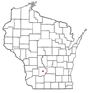
Herman is a town in Dodge County, Wisconsin, United States. The population was 1,207 at the 2000 census. The unincorporated communities of Herman Center and Huilsburg are located in the town. The unincorporated communities of Hochheim and Woodland are also located partially in the town.

<span class="mw-page-title-main">Waldwick, Wisconsin</span> Town in Wisconsin, United States

The Town of Waldwick is a town located in Iowa County, Wisconsin, United States. The population was 500 at the 2000 census. The unincorporated communitu of Jonesdale is located in the town.

<span class="mw-page-title-main">Albion, Jackson County, Wisconsin</span> Town in Wisconsin, United States

Albion is a town in Jackson County, Wisconsin, United States. The population was 1,093 at the 2000 census. The unincorporated community of Disco is located in the town.

<span class="mw-page-title-main">Brockway, Wisconsin</span> Town in Wisconsin, United States

Brockway is a town in Jackson County, Wisconsin, United States. The population was 2,580 at the 2000 census. The unincorporated communities of Brockway, Sand Pillow, Sheppard, and Vaudreuil are located in the town.

<span class="mw-page-title-main">Franklin, Jackson County, Wisconsin</span> Town in Wisconsin, United States

Franklin is a town in Jackson County, Wisconsin, United States. The population was 325 at the 2000 census. The unincorporated community of Franklin is located in the town. The ghost town of Rogneys was also located in the town.

<span class="mw-page-title-main">Garden Valley, Wisconsin</span> Town in Wisconsin, United States

Garden Valley is a town in Jackson County, Wisconsin, United States. The population was 406 at the 2000 census. The unincorporated community of North Branch is located in the town.

<span class="mw-page-title-main">Garfield, Jackson County, Wisconsin</span> Town in Wisconsin, United States

Garfield is a town in Jackson County, Wisconsin, United States. The population was 638 at the 2010 census. The unincorporated communities of Levis, Price and Requa are located in the town.

<span class="mw-page-title-main">Knapp, Jackson County, Wisconsin</span> Town in Wisconsin, United States

Knapp is a town in Jackson County, Wisconsin, in the United States. As of the 2000 census, the town population was 275. The unincorporated community of Lapham Junction is located in the town.

<span class="mw-page-title-main">Komensky, Wisconsin</span> Town in Wisconsin, United States

Komensky is a town in Jackson County, Wisconsin, United States. The population was 462 at the 2000 census. The unincorporated communities of Hatfield, Waterbury, and Winnebago Mission are located in the town.

<span class="mw-page-title-main">Manchester, Jackson County, Wisconsin</span> Town in Wisconsin, United States

Manchester is a town in Jackson County, Wisconsin, United States. The population was 680 at the 2000 census. The unincorporated communities of Fall Hall Glen and Shamrock are located in the town.

<span class="mw-page-title-main">North Bend, Wisconsin</span> Town in Wisconsin, United States

North Bend is a town in Jackson County, Wisconsin, United States. The population was 397 at the 2000 census. The unincorporated communities of Buckholz Corners and North Bend are located in the town.

<span class="mw-page-title-main">Northfield, Wisconsin</span> Town in Wisconsin, United States

Northfield is a town in Jackson County, Wisconsin, United States. The population was 586 at the 2000 census. The unincorporated communities of Northfield and York are located in the town.

<span class="mw-page-title-main">Day, Wisconsin</span> Town in Wisconsin, United States

Day is a town in southwest Marathon County, Wisconsin, United States. It is part of the Wausau, Wisconsin Metropolitan Statistical Area. The population was 1,085 at the 2010 census. The unincorporated community of Rozellville is located in the town. The unincorporated community of Rangeline is also located partially in the town.

<span class="mw-page-title-main">Harrison, Marathon County, Wisconsin</span> Town in Wisconsin, United States

The Town of Harrison is located in the northeast corner of Marathon County, Wisconsin, in the United States. It is part of the Wausau, Wisconsin Metropolitan Statistical Area. As of the 2010 census, the town population was 374. The unincorporated community of Snell is located in the town. The unincorporated community of Hogarty is also located partially in the town.

<span class="mw-page-title-main">Center, Outagamie County, Wisconsin</span> Town in Wisconsin, United States

The Town of Center is a located in Outagamie County, Wisconsin, United States. The population was 3,622 as of the 2020 census. The unincorporated communities of Center Valley, Hamples Corner, Mackville, and Twelve Corners are located in the town. The unincorporated community of Five Corners is also located partially in the town.

<span class="mw-page-title-main">Freedom, Sauk County, Wisconsin</span> Town in Wisconsin, United States

The Town of Freedom is a located in Sauk County, Wisconsin, United States. The population was 416 at the 2000 census. The unincorporated community of La Rue is located within the town. The town was named from the American ideal of freedom.

Hixton is a town in Jackson County, Wisconsin, United States. The population was 611 at the 2000 census. The Village of Hixton is located within the town. The unincorporated community of Sechlerville is also located in the town.

Luck is a town in Polk County, Wisconsin, United States. The population was 881 at the 2000 census. The village of Luck is located within the town. The unincorporated community of West Denmark is located in the town. The unincorporated community of Pole Cat Crossing is also located partially in the town.

References

  1. 1 2 "US Board on Geographic Names". United States Geological Survey. October 25, 2007. Retrieved January 31, 2008.
  2. 1 2 "U.S. Census website". United States Census Bureau . Retrieved January 31, 2008.
  3. 1 2 "The town of Freedom and Black History Month". WIWB. February 10, 2009. Archived from the original on December 11, 2021. Retrieved February 1, 2010.
  4. "History of Center, Wisconsin". history.rays-place.com. Retrieved September 29, 2016.
  5. "Census of Population and Housing". Census.gov. Retrieved January 1, 2023.
  6. "Freedom Pursuit website".

2020 census data apart from population numbers is only partially present. Remaining census data is from the 2000 and 2010 census information.