Greenville, Wisconsin

Last updated

Greenville
USA Wisconsin location map.svg
Red pog.svg
Greenville
Usa edcp location map.svg
Red pog.svg
Greenville
Coordinates: 44°17′15″N88°31′33″W / 44.28750°N 88.52583°W / 44.28750; -88.52583
CountryFlag of the United States.svg  United States
State Flag of Wisconsin.svg  Wisconsin
Counties Outagamie
Surrounding towns Clayton, Dale, Ellington, Grand Chute, Hortonia, Menasha
Settled1848
Government
   Village President Jack Anderson
Area
  Total93 km2 (35.8 sq mi)
  Land93 km2 (35.8 sq mi)
  Water0.1 km2 (0.04 sq mi)  0.06%
Elevation
252 m (827 ft)
Population
 (2018)
  Total12,264
  Density73.8/km2 (191.2/sq mi)
Time zone UTC-6 (CST)
  Summer (DST) UTC-5 (CDT)
ZIP Code
54913, 54942, 54944
Area code 274 & 920
FIPS code 55-31550 [1]
GNIS feature ID2829852 [2]
Website greenvillewi.gov

Greenville is a village in Outagamie County, Wisconsin. It is one of 18 communities that form the basis of the Fox Cities, the third largest metropolitan area in Wisconsin. The population was 12,619 in 2020. [1]

Contents

History

The town was founded in 1848 as Greenville Station, and changed its name to Becker in 1879 (named after the first postmaster). Its name was changed to Greenville in 1896. [3]

After having an initial incorporation attempt denied by the Wisconsin Incorporation Review Board, the town was able to secure a referendum for a partial incorporation in November 2020. [4] The eastern half of the community incorporated as a village in January 2021, and successfully annexed the remnant western half of the original township in June 2021. This makes it one of the largest villages in the State of Wisconsin by area and population. [5]

Geography

According to the United States Census Bureau, the village has a total area of 35.8 square miles (92.7 km2), of which, 35.8 square miles (92.7 km2) of it is land and 0.04 square miles (0.1 km2) of it (0.06%) is water.

The former unincorporated community of Greenville and the ghost town of Wakefield are located in the village.

Demographics

Greenville is a part of the Appleton, Wisconsin Metropolitan Statistical Area and the Appleton-Oshkosh-Neenah, Wisconsin Combined Statistical Area.

As of the census [1] of 2000, there were 6,844 people, 2,301 households, and 1,937 families residing in the town. The population density was 191.2 people per square mile (73.8/km2). There were 2,353 housing units at an average density of 65.7 per square mile (25.4/km2). The racial makeup of the town was 98.25% White, 0.22% African American, 0.29% Native American, 0.20% Asian, 0.07% Pacific Islander, 0.39% from other races, and 0.57% from two or more races. Hispanic or Latino of any race were 1.59% of the population.

There were 2,301 households, out of which 48.4% had children under the age of 18 living with them, 75.4% were married couples living together, 5.6% had a female householder with no husband present, and 15.8% were non-families. 11.9% of all households were made up of individuals, and 2.7% had someone living alone who was 65 years of age or older. The average household size was 2.97 and the average family size was 3.24.

In the town, the population was spread out, with 32.5% under the age of 18, 5.2% from 18 to 24, 36.2% from 25 to 44, 20.9% from 45 to 64, and 5.2% who were 65 years of age or older. The median age was 34 years. For every 100 females, there were 106.1 males. For every 100 females age 18 and over, there were 103.5 males.

The median income for a household in the town was $61,381, and the median income for a family was $65,706. Males had a median income of $45,594 versus $29,360 for females. The per capita income for the town was $22,164. About 1.4% of families and 2.0% of the population were below the poverty line, including 0.9% of those under age 18 and 6.4% of those age 65 or over.

Economy

Appleton International Airport is the economic engine for the community. Many of the village's largest employers are located in business parks surrounding the airport. Air Wisconsin, the largest privately owned regional airline in the country, is headquartered in Greenville. [6] [7] Other businesses include School Specialty, the village's largest employer; Amazon; Federal Express; Gulfstream Aerospace; VF Corporation; Miller Electric; Plexus; Oshkosh Corporation; Badger Plug; Valley Bakers Cooperative; Sonoco Products; Asten Johnson; and Zebra Technologies. [8] [9]

Government

Local

Greenville is governed by an elected five-member village board consisting of a president, vice president, and three trustees. The village is represented on the Outagamie County Board with officials from Districts 32 & 33.

State

OfficialPartyTook officeRepresenting:
State Sen. Rachael Cabral-Guevara Republican 202319th State Senate District
Rep. David Murphy Republican 201356th Assembly District

Federal

The town lies within the boundaries of Wisconsin's 8th Congressional District. This district has a cook PVI of R+10 and is safely Republican at the federal level. [10]

OfficialPartyTook officeRepresenting:
Sen. Tammy Baldwin Democratic 2013 State of Wisconsin
Sen. Ron Johnson Republican 2011 State of Wisconsin
Vacant Wisconsin's 8th District

Education

Public instruction is provided by the Hortonville Area School District. [11] The district maintains three elementary schools, two middle schools, a high school, and an independent learning center. Parochial schools include Immanuel Lutheran School and St. Mary of the Immaculate Conception Catholic School. [12]

Public schools

Private schools

The Fox Valley Technical College Public Safety Training Center is located in Greenville and provides training for law enforcement, firefighters, and emergency medical services personnel.

Religion

Churches in Greenville include:

Transportation

Appleton International Airport is located in Greenville. [6] The airport is the headquarters for regional airline carrier, Air Wisconsin, and is the original home of Midwest Airlines, which grew out of a subsidiary of Kimberly-Clark, K-C Aviation.

WIS 15.svg
WIS 15 (Greenville Drive) travels east to Grand Chute and west to Hortonville and New London.
WIS 76.svg
WIS 76 (Municipal Drive) travels south to Oshkosh and north to Shiocton.
WIS 96.svg
WIS 96 (Wisconsin Avenue) travels east to Grand Chute and Appleton and west to Fremont.
WIS County BB.svg
County BB (Prospect Avenue and Winnegamie Drive) travels east to Appleton.
WIS County CA.svg
County CA (College Avenue) travels east to Grand Chute where it becomes WIS 125.
WIS County CB.svg
County CB (West Side Arterial) travels south to Fox Crossing and Neenah.
WIS County JJ.svg
County JJ (Broadway Drive) travels east to Kaukauna and west to Hortonville.

Greenville is located 1.5 miles (2.4 km) west of Interstate 41 I-41.svg and 1.8 miles (2.9 km) north of U.S. Route 10 US 10.svg

The Yellowstone Trail National Historic Automobile Route also passes through Greenville.

Parks and recreation

The Village maintains approximately 210 acres (0.85 km2) of parkland at 10 facilities located throughout the community. These include:

The Wisconsin Department of Natural Resources-managed Heath Van Handel Memorial Forest is located in Greenville. The 39-acre forest was previously a nursery, test area, and arboretum for the Institute of Paper Chemistry. [13]

Greenville events include:

Roblox Game

A popular game on the Roblox platform is based on Greenville, and as of May 2024, has 950,000,000+ visits. The game was first created in June 2017 by Roblox user milk74l8O, and has since grown into a roleplay and driving game. The game currently has over 400+ cars and over 2300+ different trim models, but has suffered from brand copyright claims by the DMCA, leading to many car brands getting removed since November 2023. There are several roleplay communities that offer a more realistic driving experience, and many content creators on Youtube have played Greenville, leading to global success.

Points of interest

Images

Related Research Articles

<span class="mw-page-title-main">Outagamie County, Wisconsin</span> County in Wisconsin

Outagamie County is a county in the Fox Cities region of the U.S. state of Wisconsin, located in the northeast of the state. As of the 2020 Census, the population was 190,705. Its county seat is Appleton.

<span class="mw-page-title-main">Altamont, Illinois</span> City in Illinois, United States

Altamont is a city in Effingham County, Illinois, United States. The population was 2,216 at the 2020 census. Altamont is part of the Effingham, Illinois Micropolitan Statistical Area.

<span class="mw-page-title-main">Plainfield, Indiana</span> Town in Indiana, United States

Plainfield is a town in Guilford, Liberty, and Washington townships, Hendricks County, Indiana, United States. The population was 27,631 at the 2010 census, and in 2022 the estimated population was 36,074.

<span class="mw-page-title-main">Grand Chute, Wisconsin</span> Town in Wisconsin, United States

Grand Chute is a town in Outagamie County, Wisconsin, United States. The population was 23,831 at the 2020 census. The unincorporated community of Apple Creek is partially located in the town. It was the birthplace of U.S. Senator Joseph McCarthy.

<span class="mw-page-title-main">Hortonville, Wisconsin</span> Village in Wisconsin, United States

Hortonville is a village in Outagamie County, Wisconsin, United States. The population was 2,711 at the 2010 census.

<span class="mw-page-title-main">Shiocton, Wisconsin</span> Village in Wisconsin, United States

Shiocton is a village in Outagamie County, Wisconsin, United States. The population was 921 at the 2010 census. It is wholly surrounded by the Town of Bovina.

<span class="mw-page-title-main">Mequon, Wisconsin</span> City in Ozaukee County, Wisconsin

Mequon is the largest city in Ozaukee County, in the U.S. state of Wisconsin, and the third-largest city in Wisconsin by land area. Located on Lake Michigan's western shore with significant commercial developments along Interstate 43, the community is a suburb in the Milwaukee metropolitan area. Despite being an incorporated city, approximately half of Mequon's land is undeveloped and agriculture plays a significant role in the local economy. At the time of the 2020 census the population was 25,142.

<span class="mw-page-title-main">Richmond, Michigan</span> City in Michigan, United States

Richmond is a city within Metro Detroit in the U.S. state of Michigan. The population was 5,878 at the 2020 census. Most of the city is located in Macomb County, though there is a small portion in neighboring St. Clair County.
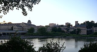
<span class="mw-page-title-main">Appleton, Wisconsin</span> City in Wisconsin, United States

Appleton is a city in and the county seat of Outagamie County, Wisconsin, United States. A small portion of the city also extends into Calumet and Winnebago counties. It is situated on the Fox River, 30 miles (48 km) southwest of Green Bay and 100 miles (160 km) north of Milwaukee. As of the 2020 census, it had a population of 75,644, making it the sixth-most populous city in Wisconsin. Appleton is part of the Fox Cities metropolitan area, the third-largest metro area in the state with over 415,000 residents.
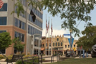
<span class="mw-page-title-main">Menasha, Wisconsin</span> City in Wisconsin, United States

Menasha is a city in Calumet and Winnebago counties in the U.S. state of Wisconsin. The population was 18,268 at the 2020 census. Of this, 15,144 were in Winnebago County, and 2,209 were in Calumet County. The city is located mostly in Winnebago County; only a small portion is in the Town of Harrison in Calumet County. Doty Island is located partially in Menasha. The city's name comes from the Winnebago word meaning "thorn" or "island". In the Menominee language, it is known as Menāēhsaeh, meaning "little island".

<span class="mw-page-title-main">St. Peters, Missouri</span> City in east central Missouri, U.S.

St. Peters is a city in St. Charles County, Missouri, United States. The population was 57,732 at the 2020 census, making it the eleventh-largest city in Missouri. It is a northwestern suburb of St. Louis.

<span class="mw-page-title-main">Black Creek, Wisconsin</span> Village in Wisconsin, United States

Black Creek is a village in north-central Outagamie County, Wisconsin, United States. The population was 1,357 at the 2020 census. The village is located within the Town of Black Creek, but is governed independently. Origins of the community trace back to 1862 when it was settled by American Civil War veteran, Thomas J. Burdick and his son, Abraham. Initially, the village had been referred to as Middleburg, due to its geographical proximity to Green Bay, Shawano, and Appleton. However, the name was later changed to "Black Creek" to reflect the dark-colored creek along the outskirts of the community with village incorporation in 1904. Today, Black Creek hosts a variety of community events including the annual Family Daze celebration.

<span class="mw-page-title-main">Cedarburg, Wisconsin</span> City in Ozaukee County, Wisconsin

Cedarburg is a city in Ozaukee County, Wisconsin, United States. Located about 20 miles (32 km) north of Milwaukee and in close proximity to Interstate 43, it is a suburban community in the Milwaukee metropolitan area. The city incorporated in 1885, and at the time of the 2020 census the population was 12,121.
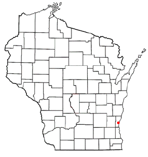
<span class="mw-page-title-main">Grafton (town), Wisconsin</span> Town in Ozaukee County, Wisconsin

The Town of Grafton is a town located in Ozaukee County, Wisconsin, United States, and is in the Milwaukee metropolitan area. The town was created in 1846 and at the time of the 2020 Census had a population of 4,157.
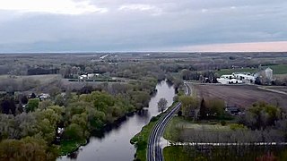
<span class="mw-page-title-main">Saukville, Wisconsin</span> Village in Ozaukee County, Wisconsin

Saukville is a village in Ozaukee County, Wisconsin, United States. Located on the Milwaukee River with a district along Interstate 43, the community is a suburb in the Milwaukee metropolitan area. The population was 4,258 at the 2020 census.

<span class="mw-page-title-main">Medford, Wisconsin</span> City in Wisconsin, United States

Medford is a city and county seat of Taylor County, in north-central Wisconsin, United States. The population was 4,349 at the 2020 census. The city is located mostly within the boundaries of the Town of Medford.

<span class="mw-page-title-main">Fox Cities</span> Combined Statistical Area in Wisconsin, United States

The Fox Cities of Northeastern Wisconsin are the cities, towns and villages along the Fox River as it flows from Lake Winnebago northward into Green Bay.
<span class="mw-page-title-main">Stephensville, Wisconsin</span> Unincorporated community in Wisconsin, United States

Stephensville is a small unincorporated community located entirely within the town of Ellington in west-central Outagamie County, Wisconsin, United States. Stephensville is classified as a Class U6 Community by the USGS, being a populated place located wholly or substantially outside the boundaries of any incorporated place or CDP with a recognized authoritative common name.

<span class="mw-page-title-main">Hortonville High School</span> Public, coeducational school in Hortonville, Wisconsin, United States

Hortonville High School is a high school located in Hortonville, Wisconsin. The only high school in the Hortonville Area School District, it serves students in grades 9 to 12 from the communities of Hortonville and Greenville, and portions of Center, Dale, Ellington, Grand Chute, Hortonia, and Liberty.

Fox Crossing is a village in Winnebago County, Wisconsin, United States. It was incorporated from the former town of Menasha in 2016. The population as of the 2020 census was 18,974.

References

  1. 1 2 3 "U.S. Census website". United States Census Bureau . Retrieved January 31, 2008.
  2. "Village of Greenville". Geographic Names Information System . United States Geological Survey, United States Department of the Interior. May 22, 2023.
  3. Gard, Robert E. (September 9, 2015). The Romance of Wisconsin Place Names. Wisconsin Historical Society. ISBN   978-0-87020-708-2.
  4. Behnke, Duke (August 25, 2020). "Greenville finalizes Nov. 3 referendum on whether to incorporate its urbanized east half as a village". Appleton Post-Crescent. Retrieved October 22, 2020.
  5. Behnke, Duke. "Back together: Town and village of Greenville reunify as one 36-square-mile community". The Post-Crescent. Retrieved September 1, 2021.
  6. 1 2 Town of Greenville. Welcome to the Town of Greenville. Retrieved October 23, 2017.
  7. "Contact Air Wisconsin Archived 2011-06-04 at the Wayback Machine ." Air Wisconsin. Retrieved on May 19, 2009.
  8. "Ch_6_Economic%20Development.pdf" (PDF). East Central Wisconsin Regional Planning Commission. Archived from the original (PDF) on February 19, 2012. Retrieved March 18, 2024.
  9. "Amazon coming to Fox Valley". WLUK. July 2, 2020. Retrieved July 3, 2020.
  10. https://www.cookpolitical.com/cook-pvi/2022-partisan-voting-index/district-map-and-list
  11. Hortonville Area School District
  12. 1 2 "Immanuel Lutheran School".
  13. "Memorial forest to be dedicated in memory of DNR pilot - Weekly News Article - Wisconsin DNR". Archived from the original on August 29, 2014. Retrieved September 17, 2015.
  14. Greenville Lions Catfish Races