
Busselton is a city in the South West region of the state of Western Australia approximately 220 km (140 mi) south-west of Perth. Busselton has a long history as a popular holiday destination for Western Australians; however, the closure of the Busselton Port in 1972 and the contemporaneous establishment of the nearby Margaret River wine region have seen tourism become the dominant source of investment and development, supplemented by services and retail. The city is best known for the Busselton Jetty, the longest wooden jetty in the Southern Hemisphere.

John Garrett Bussell was an early settler in Western Australia.
Dunsborough is a coastal town in the South West of Western Australia, 254 kilometres (158 mi) south of Perth, on the shores of Geographe Bay.
The townsite of Wonnerup is located 219 kilometres (136 mi) south of Perth and 10 kilometres (6 mi) east of Busselton. It was gazetted a townsite in 1856, deriving its name from the nearby Wonnerup Inlet.
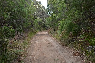
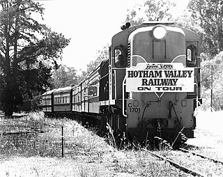
The Flinders Bay Branch Railway, also known as the Boyanup to Flinders Bay Section ran between Boyanup and Flinders Bay, in South Western Western Australia. The section from Flinders Bay to Busselton has now been converted into a rail trail for bushwalkers and cyclists, called the Wadandi Trail.

The City of Busselton is a local government area in the South West region of Western Australia, approximately 230 km (140 mi) south of Perth, the state capital. The city covers an area of 1,455 km2 (562 sq mi) and had a population of 40,640 as at the 2021 Census. It contains two large towns, Busselton and Dunsborough, and a number of smaller towns. The city office is located on Southern Drive, Busselton.

Vasse is a suburb of the city of Busselton in the South West region of Western Australia, 10 kilometres (6 mi) west of Busselton and 240 kilometres (149 mi) southwest of Perth. Its local government area is the City of Busselton. At the 2016 census, Vasse had a population of 2,479.

The Shire of Capel is a local government area in the South West region of Western Australia, taking in the land between the cities of Bunbury and Busselton about 200 kilometres (124 mi) south of the state capital, Perth. The Shire covers an area of 557.6 square kilometres (215.3 sq mi), and its seat of government is the town of Capel.

Yallingup is a town in the South West region of Western Australia, 256 kilometres (159 mi) south of Perth. Yallingup is a popular tourist destination because of its beaches and limestone caves, and proximity to Leeuwin-Naturaliste National Park.
Jarrahwood is a small town located in the South West region of Western Australia, near the Vasse Highway between Busselton and Nannup. At the 2021 census, the area had a population of nine.
The Sabina River is a river in the South West of Western Australia.
The Ludlow River is a river in the South West region of Western Australia. It was named after Frank Ludlow, one of the first Western Australian colonists, an arrival on the barque Parmelia in 1829, who explored the locality in 1834.
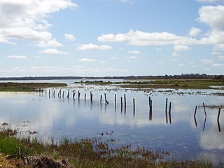
The Vasse-Wonnerup Estuary is an estuary in the South West region of Western Australia close to the town of Busselton. The estuary is listed with DIWA. It was also recognised as a wetland of international importance under the Ramsar Convention on 7 June 1990 when an area of 1,115 ha was designated Ramsar Site 484 as an important dry-season habitat for waterbirds. It is also the main part of the 2,038 ha (5,040-acre) Busselton Wetlands Important Bird Area.
Busselton Senior High School is a comprehensive public co-educational high day school, located in the Busselton suburb of West Busselton in the South West region. As of 2021, the school had 672 students.
Quindalup is a small town in the South West region of Western Australia. It is situated along Caves Road between Busselton and Dunsborough on Geographe Bay. At the 2021 census, Quindalup had a population of 1,488.
Abbey is a suburb of the Western Australian city of Busselton. At the 2021 census, it had a population of 1,321.

Broadwater is a suburb of the Western Australian city of Busselton. At the 2021 census, it had a population of 4,269.
West Busselton is a suburb of the Western Australian city of Busselton. At the 2021 census, it had a population of 8,869.
Bovell is a semi-rural suburb of the Western Australian city of Busselton. At the 2021 census, it had a population of 475. The area has been earmarked for future urban development. Bovell contains Geographe Primary School, named after the nearby suburb, which was established in 2002.

St Mary's Anglican Church is a heritage-listed Anglican church in Peel Terrace, Busselton, Western Australia. It is possibly the oldest stone church in the state. Opened in 1845, and consecrated in 1848, it has been the subject of a number of additions, and has also been repaired or conserved on several occasions.

