Georgetown, Beaver County, Pennsylvania

Last updated

Georgetown, Pennsylvania
St. Luke's Church in Georgetown.jpg
Beaver County Pennsylvania incorporated and unincorporated areas Georgetown highlighted.svg
Location in Beaver County and the state of Pennsylvania.
Coordinates: 40°38′28″N80°30′00″W / 40.64111°N 80.50000°W / 40.64111; -80.50000
Country United States
State Pennsylvania
County Beaver
Settled1793
Incorporated1850
Government
  TypeBorough Council
Area
[1]
  Total0.25 sq mi (0.65 km2)
  Land0.17 sq mi (0.45 km2)
  Water0.08 sq mi (0.20 km2)
Elevation
741 ft (226 m)
Population
 (2020) [2]
  Total208
  Density1,188.57/sq mi (459.05/km2)
Time zone UTC-5 (Eastern (EST))
  Summer (DST) UTC-4 (EDT)
Zip code
15043
Area code 724
FIPS code42-28824
GNIS feature ID1214876

Georgetown is a borough in western Beaver County, Pennsylvania, United States, along the Ohio River. The population was 208 at the 2020 census. It is part of the Pittsburgh metropolitan area. Little Blue Run Lake, the U.S.'s largest coal slurry waste impound, is located next to the town.

Contents

History

Georgetown historical marker. GeargetownPA.jpg
Georgetown historical marker.

The area of the Ohio headwaters was long inhabited by the Shawnee and several other groups of Native Americans. The first known Europeans to enter the region were French explorers/traders during the 17th century. [3]

Christopher Gist was one of the first English colonists to survey the Ohio River Region around present day Pittsburgh in 1751. [4] George Washington would also survey the area in 1753 as an envoy to demand the French to vacate the territory, which the British had claimed, as land disputes were occurring between British and French colonies at the time. [5] [6] Hostilities broke out in 1754 during the French and Indian War.

In 1763, the region became British territory after a War with France. The Province of Pennsylvania gained control of the land through an Indian treaty in 1768. [7]

After the end of the American Revolutionary War in 1783, settlers began to move into western Pennsylvania, Pittsburgh and further west by way of the Ohio River. The area around Georgetown was known to riverboat travelers west of Pittsburgh as a 'last chance' stopping place for food and supplies, before entering into the roughly-charted and dangerous Northwest Territory, (there was an ongoing Indian War in the territory at the time). The closest place of protection was Ft. McIntosh, (in modern-day Beaver), about 20 miles east of the Pennsylvania border line.

The town as it is today was laid out by Benoni Dawson January 13, 1793, and named 'Georgetown'. One theory suggests the name was bestowed in honor of George Dawson, his son. Another theory suggests the town was named in honor of the new U.S. President George Washington, who surveyed the Ohio River area years earlier. Settlement was slow due to hostilities with the Native Americans until General Wayne's Treaty of Greenville in 1795. In 1800, Georgetown would be part of the newly formed Beaver County, surrounded by several townships. The first post office in Georgetown was established in 1802, including its first hotel. [8]

In 1803, in preparation for the Lewis and Clark Expedition, Meriwether Lewis had a keelboat built near Pittsburgh, with plans to sail it down the Ohio River and meet up with William Clark in Kentucky to begin the Expedition. Lewis and his crew stopped at Georgetown to buy a canoe to replace one that was leaky. Lewis later discovered the new canoe also leaked. [9] In 1812 the nearby Mill Creek was used to power mills to grind grain into flour. The first church was built in 1814, St. Luke's Episcopal Church. Georgetown remained a river town for keelboats and later steam boats, until the expansion of railroads and oil drilling after the Civil War. [10]

Geography

Georgetown is located at 40°38′28″N80°30′0″W / 40.64111°N 80.50000°W / 40.64111; -80.50000 (40.641172, −80.500037). [11]

According to the United States Census Bureau, the borough has a total area of 0.3 square miles (0.78 km2), of which 0.2 square miles (0.52 km2) is land and 0.1 square miles (0.26 km2) (33.33%) is water.

Surrounding and adjacent neighborhoods

Georgetown has only one land border with Greene Township to the south, east and west. Across the Ohio River to the north, the borough runs adjacent with Glasgow and Ohioville.

Demographics

Historical population
CensusPop.Note
1860 295
1870 2970.7%
1880 288−3.0%
1890 274−4.9%
1900 271−1.1%
1910 269−0.7%
1920 251−6.7%
1930 2603.6%
1940 253−2.7%
1950 246−2.8%
1960 2460.0%
1970 234−4.9%
1980 231−1.3%
1990 194−16.0%
2000 182−6.2%
2010 174−4.4%
2020 20819.5%
Sources: [12] [13] [14] [2]

As of the 2000 census, [13] there were 182 people, 67 households, and 52 families residing in the borough. The population density was 1,010.6 inhabitants per square mile (390.2/km2). There were 70 housing units at an average density of 388.7 per square mile (150.1/km2). The racial makeup of the borough was 100.00% White.

There were 67 households, out of which 34.3% had children under the age of 18 living with them, 70.1% were married couples living together, 3.0% had a female householder with no husband present, and 20.9% were non-families. 16.4% of all households were made up of individuals, and 11.9% had someone living alone who was 65 years of age or older. The average household size was 2.72 and the average family size was 3.11.

In the borough, the population was spread out, with 22.0% under the age of 18, 7.7% from 18 to 24, 28.0% from 25 to 44, 25.3% from 45 to 64, and 17.0% who were 65 years of age or older. The median age was 40 years. For every 100 females, there were 122.0 males. For every 100 females age 18 and over, there were 105.8 males.

The median income for a household in the borough was $57,500, and the median income for a family was $59,167. Males had a median income of $38,750 versus $31,528 for females. The per capita income for the borough was $19,838. About 4.0% of families and 3.3% of the population were below the poverty line, including 3.7% of those under the age of eighteen and none of those sixty-five or over.

Industry

Georgetown is a rural agricultural area, just outside the major steel industries of Pittsburgh. Nevertheless, Georgetown is still close to heavy industry with potential hazards. In the 1970s the Little Blue Run Lake, the country's largest coal slurry waste impoundment, formed as a large artificial lake south-west of Georgetown (on the Pennsylvania and West-Virginia state lines). Because of its large toxic pollution content, the facilities closed down in 2016. [15]

Georgetown is a couple miles downstream from old J & L steel mills and other metal facilities such as ATI Allegheny Ludlum, Marathon Petroleum and the Beaver Valley Nuclear Power Plant.

Education

Children in Georgetown are served by the South Side Area School District. The current schools serving Georgetown are:

See also

Related Research Articles

<span class="mw-page-title-main">Ben Avon, Pennsylvania</span> Borough in Pennsylvania, United States

Ben Avon is a borough in Allegheny County, Pennsylvania, United States, along the Ohio River. The population was 1,918 at the 2020 census. It is part of the Pittsburgh metropolitan area.

<span class="mw-page-title-main">Leetsdale, Pennsylvania</span> Borough in Allegheny county, Pennsylvania

Leetsdale is a borough in Allegheny County, Pennsylvania, along the Ohio River. It is part of the Pittsburgh Metro Area. The population was 1,162 at the 2020 census.

<span class="mw-page-title-main">Baden, Pennsylvania</span> Borough in Pennsylvania, United States

Baden is a borough in southeastern Beaver County, Pennsylvania, along the Ohio River. The population was 3,904 at the 2020 census. It is part of the Pittsburgh metropolitan area. Baden is the former site of Logstown, a significant Native American settlement.

<span class="mw-page-title-main">Beaver, Pennsylvania</span> Borough in Pennsylvania, United States

Beaver is a borough in, and the county seat of, Beaver County, Pennsylvania, United States. It is located near the confluence of the Beaver and Ohio Rivers, approximately 30 miles (48 km) northwest of Pittsburgh. As of the 2020 census, the population was 4,438.

<span class="mw-page-title-main">Big Beaver, Pennsylvania</span> Borough in Pennsylvania, United States

Big Beaver is a borough in northern Beaver County, Pennsylvania, United States. The population was 1,852 at the 2020 census. It is a part of the Pittsburgh metropolitan area. The area was originally incorporated as Big Beaver Township in 1802, and was reincorporated as a borough in 1958.

<span class="mw-page-title-main">Bridgewater, Pennsylvania</span> Borough in Pennsylvania, United States

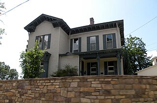
Bridgewater is a borough in central Beaver County, Pennsylvania, United States, at the confluence of the Beaver and Ohio rivers. The population was 745 at the 2020 census. It is part of the Pittsburgh metropolitan area. The borough is best known as the home of the Bruster's Ice Cream chain. A few scenes in the 1986 movie Gung Ho were also shot in Bridgewater. Much of Bridgewater, including its two major streets, are included in the Bridgewater Historic District.

<span class="mw-page-title-main">Conway, Pennsylvania</span> Borough in Pennsylvania, United States

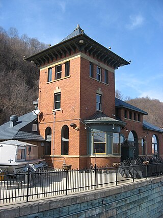
Conway is a borough in Beaver County, Pennsylvania, United States, located along the Ohio River. At the 2020 census, the borough had a total population of 2,168. It is part of the Pittsburgh metropolitan area. Conway is the site of the Conway Yard, a major railroad classification yard and locomotive facility owned by the Norfolk Southern Railway. From 1956 until 1980, it was the largest rail yard in the world.

<span class="mw-page-title-main">Freedom, Pennsylvania</span> Borough in Pennsylvania, United States

Freedom is a borough in Beaver County, Pennsylvania, United States, located along the Ohio River 25 miles (40 km) northwest of Pittsburgh. The population was 1,496 at the 2020 census. It is part of the Pittsburgh metropolitan area. Originally founded as a steamboat building town, chief industries later included the production of oil, caskets, and monuments.

<span class="mw-page-title-main">Glasgow, Pennsylvania</span> Borough in Pennsylvania, United States

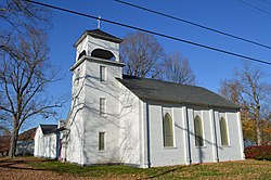
Glasgow is a borough in Beaver County, Pennsylvania, United States, along the Ohio River. The population was 71 at the 2020 census.

<span class="mw-page-title-main">Greene Township, Beaver County, Pennsylvania</span> Township in Pennsylvania, United States

Greene Township is a township in Beaver County, Pennsylvania, United States. The population was 2,194 at the 2020 census. It is part of the Pittsburgh metropolitan area.

<span class="mw-page-title-main">Industry, Pennsylvania</span> Borough in Pennsylvania, United States

Industry is a borough in western Beaver County, Pennsylvania, United States, along the Ohio River. As of the 2020 census, the population was 1,838. It is part of the Pittsburgh metropolitan area.

<span class="mw-page-title-main">Midland, Pennsylvania</span> Borough in Pennsylvania, United States

Midland is a borough located along the Ohio River in western Beaver County, Pennsylvania, United States. As of the 2020 census, the population was 2,433. It is part of the Pittsburgh metropolitan area. Founded in 1906, it was initially a company town surrounding the Crucible Steel Company's Midland Works.

<span class="mw-page-title-main">New Brighton, Pennsylvania</span> Borough in Pennsylvania, United States

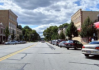
New Brighton is a borough in north-central Beaver County, Pennsylvania, United States, located along the Beaver River 28 miles (45 km) northwest of Pittsburgh. The population was 5,729 at the 2020 census. It is part of the Pittsburgh metropolitan area.

<span class="mw-page-title-main">Ohioville, Pennsylvania</span> Borough in Pennsylvania, United States

Ohioville is a borough in western Beaver County, Pennsylvania, United States. The population was 3,349 at the 2020 census. It is part of the Pittsburgh metropolitan area.

<span class="mw-page-title-main">Rochester, Pennsylvania</span> Borough in Pennsylvania

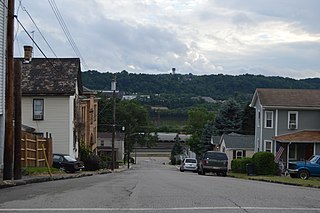
Rochester is a borough in central Beaver County, Pennsylvania, United States, at the confluence of the Beaver and Ohio rivers. Located 25 miles (40 km) northwest of Pittsburgh, it is part of the Pittsburgh metropolitan area. The population was 3,472 at the 2020 census.

<span class="mw-page-title-main">Shippingport, Pennsylvania</span> Borough in Pennsylvania, United States

Shippingport is a borough in western Beaver County, Pennsylvania, United States, located along the Ohio River. The population was 160 at the 2020 census. It is part of the Pittsburgh metropolitan area. Shippingport is home to the Beaver Valley Nuclear Power Station, and formerly the Bruce Mansfield Power Plant and Shippingport Atomic Power Station, the world's first full-scale atomic electric power plant devoted exclusively to peacetime uses.

<span class="mw-page-title-main">South Heights, Pennsylvania</span> Borough in Pennsylvania, United States

South Heights is a borough in Beaver County, Pennsylvania, United States, along the Ohio River. The population was 384 at the 2020 census. South Heights was first known as Ethel's Landing, a docking point on the Ohio River. The name of the town was changed to Shannopin when the Pittsburgh and Lake Erie Railroad established a station there. When the name of the town was changed to South Heights, the station became known as South Heights station.

<span class="mw-page-title-main">Harmony, Pennsylvania</span> Borough in Pennsylvania, United States

Harmony is a borough in Butler County, Pennsylvania, United States. The population was 890 at the 2010 census. It is located approximately 30 miles (48 km) north of Pittsburgh.

<span class="mw-page-title-main">Cassandra, Pennsylvania</span> Borough in Pennsylvania, United States

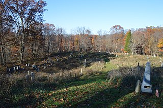
Cassandra is a borough in Cambria County, Pennsylvania, United States. The population was 147 at the 2010 census. It is part of the Johnstown, Pennsylvania Metropolitan Statistical Area.

<span class="mw-page-title-main">Ohiopyle, Pennsylvania</span> Borough in Pennsylvania, United States

Ohiopyle is a borough in Fayette County, Pennsylvania, United States. The population was 38 at the 2020 census. While Ohiopyle has a tiny year-round population, it is often filled with tourists on the weekend, who come for the outdoor recreation opportunities at the surrounding Ohiopyle State Park, as well as the Great Allegheny Passage bicycle trail which connects with the Chesapeake and Ohio Canal towpath trail to form a continuous 335-mile off-road trail from Pittsburgh, Pennsylvania to Washington, D.C. The borough of Ohiopyle is served by the Uniontown Area School District.

References

  1. "ArcGIS REST Services Directory". United States Census Bureau. Retrieved October 12, 2022.
  2. 1 2 "Census Population API". United States Census Bureau. Retrieved October 12, 2022.
  3. Solon J. Buck, Elizabeth Buck, The Planting of Civilization in Western Pennsylvania, 1976.
  4. William M. Darlington (ed.). Christopher Gist's Journals, with Historical, Geographical and Ethnological Notes and Biographies of His Contemporaries, Pittsburgh, J. R. Weldin & Co., 1893; Part 4: 1750-51.
  5. "Washington as Public Land Surveyor | George Washington: Surveyor and Mapmaker | Articles and Essays | George Washington Papers | Digital Collections | Library of Congress". Library of Congress .
  6. McCain, George Nox., Lambing, Andrew Arnold., White, John W. F.. Allegheny County: Its Early History and Subsequent Development from the Earliest Period Till 1790. Snowden & Peterson, 1888.
  7. Billington, Ray A. "The Fort Stanwix Treaty of 1768," New York History (1944), 25#2 pp. 182–194.
  8. History of Beaver County, PA. http://www.beavercountypa.gov/Pages/History.aspx
  9. Green Township - History of Georgetown. https://greenetownship.net/history/georgetown/
  10. Francis W. Nash. Georgetown Steamboats. It used to be a River Town (2009). http://georgetownsteamboats.com/gs/georgetown-pa/
  11. "US Gazetteer files: 2010, 2000, and 1990". United States Census Bureau. February 12, 2011. Retrieved April 23, 2011.
  12. "Census of Population and Housing". U.S. Census Bureau. Retrieved December 11, 2013.
  13. 1 2 "U.S. Census website". United States Census Bureau . Retrieved January 31, 2008.
  14. "Incorporated Places and Minor Civil Divisions Datasets: Subcounty Resident Population Estimates: April 1, 2010 to July 1, 2012". Population Estimates. U.S. Census Bureau. Archived from the original on June 11, 2013. Retrieved December 11, 2013.
  15. Hopey, Don (April 3, 2014). "Little Blue Run coal ash site to close sooner; Plant owner must contain pollution". Pittsburgh Post-Gazette . Retrieved April 2, 2015.