Glendoe Hydro Scheme

Last updated

Glendoe Reservoir
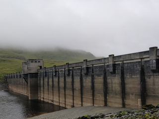
Glendoe Dam.jpg
Highland UK relief location map.jpg
Red pog.svg
Location of Glendoe Reservoir in Highland
Official nameGlendoe Hydro Scheme
Country United Kingdom
Location Scottish Highlands
Coordinates 57°05′35″N4°33′22″W / 57.093°N 4.556°W / 57.093; -4.556
Opening date29 June 2009
Owner(s) Scottish and Southern Energy
Dam and spillways
Height35 m (115 ft)
Length905 m (2,969 ft)
Reservoir
Catchment area
  • Immediate:
    15 km2 (5.8 sq mi)
  • Attached:
    60 km2 (23 sq mi)
Maximum length2 km (1.2 mi)
Normal elevation630 m (2,070 ft)
Power Station
Installed capacity 100 MW (max. planned)
Glendoe
Hydro-Electric Scheme
BSicon uexCONTgq.svg
BSicon uexSTR2+r.svg
BSicon uexSTRc3.svg
River Oich
BSicon uCONTgq.svg
BSicon uSTRq.svg
BSicon uexSTRc12.svg
BSicon uSTRq.svg
BSicon uDOCKSl.svg
BSicon uexSTR3+4.svg
BSicon uDOCKSm.svg
BSicon uDOCKSm.svg
BSicon uDOCKSm.svg
BSicon uDOCKSm.svg
Loch Ness
BSicon uexSTR+1.svg
BSicon uexSTRc4.svg
BSicon utSTR.svg
River Tarff + tailrace tunnel
BSicon uexSKRZ-Yu.svg
BSicon utSTRbm.svg
B862 bridge + power station
BSicon uexSTR.svg
BSicon utSTR.svg
BSicon uexSTR.svg
BSicon utSTR.svg
River Tarff + headrace tunnel
BSicon uexABZgl.svg
BSicon uexSTRq.svg
BSicon uxWEIRfl.svg
BSicon utENDEa.svg
BSicon uexKBHFeq.svg
BSicon utSTR.svg
Intake + Loch Carn a' Chuilinn
BSicon uexSTR2.svg
BSicon uexSTRc3.svg
BSicon uxWEIRfl.svg
BSicon utSTR.svg
BSicon uexKHSTeq.svg
BSicon utSTR.svg
unnamed intake
BSicon uexKHSTaq.svg
BSicon uxWEIRfr.svg
BSicon utENDEa.svg
BSicon uexSTRr+1.svg
BSicon uexSTR+4.svg
BSicon utSTR.svg
BSicon utSTR.svg
Uisg a' Chaime intake
BSicon utSTRl.svg
BSicon utSTRq.svg
BSicon uexRESVGDe.svg
BSicon utSTRr.svg
BSicon utSTR.svg
Glendoe Dam
BSicon uexDOCKSm.svg
BSicon utSTRq.svg
BSicon utSTRq.svg
BSicon utSTRr.svg
Headrace tunnel
BSicon uexDOCKSm.svg
Glendoe Reservoir
BSicon uexDOCKSm.svg
BSicon uexKHSTa.svg
BSicon uexDOCKSm.svg
BSicon uexSTRl.svg
BSicon uxWEIRfr.svg
BSicon utENDEa.svg
BSicon uexABZq+l.svg
BSicon uexSTR+r.svg
Allt na Feithe Glaise intake
BSicon uexDOCKSm.svg
BSicon uexKHSTaq.svg
BSicon uxWEIRfr.svg
BSicon utSTR.svg
BSicon uexSTR.svg
BSicon uexSTR.svg
unnamed intake
BSicon uexDOCKSm.svg
BSicon utSTRq.svg
BSicon utABZr+r.svg
BSicon uexSTR.svg
BSicon uexCONTf.svg
Allt Breineag
BSicon uexDOCKSm.svg
BSicon uexSTR+l.svg
BSicon uxWEIRfr.svg
BSicon utENDEe.svg
BSicon uexSTRr.svg
Allt na Feithe Gobhlaich intake
BSicon uexKHSTaq.svg
BSicon uexSTRq.svg
BSicon uexDOCKSe.svg
BSicon uexKHSTe.svg
River Tarff (far left)
BSicon uexSTR.svg
BSicon uexKHSTaq.svg
BSicon uexABZglr.svg
BSicon uexKHSTeq.svg
BSicon utSTR.svg
tunnel/pipeline
BSicon utSTR.svg
BSicon uexKHSTa.svg
Allt na Craidhleig
BSicon uexKHSTaq.svg
BSicon uxWEIRfr.svg
BSicon utSTR.svg
BSicon uexABZg+r.svg
Allt Mor intake
BSicon utSTR.svg
BSicon uexABZl+l.svg
BSicon uexSTRq.svg
BSicon uexSTR+r.svg
Allt Odhar
BSicon uexKHSTaq.svg
BSicon uexSTRq.svg
BSicon uxWEIRfr.svg
BSicon utSTR.svg
BSicon uexABZgr.svg
BSicon uexSTR.svg
Allt Creag Cromaich intake
BSicon uexKHSTaq.svg
BSicon uxWEIRfr.svg
BSicon utSTR.svg
BSicon uexSTRr.svg
BSicon uexSTR.svg
Allt Tarsuinn intake
BSicon utSTR.svg
BSicon uexSTR.svg
BSicon uexCONTg.svg
River Killin
BSicon uexKHSTaq.svg
BSicon uexSTRq.svg
BSicon uxWEIRfr.svg
BSicon utSTR.svg
BSicon uexABZq+l.svg
BSicon uexSTR+r.svg
BSicon uexABZl+l.svg
BSicon uexABZgr.svg
Allt Rhuige an t-Sidhein intake
BSicon uexKHSTaq.svg
BSicon uxWEIRfr.svg
BSicon utSTR.svg
BSicon uexSTRr.svg
BSicon uexABZl+l.svg
BSicon uexABZgr.svg
BSicon uexSTR.svg
Caochan nan Sac intake
BSicon uexKBHFaq.svg
BSicon uexABZq+l.svg
BSicon uexSTRq.svg
BSicon uxWEIRfr.svg
BSicon utSTR.svg
BSicon uexABZq+l.svg
BSicon uexSTRr.svg
BSicon uexSTR.svg
BSicon uexSTR.svg
Crom Allt intake
BSicon uexKHSTe.svg
BSicon uexKHSTaq.svg
BSicon uxWEIRfr.svg
BSicon utSTR.svg
BSicon uexSTRr.svg
BSicon uexSTR.svg
BSicon uexSTR.svg
Allt Uaine Mhachair intake
BSicon uexKHSTaq.svg
BSicon uxWEIRfr.svg
BSicon utSTR.svg
BSicon uexSTRq.svg
BSicon uexSTRq.svg
BSicon uexSTRr.svg
BSicon uexSTR.svg
Allt Coire an Eich intake
BSicon uexKHSTaq.svg
BSicon uexSTRq.svg
BSicon uxWEIRfr.svg
BSicon utENDEe.svg
BSicon uexSTRq.svg
BSicon uexSTRq.svg
BSicon uexSTRq.svg
BSicon uexSTRr.svg
Allt Cam Bàn intake

The Glendoe Hydro Scheme for the generation of hydro-electric power is located in the Monadhliath Mountains near Fort Augustus, above Loch Ness in the Highlands of Scotland. The change in financial incentives following the publication of the Renewables Obligation in 2001 caused Scottish and Southern Energy (SSE) to reconsider a number of schemes that had been mothballed in the 1960s by the North of Scotland Hydro-Electric Board, and plans for the Glendoe scheme were resurrected.

Contents

Construction started in 2006, and Hochtief completed the scheme in 2009. It is operated by SSE and was opened on 29 June 2009 by Queen Elizabeth, accompanied by the Duke of Edinburgh. Part of the main headrace tunnel collapsed in August 2009, and remedial work was not completed until 2012, with generation restarting in April. SSE and Hochtief failed to agree on who was responsible for the cost of the failure, but SSE were awarded damages in 2018 in the court of appeal, despite an adjudication and the first court case finding that the cost was an operational risk to be borne by SSE.

History

The completion of several schemes by the North of Scotland Hydro-Electric Board in the early 1960s brought to an end over two decades of expansion of conventional hydro-electricity in the Highlands of Scotland. [1] Subsequently, Cruachan was commissioned in 1968, [2] and Foyers in 1974, but both of these were pumped storage schemes. [3]

In 2001, the Scottish Parliament set an objective of increasing the proportion of electricity generated from renewable sources to 18 per cent by 2010, as part of their Scottish Climate Change Programme. The publication of the Renewables Obligation in 2001 made any new hydro-electric scheme eligible under the incentive, whereas previously only those under 10  Megawatts  (MW) had qualified. This changed the financial incentives for building new hydro-electric plants, and SSE plc, who inherited most of the Hydro-Electric Board's assets when the electricity industry was privatised, reviewed all of the large schemes that the Board had considered, but which had not been built. Nearly all had been abandoned because of their environmental impact in areas which had a high amenity value, but the exception was Glendoe. [4]

Various configurations were then considered, from a small run-of-the-river scheme generating under 10 MW, to a huge pumped storage scheme. The smaller schemes were discarded because of the cost of transferring the water from the Glendoe plateau down to Loch Ness, while the pumped storage option was discarded because it would not qualify under the Renewable Obligation scheme, and because the difference in levels between the top reservoir and Loch Ness was sufficient that it would be extremely costly to overcome the issues this would introduce. Once the choice of Glendoe was made in October 2001, an environmental statement was produced and the design was refined by May 2003. SSE then applied for planning consent under section 36 of the Electricity Act 1989, and this was eventually granted in June 2005. [5]

Although there were few objections to the scheme, and the local community was supportive, SSE did not know how long the planning consent process would take, and so began a design and build tendering process which ran concurrently. Because they could not undertake investigative work until deals with the landowners had been agreed, the design was kept flexible throughout the process. The turbine house might be above or below ground, the output of the scheme could be between 50 MW and 100 MW, while the dam could be constructed of rockfill or roller compacted concrete. [6] A contract for the scheme was awarded to Hochtief in December 2005, and they began producing the detailed designs and starting construction from January 2006. [7]

Before work could start on the main scheme, various enabling works had to be done. The bridge that carries the B862 road over the River Tarff near Fort Augustus had to be strengthened to cope with the weight of construction vehicles, [8] and this work was done in five weeks starting on 21 November 2005. [9] A refurbished tunnel boring machine was ordered from Herrenknecht, a start was made on the 28 miles (45 km) of roads needed to access the various sites where work was to be carried out, and a planning application was made to allow work camps to be constructed. [10] [11] These were built high up on the Glendoe plateau, and accommodated most of the 750 workers who were employed on the project. [12]

Construction

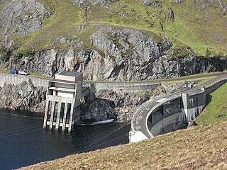
A ceremony attended by Tony Blair, the British prime minister, and Jack McConnell, the First Minister of Scotland, marked the formal start of construction. They detonated an explosive charge, to begin the reshaping of the valley. [13] A reservoir for the scheme was created by building a dam across the River Tarff. The dam is 3,150 feet (960 m) long, and some 115 feet (35 m) high where it crosses the original course of the river, but much lower at the sides. It is a rock fill dam, with most of the rock coming from a quarry which was flooded as the reservoir filled with water. The upstream side is faced with concrete, while the downstream side is exposed rock. The dam cannot be seen from any of the houses and public roads in the area. [14]

The catchment for the reservoir is around 5.8 square miles (15 km2) [14] as it is fed by the upper reaches of the River Tarff, the Caochan Uilleim, and runoff from the A' Chraidhleag bog. [15] Water is collected from another 23 square miles (60 km2) by intakes constructed on numerous streams, and transporting the water to the reservoir by a network of underground pipes and tunnels. [14] The main tunnel is 5.3 miles (8.5 km) long, of which 4.3 miles (7 km) were constructed by the drill-and-blast method and lined with shotcrete. The rest was built using the cut-and-cover technique. There are a further 2.5 miles (4 km) of 6.6-foot (2 m) diameter pipe to complete the network. [16] Water is collected from at least 14 intakes which feed into the network. [13] When full, the reservoir covers around 0.58 square miles (1.5 km2) and its surface is at 2,070 feet (630 m) above Ordnance datum. (AOD). Water is drawn down to a maximum of 20 feet (6 m) below this level when the power station is operating, on environmental grounds. [17]

The power station was constructed underground, in a cavern 125 by 59 feet (38 by 18 m) and 105 feet (32 m) high, excaved from solid rock by drill-and-blast. [16] The cavern is 820 feet (250 m) below the surface, at a level where the tailrace to Loch Ness is almost horizontal. A 5.3-mile (8.5 km) tunnel connects the reservoir to Loch Ness, with the turbines about 1.2 miles (2 km) from the loch. Some of it was cut by drill-and-blast, but the majority was created by a 16-foot (5 m) diameter tunnel boring machine, [18] 720 feet (220 m) long and named "Eliza Jane" after a competition by local schoolchildren. [19] There is a drop of 1,970 feet (600 m) from the reservoir to the turbine house, and most of the headrace tunnel slopes uphill at a gradient of 12 per cent. [16] The hard rock tunnel boring machine started at the bottom end in September 2006 and worked continuously for 16 months to reach the top on 7 January 2008, having cut through 4.675 miles (7.524 km) of rock. [20] [21] There is a second smaller cavern which houses the transformers next to the turbine house cavern, and the complex is accessed by a tunnel 0.8 miles (1.3 km) long, running from near the B862 road from Fort Augustus. [22]

For schemes between 50 MW and 100 MW, the tunnels would need to be a similar size, as making them smaller also makes building them more difficult. The cost of building either scheme is therefore similar, and SSE took the decision to go with the larger size, as it also has significant operational benefits. Consideration was given to using a fully-pressurised Francis turbine or a multi-jet Pelton turbine. While a Francis turbine can be brought online and offline more quickly, the slope of the ground between the reservoir and the turbine house meant that there were no suitable sites to build a surge shaft, and so the engineering needed to cope with pressure changes would have been complex. A Pelton turbine takes longer to bring online or offline, but deflectors can be used so that the turbine stops before the water flow does, which significantly reduces pressure surges. SSE decided that they could cope with the slower response time, as the benefits of the Pelton system's simplicity outweighed the complexity of the Francis system. [23] They therefore chose to install an Andritz six-jet vertical-axis Pelton turbine which can generate up to 100 MW, from a peak flow of 660 cubic feet per second (18.6 m3/s). [24]

Alex Salmond in his role as First Minister of Scotland initiated the filling of the reservoir on 1 September 2008. [13] Hochtief completed the contract two months early, [25] and the station had been generating power since January 2009 [26] when a formal opening of the scheme took place on 29 June 2009, at which Queen Elizabeth accompanied by Prince Philip, Duke of Edinburgh officiated. [13] The power station is operated remotely from SSE's control centre in Perth. [19]

Station shutdown

In August 2009 the station was shut down and the headrace tunnel drained because of internal rock falls near the upper end of it. [27] Although the equipment in the power station was not affected, Glendoe was unable to generate power until repairs were made. SSE reported that electricity generation was unlikely to proceed until at least April 2011. [28]

SSE employed Jacobs Gibb and Jacobs UK as their engineers, [29] and the original designs were for a fully-lined tunnel constructed by drill-and-blast. However, during the tendering process, Pöyry Energy JV who were the design engineers for Hochtief recommended that a tunnel boring machine should be used to excavate the tunnel. This would give a much smoother finish to the walls of the tunnel, and only around 40 per cent would need to be lined. Decisions as to how much lining to apply were taken once the rock could be seen, and less than one percent was actually lined. The completed tunnel was carefully inspected by Hochtief, Pöyry, Jacobs and SSE before being signed off. After about 8 months of use, some 233 feet (71 m) of the tunnel collapsed and was blocked by the rock fall. Robert Galbraith QC was appointed by Hochtief and SSE to adjudicate in 2011, and decided that Hochtief were not to blame for the collapse. Rather than take the dispute to arbitration, where the issues would be judged by technically qualified, professional engineers, SSE chose to pursue the matter in court, where it would be decided on legal issues by judges who were not technically qualified. [30]

The collapse occurred in the Conagleann Fault Zone, around 1.2 miles (2 km) from the top end of the tunnel. The fault was known from its appearance at surface level, but during tunnelling, the tunnel boring machine had passed through it, and SSE recorded that its existence was imperceptible. A contract for repair work was awarded to BAM Nuttall, who built a diversion tunnel around the rockfall by drill-and-blast. This was full-lined with 20 inches (500 mm) of waterproof concrete, and they also applied a 4-inch (100 mm) concrete lining to almost half of the rest of the tunnel. [31] A downstream access tunnel was also built as part of the repair contract. [32] Energy generation at the scheme restarted in August 2012. [33]

SSE issued proceedings seeking to recover £130 million in repair and reinstatement costs and £65 million in alleged loss of profit from Hochtief, but in December 2016 Hochtief was held by the Scottish Court of Session not to have been liable for the collapse, and that it was an operational risk to be borne by SSE. [34] In an appeal decided in 2018, SSE were awarded more than £107 million in compensation. The judges hearing the appeal split 2-to-1 in SSE's favour. [35] Hochtief subsequently appealed, and the case will be heard by the Supreme Court. [36]

Scheme details

Glendoe has a hydraulic head of 600 m (2,000 ft), the highest of any hydro-electric scheme in the United Kingdom, [37] and is thus ideally suited to generating large amounts of energy from the stored water in the reservoir, especially when combined with the relatively high annual rainfall in the area of around 2,000 mm (79 in). [24]

At the time of its construction, it was the largest of Scotland's recent civil engineering projects, with Hochtief as the design and build contractor. The scheme is predicted to produce about 180  GWh of electricity per year, [38] and to operate at a load factor of approximately 20 percent. This is based on the amount of water falling on the catchment in an average year, [39] and is enough to provide approximately 5% of the electricity consumption of the city of Glasgow. [20] [40]

Related Research Articles

<span class="mw-page-title-main">Falls of Foyers</span> Waterfall in Highland, Scotland

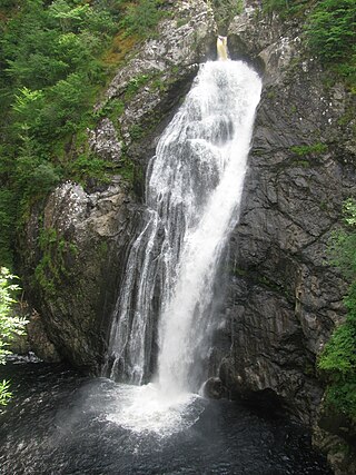
The Falls of Foyers are two waterfalls on the River Foyers, which feeds Loch Ness, in Highland, Scotland, United Kingdom. They are located on the lower portion of the River Foyers, and consist of the upper falls, with a drop of 46 feet (14 m) and the lower falls, which drop 98 feet (30 m).

<span class="mw-page-title-main">Tummel hydro-electric power scheme</span> Power stations in Perth and Inverness

The Tummel hydro-electric power scheme is an interconnected network of dams, power stations, aqueducts and electric power transmission in the Grampian Mountains of Scotland. Roughly bounded by Dalwhinnie in the north, Rannoch Moor in the west and Pitlochry in the east it comprises a water catchment area of around 1,800 square kilometres and primary water storage at Loch Ericht, Loch Errochty, Loch Rannoch and Loch Tummel, in Perth and Kinross. Water, depending on where it originates and the path it takes, may pass through as many as five of the schemes nine power stations as it progresses from north-west to south-east. The scheme was constructed in the 1940s and 50s incorporating some earlier sites. It is managed by SSE plc.

<span class="mw-page-title-main">Affric-Beauly hydro-electric power scheme</span> Power stations on River Affric and River Beauly in Scottish Highlands

The Affric-Beauly hydro-electric power scheme for the generation of hydro-electric power is located in the western Highlands of Scotland. It is based around Glen Strathfarrar, Glen Cannich and Glen Affric, and Strathglass further downstream.

<span class="mw-page-title-main">Loch Ness</span> Lake in Scotland, United Kingdom

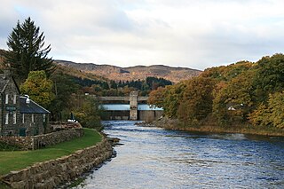
Loch Ness is a large freshwater loch in the Scottish Highlands extending for approximately 37 kilometres southwest of Inverness. It takes its name from the River Ness, which flows from the northern end. Loch Ness is best known for claimed sightings of the cryptozoological Loch Ness Monster, also known affectionately as "Nessie". It is one of a series of interconnected, murky bodies of water in Scotland; its water visibility is exceptionally low due to the high peat content of the surrounding soil. The southern end connects to Loch Oich by the River Oich and a section of the Caledonian Canal. The northern end connects to Loch Dochfour via the River Ness, which then ultimately leads to the North Sea via the Moray Firth.

<span class="mw-page-title-main">Nostie</span> Human settlement and power station in Scotland

Nostie is a small remote hamlet, lying on Nostie Bay, an inlet at the northeastern end of the sea loch, Loch Alsh in the Scottish Highlands and is in the council area of Highland. Nostie lies a short distance from one of Scotland's popular tourist attractions, Eilean Donan Castle.

<span class="mw-page-title-main">Cruachan Power Station</span> Hydroelectric power station in Scotland

The Cruachan Power Station is a pumped-storage hydroelectric power station in Argyll and Bute, Scotland. The scheme can provide 440 MW of power and produced 705 GWh in 2009.

<span class="mw-page-title-main">Loch Sloy Hydro-Electric Scheme</span> Dam in Argyll and Bute

The Loch Sloy Hydro-Electric Scheme is a hydro-electric facility situated between Loch Sloy and Inveruglas on the west bank of Loch Lomond in Scotland.

<span class="mw-page-title-main">River Moriston</span> River and power stations in Scotland

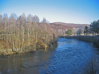
The River Moriston is a river in Inverness-shire, Scotland. It flows broadly east-north-east from the outfall of the dam at Loch Cluanie to Loch Ness. Its waters and those of its tributaries have been harnessed to generate hydro-electric power.

<span class="mw-page-title-main">Breadalbane Hydro-Electric Scheme</span> Multiple power stations in Scotland

The Breadalbane Hydro-Electric Scheme is a hydroelectric scheme in the Breadalbane area of Perthshire, Scotland. It comprises seven power stations which generate 120MW of power from the dams around Loch Lyon, Loch Earn and Loch Tay.

<span class="mw-page-title-main">Storr Lochs Hydro-Electric Scheme</span> Power station on Isle of Skye, Scotland

Storr Lochs is a hydro-electric power station built on the Isle of Skye, Inner Hebrides, Scotland and commissioned in 1952. It was built by the North of Scotland Hydro-Electric Board, and used water from Lochs Leathan and Fada, to provide the first general supply of electricity to the island. Because the location of the turbine house was not easily accessible, it is served by an electric funicular railway.

<span class="mw-page-title-main">Gisla Hydro-Electric Scheme</span> Power station on Lewis, Outer Hebrides, Scotland

Gisla Hydro-Electric Scheme was a small scheme promoted by the North of Scotland Hydro-Electric Board on the Isle of Lewis, Outer Hebrides, Scotland. It consisted of a single power station powered with water from Loch Coirceabhat, and was commissioned in 1960.

<span class="mw-page-title-main">Mucomir Hydro-Electric Scheme</span> Power station near Spean Bridge, Scotland

Mucomir Hydro-Electric Scheme is a small-scale hydro-electric power station, built by the North of Scotland Hydro-Electric Board and commissioned in 1962. It is located on the Mucomir Cut, a waterway created by Thomas Telford during the building of the Caledonian Canal to replace the existing coarse of the River Lochy below Loch Lochy, so that the old course could be used for the canal. The power station was substantially upgraded in 2017.

<span class="mw-page-title-main">Shira Hydro-Electric Scheme</span> Power stations near Loch Fyne, Scotland

The Shira Hydro-Electric Scheme is a project initiated by the North of Scotland Hydro-Electric Board to use the waters of the River Shira, the River Fyne and other small streams to generate hydroelectricity. It is located between Loch Fyne and Loch Awe in Argyll and Bute, western Scotland. It consists of three power stations and three impounding dams.

<span class="mw-page-title-main">Awe Hydro-Electric Scheme</span> Power stations near Loch Awe, Scotland

The Awe Hydro-Electric Scheme was the penultimate scheme developed by the North of Scotland Hydro-Electric Board. It centres around Loch Awe, in Argyll and Bute, on the southern edge of the Scottish Highlands. It consists of three power stations, two conventional hydro-electric stations, and the Cruachan power station, the first large pumped storage scheme built by the Board. It was completed in 1965.

<span class="mw-page-title-main">Lussa Hydro-Electric Scheme</span> Power station near Peninver, Scotland

Lussa Hydro-Electric Scheme is a small-scale hydro-electric power station, built by the North of Scotland Hydro-Electric Board and commissioned in 1956. It is located near Peninver on the Kintyre peninsula, part of Argyll and Bute in Scotland. It was originally designed to supply power to Campbeltown, but is now connected to the National Grid.

<span class="mw-page-title-main">Striven Hydro-Electric Scheme</span> Power station near Ardtaraig, Scotland

Striven Hydro-Electric Scheme is a small-scale hydro-electric power station, built by the North of Scotland Hydro-Electric Board and commissioned in 1951. It is located near Ardtaraig on the Cowal peninsula, part of Argyll and Bute in Scotland. It is sometimes known as the Cowal Hydro-Electric Scheme. It was originally designed to supply power to the remote communities on the peninsula, but is now connected to the National Grid.

<span class="mw-page-title-main">Kerry Falls Hydro-Electric Scheme</span> Power station near Peninver, Scotland

Kerry Falls Hydro-Electric Scheme, sometimes known as Gairloch is a small-scale hydro-electric power station, built by the North of Scotland Hydro-Electric Board and commissioned in 1952. It is located near Gairloch in Wester Ross, part of the Highlands of Scotland. It was originally designed to supply power to local communities in this remote area, but is now connected to the National Grid.

<span class="mw-page-title-main">Loch Dubh Hydro-Electric Scheme</span> Power station near Ullapool, Scotland

Loch Dubh Hydro-Electric Scheme is a small-scale hydro-electric power station, built by the North of Scotland Hydro-Electric Board and commissioned in 1955. It is located near Ullapool in Ross and Cromarty, Scotland. It was originally designed to supply power to the remote communities around Ullapool, but is now connected to the National Grid.

<span class="mw-page-title-main">Kilmelfort Hydro-Electric Scheme</span> Power station near Kilmelford, Scotland

Kilmelfort Hydro-Electric Scheme is a small-scale hydro-electric power station, built by the North of Scotland Hydro-Electric Board and commissioned in 1956. It is located near Kilmelford in Argyll and Bute, Scotland. It was originally designed to supply power to the local communities around Kilmelford, but is now connected to the National Grid.

References

  1. Seaton & Sawyer 2006, p. 1.
  2. Reeves 2018, p. 99.
  3. Reeves 2018, p. 87.
  4. Seaton & Sawyer 2006, pp. 2–3.
  5. Seaton & Sawyer 2006, p. 3.
  6. Seaton & Sawyer 2006, p. 4.
  7. Seaton & Sawyer 2006, p. 5.
  8. Seaton & Sawyer 2006, p. 12.
  9. "Strengthening Works To River Tarff Bridge". Highland Council. 19 April 2006. Archived from the original on 3 January 2024.
  10. Seaton & Sawyer 2006, pp. 12–13.
  11. "Glendoe Hydro Electric Scheme – Energy". Hochtief. Archived from the original on 24 June 2022.
  12. Reeves 2018, p. 107.
  13. 1 2 3 4 "Glendoe Hydro Electric Scheme". Gazetteer for Scotland. 2022. Archived from the original on 30 May 2014.
  14. 1 2 3 "Reservoir and Dam Information". Scottish and Southern Energy. Archived from the original on 9 October 2009. Retrieved 11 November 2009.
  15. Ordnance Survey, 1:25000 map
  16. 1 2 3 "Glendoe Hydro Scheme". German Tunnelling Committee (DAUB). Archived from the original on 25 September 2023.
  17. Seaton & Sawyer 2006, p. 9.
  18. "Glendoe hydro scheme". SSE Renewables. Archived from the original on 21 May 2023.
  19. 1 2 "Loch Ness Hydro Tunnel Makes Breakthrough". Tunnel Builder. 29 January 2008. Archived from the original on 3 March 2016.
  20. 1 2 Ellery 2008.
  21. "Glendoe". Herrenknecht. Archived from the original on 22 April 2021.
  22. "The Glendoe Hydro Power Plant". Power Technology. 16 November 2010. Archived from the original on 22 September 2023.
  23. Seaton & Sawyer 2006, pp. 7–8.
  24. 1 2 Reynolds 2012.
  25. Wynne 2010.
  26. Barrass 2018.
  27. Lord Woolman 2016, Paras 96-107.
  28. "Glendoe out of action until 2011". BBC. 11 November 2009. Archived from the original on 12 April 2018. Retrieved 11 November 2009.
  29. Lord Woolman 2016, Para 13.
  30. Hencher 2019, pp. 4034, 4047.
  31. Hencher 2019, pp. 4030–4040.
  32. "Glendoe repair bulletin - Issue 5". SSE. Summer 2011. Archived from the original on 8 June 2012. Retrieved 29 September 2011.
  33. "Glendoe hydro electric scheme resumes operations". BBC. 29 August 2012. Archived from the original on 27 April 2023. Retrieved 13 September 2012.
  34. "SSE loses £130m claim over Glendoe tunnel collapse". BBC News. 21 December 2016. Archived from the original on 9 February 2022.
  35. "SSE Generation wins claim over Glendoe tunnel collapse". BBC News Online. 10 April 2018. Archived from the original on 9 February 2022. Retrieved 11 April 2018.
  36. Horgan 2018.
  37. "Project Overview". Scottish and Southern Energy. Archived from the original on 25 October 2009. Retrieved 11 November 2009.
  38. "About Glendoe". SSE. Archived from the original on 6 March 2014. Retrieved 17 June 2013.
  39. Seaton & Sawyer 2006, p. 8.
  40. MacKay 2008.

Bibliography

Commons-logo.svg Media related to Glendoe hydro-electric scheme at Wikimedia Commons