The National Oceanic and Atmospheric Administration is an American scientific agency within the United States Department of Commerce that focuses on the conditions of the oceans, major waterways, and the atmosphere.
The Intergovernmental Oceanographic Commission of UNESCO (IOC/UNESCO) was established by resolution 2.31 adopted by the General Conference of UNESCO. It first met in Paris at Unesco Headquarters from 19 to 27 October 1961. Initially, 40 States became members of the Commission. The IOC assists governments to address their individual and collective ocean and coastal management needs, through the sharing of knowledge, information and technology as well as through the co-ordination of programs and building capacity in ocean and coastal research, observations and services.
The National Oceanographic Data Center (NODC) was one of the national environmental data centers operated by the National Oceanic and Atmospheric Administration (NOAA) of the U.S. Department of Commerce. The main NODC facility was located in Silver Spring, Maryland and was made up of five divisions. The NODC also had field offices collocated with major government or academic oceanographic laboratories in Stennis Space Center, MS; Miami, FL; La Jolla, San Diego, California; Seattle, WA; Austin, Texas; Charleston, South Carolina; Norfolk, Virginia; and Honolulu, Hawaii. In 2015, NODC was merged with the National Climatic Data Center and the National Geophysical Data Center into the National Centers for Environmental Information (NCEI).
The Global Oceanographic Data Archaeology and Rescue Project, or GODAR Project was established to increase the volume of historical oceanographic data available to climate change and other researchers. The project attempts to locate ocean profile and plankton data sets not yet in digital form, digitizes these data, and ensures their submission to national data centers and the World Data Center system (WDC). In addition, data on electronic media that are at risk of loss due to media degradation are also candidates for rescue.

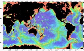
Bathymetry is the study of underwater depth of ocean floors or lake floors. In other words, bathymetry is the underwater equivalent to hypsometry or topography. The name comes from Greek βαθύς (bathus), "deep", and μέτρον (metron), "measure". Bathymetric charts are typically produced to support safety of surface or sub-surface navigation, and usually show seafloor relief or terrain as contour lines and selected depths (soundings), and typically also provide surface navigational information. Bathymetric maps may also use a Digital Terrain Model and artificial illumination techniques to illustrate the depths being portrayed. The global bathymetry is sometimes combined with topography data to yield a Global Relief Model. Paleobathymetry is the study of past underwater depths.
The World Ocean Database Project, or WOD, is a project established by the Intergovernmental Oceanographic Commission (IOC). The project leader is Sydney Levitus who is director of the International Council for Science (ICSU) World Data Center (WDC) for Oceanography, Silver Spring. In recognition of the success of the IOC Global Oceanographic Data Archaeological and Rescue Project, a proposal was presented at the 16th Session of the Committee on International Oceanographic Data and Information Exchange (IODE), which was held in Lisbon, Portugal, in October–November 2000, to establish the World Ocean Database Project. This project is intended to stimulate international exchange of modern oceanographic data and encourage the development of regional oceanographic databases as well as the implementation of regional quality control procedures. This new Project was endorsed by the IODE at the conclusion of the Portugal meeting, and the IOC subsequently approved this project in June 2001.

Argo is an international program that uses profiling floats to observe temperature, salinity, currents, and, recently, bio-optical properties in the Earth's oceans; it has been operational since the early 2000s. The real-time data it provides is used in climate and oceanographic research. A special research interest is to quantify the ocean heat content (OHC).

The Atlantic Oceanographic and Meteorological Laboratory (AOML), a federal research laboratory, is part of National Oceanic and Atmospheric Administration's (NOAA) Office of Oceanic and Atmospheric Research (OAR), located in Miami, Florida. AOML's research spans tropical cyclone and hurricanes, coastal ecosystems, oceans and human health, climate studies, global carbon systems, and ocean observations. It is one of seven NOAA Research Laboratories (RLs).

The Atlantic hurricane season is the period in a year from June through November when hurricanes usually form in the Atlantic Ocean. Tropical cyclones in the North Atlantic are called hurricanes, tropical storms, or tropical depressions. In addition, there have been several storms over the years that have not been fully tropical and are categorized as subtropical depressions and subtropical storms. Even though subtropical storms and subtropical depressions are not technically as strong as tropical cyclones, the damages can still be devastating.
The Group for High Resolution SST (GHRSST) is a follow on activity form the Global Ocean Data Assimilation Experiment (GODAE) high-resolution sea surface temperature pilot project. It provides a global high-resolution (<10 km) data products to the operational oceanographic, meteorological, climate and general scientific community, in real time and delayed mode.
The vast scale of the oceans, the difficulty and expense of making measurements due to the hostility of the environment and the internationality of the marine environment has led to a culture of data sharing in the oceanographic data community. As far back as 1961 UNESCO's Intergovernmental Oceanographic Commission (IOC) set up IODE to enhance marine research, exploitation and development by facilitating the exchange of oceanographic data and information.
The following are considered essential ocean climate variables by the Ocean Observations Panel for Climate (OOPC) that are currently feasible with current observational systems.

A CTD or Sonde is an oceanography instrument used to measure the conductivity, temperature, and pressure of seawater. The reason to measure conductivity is that it can be used to determine the salinity.

The Flanders Marine Institute provides a focal point for marine scientific research in Flanders, northern Belgium.

CORA is a global oceanographic temperature and salinity dataset produced and maintained by the French institute IFREMER. Most of those data are real-time data coming from different types of platforms such as research vessels, profilers, underwater gliders, drifting buoys, moored buoys, sea mammals and ships of opportunity.
The Tropical Atmosphere Ocean (TAO) project is a major international effort that instrumented the entire tropical Pacific Ocean with approximately 70 deep ocean moorings. The development of the TAO array in 1985 was motivated by the 1982-1983 El Niño event and ultimately designed for the study of year-to-year climate variations related to El Niño and the Southern Oscillation (ENSO). Led by the TAO Project Office of the Pacific Marine Environmental Laboratory (PMEL), the full array of 70 moorings was completed in 1994.

The Global Drifter Program (GDP), was conceived by Prof. Peter Niiler, with the objective of collecting measurements of surface ocean currents, sea surface temperature and sea-level atmospheric pressure using drifters. It is the principal component of the Global Surface Drifting Buoy Array, a branch of NOAA's Global Ocean Observing System (GOOS) and a scientific project of the Data Buoy Cooperation Panel (DBCP). The project originated in February 1979 as part of the TOGA/Equatorial Pacific Ocean Circulation Experiment (EPOCS) and the first large-scale deployment of drifters was in 1988 with the goal of mapping the tropical Pacific Ocean's surface circulation. The current goal of the project is to use 1250 satellite-tracked surface drifting buoys to make accurate and globally dense in-situ observations of mixed layer currents, sea surface temperature, atmospheric pressure, winds and salinity, and to create a system to process the data. Horizontal transports in the oceanic mixed layer measured by the GDP are relevant to biological and chemical processes as well as physical ones.
The Thermosalinograph or TSG is an measuring instrument mounted near the water intake of ships to continuously measure sea surface temperature and conductivity while the ship is in motion. Various programs have been developed to assist in the collection and analysis of data from a TSG. The data can be used to calculate salinity, density, sound velocity within the water, and other parameters. There are various types of thermosalinographs available on the market today.
The National Centers for Environmental Information (NCEI), an agency of the United States government, manages one of the world's largest archives of atmospheric, coastal, geophysical, and oceanic data, containing information that ranges from the surface of the sun to Earth's core, and from ancient tree ring and ice core records to near-real-time satellite images.

The Ocean Biodiversity Information System (OBIS), formerly Ocean Biogeographic Information System, is a web-based access point to information about the distribution and abundance of living species in the ocean. It was developed as the information management component of the ten year Census of Marine Life (CoML) (2001-2010), but is not limited to CoML-derived data, and aims to provide an integrated view of all marine biodiversity data that may be made available to it on an open access basis by respective data custodians. According to its web site as at July 2018, OBIS "is a global open-access data and information clearing-house on marine biodiversity for science, conservation and sustainable development." 8 specific objectives are listed in the OBIS site, of which the leading item is to "Provide [the] world's largest scientific knowledge base on the diversity, distribution and abundance of all marine organisms in an integrated and standardized format".


