Golden Lakes, Florida

Last updated
Golden Lakes, Florida
FLMap-doton-GoldenLakes.PNG
Location of Golden Lakes, Florida
Coordinates: 26°42′1″N80°10′3″W / 26.70028°N 80.16750°W / 26.70028; -80.16750 Coordinates: 26°42′1″N80°10′3″W / 26.70028°N 80.16750°W / 26.70028; -80.16750
Country Flag of the United States.svg  United States
State Flag of Florida.svg  Florida
County   Palm Beach
Area
  Total2.4 sq mi (6.1 km2)
  Land2.4 sq mi (6.1 km2)
  Water0.0 sq mi (0.0 km2)
Elevation
16 ft (5 m)
Population
 (2000)
  Total6,694
  Density2,831.0/sq mi (1,093.1/km2)
Time zone UTC-5 (Eastern (EST))
  Summer (DST) UTC-4 (EDT)
FIPS code 12-26460 [1]
GNIS feature ID1867146 [2]

Golden Lakes was a census-designated place (CDP) in Palm Beach County, Florida, United States. The population was 6,694 at the 2000 census.

Contents

Geography

Golden Lakes is located at 26°42′1″N80°10′3″W / 26.70028°N 80.16750°W / 26.70028; -80.16750 (26.700193, -80.167371). [3]

According to the United States Census Bureau, the CDP has a total area of 6.1 km2 (2.4 mi2), all land.

Demographics

Historical population
CensusPop.
1990 3,867
2000 6,69473.1%
source: [4]

As of the census [1] of 2000, there were 6,694 people, 3,118 households, and 1,733 families residing in the CDP. The population density was 1,095.2/km2 (2,831.0/mi2). There were 3,761 housing units at an average density of 615.3/km2 (1,590.6/mi2). The racial makeup of the CDP was 68.93% White (58.1% were Non-Hispanic White,) [5] 22.59% African American, 0.40% Native American, 1.18% Asian, 0.04% Pacific Islander, 3.20% from other races, and 3.66% from two or more races. Hispanic or Latino of any race were 16.03% of the population.

There were 3,118 households, out of which 22.8% had children under the age of 18 living with them, 38.9% were married couples living together, 12.1% had a female householder with no husband present, and 44.4% were non-families. 38.0% of all households were made up of individuals, and 24.7% had someone living alone who was 65 years of age or older. The average household size was 2.15 and the average family size was 2.79.

In the CDP, the population was spread out, with 22.0% under the age of 18, 10.7% from 18 to 24, 24.0% from 25 to 44, 12.1% from 45 to 64, and 31.1% who were 65 years of age or older. The median age was 38 years. For every 100 females, there were 83.9 males. For every 100 females age 18 and over, there were 80.0 males.

The median income for a household in the CDP was $27,674, and the median income for a family was $33,182. Males had a median income of $28,269 versus $25,367 for females. The per capita income for the CDP was $17,818. About 9.9% of families and 13.0% of the population were below the poverty line, including 14.9% of those under age 18 and 10.8% of those age 65 or over.

As of 2000, English as a first language accounted for 77.57% of all residents, while Spanish accounted for 15.49%, French Creole made up 3.11%, Yiddish totaled 1.55%, both Arabic and German were at 0.77%, and Italian was the mother tongue for 0.69% of the population. [6]

Related Research Articles

Vail, Arizona CDP in Arizona, United States

Vail is a census-designated place (CDP) in Pima County, Arizona, United States. It is twenty-four miles southeast of Tucson. The population was 10,208 at the 2010 census, up from 588 in the 2000 census. The area is known for the nearby Colossal Cave, a large cave system, and the Rincon Mountains District of Saguaro National Park, a top tourism spot within Arizona.

North Crossett, Arkansas CDP in Arkansas, United States

North Crossett is a census-designated place (CDP) in Ashley County, Arkansas, United States. The population was 3,119 at the 2010 census.

Edgemoor, Delaware CDP in Delaware, United States

Edgemoor is a census-designated place in New Castle County, Delaware, United States. The population was 5,677 at the 2010 census.

Washington Park, Florida CDP in Florida, United States

Washington Park is a census-designated place (CDP) in Broward County, Florida, United States. Its population was 1,672 at the 2010 census.

Buckhead Ridge, Florida CDP in Florida, United States

Buckhead Ridge is a census-designated place (CDP) in Glades County, Florida, United States. The population was 1,450 at the 2010 census. The community consists of a few small commercial developments and a large mobile home park. Most residential lots in the community abut canals that feed into Lake Okeechobee.

Lake Kathryn, Florida Census-designated place in Florida

Lake Kathryn is a census-designated place (CDP) in Lake County, Florida, United States. The population was 920 at the 2010 census. The area is also known as Lake Kathryn Heights. It is part of the Orlando–Kissimmee Metropolitan Statistical Area.

Golden Glades, Florida CDP in Florida, United States

Golden Glades is a census-designated place (CDP) in Miami-Dade County, Florida, United States. The population was 33,145 at the 2010 census.

Olympia Heights, Florida CDP in Florida, United States

Olympia Heights is a census-designated place (CDP) in Miami-Dade County, Florida, United States. The population was 13,488 at the 2010 census.

Palm Springs North, Florida CDP in Florida, United States

Palm Springs North is a census-designated place (CDP) in Miami-Dade County, Florida, United States. The population was 5,253 at the 2010 census.

Westwood Lakes, Florida CDP in Florida, United States

Westwood Lakes is a census-designated place (CDP) in Miami-Dade County, Florida, United States. The population was 11,838 at the 2010 census.

Bass Lake, Indiana Census-designated place in Indiana, United States

Bass Lake is a census-designated place (CDP) in California and North Bend Townships, Starke County, in the U.S. state of Indiana. The population was 1,195 at the 2010 census. Covering over 1,300 surface acres, Bass Lake is the third-largest natural lake in Indiana.

Monument Beach, Massachusetts Census-designated place in Massachusetts, United States

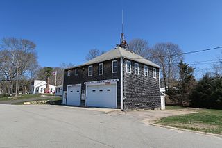
Monument Beach is a census-designated place (CDP) in the town of Bourne in Barnstable County, Massachusetts, United States. The population was 2,790 at the 2010 census.

North Patchogue, New York Hamlet and census-designated place in New York, United States

North Patchogue is a hamlet and census-designated place (CDP) in Suffolk County, New York, United States. The CDP population was 7,246 at the 2010 census. The community is located on Long Island.

New Castle Northwest, Pennsylvania Census-designated place in Pennsylvania, United States

New Castle Northwest is an unincorporated area and census-designated place (CDP) in Lawrence County, Pennsylvania, United States. The population was 1,413 at the 2010 census.

New Boston-Morea, Pennsylvania CDP in Pennsylvania, United States

New Boston-Morea is a census-designated place (CDP) in Schuylkill County, Pennsylvania, United States. The population was 441 at the 2000 census. It uses the Mahanoy City zip code of 17948.

Troxelville, Pennsylvania CDP in Pennsylvania, United States

Troxelville is a census-designated place (CDP) in Snyder County, Pennsylvania, United States. The population was 192 at the 2000 census.

Lake Brownwood, Texas Census-designated place in Texas, United States

Lake Brownwood is a census-designated place (CDP) located in Brown County in central Texas, United States. The population was 1,532 at the 2010 census.

Falman-County Acres, Texas former CDP in Texas, United States

Falman-County Acres is a census-designated place (CDP) in San Patricio County, Texas, United States. The population was 289 at the 2000 census.

Moses Lake North, Washington Census-designated place in Washington, United States

Moses Lake North is a census-designated place (CDP) in Grant County, Washington, United States. The population was 4,418 at the 2010 census, up from 4,232 at the 2000 census.

Greece is a suburban community and census-designated place in Monroe County, New York, United States. The population was 14,519 at the 2010 census.

References

  1. 1 2 "U.S. Census website". United States Census Bureau . Retrieved 2008-01-31.
  2. "US Board on Geographic Names". United States Geological Survey. 2007-10-25. Retrieved 2008-01-31.
  3. "US Gazetteer files: 2010, 2000, and 1990". United States Census Bureau. 2011-02-12. Retrieved 2011-04-23.
  4. "CENSUS OF POPULATION AND HOUSING (1790-2000)". U.S. Census Bureau . Retrieved 2010-07-30.
  5. "Demographics of Golden Lakes, FL". MuniNetGuide.com. Archived from the original on 2008-05-25. Retrieved 2007-12-08.
  6. "MLA Data Center Results for Golden Lakes, Florida". Modern Language Association . Retrieved 2007-12-08.