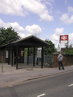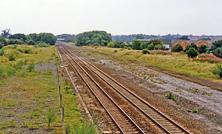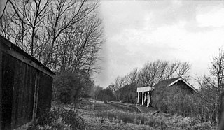
Winnersh railway station, previously known as Sindlesham and Hurst Halt and then Winnersh Halt, is a railway station located in the centre of the village of Winnersh in Berkshire, England. It is served by South Western Railway services between London Waterloo and Reading. The station is 38 miles 53 chains (62.2 km) from London Waterloo and 7.7 kilometres (4.8 mi) from Reading, at the point where the B3030 road crosses the line on an overbridge.

Leigh-on-Sea railway station is on the London, Tilbury and Southend line, serving the town of Leigh-on-Sea, Essex. It is 32 miles 43 chains (52.4 km) down the main line from London Fenchurch Street via Basildon and it is situated between Benfleet to the west and Chalkwell to the east. Its three-letter station code is LES.

Ashton Park Parade railway station was a station on the line between Guide Bridge and Stalybridge in Greater Manchester, England. This station served the town of Ashton-under-Lyne, now served only by Ashton Charlestown, north of this former station.

Finedon railway station was built by the Midland Railway in 1857 on its extension from Leicester to Bedford and Hitchin.

There are eleven disused railway stations between Exeter St Davids and Plymouth Millbay, Devon, England. At eight of these there are visible remains. Of the eleven stations, South Brent and Plympton are subject of campaigns for reopening while Ivybridge station was replaced by another station on a different site.
Turton and Edgworth railway station, located at 4 miles, 856 yards from Bolton, on the Bolton to Blackburn line, opened as Chapel Town Station. The short length original low height platform seen in early photographs at the front of the station building are replicated exactly at Bromley Cross, itself known to have opened in June 1848. Permanent station buildings were provided along the line in 1859, constructed with locally quarried sandstone, by Joseph Greenup and Co of Manchester. The original minutes of the railway company held at National Archives, Kew, reveal that the engineers drew up the plans for the 1859 building at Chapel Town and minute 273, dated 25 May 1859, reveals that tenders were sought for a station and detached cottage and loading shed at Chapel Town, at an estimated cost of £500. The 'detached cottage' survives as a private house close to the automated level crossing and the distinct two-half structure there appears identical to that surviving at the former Oaks Station, down the line towards Bolton, both being built as part of the same contract.

Old North Road was a railway station on the Varsity Line which served the small village of Longstowe near Bourn in Cambridgeshire. As its name suggests, the station was located on the eastern side of the Old North Road, the A1198 road - a major Roman road which linked London with Lincoln. Opened in 1862, the station was located in a rural area and saw little passenger traffic; it closed together with the line in 1968.

Killamarsh Central is a former railway station in Killamarsh, Derbyshire, England.
Peakirk railway station served the parish of Peakirk in Cambridgeshire.

Saxby railway station was a station serving the villages of Saxby and Freeby, Leicestershire. It was located between the two villages.

Honington railway station was a station in the village of Honington, Lincolnshire. It was located on the line Grantham and Lincoln railway line from Grantham to Sleaford and Skegness, at the junction with the branch to Lincoln. It was closed for regular services on 10 September 1962 but was used occasionally until 1965. The disused platforms are still in situ.

Breadsall railway station was a former railway station in Breadsall, Derbyshire. It was opened by the Great Northern Railway on its Derbyshire Extension in 1878.

Egginton Junction railway station is a disused railway station in Egginton, Derbyshire.

Barnwell railway station is a former railway station in Barnwell, Northamptonshire on the former Northampton and Peterborough Railway line which connected Peterborough and Northampton.

Gretton railway station was a railway station near Gretton, Northamptonshire. It was on the Nottingham direct line of the Midland Railway of the Midland Railway. The steps up to the former platforms can still be seen, but the station building itself is in private ownership.

Cockfield railway station was on the Long Melford-Bury St Edmunds branch line in Cockfield, Suffolk.

Linton railway station was a railway station in Linton, Cambridgeshire on the Stour Valley Railway. It closed in 1967. The station house is H-shaped and made of tan colour brick. It is still standing, as well as the platform and sunken trackbed space at the back of the building.

Frittenden Road was a railway station on the Kent and East Sussex Railway which closed in 1954. The wooden station building lay derelict for years and was destroyed by fire in October 2003.

Biddenden was a railway station on the Kent and East Sussex Railway which closed in 1954.

Thornhill is a closed station. It served the country town of Thornhill in Dumfries and Galloway. The station site is a mile or so from the town. Four miles north of Thornhill is Drumlanrig Castle, home to the Duke of Buccleuch and Queensberry. The Glasgow and South Western main line rail route between Kilmarnock and Dumfries is forced to make a long detour to the east of Thornhill and through a long tunnel, rather than the more logical route nearer Thornhill town centre and up the Nith Valley, so as not to be seen from the Buccleuch estate. The distance of the station from Thornhill may be one reason that passenger use was light and stopping services ended in 1965. There was formerly a busy livestock market near to the station, which eventually closed around 2001.


