Great Kei Local Municipality

Last updated

Great Kei
Great Kei CoA.png
Map of the Eastern Cape with Great Kei highlighted.svg
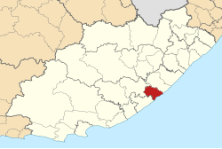
Location in the Eastern Cape
Country South Africa
Province Eastern Cape
District Amathole
Seat Qumrha
Wards 7
Government
[1]
  Type Municipal council
  MayorNgenisile Wellington Tekile (ANC)
  SpeakerNgenisile Wellington Tekile (ANC)
  Chief WhipNdileka Kantshashe (ANC)
Area
  Total1,736 km2 (670 sq mi)
Population
 (2011) [2]
  Total38,991
  Density22/km2 (58/sq mi)
Racial makeup (2011)
[2]
   Black African 91.3%
   Coloured 1.3%
   Indian/Asian 0.1%
   White 7.1%
First languages (2011)
[2]
   Xhosa 88.8%
   English 7.0%
   Afrikaans 2.7%
  Other1.5%
Time zone UTC+2 (SAST)
Municipal codeEC123

Great Kei Municipality (Xhosa : uMasipala wase Great Kei) is a local municipality within the Amathole District Municipality, in the Eastern Cape province of South Africa. The word Kei is of Khoekhoe origin, meaning "sand". The municipality is named after the Great Kei River. [3]

Contents

Main places

The 2001 census divided the municipality into the following main places: [4]

PlaceCodeArea (km2)Population
Chintsa East 21202 3.801,317
Chintsa 21201 2.57423
Cwili 21203 0.511,473
Haga Haga 21205 1.20114
Kei Mouth 21206 3.20284
Qumrha 21207 5.321,267
Kwelerha Point 21209 0.3696
Kwelerha 21208 50.838,941
Mooiplaas 21210 145.0717,281
Morgans Bay 21211 1.36453
Ocean View 21212 0.1767
Qumrha 21213 1.945,652
Remainder of the municipality 21204 1,519.307,087

Politics

The municipal council consists of thirteen members elected by mixed-member proportional representation. Seven councillors are elected by first-past-the-post voting in seven wards, while the remaining six are chosen from party lists so that the total number of party representatives is proportional to the number of votes received. In the election of 1 November 2021 the African National Congress (ANC) won a majority of nine seats on the council. The following table shows the results of the election. [5]

PartyWardListTotal
seats
Votes%SeatsVotes%Seats
African National Congress 6,22763.8976,51867.3629
Democratic Alliance 1,43414.7101,80718.6733
Economic Freedom Fighters 7828.0201,03110.6511
Independent candidates 1,03810.6500
Good 1651.6901701.7600
United Democratic Movement 600.620910.9400
African Transformation Movement 400.410600.6200
Total9,746100.0079,677100.00613
Valid votes9,74698.609,67798.29
Invalid/blank votes1381.401681.71
Total votes9,884100.009,845100.00
Registered voters/turnout17,93555.1117,93554.89

Related Research Articles

<span class="mw-page-title-main">Siyancuma Local Municipality</span> Local municipality in Northern Cape, South Africa

Siyancuma Municipality is a local municipality within the Pixley ka Seme District Municipality, in the Northern Cape province of South Africa.

<span class="mw-page-title-main">Thaba Chweu Local Municipality</span> Local municipality in Mpumalanga, South Africa

Thaba Chweu Municipality is a local municipality within the Ehlanzeni District Municipality, in the Mpumalanga province of South Africa.

<span class="mw-page-title-main">Ba-Phalaborwa Local Municipality</span> Local municipality in Limpopo, South Africa

Ba-Phalaborwa Municipality is a local municipality within the Mopani District Municipality, in the Limpopo province of South Africa. The seat is Phalaborwa.

<span class="mw-page-title-main">Kgetlengrivier Local Municipality</span> Local municipality in North West, South Africa

Kgetlengrivier Municipality is a local municipality within the Bojanala Platinum District Municipality, in the North West province of South Africa.

<span class="mw-page-title-main">Lekwa-Teemane Local Municipality</span> Local municipality in North West, South Africa

Lekwa-Teemane Municipality is a local municipality within the Dr Ruth Segomotsi Mompati District Municipality, located in the North West province of South Africa. The seat of the municipality is Christiana.

<span class="mw-page-title-main">King Sabata Dalindyebo Local Municipality</span> Local municipality in Eastern Cape, South Africa

King Sabata Dalindyebo Local Municipality is a municipality situated in the inland of Eastern Cape Province in South Africa. The municipality is made up of Mthatha and Mqanduli. The King Sabata Dalindyebo Local Municipality is one of the seven local municipalities within the Oliver Reginald Tambo District Municipality.

<span class="mw-page-title-main">Endumeni Local Municipality</span> Local municipality in KwaZulu-Natal, South Africa

Endumeni Local Municipality is an administrative area in the Umzinyathi District of KwaZulu-Natal in South Africa. Endumeni is an isiZulu name meaning "a place of thunderstorm". The municipality shares its name with the Endumeni hill.

uMdoni Local Municipality Area in KwaZulu-Natal, South Africa

uMdoni Local Municipality is an administrative area in the Ugu District of KwaZulu-Natal in South Africa. Umdoni is an isiZulu name for the indigenous tree, Mdoni.

<span class="mw-page-title-main">Mnquma Local Municipality</span> Local municipality in Eastern Cape, South Africa

Mnquma Municipality is a local municipality within the Amatole District Municipality, in the Eastern Cape of South Africa.

<span class="mw-page-title-main">Mtubatuba Local Municipality</span> Local municipality in KwaZulu-Natal, South Africa

Mtubatuba is an administrative area in the Umkhanyakude District of KwaZulu-Natal in South Africa.

<span class="mw-page-title-main">Jozini Local Municipality</span> Local municipality in KwaZulu-Natal, South Africa

Jozini is an administrative area in the Umkhanyakude District of KwaZulu-Natal in South Africa. Significant portions of Jozini have been neglected in terms of economic development. There is a great disparity between the level of service and infrastructure provision between settlement nodes, such as the towns of Mkuze and Jozini, and the surrounding rural areas. Most of the rural area is associated with a lack of development, poverty and poor service provision.

<span class="mw-page-title-main">Letsemeng Local Municipality</span> Local municipality in Free State, South Africa

Letsemeng Municipality is a local municipality within the Xhariep District Municipality, in the Free State province of South Africa.

<span class="mw-page-title-main">Amahlathi Local Municipality</span> Local municipality in Eastern Cape, South Africa

Amahlathi Municipality is a local municipality within the Amatole District Municipality, in the Eastern Cape province of South Africa. Amahlati is an isiXhosa word meaning "a place where many trees are grouped together, a forest". Forests are a key feature of the area.

<span class="mw-page-title-main">Nquthu Local Municipality</span> Local municipality in KwaZulu-Natal, South Africa

Nquthu Local Municipality is an administrative area in the Umzinyathi District of KwaZulu-Natal in South Africa. Nquthu is an isiZulu name meaning "the back of the head".

<span class="mw-page-title-main">Richmond Local Municipality</span> Local municipality in KwaZulu-Natal, South Africa

Richmond Local Municipality is an administrative area in the UMgungundlovu District of KwaZulu-Natal in South Africa.

<span class="mw-page-title-main">Ndwedwe Local Municipality</span> Local municipality in KwaZulu-Natal, South Africa

Ndwedwe Local Municipality is an administrative area in the iLembe District of KwaZulu-Natal in South Africa.

<span class="mw-page-title-main">Ubuhlebezwe Local Municipality</span> Local municipality in KwaZulu-Natal, South Africa

Ubuhlebezwe Local Municipality is an administrative area in the Harry Gwala District of KwaZulu-Natal in South Africa. Ubuhlebezwe is an isiZulu name meaning "The Beauty of the Land". The name is derived from Alan Paton's novel, Cry, The Beloved Country.

<span class="mw-page-title-main">Mkhambathini Local Municipality</span> Local municipality in KwaZulu-Natal, South Africa

Mkhambathini Local Municipality is an administrative area in the UMgungundlovu District of KwaZulu-Natal in South Africa. Mkhabathini is the isiZulu name derived from the Zulu word eMkhambathini meaning the place of acacia trees.

<span class="mw-page-title-main">Umvoti Local Municipality</span> Local municipality in KwaZulu-Natal, South Africa

Umvoti Local Municipality is an administrative area in the Umzinyathi District of KwaZulu-Natal in South Africa.

The Great Kei Local Municipality council consists of thirteen members elected by mixed-member proportional representation. Seven are elected by first-past-the-post voting in seven wards, while the remaining six are chosen from party lists so that the total number of party representatives is proportional to the number of votes received. In the election of 1 November 2021 the African National Congress (ANC) won a majority of nine seats.

References

  1. "Contact list: Executive Mayors". Government Communication & Information System. Archived from the original on 14 July 2010. Retrieved 22 February 2012.
  2. 1 2 3 "Statistics by place". Statistics South Africa. Retrieved 27 September 2015.
  3. South African Languages - Place names
  4. Lookup Tables - Statistics South Africa [ permanent dead link ]
  5. "Election Result Table for LGE2021 — Great Kei". wikitable.frith.dev. Retrieved 30 December 2021.

32°35′30″S27°53′02″E / 32.59167°S 27.88389°E / -32.59167; 27.88389