Senqu Local Municipality

Last updated

Senqu
Senqu CoA.png
Map of the Eastern Cape with Senqu highlighted.svg
Location in the Eastern Cape
Country South Africa
Province Eastern Cape
District Joe Gqabi
Seat Lady Grey
Wards 19
Government
[1]
  Type Municipal council
  MayorNomvuyo Mposelwa (ANC)
  SpeakerVelile Stokhwe (ANC)
  Chief WhipMlifi Mshasha (ANC)
Area
  Total7,329 km2 (2,830 sq mi)
Population
 (2011) [2]
  Total134,150
  Density18/km2 (47/sq mi)
Racial makeup (2011)
[2]
   Black African 97.3%
   Coloured 1.2%
   Indian/Asian 0.2%
   White 1.1%
First languages (2011)
[3]
   Xhosa 74.3%
   Sotho 20.2%
   Afrikaans 2.4%
   English 1.3%
  Other1.8%
Time zone UTC+2 (SAST)
Municipal codeEC142

Senqu Municipality (Xhosa : uMasipala wase Senqu; Sotho : Masepala wa Senqu) is a local municipality within the Joe Gqabi District Municipality, in the Eastern Cape province of South Africa. Senqu is the Sesotho name for the Orange River. [4]

Contents

Main places

The 2001 census divided the municipality into the following main places: [5]

PlaceCodeArea (km2)Population
Amaqwati 22701 62.984,284
Amavundla 22702 86.378,123
Barkly East 22703 16.104,292
Basoto 22704 250.7431,727
Batlokoa 22705 127.835,054
Herschel 22706 4.89561
Hlubi 22707 1,061.3751,548
Khwezinaledi 22708 0.814,793
Lady Grey 22709 23.751,312
Mfelandawonye 22710 0.0527
Myamane 22711 122.049,296
Nkululeko 22712 0.534,077
Polar Park 22713 0.05630
Rhodes 22714 10.28129
Rossouw 22715 0.66302
Sterkspruit 22717 4.021,557
Zakhele 22718 0.14377
Zola 22719 0.02337
Remainder of the municipality 22716 4,998.126,736

Politics

The municipal council consists of thirty-four members elected by mixed-member proportional representation. Seventeen councillors are elected by first-past-the-post voting in seventeen wards, while the remaining seventeen are chosen from party lists so that the total number of party representatives is proportional to the number of votes received. In the election of 1 November 2021 the African National Congress (ANC) won an increased majority of twenty-five seats on the council. The following table shows the results of the election. [6]

PartyWardListTotal
seats
Votes%SeatsVotes%Seats
African National Congress 19,70272.231720,27274.22825
Economic Freedom Fighters 2,99210.9703,12511.4444
Sterkspruit Civic Association 1,0613.8901,2214.4722
Democratic Alliance 8753.2109413.4511
Pan Africanist Congress of Azania 5081.8605361.9611
Independent candidates 1,0103.7000
United Democratic Movement 2600.9503631.3311
Freedom Front Plus 3131.1502851.0400
African Transformation Movement 2921.0702470.9000
African People's Convention 1880.6901820.6700
Arusha Economic Coalition 770.2801400.5100
Total27,278100.001727,312100.001734
Valid votes27,27897.7627,31297.78
Invalid/blank votes6242.246202.22
Total votes27,902100.0027,932100.00
Registered voters/turnout60,18746.3660,18746.41

Related Research Articles

<span class="mw-page-title-main">Bela-Bela Local Municipality</span> Local municipality in Limpopo, South Africa

Bela-Bela Municipality is a local municipality within the Waterberg District Municipality, in the Limpopo province of South Africa. The seat is Bela-Bela. Th municipality lies north of Hammanskraal. It is the only municipality in South Africa that straddles 4 provinces.

<span class="mw-page-title-main">Victor Khanye Local Municipality</span> Local municipality in Mpumalanga, South Africa

Victor Khanye Municipality, formerly Delmas Municipality, is a local municipality within the Nkangala District Municipality, in the Mpumalanga province of South Africa. The seat is Delmas. The local municipality was one of the four to have passed the 2009-10 audit by the Auditor-General of South Africa, who deemed it to have a clean administration.

<span class="mw-page-title-main">Ditsobotla Local Municipality</span> Local municipality in North West, South Africa

Ditsobotla Municipality is a local municipality within the Ngaka Modiri Molema District Municipality, in the North West province of South Africa. The seat of the municipality is Lichtenburg.

<span class="mw-page-title-main">Moqhaka Local Municipality</span> Local municipality in Free State, South Africa

Moqhaka Municipality is a local municipality within the Fezile Dabi District Municipality, in the Free State province of South Africa. In 2001, the population was 267,881 with a total area of 7925 km². The seat is Kroonstad. Moqhaka is the Sesotho word for "crown".

<span class="mw-page-title-main">Kopanong Local Municipality</span> Local municipality in Free State, South Africa

Kopanong Municipality is a local municipality within the Xhariep District Municipality, in the Free State province of South Africa. Kopanong is a Sesotho word meaning "meeting place or where people are invited". The name earmarks unity and seeks to encourage co-operation.

uMdoni Local Municipality Area in KwaZulu-Natal, South Africa

uMdoni Local Municipality is an administrative area in the Ugu District of KwaZulu-Natal in South Africa. Umdoni is an isiZulu name for the indigenous tree, Mdoni.

<span class="mw-page-title-main">Elundini Local Municipality</span> Local municipality in Eastern Cape, South Africa

Elundini Municipality is a local municipality within the Joe Gqabi District Municipality, in the Eastern Cape province of South Africa. The name originates from isiZulu and refers to the Drakensberg Mountains.

<span class="mw-page-title-main">Ga-Segonyana Local Municipality</span> Local municipality in Northern Cape, South Africa

Ga-Segonyana Municipality is a local municipality within the John Taolo Gaetsewe District Municipality, in the Northern Cape province of South Africa.

<span class="mw-page-title-main">Setsoto Local Municipality</span> Local municipality in Free State, South Africa

Setsoto Municipality is a local municipality within the Thabo Mofutsanyane District Municipality, in the Free State province of South Africa. Setsoto is a Sesotho word meaning "beauty". The seat is Ficksburg. Other towns include Senekal, Clocolan and Marquard. The municipality is rich in agriculture and is known for producing cherries.

<span class="mw-page-title-main">Emalahleni Local Municipality, Eastern Cape</span> Local municipality in Eastern Cape, South Africa

Emalahleni Municipality is a local municipality within the Chris Hani District Municipality, in the Eastern Cape province of South Africa. Emalahleni is an isiXhosa word meaning "a place of coal".

<span class="mw-page-title-main">Mafube Local Municipality</span> Local municipality in Free State, South Africa

Mafube Municipality is a local municipality within the Fezile Dabi District Municipality, in the Free State province of South Africa. Mafube is a Sesotho word meaning "dawning of the new day".

<span class="mw-page-title-main">Great Kei Local Municipality</span> Local municipality in Eastern Cape, South Africa

Great Kei Municipality is a local municipality within the Amathole District Municipality, in the Eastern Cape province of South Africa. The word Kei is of Khoekhoe origin, meaning "sand". The municipality is named after the Great Kei River.

<span class="mw-page-title-main">Sakhisizwe Local Municipality</span> Local municipality in Eastern Cape, South Africa

Sakhisizwe Municipality is a local municipality within the Chris Hani District Municipality, in the Eastern Cape province of South Africa. Sakhisizwe is an isiXhosa word meaning "we are building the nation".

<span class="mw-page-title-main">Nquthu Local Municipality</span> Local municipality in KwaZulu-Natal, South Africa

Nquthu Local Municipality is an administrative area in the Umzinyathi District of KwaZulu-Natal in South Africa. Nquthu is an isiZulu name meaning "the back of the head".

<span class="mw-page-title-main">Mandeni Local Municipality</span> Local municipality in KwaZulu-Natal, South Africa

Mandeni Local Municipality is an administrative area in the iLembe District of KwaZulu-Natal in South Africa.

<span class="mw-page-title-main">Ubuhlebezwe Local Municipality</span> Local municipality in KwaZulu-Natal, South Africa

Ubuhlebezwe Local Municipality is an administrative area in the Harry Gwala District of KwaZulu-Natal in South Africa. Ubuhlebezwe is an isiZulu name meaning "The Beauty of the Land". The name is derived from Alan Paton's novel, Cry, The Beloved Country.

uMfolozi Local Municipality Local municipality in KwaZulu-Natal, South Africa

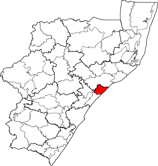
uMfolozi Local Municipality is a local municipality within the King Cetshwayo District Municipality of KwaZulu-Natal in South Africa. It is situated around the town of KwaMbonambi, to the north of Richard's Bay, stretching from the Indian Ocean to the edge of the Hluhluwe–Imfolozi Park.

<span class="mw-page-title-main">Mohokare Local Municipality</span> Local municipality in Free State, South Africa

Mohokare Municipality is a local municipality within the Xhariep District Municipality, in the Free State province of South Africa. Mohokare is the Sesotho word for the Caledon River, which runs through the municipality.

<span class="mw-page-title-main">Walter Sisulu Local Municipality</span> Local municipality in Eastern Cape, South Africa

Walter Sisulu Municipality is a local municipality within the Joe Gqabi District Municipality, in the Eastern Cape province of South Africa. The municipality was formed by merging the Maletswai and Gariep local municipalities immediately after the August 2016 local municipal elections.

The Senqu Local Municipality council consists of thirty-four members elected by mixed-member proportional representation. Seventeen councillors are elected by first-past-the-post voting in seventeen wards, while the remaining seventeen are chosen from party lists so that the total number of party representatives is proportional to the number of votes received. In the election of 1 November 2021 the African National Congress (ANC) won a majority of twenty-five seats.

References

  1. "Contact list: Executive Mayors". Government Communication & Information System. Archived from the original on 14 July 2010. Retrieved 22 February 2012.
  2. 1 2 "Statistics by place". Statistics South Africa. Retrieved 27 September 2015.
  3. "Statistics by place". Statistics South Africa. Retrieved 27 September 2015.
  4. South African Languages - Place names
  5. Lookup Tables - Statistics South Africa
  6. "Election Result Table for LGE2021 — Senqu". wikitable.frith.dev. Retrieved 29 December 2021.

30°42′S27°14′E / 30.700°S 27.233°E / -30.700; 27.233