Grover Hill, Ohio

Last updated

Grover Hill, Ohio
Grover Hill Bible Baptist Church.jpg
Bible Baptist Church
OHMap-doton-Grover Hill.png
Location of Grover Hill, Ohio
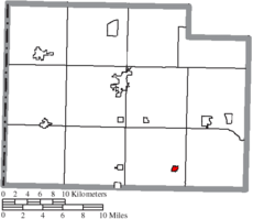
Map of Paulding County Ohio Highlighting Grover Hill Village.png
Location of Grover Hill in Paulding County
Coordinates: 41°01′08″N84°28′39″W / 41.01889°N 84.47750°W / 41.01889; -84.47750
Country United States
State Ohio
County Paulding
Township Latty
Area
[1]
  Total0.28 sq mi (0.71 km2)
  Land0.28 sq mi (0.71 km2)
  Water0.00 sq mi (0.00 km2)
Elevation
[2]
728 ft (222 m)
Population
 (2020)
  Total382
  Density1,384.06/sq mi (534.30/km2)
Time zone UTC-5 (Eastern (EST))
  Summer (DST) UTC-4 (EDT)
ZIP code
45849
Area code 419
FIPS code 39-32620 [3]
GNIS feature ID2398214 [2]

Grover Hill is a village in Paulding County, Ohio, United States. The population was 382 at the 2020 census. The village is named after President Grover Cleveland.

Contents

Geography

According to the United States Census Bureau, the village has a total area of 0.28 square miles (0.73 km2), all land. [4]

Demographics

Historical population
CensusPop.Note
1900 655
1910 6763.2%
1920 530−21.6%
1930 414−21.9%
1940 47815.5%
1950 463−3.1%
1960 54718.1%
1970 536−2.0%
1980 486−9.3%
1990 5186.6%
2000 412−20.5%
2010 402−2.4%
2020 382−5.0%
U.S. Decennial Census [5]

2010 census

As of the census [6] of 2010, there were 402 people, 159 households, and 110 families residing in the village. The population density was 1,435.7 inhabitants per square mile (554.3/km2). There were 183 housing units at an average density of 653.6 per square mile (252.4/km2). The racial makeup of the village was 98.5% White, 0.2% African American, and 1.2% from two or more races. Hispanic or Latino of any race were 1.0% of the population.

There were 159 households, of which 34.6% had children under the age of 18 living with them, 52.2% were married couples living together, 12.6% had a female householder with no husband present, 4.4% had a male householder with no wife present, and 30.8% were non-families. 25.8% of all households were made up of individuals, and 11.3% had someone living alone who was 65 years of age or older. The average household size was 2.53 and the average family size was 3.03.

The median age in the village was 37.1 years. 28.6% of residents were under the age of 18; 7.4% were between the ages of 18 and 24; 22.4% were from 25 to 44; 26.6% were from 45 to 64; and 14.9% were 65 years of age or older. The gender makeup of the village was 51.0% male and 49.0% female.

2000 census

As of the census [3] of 2000, there were 412 people, 167 households, and 115 families residing in the village. The population density was 1,420.4 inhabitants per square mile (548.4/km2). There were 183 housing units at an average density of 630.9 per square mile (243.6/km2). The racial makeup of the village was 96.12% White, 0.49% African American, 0.24% Native American, 0.73% from other races, and 2.43% from two or more races. Hispanic or Latino of any race were 2.43% of the population.

There were 167 households, out of which 31.7% had children under the age of 18 living with them, 55.7% were married couples living together, 11.4% had a female householder with no husband present, and 31.1% were non-families. 28.7% of all households were made up of individuals, and 12.6% had someone living alone who was 65 years of age or older. The average household size was 2.47 and the average family size was 2.97.

In the village, the population was spread out, with 26.0% under the age of 18, 7.8% from 18 to 24, 29.1% from 25 to 44, 21.8% from 45 to 64, and 15.3% who were 65 years of age or older. The median age was 37 years. For every 100 females there were 93.4 males. For every 100 females age 18 and over, there were 95.5 males.

The median income for a household in the village was $33,750, and the median income for a family was $41,667. Males had a median income of $31,563 versus $22,222 for females. The per capita income for the village was $14,872. About 11.5% of families and 17.7% of the population were below the poverty line, including 31.0% of those under age 18 and 8.8% of those age 65 or over.

History

Grover Hill was a boom town, created as a stop on the railroad. A comprehensive history of the town and nearby communities was self-published by Laurence R. Hipp, a longtime resident of Grover Hill. [7]

Related Research Articles

Maple Grove Township is a civil township of Manistee County in the U.S. state of Michigan. The population was 1,342 at the 2020 census. The township is home to the village of Kaleva.

<span class="mw-page-title-main">Calverton Park, Missouri</span> City in Missouri, United States

Calverton Park is a city in St. Louis County, Missouri, United States. The population was 1,293 at the 2010 census. The Village of Calverton Park incorporated as the City of Calverton Park in 2014.

<span class="mw-page-title-main">Lafayette, Ohio</span> Village in Ohio, United States

Lafayette is a village in Allen County, Ohio, United States. The population was 406 at the 2020 census. It is included in the Lima, Ohio Metropolitan Statistical Area.

<span class="mw-page-title-main">Oakwood, Cuyahoga County, Ohio</span> Village in Ohio, United States

Oakwood is a village in Cuyahoga County, Ohio, United States. The population was 3,572 at the 2020 census. An eastern suburb of Cleveland, it is a part of the Cleveland metropolitan area.

<span class="mw-page-title-main">Sugar Grove, Ohio</span> Village in Ohio, United States

Sugar Grove is a village in Fairfield County, Ohio, United States. The population was 429 at the 2020 census.

<span class="mw-page-title-main">Addyston, Ohio</span> Village in Ohio, United States

Addyston is a village in Miami Township, Hamilton County, Ohio, United States. Located along the Ohio River, it is a western suburb of the neighboring city of Cincinnati. The population was 927 at the 2020 census.

<span class="mw-page-title-main">Antwerp, Ohio</span> Village in Ohio, United States

Antwerp is a village in Paulding County, Ohio, United States, along the Maumee River. The population was 1,676 at the 2020 census.

<span class="mw-page-title-main">Broughton, Ohio</span> Village in Ohio, United States

Broughton is a village in Paulding County, Ohio, United States. The population was 116 at the 2020 census.

<span class="mw-page-title-main">Haviland, Ohio</span> Village in Ohio, United States

Haviland is a village in Paulding County, Ohio, United States. The population was 160 at the 2020 census.

<span class="mw-page-title-main">Latty, Ohio</span> Village in Ohio, United States

Latty is a village in Paulding County, Ohio, United States. The population was 165 at the 2020 census.

<span class="mw-page-title-main">Melrose, Ohio</span> Village in Ohio, United States

Melrose is a village in Paulding County, Ohio, United States. The population was 233 at the 2020 census.

<span class="mw-page-title-main">Oakwood, Paulding County, Ohio</span> Village in Ohio, United States

Oakwood is a village in Paulding County, Ohio, United States. The population was 546 at the 2020 census.

<span class="mw-page-title-main">Paulding, Ohio</span> Village in Ohio, United States

Paulding is a village in and the county seat of Paulding County, Ohio, United States. It is located predominantly in Paulding Township about 64 miles (103 km) southwest of Toledo. The population was 3,555 at the 2020 census.

<span class="mw-page-title-main">Payne, Ohio</span> Village in Ohio, United States

Payne is a village in Paulding County, Ohio, United States. The population was 1,192 at the 2020 census.

<span class="mw-page-title-main">West Millgrove, Ohio</span> Village in Ohio, United States

West Millgrove is a village in Wood County, Ohio, United States. The population was 131 at the 2020 census.

<span class="mw-page-title-main">Cedar Grove, West Virginia</span> Town in West Virginia, United States

Cedar Grove is a town in Kanawha County, West Virginia, United States. The population was 714 at the 2020 census. Cedar Grove was incorporated in 1902. Its name is derived from the time the town was established, when a large juniper forest, misidentified as cedars by early settlers, was growing at that location. Cedar Grove is the site of Fort Kelley and the oldest settlement in the Kanawha Valley, dating from 1773. Landmarks located here include the Tompkins Home (1844) and the Old Brick Church (1853). The current mayor is as of July 1, 2023, is Melissa (Missy) Young.

<span class="mw-page-title-main">Bluffton, Ohio</span> Village in Ohio, United States

Bluffton, originally known as Shannon, is a village in Allen and Hancock counties in the U.S. state of Ohio. The population was 3,967 at the 2020 census. Bluffton is home to Bluffton University, a four-year educational institution affiliated with Mennonite Church USA. Bluffton is served by the Bluffton general aviation airport. Bluffton participates in the Tree City USA program.

<span class="mw-page-title-main">Scott, Ohio</span> Village in Ohio, United States

Scott is a village in Paulding and Van Wert counties in the U.S. state of Ohio. The population was 242 at the 2020 census. The Van Wert County portion of Scott is part of the Van Wert Micropolitan Statistical Area.

<span class="mw-page-title-main">Cottage Grove, Wisconsin</span> Village in Wisconsin, United States

Cottage Grove is a village in Dane County, Wisconsin, United States. Its population was 7,303 at the 2020 census. A suburb of Madison, it shares a school district with Monona. The village is located partially within the survey township of Cottage Grove.

<span class="mw-page-title-main">Patch Grove, Wisconsin</span> Village in Wisconsin, United States

Patch Grove is a village in Grant County, Wisconsin, United States. The population was 198 at the 2010 census. The village is located within the Town of Patch Grove.

References

  1. "ArcGIS REST Services Directory". United States Census Bureau. Retrieved September 20, 2022.
  2. 1 2 U.S. Geological Survey Geographic Names Information System: Grover Hill, Ohio
  3. 1 2 "U.S. Census website". United States Census Bureau . Retrieved January 31, 2008.
  4. "US Gazetteer files 2010". United States Census Bureau. Archived from the original on January 25, 2012. Retrieved January 6, 2013.
  5. "Census of Population and Housing". Census.gov. Retrieved June 4, 2015.
  6. "U.S. Census website". United States Census Bureau . Retrieved January 6, 2013.
  7. Hipp, Laurence R. 1971. History of Grover Hill (Latty and Washington Townships of Paulding County, Ohio). 393 pp.