Yenagoa is a Local Government Area and capital city of Bayelsa State, southern Nigeria. It is located at the southern part of the country at coordinates 4°55′29″N6°15′51″E.

Kukawa is a town and Local Government Area in the northeastern Nigerian state of Borno, close to Lake Chad.
Igabi is a Local Government Area (LGA) of Kaduna State, Nigeria. It is chaired by the Executive Chairman - Jabir Khamis, It is one of 774 local government areas in Nigeria. Rigasa ward is under Igabi LGA, one of the most populous wards in the country.
Bakori is a local government area in Katsina State, Nigeria. It was created on 15 May 1989 by the then military governor of Katsina State Major General Lawrence Onoja
Konduga is a community in Borno State, Nigeria and the center of a Local Government Area of the same name about 25 km to the southeast of Maiduguri, situated on the north bank of the Ngadda River. The population of the Konduga Local Government Area is about 13,400. It is one of the sixteen LGAs that constitute the Borno Emirate, a traditional state located in Borno State, Nigeria. The primary languages are Shuwa Arabic, Kanuri Maffa and Wandala / Malgwa.
Marte is a Local Government Area of Borno State, Nigeria, on the western coast of Lake Chad. Its headquarters are in the town of Marte
Bama is a local government area of Borno State, Nigeria. It has its headquarters in the town of Bama.
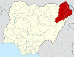
Damboa is a Local Government Area of Borno State, Nigeria. Its headquarters are in the town of Damboa. It has an area of 6,219 km² and had a population of 233,200 at the 2006 census.
Kwaya Kusar is a Local Government Area of Borno State, Nigeria. Its headquarters are in the town of Kwaya Kusar.
Mafa is a local government area of Borno State, Nigeria. It has its headquarters in the town of Mafa.
Monguno is one of the LGAs Local Government Area of Borno State in northeastern Nigeria.
Ngala is a local government area of Borno State, Nigeria, adjacent to the border with Cameroon. Its headquarters is in the town of Gamboru Ngala.
Shani is a Local Government Area of Borno State, Nigeria. Its headquarters are in the town of Shani.
Bunza is a Local Government Area (LGA) in Kebbi State, Nigeria. Its headquarters are in the town of Bunza and was created in 1975 out of the then-state of Sokoto during the local government reform under the general Murtala administration. Bunza shares bounders in the east with Kalgo LGA, the latter was created in 1996 out of the present Bunza; in the north with Dandi and Arewa LGA's; and in the south and west with Suru Local Government Area, the latter was created in 1991 out of Bunza.
Kagarko is a Local Government Area in southern Kaduna State of Nigeria. Its headquarters are in the town of Kagarko. It has an area of 2,356 km2 and a population of 239,058 at the 2006 census. The Local Government Council is chaired by Nasara Rabo. The postal code is 802.
Kachia is a Local Government Area in the southern part of Kaduna State, Nigeria. Its headquarters are in the town of Kachia. It has an area of 4,570 km2 and a population of 252,568 in the 2006 census. The postal code of the area is 802.
Kauru is a Local Government Area in southern Kaduna State, Nigeria. The area is 3,186 km2. Its headquarters are in the town of Kauru. The postal code of the area is 811.
Anka is a Local Government Area in Zamfara State, Nigeria. Its headquarters is in the town of Anka at 12°06′30″N5°56′00″E.
Maradun is a Local Government Area in Zamfara State, Nigeria. Its headquarters is in the town of Maradun12°34′00″N6°14′40″E towards the south of the Area.