Kukawa is a town and Local Government Area in the northeastern Nigerian state of Borno, close to Lake Chad.

Gboko is a Local Government Area in Benue state, North-central Nigeria. It is headquartered in the town of Gboko.
Agaie is a Local Government Area in Niger State, Nigeria. Its headquarters are in the town of Agaie on the A124 highway.
Konduga is a community in Borno State, Nigeria and the center of a Local Government Area of the same name about 25 km to the southeast of Maiduguri, situated on the north bank of the Ngadda River. The population of the Konduga Local Government Area is about 13,400. It is one of the sixteen LGAs that constitute the Borno Emirate, a traditional state located in Borno State, Nigeria. The primary languages are Shuwa Arabic, Kanuri Maffa and Wandala / Malgwa.
Biu is a town and a Local Government Area (LGA) in southern Borno State of Nigeria. The town is the administrative center of the LGA and was once the capital of the Biu kingdom, and is now capital of the Biu Emirate. Biu lies on the Biu Plateau at an average elevation of 626 meters. The region is semi-arid.
Demsa is a Local Government Area of Adamawa State, Nigeria with headquarters located in Demsa. Demsa lies on the Benue River.

Mubi South is a Local Government Area of Adamawa State, Nigeria.
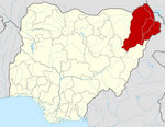
Marte is a Local Government Area of Borno State, Nigeria, on the western coast of Lake Chad. Its headquarters are in the town of Marte
Damboa is a Local Government Area of Borno State, Nigeria. Its headquarters are in the town of Damboa. It has an area of 6,219 km² and had a population of 233,200 at the 2006 census.
Dikwa is a town and a local government area in Borno State, Nigeria.
Gubio, also Gobiyo, is a Local Government Area of Borno State, in northeastern Nigeria. Its headquarters are in the town of Gubio.
Mafa is a local government area of Borno State, Nigeria. It has its headquarters in the town of Mafa.
Monguno is one of the LGAs Local Government Area of Borno State in northeastern Nigeria.
Ngala is a local government area of Borno State, Nigeria, adjacent to the border with Cameroon. Its headquarters are in the town of Gamboru Ngala.
Shani is a Local Government Area of Borno State, Nigeria. Its headquarters are in the town of Shani.
Ise/Orun is a Local Government Area of Ekiti State, Nigeria. Its headquarters are in the town of Ise Ekiti.
Billiri is one of the 11 Local Government Areas of Gombe State, Nigeria bordered to the north by Akko Local Government Area, south and east by Shongom as well as North-East by Kaltungo Local Government Area. It is a historical settlement of the Tangales which is located South of Gombe It has an area of 737 km2 and a population of 202,144 at the 2006 census. Apart from Tangale language, Fulfulde and Hausa are commonly spoken The postal code of the area is 771.
Jakusko is a Local Government Area in Yobe State, Nigeria. Its headquarters are in the town of Jakusko in the west of the area at 12°22′09″N10°46′23″E.
Gujba is a town and Local Government Area in Yobe State, Nigeria. Its headquarters are situated in Buni Yadi at 11°16′08″N11°55′49″E towards the south of the area; the eponymous town of Gujba lies in the north of the area. It has an area of 3,239 km2 (1,251 sq mi) and a population of 130,088 at the 2006 census. The postal code of the area is 621. The town serves as the seat of the Gujba Emirate.
The Biu Emirate is a traditional state based in Biu in Borno State, Nigeria. Prior to 1920 it was referred to as the Biu Kingdom.