Halls Crossing, Utah

Last updated
Halls Crossing, Utah
CDP
Halls Crossing entrance, February 2019.jpg
San Juan County Utah incorporated and unincorporated areas Halls Crossing highlighted.svg
Location in San Juan County and the state of Utah.
Coordinates: 37°27′41″N110°40′29″W / 37.46139°N 110.67472°W / 37.46139; -110.67472
Country United States
State Utah
County San Juan
Area
  Total17.5 sq mi (45.3 km2)
  Land13.2 sq mi (34.2 km2)
  Water4.3 sq mi (11.1 km2)
Elevation
3,842 ft (1,171 m)
Population
 (2010)
  Total6
  Density0.34/sq mi (0.13/km2)
Time zone UTC-7 (Mountain (MST))
  Summer (DST) UTC-6 (MDT)
ZIP code
84533
Area code 435
FIPS code 49-33027 [1]
GNIS feature ID1437579 [2]

Halls Crossing is a census-designated place (CDP) on the western edge of San Juan County, Utah, United States. The population was six at the 2010 Census. State Route 276 crosses the Colorado River at Halls Crossing using the Charles Hall Ferry.

Contents

Geography

Halls Crossing is located at 37°27′41″N110°40′29″W / 37.46139°N 110.67472°W / 37.46139; -110.67472 (37.461406, -110.674821). [3]

According to the United States Census Bureau, the CDP has a total area of 17.5 square miles (45.2 km2), of which 13.2 square miles (34.2 km2) is land and 4.3 square miles (11.1 km2) (24.50%) is water.

Demographics

Only 8–10 people live here year-round. The rest, up to 40, are seasonal employees during the spring and summer months. Demographics depend on the seasonal employees.

Bullfrog Ferry at Halls Crossing Halls Crossing - Bullfrog Ferry, Lake Powell (3684657843).jpg
Bullfrog Ferry at Halls Crossing

As of the census [1] of 2000, there were 89 people, 39 households, and 20 families residing in the CDP. The population density was 6.7 inhabitants per square mile (2.6/km2). There were 58 housing units at an average density of 4.4 per square mile (1.7/km2). The racial makeup of the CDP was 66% White, 28% Native American, 2% Asian, 3% from other races. Hispanic or Latino of any race were 3% of the population.

There were 8 households, out of which 20% had children under the age of 18 living with them, 20% were married couples living together, and 80% were non-families. 80% of all households were made up of individuals, and 0% had someone living alone who was 65 years of age or older. The average household size was 2.28 and the average family size was 2.90.

In the CDP, the population was spread out, with 19% under the age of 18, 25% from 18 to 24, 33% from 25 to 44, 23% from 45 to 64, and 0% who were 65 years of age or older. The median age was 30 years. For every 100 females, there were 196.7 males. For every 100 females age 18 and over, there were 188.0 males.

The median income for a household in the CDP was $26,635, and the median income for a family was $50,250. Males had a median income of $19,250 versus $20,625 for females. The per capita income for the CDP was $13,933. There were no families and 30% of the population living below the poverty line, including no under eighteens and none of those over 64.

Halls Crossing Marina Halls Crossing Marina, February 2019.jpg
Halls Crossing Marina

See also

Related Research Articles

<span class="mw-page-title-main">Winslow West, Arizona</span> CDP in Coconino County, Arizona

Winslow West is a census-designated place (CDP) in Coconino and Navajo counties in Arizona, United States. The population was 438 at the 2010 census. The entire community is off-reservation trust land belonging to the Hopi tribe. It lies just west of the city of Winslow, and is more than 50 km (31 mi) south of the main Hopi reservation.

<span class="mw-page-title-main">First Mesa, Arizona</span> CDP in Navajo County, Arizona

First Mesa is a census-designated place (CDP) in Navajo County, Arizona, United States, on the Hopi Reservation. As of the 2010 census, the CDP population was 1,555, spread among three Hopi villages atop the 5,700-foot mesa: Hano, Sitsomovi, and Waalpi.

<span class="mw-page-title-main">East Sahuarita, Arizona</span> Community in Pima County, Arizona

East Sahuarita was a census-designated place (CDP) in Pima County, Arizona, United States. The population was 1,419 at the 2000 census. The CDP comprises the unincorporated neighborhoods east of incorporated Sahuarita.

<span class="mw-page-title-main">Summit, Arizona</span> CDP in Pima County, Arizona

Summit is a census-designated place (CDP) in Pima County, Arizona, United States. The population was 3,702 at the 2000 census.

<span class="mw-page-title-main">Tice, Florida</span> Census-designated place in Florida, United States

Tice is an unincorporated community and census-designated place (CDP) in Lee County, Florida, United States. As of the 2020 census, the CDP population was 4,853. It is part of the Cape Coral-Fort Myers, Florida Metropolitan Statistical Area.
<span class="mw-page-title-main">Tenstrike, Minnesota</span> City in Minnesota, United States

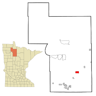
Tenstrike is a city in Beltrami County, Minnesota, United States. The population was 201 at the 2010 census. It is 21 miles northeast of Bemidji.

<span class="mw-page-title-main">Pymatuning North, Pennsylvania</span> Census-designated place in Pennsylvania, United States

Pymatuning North is a census-designated place (CDP) in Crawford County, Pennsylvania, United States. The population was 311 at the 2010 census.

<span class="mw-page-title-main">Cache, Utah</span> CDP in Utah, United States

Cache Junction is a census-designated place (CDP) in Cache County, Utah, United States. The population was 38 at the 2010 census. It is included in the Logan, Utah-Idaho (partial) Metropolitan Statistical Area.

<span class="mw-page-title-main">Garden, Utah</span> CDP in Utah, United States

Garden is a census-designated place (CDP) in Rich County, Utah, United States. It includes the southernmost subdivision of Garden City at its northeast and the hamlet of Meadowville at its southeast; otherwise it is farmland. The population was 181 at the 2010 census.
<span class="mw-page-title-main">Halchita, Utah</span> CDP in Utah, United States

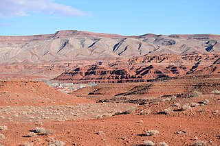
Halchita is a census-designated place (CDP) in San Juan County, Utah, United States. The population was 270 at the 2000 census.

<span class="mw-page-title-main">Navajo Mountain, Utah</span> Census-designated place in San Juan County, Utah, United States

Navajo Mountain is a census-designated place (CDP) on the Navajo Nation in southwestern San Juan County, Utah, United States. The 2020 census was recorded as 450.

<span class="mw-page-title-main">Tselakai Dezza, Utah</span> CDP in Utah, United States

Tselakai Dezza is a census-designated place (CDP) in San Juan County, Utah, United States. The population was 103 at the 2000 census.

<span class="mw-page-title-main">White Mesa, Utah</span> CDP in Utah, United States

White Mesa is a census-designated place (CDP) in San Juan County, Utah, United States. The population was 277 at the 2000 census. It is located within a section of the Ute Mountain Ute Tribe reservation along U.S. Route 191, south of Blanding and north of Bluff.

<span class="mw-page-title-main">Woodland, Utah</span> CDP in Utah, United States

Woodland is a census-designated place (CDP) in Summit County, Utah, United States. The population was 335 at the 2000 census.

<span class="mw-page-title-main">Fort Duchesne, Utah</span> CDP in Utah, United States

Fort Duchesne is a census-designated place (CDP) in Uintah County, Utah, United States. The population was 714 at the 2010 census, an increase from the 2000 figure of 621.

<span class="mw-page-title-main">Spring Lake, Utah</span> CDP in Utah, United States

Spring Lake is a census-designated place (CDP) in southern Utah County, Utah, United States. It is part of the Provo–Orem Metropolitan Statistical Area. The population was 458 at the 2010 census. It is an unincorporated part of Utah County, located just south of Payson and north of Santaquin.

<span class="mw-page-title-main">Piedmont, South Carolina</span> Census-designated place in South Carolina, United States

Piedmont is a census-designated place (CDP) along the Saluda River in Anderson and Greenville counties in the U.S. state of South Carolina. The population was 5,411 at the 2020 census.

Spurgeon is a census-designated place (CDP) in Sullivan and Washington counties in the U.S. state of Tennessee. The population was 3,957 at the 2010 census.

<span class="mw-page-title-main">Oljato–Monument Valley, Utah</span> CDP in Utah, United States

Oljato-Monument Valley is a census-designated place (CDP) in San Juan County, Utah, United States. The population was 864 at the 2000 census.

<span class="mw-page-title-main">Oljato-Monument Valley, Arizona</span> CDP in Navajo County, Arizona

Oljato-Monument Valley is a census-designated place (CDP) in Navajo County, Arizona, United States. The population was 154 at the 2010 census.

References

  1. 1 2 "U.S. Census website". United States Census Bureau . Retrieved 2008-01-31.
  2. "US Board on Geographic Names". United States Geological Survey. 2007-10-25. Retrieved 2008-01-31.
  3. "US Gazetteer files: 2010, 2000, and 1990". United States Census Bureau. 2011-02-12. Retrieved 2011-04-23.

Commons-logo.svg Media related to Halls Crossing, Utah at Wikimedia Commons