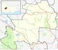
Halls Gap

Last updated

Halls Gap
Budja Budja
Victoria
Grampians Halls Gap from Pinnacle Crop - Nov 2008.jpg
Australia Victoria Northern Grampians Shire location map.svg
Red pog.svg
Halls Gap
Coordinates 37°07′0″S142°33′0″E / 37.11667°S 142.55000°E / -37.11667; 142.55000
Population495 (2021 census) [1]
 • Density6.505/km2 (16.847/sq mi)
Postcode(s) 3381
Area76.1 km2 (29.4 sq mi)
Time zone AEST (UTC+10)
 • Summer (DST) AEDT (UTC+11)
Location
LGA(s)
County Borung
State electorate(s) Lowan
Federal division(s) Wannon

Halls Gap (Djab Wurrung/Jardwadjali: Budja Budja) [2] is a town in Victoria, Australia. It is located on Grampians Road, adjacent to the Grampians National Park, in the Shire of Northern Grampians local government area. The town is set in the Fyans Valley at the foot of the Wonderland and Mount William ranges. [3] At the 2021 census Halls Gap had a population of 495. [1] The approximate driving time from Melbourne is 3 hours.

Contents

History

The first settler was Charles Browning Hall who set out in search of a suitable grazing run when he found the cattle market at Port Phillip overstocked in 1841. Establishing a station just east of the Grampians in a spot known as "Mokepilli" to the indigenous inhabitants the Mukjarawaint. [4] Halls Gap was originally located where Lake Bellfield Reservoir now lies.

Hall discovered the gap by following Aboriginal tracks. [5]

Hall's Gap Post Office opened on 3 February 1893, closed in 1896, and reopened in 1902. [6]

First Nations

The Traditional Owners of the area are the Djab Wurrung and the Jardwadjali, [4] who referred to the area as "Mokepilli".

Hall's Gap, The Grampians HallsGap (1).jpeg
Hall's Gap, The Grampians
The Flume in Hall's Gap, Victoria The Flume, Hall's Gap.jpg
The Flume in Hall's Gap, Victoria
Lookout in the Grampians Hall's Gap Lookout.jpg
Lookout in the Grampians

Today

Its chief industry is tourism, due to its location in the Grampians National Park. Australia's longest running Aboriginal cultural centre, Brambuk, is located in the town. [7] The Halls Gap Zoo is located 7 kilometres (4.3 mi) from town. There is now a local chemist in town located at the Stoney Creek shops.

Golfers play at the course of the Halls Gap Golf Club on Red Gum Lease Track. [8]

Food and Wine Festival

Halls Gap is home to one of Australia's longest running food and wine festivals, held over the first weekend of May every year. Launched in 1992, Grampians Grape Escape is a hallmark event for Victoria and provides food and wine offerings by more than 100 local artisan producers, live music and family entertainment. [9]

Climate

Climate data for Halls Gap
MonthJanFebMarAprMayJunJulAugSepOctNovDecYear
Mean daily maximum °C (°F)29.2
(84.6)
28.7
(83.7)
25.4
(77.7)
20.7
(69.3)
16.3
(61.3)
13.2
(55.8)
12.4
(54.3)
13.9
(57.0)
16.7
(62.1)
20.0
(68.0)
23.8
(74.8)
26.6
(79.9)
20.6
(69.0)
Mean daily minimum °C (°F)13.6
(56.5)
13.7
(56.7)
11.5
(52.7)
8.5
(47.3)
6.3
(43.3)
4.7
(40.5)
4.2
(39.6)
4.7
(40.5)
6.0
(42.8)
7.4
(45.3)
9.8
(49.6)
11.3
(52.3)
8.5
(47.3)
Average precipitation mm (inches)37.6
(1.48)
30.6
(1.20)
20.7
(0.81)
30.0
(1.18)
39.8
(1.57)
55.0
(2.17)
57.6
(2.27)
53.9
(2.12)
54.3
(2.14)
36.1
(1.42)
41.0
(1.61)
35.9
(1.41)
492.5
(19.38)
Source: [10]

Related Research Articles

<span class="mw-page-title-main">Grampians National Park</span> Protected area in Victoria, Australia

The Grampians National Park commonly referred to as the Grampians, is a national park located in the Grampians region of Victoria, Australia. The Jardwadjali name for the mountain range itself is Gariwerd.

<span class="mw-page-title-main">Shire of Northern Grampians</span> Local government area in Victoria, Australia

The Shire of Northern Grampians is a local government area in the Wimmera region of Victoria, Australia, located in the western part of the state. It covers an area of 5,730 square kilometres (2,210 sq mi) and in June 2018 had a population of 11,431, having fallen from 12,087 in 2008. It includes the city of Stawell and the towns of St Arnaud, Great Western, Marnoo, Glenorchy, Stuart Mill, Navarre and the tourist town of Halls Gap. It was formed in 1995 from the amalgamation of the City of Stawell, Town of St Arnaud, Shire of Stawell, Shire of Kara Kara and parts of the Shire of Wimmera, Shire of Dunmunkle and Shire of Donald.

<span class="mw-page-title-main">Stawell, Victoria</span> Town in Victoria, Australia

Stawell ( "stall"), is an Australian town in the Wimmera region of Victoria 237 kilometres (147 mi) west-north-west of the state capital, Melbourne. Located within the Shire of Northern Grampians local government area, it is a seat of local government for the shire and its main administrative centre. At the 2021 census, Stawell had a population of 6,220.

<span class="mw-page-title-main">Ararat, Victoria</span> City in Australia

Ararat is a town in south-west Victoria, Australia, about 198 kilometres (120 mi) west of Melbourne, on the Western Highway on the eastern slopes of the Ararat Hills and Cemetery Creek valley between Victoria's Western District and the Wimmera. Its urban population according to 2021 census is 8,500 and services the region of 11,880 residents across the Rural City's boundaries. It is also the home of the 2018/19 GMGA Golf Championship Final.

<span class="mw-page-title-main">Coleraine, Victoria</span> Town in Victoria, Australia

Coleraine is a town in Victoria, Australia on the Glenelg Highway, 334 kilometres (208 mi) west of the state capital, Melbourne and 34 kilometres (21 mi) north-west of Hamilton in the Shire of Southern Grampians local government area. It was named after the town in County Londonderry, Northern Ireland. At the 2006 census, the urban area of Coleraine had a population of 991.

<span class="mw-page-title-main">St Arnaud, Victoria</span> City in Victoria, Australia

St Arnaud is a town in the Wimmera region of Victoria, Australia, 244 kilometres north west of the capital Melbourne. It is in the Shire of Northern Grampians local government area. At the 2021 census, St Arnaud had a population of 3,453.

<span class="mw-page-title-main">Dunkeld, Victoria</span> Town in Victoria, Australia

Dunkeld is a town in Victoria, Australia, at the southern end of the Grampians National Park, in the Shire of Southern Grampians. It is approx 283 km west of Melbourne on the Glenelg Highway. The town's population is holding steady but aging. At the 2016 census, Dunkeld had a population of 678.

<span class="mw-page-title-main">Lake Bolac, Victoria</span> Town in Victoria, Australia

Lake Bolac is a town in the Western District region of Victoria, Australia. The town is on the shores of Lake Bolac, and the Glenelg Highway passes through the town. At the 2021 census, Lake Bolac and the surrounding area had a population of 368.

The Grampians is an Australian wine region located in the state of Victoria, west of Melbourne. It is located near the Grampians National Park and the Pyrenees hills. The area is dominated by red wine production, particularly Shiraz and Cabernet Sauvignon.

The Jardwadjali (Yartwatjali), also known as the Jaadwa, are an Aboriginal Australian people of the state of Victoria, whose traditional lands occupy the lands in the upper Wimmera River watershed east to Gariwerd (Grampians) and west to Lake Bringalbert.

The Djab Wurrung, also spelt Djabwurrung, Tjapwurrung, Tjap Wurrung, or Djapwarrung, people are Aboriginal Australians whose country is the volcanic plains of central Victoria from the Mount William Range of Gariwerd in the west to the Pyrenees range in the east encompassing the Wimmera River flowing north and the headwaters of the Hopkins River flowing south. The towns of Ararat, Stawell and Hamilton are within their territory. There were 41 Djab Wurrung clans who formed an alliance with the neighbouring Jardwadjali people through intermarriage, shared culture, trade and moiety system before colonisation. Their lands were conquered but never ceded.

<span class="mw-page-title-main">Girai wurrung</span> Aboriginal Australian people of present-day western Victoria

The Girai wurrung, also spelt Kirrae Wuurong and Kirrae Whurrung, are an Aboriginal Australian people who traditionally occupied the territory between Mount Emu Creek and the Hopkins River up to Mount Hamilton, and the Western Otways from the Gellibrand River to the Hopkins River. The historian Ian D. Clark has reclassified much of the material regarding them in Norman Tindale's compendium under the Djargurd Wurrung, a term reflecting the assumed pre-eminence of one of their clans, the Jacoort/Djargurd.

<span class="mw-page-title-main">Mount William (Victoria)</span> Mountain in Victoria, Australia

Mount William is a mountain of the Grampians Mountain Range, located within the Grampians National Park, in the Australian state of Victoria. The mountain is situated approximately 250 kilometres (160 mi) west-northwest of Melbourne on the eastern edge of the national park, approximately 22 kilometres (14 mi) drive from Halls Gap.

Hexham is a township in Victoria, Australia.

<span class="mw-page-title-main">Mount Buangor State Park</span> Protected area in Victoria, Australia

Mount Buangor State Park is located 60 kilometres west of Ballarat, Victoria in Bayindeen. The 2400-hectare park takes in varied eucalypt forest, creek flats, a waterfall, steep escarpments, and the area's highest peak, Mount Buangor. The park contains a 15 km network of walking trails.

<span class="mw-page-title-main">Aboriginal Victorians</span> Indigenous people of the Australian state of Victoria

Aboriginal Victorians, the Aboriginal Australians of Victoria, Australia, occupied the land for tens of thousands of years prior to European settlement. Aboriginal people have lived a semi-nomadic existence of fishing, hunting and gathering, and farming eels in Victoria for at least 40,000 years.

<span class="mw-page-title-main">Grampians (region)</span> Economic region of Victoria, Australia

The Grampians is an economic rural region located in the western part of Victoria, Australia. The 48,646-square-kilometre (18,782 sq mi) region lies to the northwest of the western suburbs of Greater Melbourne, to the state's western border with South Australia and includes the Grampians National Park and significant gold mining heritage assets. The Grampians region has two sub-regions: the Central Highlands and Wimmera Southern Mallee.

Grampians Grape Escape is one of the longest running food and wine festivals in Australia and a hallmark event for Victoria. It was launched in 1992.

Deep Lead Nature Conservation Reserve is a protected area in the Australian state of Victoria located in the state's west on the north side of the town centre in Stawell. The area was formerly used for gold mining but now contains a variety of Eucalyptus which provide habitat for a range of birds and mammals, including some endangered species. Several species of rare ground orchids also grow in the reserve.

The following is a maintained list of contemporary Australian environmental and cultural incidents that have resulted in destroyed, degraded or damaged notable cultural or environmental items.

References

  1. 1 2 "2021 Census QuickStats Halls Gap". Australian Bureau of Statistics. Retrieved 23 February 2024.
  2. "Budja Budja Aboriginal Cooperative | Halls Gap | Gariwerd". Budja Budja Aboriginal Cooperative. Retrieved 27 December 2023.
  3. "Visit Victoria". Halls Gap. Tourism Victoria. Retrieved 22 August 2011.
  4. 1 2 "Native Tribes of South-East Australia". Wikisource. Retrieved 25 January 2021.
  5. Shawfactor. "Local history of Halls Gap".
  6. Phoenix Auctions History, Post Office List , retrieved 29 March 2021
  7. "Visit Victoria". Halls Gap. Tourism Victoria. Retrieved 22 August 2011.
  8. Golf Select, Halls Gap , retrieved 11 May 2009
  9. "2014 Grampians Grape Escape | Victorian Government". Archived from the original on 5 December 2014. Retrieved 31 January 2015.
  10. "Climate History".