Henderson Hall Historic District

Last updated

Henderson Hall Historic District
HendersonHallWilliamstownWV FRONT.jpg
USA West Virginia location map.svg
Red pog.svg
Usa edcp location map.svg
Red pog.svg
LocationCR 21/2 off WV 14, near Williamstown, West Virginia [1]
Coordinates 39°22′40″N81°28′58″W / 39.37778°N 81.48278°W / 39.37778; -81.48278
Area65 acres (26 ha)
Builtearliest portions in 1836
ArchitectJ. M. Slocomb
Architectural styleItalianate
NRHP reference No. 86000811 [1]
Added to NRHPApril 17, 1986 [1]

Henderson Hall Historic District is a National Register of Historic Places (NRHP)-listed historic district in Boaz, Wood County, West Virginia. The primary contributing property is Henderson Hall, a home in the Italianate style from the first half of the 19th century. Other residences at the site are a tenant house from the end of the 19th century, and "Woodhaven", the 1877 home of Henry Clay Henderson. Additional structures include a smokehouse, two corn cribs, a carriage barn that also served as a schoolhouse, a scale house used for storing agricultural equipment, and two barns. Also included within the district are the 19th-century Henderson family cemetery, a wall, a mounting block, and three mounds associated with the pre-Columbian Adena culture.

Contents

Henderson Hall was a significant plantation before the American Civil War, and the farm's local significance lasted until about 1935. The Hendersons, who developed the farm, lived at the site until 1984, when cousin of the family Michael Rolston became the owner. On April 17, 1986, Henderson Hall was listed on the NRHP. Now used a museum, the home contains a sizable collection of historic items. Historically, the farm was associated with the name Pohick.

History

During the late 1700s and early 1800s, the Henderson family was a major landowner in the area. Several members were influential farmers who helped incorporate what is now Wood County, West Virginia, in 1798. [lower-alpha 1] By the time of the 1826 marriage of George W. Henderson and Elizabeth Ann Tomlinson Henderson, the family controlled about 2,000 acres (810 ha) in Wood County alone, as well as more land in other parts of the region. [3] Before the development of Henderson Hall itself in the late 1850s, the area was known as Pohick, [4] a name which is believed to be of Native American origin. [5] During the period before the American Civil War, George W. Henderson and three of his sons developed land in the bottomground along the Ohio River into a plantation and raised cash crops, cattle, and horses. [3] The plantation used slave labor, and Salmon P. Chase made a legal defense of a man accused of aiding the escape of some of the Hendersons' slaves. [6] In addition to the site's historic use as a farm, prehistoric mounds at the site have been identified with the Adena culture. [4]

Under the name Pohick, the site was listed as a stop on the Ohio River Railroad in 1899. [7] While development at Henderson Hall continued until after the American Civil War, and Jock B. Henderson, son of George W. Henderson, ran the farm until the 1930s, the farm decreased in importance after 1935. [4] A 1941 Federal Writers' Project associated the name Pohick with the older portion of Henderson Hall, and stated that the farm was related to the "river village" of Hendersons, which had a population of 25. [8] The last Henderson daughter, Lorna, died in 1984, and Michael Rolston, a graphic designer from New York City and a cousin of the Hendersons, moved into the home. Rolston held tours of the home on Christmas and weekends, and was able to have the site listed on the National Register of Historic Places (NRHP) [9] on April 17, 1986. [1] The listing included 10 buildings on 65 acres (26 ha). After Rolston died in 2007, ownership of the site passed to the Oil & Gas Museum in Parkersburg, West Virginia, to be developed into a museum. [9]

Features

Contributing properties

Henderson Hall

The key contributing property to the district is Henderson Hall. The oldest part of the building is a brick structure built in 1836. This structure was enlarged between 1856 and 1859 to produce Henderson Hall. Built in the Italianate style, the 1850s portion of the structure was designed by J. M. Slocomb [10] and constructed with brick, stone, and timber sourced from the farm. [11] Significant features of the architectural style include deep overhanging eaves decorated with bracketwork, hoodmould decoration around windows, balustrades and stone columns associated with the porch, and a belvedere in the center of the roof. The newer portion of the house incorporates paired windows in three bays. [12] The home's rooms add up to 8,000 square feet (740 m2) of space. [13] The home contains sizable collections of historic items, including material from the 1860 United States presidential election, a wedding dress from 1802, and a piano from 1873. [14]

Back view of Henderson Hall HendersonHallWilliamstownWV BACK.jpg
Back view of Henderson Hall

The 1836 portion of the structure is two stories tall and has a gabled roof. A water table is included as part of the foundation of the newer addition, which is three stories tall. Both the main structure and the belvedere for the 1850s addition have hipped roofs. When the district was nominated for inclusion on the NRHP in 1986, it was noted that the interior structure of Henderson Hall had seen few alterations aside from the addition of gas and electricity. [12] A 2003 newspaper report noted that the house's parlor still had the original wallpaper intact. [15] On the exterior, gutter leaks had led to water damage and rot, and the older portion of the structure was afflicted with rising damp. [12]

Other contributing properties

A number of other structures within the district are designated as contributing properties. A one-story log smokehouse has a gabled roof and dates to about 1836; it was listed as being in fair condition at the time of the NRHP application. What is believed to be one of the oldest extant schools in West Virginia is also on the property. [16] The building was constructed in around 1860 and also functioned as a carriage barn. [17] Original benches and school supplies were still preserved in the schoolhouse as of 2019. [14] Multiple agricultural buildings are classified as contributing properties, including two corncribs, a scale house, and two barns. Of the two corncribs, one dates to 1836 and suffered a roof collapse, while the other is from 1856 and was in better condition at the time of the NRHP nomination. The scale house stored equipment and dates to about 1856, while the two barns were from approximately 1850 and 1895. Both barns were in poor condition in 1986. [16]

In addition, two other residences are included as contributing properties; both date to the late 19th century. The first is a one-and-a-half story farmhouse used to house tenant farmers. The tenant house dates from the period between 1895 and 1900 and has a slate roof. The other is "Woodhaven" house, which was built by Henry Clay Henderson around 1877. Woodhaven is two stories tall, with an L-shaped floor plan and gabled roofs. First built for the Henry Clay Henderson family, it later housed the George Travis Henderson family. [18] Several non-residence features are also classified as contributing properties. The Henderson Cemetery dates from the early 1800s and contains interments from both the Henderson and Tomlinson families. A stone wall from the mid-1800s constructed of locally sourced stone and divides the complex of buildings from the farmland along the Ohio River. To the east of Henderson Hall is a sandstone mounting block, which was used to make mounting horses easier. Also contributing to the district are three mounds from the Adena culture. Mound A is the largest and is located southwest of Henderson Hall. Mounds B and C are smaller and are located east of Mound A and north of Henderson Hall, respectively. [19]

Noncontributing properties

The railroad line of the Baltimore and Ohio Railroad passes through part of the historic district in the farmland near the Ohio River. The railroad's right-of-way also passes through the district. The railroad and right of way are not part of the district's historic significance. The NRHP nomination form describes the railroad as being inobtrusive to the site. [20]

Notes

  1. What is now the state of West Virginia was part of the state of Virginia until 1863. [2]

Related Research Articles

<span class="mw-page-title-main">Nisbet Homestead Farm</span> United States historic place

Nisbet Homestead Farm, also known as the Old Stone House, is located near the LaSalle County town of Earlville, Illinois. The farm itself is actually in DeKalb County. The homestead is a stone structure, the only one in DeKalb County. The stone house was listed on the National Register of Historic Places (NRHP) on May 31, 1984.

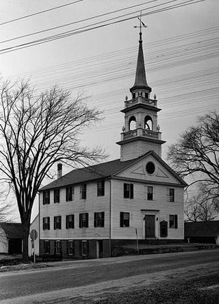
This is an incomplete list of historic properties and districts at United States colleges and universities that are listed on the National Register of Historic Places (NRHP). This includes National Historic Landmarks (NHLs) and other National Register of Historic Places listings. It includes listings at current and former educational institutions.

<span class="mw-page-title-main">Washington Bottom Farm</span> Historic house in West Virginia, United States

Ridgedale is a 19th-century Greek Revival plantation house and farm on a plateau overlooking the South Branch Potomac River north of Romney, West Virginia, United States. The populated area adjacent to Washington Bottom Farm is known as Ridgedale. The farm is connected to West Virginia Route 28 via Washington Bottom Road.

<span class="mw-page-title-main">Scales Mound Historic District</span> Historic district in Illinois, United States

The Scales Mound Historic District is a historic district in the small Illinois village of Scales Mound. The district encompasses the entire corporate limit of the village and has more than 200 properties within its boundaries. The district was added to the U.S. National Register of Historic Places in 1990.

<span class="mw-page-title-main">Preston City, Connecticut</span> United States historic place

Preston City is a village and the original town center of the town of Preston, Connecticut. The core of the village around the junction of Old Northwest Road and Route 164 is designated as the Preston City Historic District, a historic district that is listed on the National Register of Historic Places. The district is located along Old Shetucket and Amos Roads, which, prior to the 1930s, were major thoroughfares.

<span class="mw-page-title-main">Cannondale Historic District</span> Historic district in Connecticut, United States

Cannondale Historic District is a historic district in the Cannondale section in the north-central area of the town of Wilton, Connecticut. The district includes 58 contributing buildings, one other contributing structure, one contributing site, and 3 contributing objects, over a 202 acres (82 ha). About half of the buildings are along Danbury Road and most of the rest are close to the Cannondale train station .The district is significant because it embodies the distinctive architectural and cultural-landscape characteristics of a small commercial center as well as an agricultural community from the early national period through the early 20th century....The historic uses of the properties in the district include virtually the full array of human activity in this region—farming, residential, religious, educational, community groups, small-scale manufacturing, transportation, and even government. The close physical relationship among all these uses, as well as the informal character of the commercial enterprises before the rise of more aggressive techniques to attract consumers, capture some of the texture of life as lived by prior generations. The district is also significant for its collection of architecture and for its historic significance.

<span class="mw-page-title-main">East Hampton Village District</span> Historic district in New York, United States

East Hampton Village District is a historic district in East Hampton, New York.

<span class="mw-page-title-main">Earnest Farms Historic District</span> Historic district in Tennessee, United States

The Earnest Farms Historic District is a historic district consisting of four historic farms and associated structures near the community of Chuckey in Greene County, Tennessee, United States. The farms include the Elmwood Farm, the Broyles Farm, the Crum Farm, and the Jim Earnest Farm, all of which were initially developed by early pioneer Henry Earnest (1732–1809) and his descendants in the late-18th and 19th centuries. The district includes the Ebenezer Methodist Church, which is home to the oldest Methodist congregation in Tennessee, and the Earnest Fort House, which is one of the oldest houses in the state. Elmwood Farm has been designated a century farm and is one of the oldest farms in Tennessee, having been cultivated continuously since 1777.

Smithson–McCall Farm is a 256.3-acre (103.7 ha) historic district in Bethesda, Tennessee. The farm was listed under the National Register of Historic Places in 2007. The listing claims that the property "documents the impact of the progressive agricultural movement of the early twentieth century on the operations and landscape of a middle-class family farm," and includes an "architecturally significant group of buildings and structures, placed within an agricultural landscape of high integrity...that represents a good example of farmstead architecture in Middle Tennessee and that reflects the impact of the Progressive Farm movement of the early twentieth century".

<span class="mw-page-title-main">Vancroft</span> Historic house in West Virginia, United States

Vancroft, also known as Mt. St. George Historic District, is a historic home and national historic district. It is located near Wellsburg, Brooke County, West Virginia. It encompasses 10 contributing buildings, one contributing structure, and one contributing object associated with the manor house. The manor house was designed by Alden & Harlow in 1901 for steel magnate Joseph B. Vandergrift. It is a Shingle Style dwelling with broad gable roofs, a rough stone turret, and stone chimney. Also on the property are a pergola, a club house or retreat house, spring house, race track, grotto, farm manager's house, two farm laborer's residences, mill, barn, and "the Apple House." The property was purchased by the Catholic Knights of St. George and operated as a home for the aged. In 1998, it was purchased by the Catholic Knights of America.

Smithland Farm, also known as the General John McCausland Memorial Farm, is a historic home and farm located near Henderson, Mason County, West Virginia. The main house is a two-story frame structure constructed in 1869. The house is a side-gabled, two-story, weatherboarded frame structure with a two-story frame wing. The property includes a contributing corncrib, silo, pole barn, barn, main barn, block school, and Poffenbarger Cemetery. It was for many years part of a larger farm owned by Confederate General John McCausland. The West Virginia Department of Agriculture acquired the farm in 1981.

<span class="mw-page-title-main">Cobble Hill Farm</span> United States historic place

Cobble Hill Farm is a 196-acre farm in Staunton, Virginia. It was listed on the National Register of Historic Places (NRHP) in 2004. It is composed of three parcels: two tenant farms and the Cobble Hill parcel. The Cobble Hill house is a 2+12-story masonry house with a steep-gabled roof, with accents in the Tudor Revival and French Eclectic styles, with a formal garden and pool. It has a one-story, side-gabled porch, with a large, coursed-stone chimney near the entry porch. The roof surfaces are all finished with wood shingles. The building was designed in 1936 by Sam Collins, and built in 1937 for William Ewing's widow.

<span class="mw-page-title-main">Valley View (Romney, West Virginia)</span> 1855 Greek Revival residence and associated farm

Valley View is a mid-19th-century Greek Revival residence and farm overlooking the South Branch Potomac River northwest of Romney, West Virginia. The house is atop a promontory where Depot Valley joins the South Branch Potomac River valley.

<span class="mw-page-title-main">Gen. Mason J. Young House</span> Historic house in New Hampshire, United States

The Gen. Mason J. Young House, also known as the William Boyd House, is a historic house and connected farm complex at 4 Young Road in Londonderry, New Hampshire. With a building history dating to 1802, it is a well-preserved example of a New England connected farmstead. The house was listed on the National Register of Historic Places in 1986.

<span class="mw-page-title-main">Fox–Cook Farm</span> United States historic place

The Fox–Cook Farm is a historic farm property on Cook Drive in Wallingford, Vermont. Established in the 1790s, it is one of the oldest surviving farmsteads in the Otter Creek valley south of Wallingford village. It includes a c. 1800 Cape style farmhouse and a c. 1850 barn, among other outbuildings. The property was listed on the National Register of Historic Places in 1986.

<span class="mw-page-title-main">Hager Farm</span> United States historic place

The Hager Farm is a historic farmstead on United States Route 7 in southern Wallingford, Vermont. Its farmhouse, built about 1800, is one of the oldest in the community, and is regionally unusual because of its gambrel roof. The property was listed on the National Register of Historic Places in 1986.

<span class="mw-page-title-main">Field Farm (Ferrisburgh, Vermont)</span> United States historic place

Field Farm is a historic farm property on Fuller Mountain Road in Ferrisburgh, Vermont. Developed around the turn of the 19th century, the property includes an early farmhouse and barn, as well as outbuildings representative of Vermont's trends in agriculture over two centuries. The property was listed on the National Register of Historic Places in 1995.

The Osage Farms Resettlement Properties in Pettis County, Missouri is a National Register of Historic Places multiple property submission located at Pettis County, Missouri. The submission includes 10 national historic districts and 2 individual properties listed on the National Register of Historic Places. The properties included were built by the Resettlement Administration / Farm Security Administration in 1937 as model farms and known as Osage Farms. Model farmsteads typically included a 1+12-story frame dwelling, barn, poultry house and privy.

<span class="mw-page-title-main">Swindler House</span> United States historic place

The Swindler House, in Shelby County, Kentucky, near Cropper, Kentucky, is a "Settlement Vernacular" home that was built c. 1825 – c. 1835 and expanded later. It was listed on the National Register of Historic Places in 1988.

References

  1. 1 2 3 4 "National Register Database and Research". National Park Service. Archived from the original on August 28, 2018. Retrieved May 1, 2021.
  2. "Why Is There a West Virginia?". Virginia Museum of History & Culture. Archived from the original on April 27, 2021. Retrieved April 27, 2021.
  3. 1 2 Collins 1986, p. 8.
  4. 1 2 3 Collins 1986, p. 11.
  5. Kenny 1945, p. 498.
  6. Collins 1986, p. 10.
  7. White 1899, p. 39.
  8. Federal Writers' Project 1941, p. 414.
  9. 1 2 "The Permanent Collection". West Virginia Living. December 4, 2017. Archived from the original on April 28, 2021. Retrieved April 28, 2021.
  10. Collins 1986, pp. 3–4.
  11. Rice, Brad (May 12, 2016). "Traveling WV: Henderson Hall". WCHS. Archived from the original on May 1, 2021. Retrieved May 1, 2021.
  12. 1 2 3 Collins 1986, p. 4.
  13. "Henderson Hall". Greater Parkersburg Convention & Visitors Bureau. Archived from the original on April 28, 2021. Retrieved April 28, 2021.
  14. 1 2 Glaser, Susan (January 12, 2019). "Henderson Hall in West Virginia". Cleveland Plain Dealer. Archived from the original on May 1, 2021. Retrieved May 1, 2021.
  15. "Slavery Just Across Border". The Cincinnati Enquirer. August 31, 2003. Archived from the original on April 28, 2021. Retrieved April 28, 2021.
  16. 1 2 Collins 1986, pp. 4–5.
  17. Collins 1986, p. 5.
  18. Collins 1986, pp. 5–6.
  19. Collins 1986, pp. 6–7.
  20. Collins 1986, p. 7.

Sources