National Register of Historic Places listings in Marion County, West Virginia

Last updated

Location of Marion County in West Virginia Map of West Virginia highlighting Marion County.svg
Location of Marion County in West Virginia

This is a list of the National Register of Historic Places listings in Marion County, West Virginia.

Contents

This is intended to be a complete list of the properties and districts on the National Register of Historic Places in Marion County, West Virginia, United States. The locations of National Register properties and districts for which the latitude and longitude coordinates are included below, may be seen in an online map. [1]

There are 24 properties and districts listed on the National Register in the county.


    This National Park Service list is complete through NPS recent listings posted March 29, 2024. [2]

Contents: Counties in West Virginia

Current listings

[3] Name on the RegisterImageDate listed [4] Location City or townDescription
1 Amos Farmstead Historic District March 28, 2024
(#100010183)
309 Gilboa Road
39°32′47″N80°11′59″W / 39.5464°N 80.1997°W / 39.5464; -80.1997 (Amos Farmstead Historic District)
Fairmont vicinity
2 Barrackville Covered Bridge
Barrackville Covered Bridge Barrackville Covered Bridge - Side in Winter.jpg
Barrackville Covered Bridge
March 30, 1973
(#73001921)
County Route 21 over Buffalo Creek
39°30′21″N80°10′05″W / 39.505833°N 80.168056°W / 39.505833; -80.168056 (Barrackville Covered Bridge)
Barrackville
3 Colonial Apartments
Colonial Apartments Colonial Apartments Fairmont WV.jpg
Colonial Apartments
July 26, 2006
(#06000653)
2 E. Garden Ln.
39°29′00″N80°09′54″W / 39.483333°N 80.165°W / 39.483333; -80.165 (Colonial Apartments)
Fairmont
4 Dunbar School
Dunbar School Dunbar School south side (Fairmont, West Virginia).jpg
Dunbar School
April 28, 2015
(#15000188)
103 High St.
39°29′12″N80°08′48″W / 39.4866°N 80.1466°W / 39.4866; -80.1466 (Dunbar School)
Fairmont
5 Fairmont Downtown Historic District
Fairmont Downtown Historic District Fairmont Downtown Historical District.jpg
Fairmont Downtown Historic District
August 15, 1995
(#95001008)
Along Jackson, Adams, Washington and Quincy Sts. and Cleveland and Fairmont Aves.
39°28′57″N80°08′39″W / 39.4825°N 80.144167°W / 39.4825; -80.144167 (Fairmont Downtown Historic District)
Fairmont
6 Fairmont Normal School Administration Building
Fairmont Normal School Administration Building FairmontstateHB.JPG
Fairmont Normal School Administration Building
March 28, 1994
(#94000216)
Junction of Locust Ave. and Bryant St.
39°28′59″N80°09′37″W / 39.483056°N 80.160278°W / 39.483056; -80.160278 (Fairmont Normal School Administration Building)
Fairmont
7 Fairmont Senior High School
Fairmont Senior High School FSHS spring.jpg
Fairmont Senior High School
March 22, 2002
(#02000254)
1 Loop Park
39°28′43″N80°09′26″W / 39.478611°N 80.157222°W / 39.478611; -80.157222 (Fairmont Senior High School)
Fairmont
8 Thomas W. Fleming House
Thomas W. Fleming House Thomas W. Fleming House.jpg
Thomas W. Fleming House
August 29, 1979
(#79002587)
300 1st St.
39°28′53″N80°08′41″W / 39.4815°N 80.1448°W / 39.4815; -80.1448 (Thomas W. Fleming House)
Fairmont
9 Fleming-Watson Historic District
Fleming-Watson Historic District 701 Benoni Avenue, Fairmont, West Virginia north.jpg
Fleming-Watson Historic District
November 29, 2001
(#01001330)
Approximately bounded by Fairmont Ave., Second, Fay Sts., Apple Ct, Green, Emerson Sts., Coleman Ave., Seventh St., Outlook
39°29′N80°09′W / 39.48°N 80.15°W / 39.48; -80.15 (Fleming-Watson Historic District)
Fairmont
10 Hamilton Round Barn
Hamilton Round Barn Hamilton Round Barn.jpg
Hamilton Round Barn
July 9, 1985
(#85001548)
County Route 11
39°30′59″N80°20′16″W / 39.5164°N 80.3377°W / 39.5164; -80.3377 (Hamilton Round Barn)
Mannington
11 High Gate
High Gate High Gate entrance.jpg
High Gate
April 15, 1982
(#82004326)
801 Fairmont Ave.
39°28′29″N80°09′10″W / 39.474722°N 80.152778°W / 39.474722; -80.152778 (High Gate)
Fairmont
12 High Level Bridge
High Level Bridge Fairmont High Level Bridge.jpg
High Level Bridge
December 4, 1991
(#91001734)
Jefferson St. across the Monongahela River
39°28′57″N80°08′27″W / 39.4825°N 80.140833°W / 39.4825; -80.140833 (High Level Bridge)
Fairmont
13 Jacobs-Hutchinson Block
Jacobs-Hutchinson Block Jacobs-Hutchinson Block.jpg
Jacobs-Hutchinson Block
July 21, 1995
(#95000874)
201-209 Adams St.
39°29′05″N80°08′38″W / 39.4846°N 80.1438°W / 39.4846; -80.1438 (Jacobs-Hutchinson Block)
Fairmont
14 Mannington Historic District
Mannington Historic District Mannington Historic District.jpg
Mannington Historic District
November 22, 1995
(#95001313)
Roughly bounded by High, Clarksburg and Howard Sts. and Buffalo Creek
39°31′44″N80°20′39″W / 39.528889°N 80.344167°W / 39.528889; -80.344167 (Mannington Historic District)
Mannington
15 Marion County Courthouse and Sheriff's House
Marion County Courthouse and Sheriff's House Marion County Courthouse Fairmont.jpg
Marion County Courthouse and Sheriff's House
May 29, 1979
(#79003149)
Adams and Jefferson Sts.
39°29′06″N80°08′37″W / 39.485°N 80.143611°W / 39.485; -80.143611 (Marion County Courthouse and Sheriff's House)
Fairmont
16 Masonic Temple
Masonic Temple Masonic Temple Fairmont WV.jpg
Masonic Temple
April 9, 1993
(#93000218)
320 Jefferson St.
39°29′08″N80°08′34″W / 39.485556°N 80.142778°W / 39.485556; -80.142778 (Masonic Temple)
Fairmont
17 Thomas C. Miller Public School
Thomas C. Miller Public School Thomas C. Miller Public School Front.jpg
Thomas C. Miller Public School
May 8, 2013
(#13000263)
2 Pennsylvania Ave.
39°29′20″N80°08′30″W / 39.488886°N 80.141649°W / 39.488886; -80.141649 (Thomas C. Miller Public School)
Fairmont
18 George Pinkney Morgan House
George Pinkney Morgan House George Pinkney Morgan House.jpg
George Pinkney Morgan House
May 1, 2003
(#03000348)
County Route 19/3
39°32′01″N80°05′42″W / 39.533611°N 80.095°W / 39.533611; -80.095 (George Pinkney Morgan House)
Rivesville
19 Mount Zion Baptist Church July 13, 2023
(#100009141)
501 Cleveland Ave.
39°29′11″N80°08′49″W / 39.4863°N 80.1470°W / 39.4863; -80.1470 (Mount Zion Baptist Church)
Fairmont
20 Prickett's Fort
Prickett's Fort Prickett's Fort.jpg
Prickett's Fort
February 13, 1974
(#74002404)
Address Restricted; located at Prickett's Fort State Park
39°30′55″N80°05′53″W / 39.515278°N 80.098056°W / 39.515278; -80.098056 (Prickett's Fort)
Fairmont
21 Jacob Prickett, Jr. Log House
Jacob Prickett, Jr. Log House Jacob Prickett Jr. Log House.jpg
Jacob Prickett, Jr. Log House
April 20, 1979
(#79002588)
South of Montana off County Route 72
39°31′07″N80°06′01″W / 39.518525°N 80.100302°W / 39.518525; -80.100302 (Jacob Prickett, Jr. Log House)
Montana
22 Shaw House
Shaw House Shaw House Fairmont WV.jpg
Shaw House
September 14, 1988
(#88001461)
425 Morgantown Ave.
39°28′50″N80°07′56″W / 39.480559°N 80.132263°W / 39.480559; -80.132263 (Shaw House)
Fairmont
23 Wilson School
Wilson School Wilson School - Mannington.jpg
Wilson School
November 29, 2001
(#01001331)
917 E. Main St.
39°31′32″N80°20′05″W / 39.525556°N 80.334722°W / 39.525556; -80.334722 (Wilson School)
Mannington
24 Woodlawn Cemetery
Woodlawn Cemetery Woodlawn Cemetery Fairmont WV.jpg
Woodlawn Cemetery
April 14, 2004
(#04000305)
335 Maple Ave.
39°29′37″N80°08′14″W / 39.493611°N 80.137222°W / 39.493611; -80.137222 (Woodlawn Cemetery)
Fairmont

See also

Related Research Articles

<span class="mw-page-title-main">National Register of Historic Places listings in Preston County, West Virginia</span>

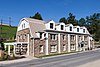
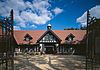
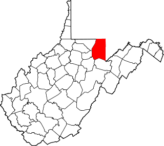
This is a list of the National Register of Historic Places listings in Preston County, West Virginia. This is intended to be a complete list of the properties and districts on the National Register of Historic Places in Preston County, West Virginia. The locations of National Register properties and districts for which the latitude and longitude coordinates are included below, may be seen in an online map.

<span class="mw-page-title-main">National Register of Historic Places listings in Morgan County, West Virginia</span>

This is a list of the National Register of Historic Places listings in Morgan County, West Virginia.

<span class="mw-page-title-main">National Register of Historic Places listings in Pendleton County, West Virginia</span>

This is a list of the National Register of Historic Places listings in Pendleton County, West Virginia.

<span class="mw-page-title-main">National Register of Historic Places listings in Mineral County, West Virginia</span>

This is a list of the National Register of Historic Places listings in Mineral County, West Virginia.

<span class="mw-page-title-main">National Register of Historic Places listings in Wetzel County, West Virginia</span>

This is a list of the National Register of Historic Places listings in Wetzel County, West Virginia.

<span class="mw-page-title-main">National Register of Historic Places listings in Tyler County, West Virginia</span>

This is a list of the National Register of Historic Places listings in Tyler County, West Virginia.

<span class="mw-page-title-main">National Register of Historic Places listings in Barbour County, West Virginia</span>

This is a list of the National Register of Historic Places listings in Barbour County, West Virginia.

<span class="mw-page-title-main">National Register of Historic Places listings in Marshall County, West Virginia</span>

This is a list of the National Register of Historic Places listings in Marshall County, West Virginia.

<span class="mw-page-title-main">National Register of Historic Places listings in Doddridge County, West Virginia</span>

This is a list of the National Register of Historic Places listings in Doddridge County, West Virginia.

<span class="mw-page-title-main">National Register of Historic Places listings in Upshur County, West Virginia</span>

This is a list of the National Register of Historic Places listings in Upshur County, West Virginia.

<span class="mw-page-title-main">National Register of Historic Places listings in Ritchie County, West Virginia</span>

This is a list of the National Register of Historic Places listings in Ritchie County, West Virginia.

<span class="mw-page-title-main">National Register of Historic Places listings in Boone County, West Virginia</span>

This is a list of the National Register of Historic Places listings in Boone County, West Virginia.

<span class="mw-page-title-main">National Register of Historic Places listings in Calhoun County, West Virginia</span>

This is a list of the National Register of Historic Places listings in Calhoun County, West Virginia.

<span class="mw-page-title-main">National Register of Historic Places listings in Gilmer County, West Virginia</span>

This is a list of the National Register of Historic Places listings in Gilmer County, West Virginia.

<span class="mw-page-title-main">National Register of Historic Places listings in Lincoln County, West Virginia</span>

This is a list of the National Register of Historic Places listings in Lincoln County, West Virginia.

<span class="mw-page-title-main">National Register of Historic Places listings in Pleasants County, West Virginia</span>

This is a list of the National Register of Historic Places listings in Pleasants County, West Virginia.

<span class="mw-page-title-main">National Register of Historic Places listings in Putnam County, West Virginia</span>

This is a list of the National Register of Historic Places listings in Putnam County, West Virginia.

<span class="mw-page-title-main">National Register of Historic Places listings in Summers County, West Virginia</span>

This is a list of the National Register of Historic Places listings in Summers County, West Virginia.

<span class="mw-page-title-main">National Register of Historic Places listings in Taylor County, West Virginia</span>

This is a list of the National Register of Historic Places listings in Taylor County, West Virginia.

<span class="mw-page-title-main">National Register of Historic Places listings in Tucker County, West Virginia</span>

This is a list of the National Register of Historic Places listings in Tucker County, West Virginia.

References

  1. The latitude and longitude information provided in this table was derived originally from the National Register Information System, which has been found to be fairly accurate for about 99% of listings. Some locations in this table may have been corrected to current GPS standards.
  2. National Park Service, United States Department of the Interior, "National Register of Historic Places: Weekly List Actions", retrieved March 29, 2024.
  3. Numbers represent an alphabetical ordering by significant words. Various colorings, defined here, differentiate National Historic Landmarks and historic districts from other NRHP buildings, structures, sites or objects.
  4. The eight-digit number below each date is the number assigned to each location in the National Register Information System database, which can be viewed by clicking the number.