Hingham, Montana

Last updated

Hingham, Montana
Hingham.JPG
Hill County Montana Incorporated and Unincorporated areas Hingham Highlighted.svg
Location of Hingham, Montana
Coordinates: 48°33′20″N110°25′23″W / 48.55556°N 110.42306°W / 48.55556; -110.42306
Country United States
State Montana
County Hill
Area
[1]
  Total0.17 sq mi (0.44 km2)
  Land0.17 sq mi (0.44 km2)
  Water0.00 sq mi (0.00 km2)
Elevation
3,031 ft (924 m)
Population
 (2020)
  Total131
  Density761.63/sq mi (294.49/km2)
Time zone UTC-7 (Mountain (MST))
  Summer (DST) UTC-6 (MDT)
ZIP code
59528
Area code 406
FIPS code 30-36400
GNIS feature ID0772428

Hingham is a town in Hill County, Montana, United States. Its economy is largely agricultural. The population was 131 at the 2020 census. [2]

Contents

Geography

Hingham is located at 48°33′20″N110°25′23″W / 48.55556°N 110.42306°W / 48.55556; -110.42306 (48.555641, -110.422951). [3] Located on U.S. Route 2, it is 35 miles to Havre. It is near Fresno Reservoir.

According to the United States Census Bureau, the town has a total area of 0.17 square miles (0.44 km2), all land. [4]

History of "The Town on the Square"

Hingham is a small agricultural community in northern Montana. Hingham, like many Hi-Line towns, developed as a grain storage and shipping center along the Great Northern Railway (BNSF Railway) and U.S. Route 2. In 1909, homesteaders purchased a relinquishment for the town site, and by early 1910 [5] they had a town established. The community was planned on a broad grid with a central town square as its dominant feature. [6] Hingham prospered in its early years with the opening of a school, hospital, several churches and over forty businesses. In 1917 Hingham incorporated with an elected mayor/council style government.

The Hingham Bar (bank) photographed by John Margolies Hingham Bar (bank), Hingham, Montana LCCN2017706145.tif
The Hingham Bar (bank) photographed by John Margolies

Community members have developed the town square into one of the best parks on the Hi-Line, much of it through volunteer work and donations. A popular landmark of the town is the water tower which can be seen for miles. The Hingham School was established in 1910 with the Rangers as their mascot and red, white and black as their colors. The school operated until the early 1980s when it consolidated with the neighboring Rudyard School to form Blue Sky Schools. Once again in 2005, Blue Sky Schools consolidated with KG Schools (Kremlin-Gildford) to form North Star Schools. In recent decades Hingham's population has declined due to lack of economic opportunity. In 2010 Hingham celebrated its Centennial. [6] Hingham shares its name with towns in Wisconsin, Massachusetts and Norfolk, England.

Demographics

Historical population
CensusPop.Note
1920 154
1930 25163.0%
1940 205−18.3%
1950 2144.4%
1960 25418.7%
1970 2623.1%
1980 186−29.0%
1990 181−2.7%
2000 157−13.3%
2010 118−24.8%
2020 13111.0%
U.S. Decennial Census [7] [2]

2010 census

As of the census [8] of 2010, there were 118 people, 60 households, and 33 families residing in the town. The population density was 694.1 inhabitants per square mile (268.0/km2). There were 83 housing units at an average density of 488.2 per square mile (188.5/km2). The racial makeup of the town was 91.5% White, 3.4% Native American, 0.8% Asian, and 4.2% from two or more races. Hispanic or Latino of any race were 0.8% of the population.

There were 60 households, of which 13.3% had children under the age of 18 living with them, 50.0% were married couples living together, 3.3% had a female householder with no husband present, 1.7% had a male householder with no wife present, and 45.0% were non-families. 40.0% of all households were made up of individuals, and 21.7% had someone living alone who was 65 years of age or older. The average household size was 1.97 and the average family size was 2.58.

The median age in the town was 52 years. 13.6% of residents were under the age of 18; 4.2% were between the ages of 18 and 24; 12.7% were from 25 to 44; 49.2% were from 45 to 64; and 20.3% were 65 years of age or older. The gender makeup of the town was 52.5% male and 47.5% female.

2000 census

As of the census [9] of 2000, there were 157 people, 65 households, and 38 families residing in the town. The population density was 930.0 inhabitants per square mile (359.1/km2). There were 87 housing units at an average density of 515.4 per square mile (199.0/km2). The racial makeup of the town was 96.82% White, 1.91% Native American, and 1.27% from two or more races.

There were 65 households, out of which 32.3% had children under the age of 18 living with them, 55.4% were married couples living together, 1.5% had a female householder with no husband present, and 41.5% were non-families. 32.3% of all households were made up of individuals, and 20.0% had someone living alone who was 65 years of age or older. The average household size was 2.42 and the average family size was 3.21.

In the town, the population was spread out, with 27.4% under the age of 18, 5.1% from 18 to 24, 30.6% from 25 to 44, 18.5% from 45 to 64, and 18.5% who were 65 years of age or older. The median age was 41 years. For every 100 females there were 96.3 males. For every 100 females age 18 and over, there were 96.6 males.

The median income for a household in the town was $38,333, and the median income for a family was $45,417. Males had a median income of $32,000 versus $20,625 for females. The per capita income for the town was $16,525. About 9.1% of families and 10.8% of the population were below the poverty line, including 16.4% of those under the age of eighteen and none of those 65 or over.

Climate

Hingham experiences a semi-arid climate (Köppen BSk) with long, cold, dry winters and hot summers. [10]

Climate data for Hingham
MonthJanFebMarAprMayJunJulAugSepOctNovDecYear
Record high °F (°C)68
(20)
87
(31)
79
(26)
95
(35)
98
(37)
108
(42)
108
(42)
111
(44)
101
(38)
91
(33)
78
(26)
71
(22)
111
(44)
Mean daily maximum °F (°C)25.5
(−3.6)
33.4
(0.8)
44.9
(7.2)
58.5
(14.7)
68.8
(20.4)
77.4
(25.2)
84.6
(29.2)
83.9
(28.8)
71.9
(22.2)
59.4
(15.2)
40.8
(4.9)
30.1
(−1.1)
56.6
(13.7)
Daily mean °F (°C)14.6
(−9.7)
21.9
(−5.6)
32.5
(0.3)
44.3
(6.8)
54.5
(12.5)
62.7
(17.1)
68.3
(20.2)
67.6
(19.8)
56.3
(13.5)
44.6
(7.0)
29.1
(−1.6)
19.0
(−7.2)
43.0
(6.1)
Mean daily minimum °F (°C)3.7
(−15.7)
10.4
(−12.0)
20.0
(−6.7)
30.0
(−1.1)
40.2
(4.6)
48.0
(8.9)
52.0
(11.1)
51.3
(10.7)
40.7
(4.8)
29.8
(−1.2)
17.3
(−8.2)
7.8
(−13.4)
29.3
(−1.5)
Record low °F (°C)−57
(−49)
−55
(−48)
−41
(−41)
−14
(−26)
9
(−13)
29
(−2)
31
(−1)
27
(−3)
18
(−8)
−21
(−29)
−33
(−36)
−50
(−46)
−57
(−49)
Average precipitation inches (mm)0.47
(12)
0.36
(9.1)
0.70
(18)
0.87
(22)
1.84
(47)
1.90
(48)
1.51
(38)
1.20
(30)
1.03
(26)
0.62
(16)
0.45
(11)
0.51
(13)
11.46
(290.1)
Source 1: NOAA (normals, 1971–2000) [11]
Source 2: The Weather Channel (Records) [12]

Transportation

Amtrak’s Empire Builder, which operates between Seattle/Portland and Chicago, passes through the town on BNSF tracks, but makes no stop. The nearest station is located in Havre, 35 miles (56 km) to the east.

Related Research Articles

<span class="mw-page-title-main">Dennysville, Maine</span> Town in the state of Maine, United States

Dennysville is a town in Washington County, Maine, United States. The population was 300 at the 2020 census.

<span class="mw-page-title-main">East Sandwich, Massachusetts</span> Census-designated place in Massachusetts, United States

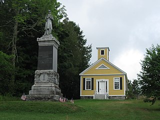
East Sandwich is a village and census-designated place (CDP) within the town of Sandwich in Barnstable County, Massachusetts, United States. The population was 3,940 at the 2010 census.

<span class="mw-page-title-main">Lima, Montana</span> Town in Montana, United States

Lima is a town in Beaverhead County, Montana, United States. As of the 2020 census, the population was 212.

<span class="mw-page-title-main">Fromberg, Montana</span> Town in Carbon County, Montana, United States

Fromberg is a town in Carbon County, Montana, United States. As of the 2020 census, the population of the town was 392.

<span class="mw-page-title-main">Cascade, Montana</span> Town in Cascade County, Montana, United States

Cascade is a town in Cascade County, Montana, United States. The population was 600 at the 2020 census. It is part of the Great Falls, Montana Metropolitan Statistical Area, which in 2020 had a population of 84,414. Cascade was incorporated in 1911.

<span class="mw-page-title-main">Grass Range, Montana</span> Town in Montana, United States

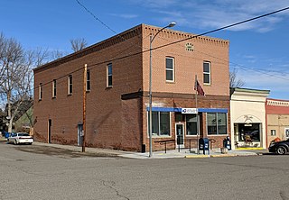
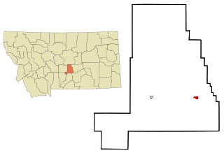
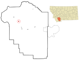
Grass Range is a town in Fergus County, Montana, United States. The population was 110 in both the 2010 census and 2020 census.

<span class="mw-page-title-main">Moore, Montana</span> Town in Montana, United States

Moore is a town in Fergus County, Montana, United States. The population was 194 at the 2020 census.

<span class="mw-page-title-main">Winifred, Montana</span> Town in Montana, United States

Winifred is a small town in rural north-central Fergus County, Montana, United States. It was founded in 1913 and provides services for its region's populace. The town population was 172 at the 2020 census. The current mayor is Travis Willson.

<span class="mw-page-title-main">Lavina, Montana</span> Town in Montana, United States

Lavina is a town in Golden Valley County, Montana, United States. The population was 136 at the 2020 census. The town is situated on the north bank of the Musselshell River.

<span class="mw-page-title-main">Ryegate, Montana</span> Town in Montana, United States

Ryegate is a town in, and the county seat of, Golden Valley County, Montana, United States. The population was 223 at the 2020 census. Ryegate is situated on the north bank of the Musselshell River.

<span class="mw-page-title-main">Drummond, Montana</span> Town in Montana, United States

Drummond is a town in Granite County, Montana, United States. The population was 272 at the 2020 census.

<span class="mw-page-title-main">Sheridan, Montana</span> Town in Montana, United States

Sheridan is a town in Madison County, Montana, United States named after the Civil War general Philip Sheridan. The population was 694 at the 2020 census. Sheridan is known as the "heart of the Ruby Valley." Seven mountain ranges surround the town: Tobacco Root Mountains, Highland Mountains, McCartney Mountain, The Pioneers, The Ruby Range, The Gravelly Range and the Snowcrest Range. The Ruby River winds through the valley just west of the town.

<span class="mw-page-title-main">Fairview, Montana</span> Town in Montana, United States

Fairview is a town in Richland County, Montana, United States. The population was 896 at the 2020 census. The town is directly on the North Dakota border. Fairview incorporated in 1913.

<span class="mw-page-title-main">Bainville, Montana</span> Town in Montana, United States

Bainville is a town in Roosevelt County, Montana, United States. The population was 271 at the 2020 census. It is named for Charles M. Bain, an early resident and the town's first postmaster. Bainville celebrated its centennial on July 4, 2006.

<span class="mw-page-title-main">Brockton, Montana</span> Census-designated place in Montana, United States

Brockton is a census-designated place and former town in Roosevelt County, Montana, United States. The population was 358 at the 2020 census.

<span class="mw-page-title-main">Westby, Montana</span> Town in Montana, United States

Westby is a town in Sheridan County, Montana, United States. The population was 167 at the 2020 census.

<span class="mw-page-title-main">Nashua, Montana</span> Town in Montana, United States

Nashua is a town in Valley County, Montana, United States. The population was 301 at the 2020 census.

<span class="mw-page-title-main">Broadview, Montana</span> Town in Montana, United States

Broadview is a town in Yellowstone County, Montana, United States. The population was 139 at the 2020 census.

<span class="mw-page-title-main">Plevna, Montana</span> Town in Montana, United States

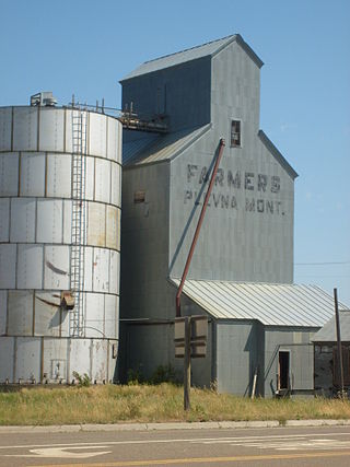
Plevna is a town in Fallon County, Montana, United States. The population was 179 at the 2020 census.

<span class="mw-page-title-main">Summit, South Carolina</span> Town in South Carolina, United States

Summit is a town in Lexington County, South Carolina, United States. The population was 402 at the 2010 census. It is part of the Columbia, South Carolina Metropolitan Statistical Area.

References

  1. "ArcGIS REST Services Directory". United States Census Bureau. Retrieved September 5, 2022.
  2. 1 2 "U.S. Census website". United States Census Bureau . Retrieved November 2, 2021.
  3. "US Gazetteer files: 2010, 2000, and 1990". United States Census Bureau. February 12, 2011. Retrieved April 23, 2011.
  4. "US Gazetteer files 2010". United States Census Bureau. Archived from the original on January 12, 2012. Retrieved December 18, 2012.
  5. "Hingham". Montana Place Names Companion. Montana Historical Society. Retrieved April 5, 2021.
  6. 1 2 Inbody, Kristen (July 10, 2010). "Hingham: 'Town on the Square' hits 100". Great Falls Tribune. Retrieved February 25, 2014.
  7. "Census of Population and Housing". Census.gov. Retrieved June 4, 2015.
  8. "U.S. Census website". United States Census Bureau . Retrieved December 18, 2012.
  9. "U.S. Census website". United States Census Bureau . Retrieved January 31, 2008.
  10. Climate Summary for Hingham, Montana
  11. "Climatography of the United States NO.81" (PDF). National Oceanic and Atmospheric Administration. Archived from the original (PDF) on July 15, 2014. Retrieved January 15, 2011.
  12. "Monthly Averages for Hingham, MT". The Weather Channel . Retrieved January 15, 2011.