West Havre, Montana

Last updated

West Havre, Montana
Hill County Montana Incorporated and Unincorporated areas West Havre Highlighted.svg
Location of West Havre, Montana
Coordinates: 48°32′17″N109°44′2″W / 48.53806°N 109.73389°W / 48.53806; -109.73389
Country United States
State Montana
County Hill
Area
[1]
  Total1.89 sq mi (4.90 km2)
  Land1.89 sq mi (4.90 km2)
  Water0.00 sq mi (0.00 km2)
Elevation
2,612 ft (796 m)
Population
 (2020)
  Total290
  Density153.28/sq mi (59.19/km2)
Time zone UTC-7 (Mountain (MST))
  Summer (DST) UTC-6 (MDT)
Area code 406
FIPS code 30-79098
GNIS feature ID1853192

West Havre is a census-designated place (CDP) in Hill County, Montana, United States. The population was 316 at the 2010 census, [2] up from 284 in 2000.

Contents

Geography

West Havre is located in eastern Hill County at 48°32′17″N109°44′2″W / 48.53806°N 109.73389°W / 48.53806; -109.73389 (48.537996, -109.733872). [3] It is bordered to the east by the city of Havre, and to the west by unincorporated Herron. U.S. Route 2 forms the northern edge of the West Havre CDP, leading east into Havre and west 100 miles (161 km) to Shelby. U.S. Route 87 has its northern terminus at US 2 at the northwest corner of West Havre, and leads southwest 110 miles (180 km) to Great Falls.

According to the United States Census Bureau, the West Havre CDP has a total area of 1.9 square miles (4.9 km2), all land. [2]

Demographics

Historical population
CensusPop.Note
2020 290
U.S. Decennial Census [4]

As of the census [5] of 2000, there were 284 people, 100 households, and 79 families residing in the CDP. The population density was 151.4 inhabitants per square mile (58.5/km2). There were 103 housing units at an average density of 54.9 per square mile (21.2/km2). The racial makeup of the CDP was 92.25% White, 1.41% Native American, 1.41% Asian, and 4.93% from two or more races.

There were 100 households, out of which 44.0% had children under the age of 18 living with them, 72.0% were married couples living together, 3.0% had a female householder with no husband present, and 21.0% were non-families. 17.0% of all households were made up of individuals, and 5.0% had someone living alone who was 65 years of age or older. The average household size was 2.84 and the average family size was 3.24.

In the CDP, the population was spread out, with 31.7% under the age of 18, 6.3% from 18 to 24, 25.0% from 25 to 44, 31.0% from 45 to 64, and 6.0% who were 65 years of age or older. The median age was 36 years. For every 100 females, there were 95.9 males. For every 100 females age 18 and over, there were 104.2 males.

The median income for a household in the CDP was $56,375, and the median income for a family was $57,125. Males had a median income of $48,000 versus $19,519 for females. The per capita income for the CDP was $24,823. None of the families and 2.0% of the population were living below the poverty line.

Related Research Articles

<span class="mw-page-title-main">East Fork, Arizona</span> CDP in Navajo County, Arizona

East Fork is a census-designated place (CDP) in Navajo County, Arizona, United States, on the Fort Apache Indian Reservation. The population was 699 at the 2010 census.

<span class="mw-page-title-main">Dudleyville, Arizona</span> CDP in Pinal County, Arizona

Dudleyville is a census-designated place (CDP) in Pinal County, Arizona, United States. The population was 959 at the 2010 census.

<span class="mw-page-title-main">Cypress Lake, Florida</span> Census-designated place in Florida, United States

Cypress Lake is an unincorporated community and census-designated place (CDP) in Lee County, Florida, United States. The population was 13,727 at the 2020 census. It is part of the Cape Coral-Fort Myers, Florida Metropolitan Statistical Area.

<span class="mw-page-title-main">Puako, Hawaii</span> Census-designated place in Hawaii, U.S.

Puako is a census-designated place (CDP) in Hawaiʻi County, Hawaii, United States. The population was 772 at the 2010 census, up from 429 at the 2000 census. The epicenter of the 2006 Kiholo Bay earthquake was some 6 miles (10 km) offshore of the village.

<span class="mw-page-title-main">Boneau, Montana</span> Census-designated place in Montana, United States

Boneau is a census-designated place (CDP) in Chouteau County, Montana, United States. The population was 380 at the 2010 census, up from 190 in 2000.

<span class="mw-page-title-main">Loma, Montana</span> Census-designated place in Montana, United States

Loma is a census-designated place (CDP) in Chouteau County, Montana, United States. The population was 85 at the 2010 census.

<span class="mw-page-title-main">Beaver Creek, Montana</span> Census-designated place in Montana, United States

Beaver Creek is a census-designated place (CDP) in Hill County, Montana, United States. The population was 271 at the 2010 census.

<span class="mw-page-title-main">Havre North, Montana</span> Census-designated place in Montana, United States

Havre North is a census-designated place (CDP) in Hill County, Montana, United States. The population was 716 at the 2010 census, down from 973 in 2000.

<span class="mw-page-title-main">Herron, Montana</span> Census-designated place in Montana, United States

Herron is a census-designated place (CDP) in Hill County, Montana, United States. The population was 43 at the 2010 census.

<span class="mw-page-title-main">Inverness, Montana</span> CDP in Montana, United States

Inverness is a census-designated place (CDP) in Hill County, Montana, United States. The population was 55 at the 2010 census. It was named after a town in Scotland.

<span class="mw-page-title-main">Kremlin, Montana</span> Census-designated place in Montana, United States

Kremlin is an unincorporated community and census-designated place (CDP) in Hill County, Montana, United States. The population was 98 at the 2010 census, down from 126 in 2000.

<span class="mw-page-title-main">Rudyard, Montana</span> Census-designated place in Montana, United States

Rudyard is an unincorporated community and census-designated place (CDP) in Hill County, Montana, United States. The population was 258 at the 2010 census.

<span class="mw-page-title-main">Saddle Butte, Montana</span> Census-designated place in Montana, United States

Saddle Butte is a census-designated place (CDP) in Hill County, Montana, United States. The population was 128 at the 2010 census.

<span class="mw-page-title-main">Sangrey, Montana</span> Census-designated place in Montana, United States

Sangrey is a census-designated place (CDP) in Hill County, Montana, United States. The population was 306 at the 2010 census, up from 263 in 2000.

<span class="mw-page-title-main">St. Pierre, Montana</span> Census-designated place in Montana, United States

St. Pierre is a census-designated place (CDP) in Hill County, Montana, United States, within the Rocky Boy Indian Reservation. The population of St. Pierre was 350 at the 2010 census, up from 289 in 2000.

<span class="mw-page-title-main">Joplin, Montana</span> Unincorporated community in Montana, United States

Joplin is a unincorporated community and census-designated place (CDP) in Liberty County, Montana, United States. The population was 157 at the 2010 census.

<span class="mw-page-title-main">Valley View, Schuylkill County, Pennsylvania</span> CDP in Pennsylvania, United States

Valley View is a census-designated place (CDP) in Schuylkill County, Pennsylvania, United States. The population was 1,677 at the 2000 census.

<span class="mw-page-title-main">Ocean City, Washington</span> Census-designated place in Washington, United States

Ocean City is a census-designated place (CDP) in Grays Harbor County, Washington, United States. The population was 200 at the 2010 census.

<span class="mw-page-title-main">Marblemount, Washington</span> CDP in Washington, United States

Marblemount is a census-designated place in Skagit County, Washington, United States. The population was 203 at the 2010 census. It is included in the Mount Vernon–Anacortes, Washington Metropolitan Statistical Area.

<span class="mw-page-title-main">Rockport, Washington</span> CDP in Washington, United States

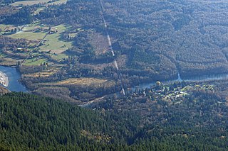
Rockport is a census-designated place (CDP) in Skagit County, Washington, United States. The population was 109 at the 2010 census. It is included in the Mount Vernon–Anacortes, Washington Metropolitan Statistical Area.

References

  1. "ArcGIS REST Services Directory". United States Census Bureau. Retrieved September 5, 2022.
  2. 1 2 "Geographic Identifiers: 2010 Census Summary File 1 (G001): West Havre CDP, Montana". American Factfinder. U.S. Census Bureau. Archived from the original on February 13, 2020. Retrieved August 24, 2017.
  3. "US Gazetteer files: 2010, 2000, and 1990". United States Census Bureau. February 12, 2011. Retrieved April 23, 2011.
  4. "Census of Population and Housing". Census.gov. Retrieved June 4, 2016.
  5. "U.S. Census website". United States Census Bureau . Retrieved January 31, 2008.