Hogsmill River

Last updated

Hogsmill
Hogsmill01.JPG
The Hogsmill at Kingston as it flows into the Thames
Greater London UK relief location map.jpg
Red pog.svg
Location of the mouth in Greater London
Location
Country England
Counties Surrey, Greater London
Districts / Boroughs Epsom and Ewell, Royal Borough of Kingston upon Thames
Towns Ewell, Old Malden, Berrylands, Kingston upon Thames
Physical characteristics
SourceBourne Hall Park
  location Ewell, Surrey
  coordinates 51°21′01″N0°15′03″W / 51.350313°N 0.250945°W / 51.350313; -0.250945
Mouth River Thames
  location
Kingston upon Thames
  coordinates
51°24′33″N0°18′30″W / 51.40917°N 0.30833°W / 51.40917; -0.30833
Length9.9 km (6.2 mi)
Basin size73 km2 (28 sq mi)
Discharge 
  location Kingston upon Thames
  average0.98 m3/s (35 cu ft/s)
  minimum0.33 m3/s (12 cu ft/s)9 September 1976
  maximum26.3 m3/s (930 cu ft/s)6 August 1981
Discharge 
  location Ewell
  average0.04 m3/s (1.4 cu ft/s)
Basin features
ProgressionHogsmill, Thames, North Sea
Tributaries 
  leftHorton Stream, Bonesgate Stream, Green Lanes Stream, Tolworth Brook
  rightEwell Court Stream
Hogsmill River Map
BSicon uCONTfaq.svg
BSicon ueABZq+l.svg
BSicon uCONTfq.svg
River Thames
BSicon uexSKRZ-Eu.svg
Riverside Promenade
BSicon uexSKRZ-Yu.svg
Wadbrook Street bridge
BSicon uexSKRZ-Au.svg
Clattern Bridge
BSicon uexSKRZ-Yu.svg
St James's Road bridge
BSicon uexSKRZ-Au.svg
A307 Wheatfield Way bridge
BSicon uxMILL.svg
Hogg's Mill
BSicon uexSKRZ-Yu.svg
Springfield Road bridge
BSicon uexKRW+l.svg
BSicon uexABZlr.svg
BSicon uexKRW+r.svg
BSicon uexSKRZ-Yu.svg
BSicon uexSKRZ-Eu.svg
Mill Street bridges
BSicon uexSTR.svg
BSicon BUILDING.svg
BSicon uexSTR.svg
Kingston University
Halls of residence
BSicon uexSTRl.svg
BSicon uexABZ+lr.svg
BSicon uexSTRr.svg
BSicon uxMILL.svg
Kingston Middle Mill
BSicon uexSKRZ-Au.svg
Villiers Road bridge
BSicon uxMILL.svg
Chapel Mill
BSicon BUILDING.svg
BSicon uexFABZgr+r.svg
Hogsmill STW
BSicon CONTgq.svg
BSicon uxmKRZu.svg
BSicon CONTfq.svg
South West Main Line
BSicon uexCONTfaq.svg
BSicon uexABZgr.svg
Tolworth Brook
BSicon uexSKRZ-Au.svg
A3 Kingston by-pass
BSicon CONTgq.svg
BSicon uxmKRZu.svg
BSicon CONTfq.svg
Chessington branch line
BSicon uxMILL.svg
Worcester Park gunpowder mills
BSicon uexSKRZ-Au.svg
A240 Kingston Road bridge
BSicon uexCONTfaq.svg
BSicon uexABZgr.svg
Bonesgate Stream
BSicon exBUILDING.svg
BSicon uexSTR.svg
Ruxley STW
BSicon uexSKRZ-Yu.svg
B284 Ruxley Lane bridge
BSicon uexCONTfaq.svg
BSicon uexABZgr.svg
Horton Stream
BSicon uxMILL.svg
Ewell Court gunpowder mills
BSicon uexABZgl.svg
BSicon uexCONTgeq.svg
Ewell Court Stream
BSicon uexCONTfaq.svg
BSicon uexABZgr.svg
Green Lanes Stream
BSicon CONTgq.svg
BSicon uxmKRZu.svg
BSicon CONTfq.svg
Sutton and Mole Valley lines
BSicon uxMILL.svg
Ewell Lower Mill
BSicon dWDOCKS.svg
BSicon uxMILL.svg
Ewell Upper Mill
BSicon uexSKRZ-Yu.svg
B2200 Chessington Road bridge
BSicon dWDOCKS.svg
Source in Bourne Park

The Hogsmill River in Surrey and Greater London, England is a small chalk stream tributary of the River Thames. It rises in Ewell and flows into the Thames at Kingston upon Thames on the lowest non-tidal reach, that above Teddington Lock.

Contents

The river is 10 km (6 mi) long and has a catchment area of about 73 km2 (28 sq mi). [1] Nearby land was formerly flood-meadows; following improvements it is now mostly sports grounds, a sewage treatment works and green space, save for Kingston and Epsom town centres. It is a habitat of many animals, fish and insects.

The 12th-century Clattern Bridge, one of the oldest road bridges in England, crosses the river in the southwest of Kingston town centre. [2] The Coronation Stone, now sited close to the river in Kingston, is believed to have been used for the coronation of Saxon kings in the 10th century. It was used as a horse mounting block until 1850 when it was mounted on a plinth in the town centre.

The river has five tributaries: Green Lanes Stream, Ewell Court Stream, Horton Stream, Bonesgate Stream and Tolworth Brook.
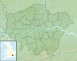
Course of the river

Epsom and Ewell

The source of the Hogsmill River is a chalk spring just outside Bourne Hall Park in Ewell, Surrey. It flows in a northerly direction between Kingston Road and the sports field beside the railway track. The Hogsmill passes the sites of the Lower and Upper Mills, and Ewell Court Mills, where gunpowder was produced in the 18th and 19th centuries, and gently bends to the left before flowing under the Mole Valley railway line between Ewell West and Stoneleigh at the start of the Hogsmill Open Space which follows the river until the borough boundary with Kingston.

The river continues its course in green space between the residential areas of Ewell Court and West Ewell and is joined by the Green Lanes Stream. After a short distance of green space, the river runs as a boundary between Poole Road Recreation Ground and Ewell Court Park and flows behind Ewell Athletics Track. It reaches another confluence, this one being with the Ewell Court Stream, flowing in just downstream from Ewell Court Lake as it continues into West Ewell.

The Hogsmill runs further through the open space and passes near West Ewell Infants School and Ruxley Church before flowing under Ruxley Farm Bridge, the site of the former Ruxley Splash. It passes Riverview Primary School in the residential area of Ruxley Ward before the confluence with the Bonesgate Stream, which here marks the boundary between the boroughs of Epsom and Ewell in Surrey and Kingston in Greater London. After the confluence, the Hogsmill bends to the right near Riverview Road and continues as the boundary past Tolworth Court Bridge with the A240 (Kingston Road) to the junction with the B284 (Worcester Park Road).

Kingston

The river flows beside Worcester Park Road and Old Malden Lane (both the B284) along the edge of a few sports grounds and under the entrance to the Surbiton Raceway go-karting track. The river leaves the boundary as it turns left into the outskirts of Old Malden in an area of woodland and green space. It crosses the Chessington branch railway line a short distance away from Malden Manor railway station. The Hogsmill is now flowing in a NNW direction as it crosses the A3 between Tolworth and Malden junctions.

The Hogsmill flowing under the Clattern Bridge in Kingston. The bridge is one of the oldest in Surrey, being mentioned in 1293 as "Clateryngbrugge". Clattern.JPG
The Hogsmill flowing under the Clattern Bridge in Kingston. The bridge is one of the oldest in Surrey, being mentioned in 1293 as "Clateryngbrugge".

The river delimits New Malden (historically the bulk of "Malden") and Berrylands (historically part of Kingston), beside sport and recreation grounds near Elmbridge Avenue, where it is joined by Tolworth Brook, [4] after which it passes under the South Western main railway line near Berrylands railway station. The Hogsmill leaves the green space area at the railway line and passes Kingsmeadow, Kingston Cemetery and sewage works in the eastern outskirts of Kingston upon Thames, which covers not only that borough but also Epsom and Ewell which had a large sewage farm against the river in the decades around 1900.

It crosses under Villiers Road before heading alongside the Kingston School of Art campus of Kingston University and through the Middle Mill Hall of Residence site. It then crosses Springfield Road beside Denmark Road and Grange Road. It also runs under the bridge for the A307 (Wheatfield Way) near College Roundabout beside Kingston College. The river then runs under St. James's Road by the Magistrates Court and the Guildhall before flowing under Kingston High Street and Wadbrook Street. The Hogsmill River meets the Thames beside a restaurant and street and promenade of shops beside the Thames Path footbridge at grid reference TQ177691 , just upstream of Kingston Bridge.

Tributaries

Green Lanes Stream

The Green Lanes Stream is 2.1 miles (3.4 km) long and starts as a run-off from Stamford Green Pond on the eastern edge of Epsom Common. Other smaller streams from the common join the main stream a few metres from the pond as it goes underground. It runs near Manor Green Road and is above the ground in places, for example by the bridges under Christ Church Mount (a crescent road off Manor Green Road). Shortly afterwards, it flows underground again and this is where it runs under Epsom Primary School on Hook Road at the junction with Longmead Road. This is where the stream comes above the ground.

It runs parallel with Longmead Road where it runs near to Longmead Industrial Estate and Blenheim High School until the road meets the B2200 (Chessington Road) and the stream runs under it. This is where it flows between the two roads named Green Lanes (the river is named after the roads). It runs into the Hogsmill Open Space before meeting the confluence with Hogsmill Stream.

Ewell Court Stream

Ewell Court Stream is 1.7 miles (2.7 km) long [1] and starts near a pond on the edge of Nonsuch Park by the A24 (London Road) in Stoneleigh. After running under the A24, it continues under Briarwood Road. It is visible again briefly in an alley near Stoneleigh railway station. The stream bends left under Stoneleigh Park Road and runs under Walsingham Gardens and the A240 (Kingston Road) where it enters Ewell Court. After running after Preston Drive, it enters Ewell Court Park and comes above ground before running through Ewell Court Lake.

As it continues through the park towards the meeting point with the Hogsmill it passes the Packhorse Bridge, which was named after the mules that regularly transported gunpowder from the mills, across the river and into a brick magazine. [2] At its height in the mid-19th century, the gunpowder mill complex by the bridge employed 156 men. Gunpowder from Ewell is said to have been used in the American Civil War. [2]

Bonesgate Stream

The Bonesgate Stream is the principal stream of the Hogsmill River. It is 3 miles (5 km) in length and rises in Malden Rushett near the crossroads of the A243 and B280. It flows in a NE direction through farmlands before flowing just east of Chessington. After crossing under Filby Road, it heads past the Bonesgate pub, now called the William Bourne, in Moor Lane on the eastern edge of Chessington. The bridge over the stream is where Moor Lane and Chessington Road meet. The river then heads through open space, flowing under a bridge near Cox Lane Community Centre. The river goes past the edge of the Cox Lane Estate shortly before joining the Hogsmill by Tolworth Court Bridge under the A240 Kingston Road. From the William Bourne pub to Tolworth Court Bridge, the river serves as a boundary between West Ewell (Surrey) and Chessington (Greater London).

Horton Stream

The source of Horton Stream is in the centre of Horton Country Park, Epsom. It is 3.3 miles (5.3 km) long and its source is near West Park Hospital beside Horton Lane, Epsom. The stream carries on parallel with Horton Lane as it passes near to West Park Farm and Horton Park Farm. After travelling through Horton Country Park, it heads through Horton Golf Course before crossing Chessington Road, West Ewell. It runs alongside Chessington Close before running through the playing fields of Epsom and Ewell High School. It continues behind Scotts Farm Road before the confluence with the Hogsmill near Ruxley Lane after running under Scotts Farm Road.

Tolworth Brook

At 3.75 miles (6.0 km), Tolworth Brook (or Surbiton Stream) is the longest tributary. Its source is on the edge of Claygate from springs at Grapesome Wood on the west side of the A3, [5]

It flows under the A3 to skirt Lovelace Primary School, north under Clayton Road between the withy bed and Oaklands Close, then through rugby playing fields and crosses the A309 Esher bypass going north between allotments and Kelvin Grove. It then passes west of Gladstone and Brook Roads through playing fields, then is culverted from the rear of 1 Herne Road. Its culvert is then visible east of Hook Road at Vale Road North, and after, under Waterside Close and Thornhill Road, to turn east under Cotterill Road. It is the open limit of gardens between Cotterill and Ellerton Roads, until Ditton Road (where culverted). The brook reappears north of pub/restaurant The Oak on Ewell Road. It follows the rear of Beaconsfield Road and then goes under King Charles Road to reappear in Alexandra Recreation Ground, and then flows north-east bisecting Edith Gardens Nature Reserve; east under Raeburn Avenue; north under Meldone Close. It is the central, northward, feature of Berrylands Nature Reserve; under Stirling Walk, it falls east under Elmbridge Avenue to meet the Hogsmill.

Water quality

The Environment Agency measure water quality of the river systems in England. Each is given an overall ecological status, which may be one of five levels: high, good, moderate, poor and bad. There are several components that are used to determine this, including biological status, which looks at the quantity and varieties of invertebrates, angiosperms and fish. Chemical status, which compares the concentrations of various chemicals against known safe concentrations, is rated good or fail. [6]

Water quality of the Hogsmill in 2019:

SectionEcological
Status
Chemical
Status
Overall
Status
LengthCatchmentChannel
Hogsmill [7] Moderate Fail Moderate 9.908 km (6.157 mi)72.636 km2 (28.045 sq mi)Heavily modified

Flooding

In January 2014, the Hogsmill burst its banks on the edge of Bourne Hall in Ewell Village, causing several local roads to flood. [8]

Literature

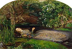
Richard Jefferies (1848–1887), best known for his nature-writing, wrote about the Hogsmill brook during his years living at Tolworth in two essays, "A Brook" and "A London Trout", that were collected in his book, Nature Near London, published by Chatto and Windus in 1883.

Art

Ophelia - The landscape background was painted by the Hogsmill near Ewell John Everett Millais - Ophelia - Google Art Project.jpg
Ophelia – The landscape background was painted by the Hogsmill near Ewell
The Hireling Shepherd, dalliance in the Surrey countryside William Holman Hunt 001.jpg
The Hireling Shepherd , dalliance in the Surrey countryside

The Hogsmill has appeared in the art of the Pre-Raphaelite painters, John Millais in his rendition of Ophelia , and William Holman Hunt who painted The Hireling Shepherd on the meadows by the Hogsmill, looking north towards Ewell Court Farm. [9] [10] The doorway (to the soul) in Hunt's The Light of the World is believed to be part of a gunpowder mill on the Hogsmill at Ewell. [11]

Local legend

William the Conqueror is said to have "watered his horse" in the source waters near today's Spring Hotel. [2] Traditionally, this was at the pool in Bourne Hall Park.

Industry

Part of the course was engineered to be harnessed for watermills near Ewell Court. These joined those of nearby Whitton in the production of gunpowder; which continued for some time after the Napoleonic Wars to help supply the American Civil War. [2] The mills closed in 1875 as they couldn't meet new safety legislation. [11] Dynamos were later installed in one of the old mill buildings to generate electricity for Ewell Court House. [12]

There were also two flour mills in Ewell, the Upper and Lower mills, both also used for paper making at one time. The latter was supposed to have provided the flour for Queen Victoria's bakers. [13] The Upper Mill was the last working corn mill on the river, still working in 1951 when visited by Jack Hillier. [14] It is now the headquarters of the Samaritans. [15]

Another group of gunpowder mills were established at Worcester Park by William Taylor in 1720. They were variously known as the Malden Mills, Long Ditton Mills or Tolworth Mills, being located on the meeting of the three parishes. The works finally closed in the 1860s. [16]

Kingston had three mills; Chapel Mill, or the Old Mill; Middle Mill and the eponymous Hogg's Mill or New Mill. All three were corn mills originally. In later years Middle Mill was used for processing coconut fibres. Chapel Mill was used to crush the coconut kernels to produce oil. Hogg's Mill found further use as a metal polish factory, possibly using crushed coconut shells as the secret ingredient. [17] All have been demolished, although the Old Mill House still exists and is a Grade II listed building. [18] The coconut fibre industry ceased by 1880 and the Middle Mill site was sold to Kelly & Co, Printers (printers of the famous Kelly's Directory,) and became a significant employer in Kingston. Kelly's moved out in 1932 to Andover. [19] The site was redeveloped by Kingston University in the 1990s.

See also

Related Research Articles

<span class="mw-page-title-main">Kingston upon Thames</span> Town in South West London

Kingston upon Thames is a town in the Royal Borough of Kingston upon Thames, southwest London, England. It is situated on the River Thames and 10 miles (16 km) southwest of Charing Cross. It is notable as the ancient market town in which Saxon kings were crowned and today is the administrative centre of the Royal Borough of Kingston upon Thames.

<span class="mw-page-title-main">New Malden</span> Suburb of London

New Malden is an area in South West London, England. It is located within the Royal Borough of Kingston upon Thames and the London Borough of Merton, and is 9.4 miles (15.1 km) from Charing Cross. Neighbouring localities include Kingston, Norbiton, Raynes Park, Surbiton, Tolworth, Wimbledon, Old Malden, and Worcester Park. Prior to the creation of Greater London in 1965, New Malden was in the administrative county of Surrey.

<span class="mw-page-title-main">Chessington</span> Human settlement in England

Chessington is an area in the Royal Borough of Kingston upon Thames within Greater London. Historically part of Surrey, today it is the largest salient of Greater London into that county. At the 2011 census it had a population of 18,973. The Bonesgate Stream, a tributary of the Hogsmill River, runs through it. The popular theme park resort Chessington World of Adventures, which incorporates Chessington Zoo, is located in the south-west of the area.

<span class="mw-page-title-main">Royal Borough of Kingston upon Thames</span> Royal borough in London, England

The Royal Borough of Kingston upon Thames is a borough in southwest London. The main town is Kingston upon Thames and it includes Chessington, Malden Rushett, New Malden, Surbiton and Tolworth. It is the oldest of the four royal boroughs in England. The others are the London boroughs of Greenwich and Kensington and Chelsea and Windsor and Maidenhead, the site of Windsor Castle. The local authority is Kingston upon Thames London Borough Council.

<span class="mw-page-title-main">Tolworth</span> Human settlement in England

Tolworth is a suburban area in the Surbiton district, Royal Borough of Kingston upon Thames, Greater London. It is 11 miles (17.7 km) southwest of Charing Cross. Neighbouring places include Berrylands, Chessington, Epsom, Ewell, Hinchley Wood, Kingston, Long Ditton, New Malden, Surbiton and Worcester Park. Surbiton is the nearest, about a mile to the northwest. Tolworth is divided in two by the A3 Kingston Bypass and is situated slightly north of the Greater London-Surrey border.

<span class="mw-page-title-main">Epsom and Ewell</span> Borough and non-metropolitan district in England

Epsom and Ewell is a local government district with borough status in Surrey, England, covering the towns of Epsom and Ewell. The borough lies just outside the administrative boundary of Greater London, but it is entirely within the M25 motorway which encircles London. Many of the borough's urban areas form part of the wider Greater London Built-up Area.

<span class="mw-page-title-main">Berrylands</span> Residential neighbourhood in Surbiton, London

Berrylands is a residential neighbourhood in Surbiton, London, originally forming part of the Municipal Borough of Surbiton, and since 1965 part of the Royal Borough of Kingston upon Thames. It is a suburban development situated 10.1 miles (16.3 km) south west of Charing Cross. Nearby places include Surbiton, New Malden, Old Malden, Tolworth and Chessington. Berrylands railway station is 24 minutes from London Waterloo by train.

<span class="mw-page-title-main">Chessington branch line</span> Railway line in the UK in SW London

The Chessington branch line is a short National Rail railway line in England, mostly in the Royal Borough of Kingston upon Thames, from Motspur Park to Chessington South.

<span class="mw-page-title-main">Ewell</span> Town in Surrey, England

Ewell is a town in the Borough of Epsom and Ewell in Surrey, England. It is approximately 12 miles (19 km) south of central London and 2 miles (3.2 km) northeast of Epsom. In the 2011 Census, the town had a population of 34,872. The majority of which (73%) is in the ABC1 social class, except the Ruxley Ward that is C2DE.

<span class="mw-page-title-main">Worcester Park</span> Suburb of Greater London, England

Worcester Park is a suburban town in South West London, England. It lies in the London boroughs of Sutton and Kingston, and partly in the Surrey borough of Epsom and Ewell. The area is 10 miles (16 km) southwest of Charing Cross. The suburb's population was 16,031 at the time of the 2001 census. The suburb comprises the Worcester Park ward, an electoral area of the London Borough of Sutton with a population in 2011 of 11,655, as well as the Cuddington ward, an electoral area of Epsom and Ewell, which had a population of 5,791 at the time of the 2001 census.

Stoneleigh is a village in the Epsom and Ewell borough in the county of Surrey, England. It is situated approximately 11 miles (18 km) from central London. In the 2011 Census, the population was 8,741.

Horton is a village in the borough of Epsom and Ewell, in the county of Surrey, England. It is situated between the towns and villages of Epsom, West Ewell, Chessington and Malden Rushett. Its principal road is Horton Lane, which runs the length of the area between West Ewell and Epsom Common. Horton Country Park also runs along the length of the area, between Epsom Common and West Ewell.

Old Malden is a ward of the Royal Borough of Kingston upon Thames in south London, 10 miles (16 km) south west of Charing Cross. It is between New Malden and Worcester Park, along the A4023 road, here named Malden Road.

<span class="mw-page-title-main">A240 road</span> Road in Surrey and Greater London

The A240 is a partially primary status A road in Surrey and Greater London that connects the A217 with the A3 and continues beyond through Surbiton to Kingston upon Thames. The road is 8.5 miles (13.7 km) long and is dualled as the Ewell bypass and thereafter to Tolworth Broadway. In conjunction with the A3 it provides an alternative to the congested A24 corridor through Morden and Merton.

<span class="mw-page-title-main">A243 road</span> Road in England

The A243 road in England is a partially primary status A-road that runs from Leatherhead in Surrey to Surbiton in the Royal Borough of Kingston Upon Thames, Greater London. It is primary for most of its length, from Leatherhead to Hook Junction with the A3 before running as a non-primary A-road through Surbiton to its terminus at the A307. Although comparatively short it is a busy road connecting a number of other A roads with the M25 motorway.

<span class="mw-page-title-main">Southborough High School</span> Academy in Surbiton, Greater London, England

Southborough High School, commonly known as Southborough, is a boys secondary School with a mixed sixth form. Founded in 1962, it has academy status and is in Surbiton, Greater London. It was rated a grade 2 school (Good) in 2017 by Ofsted.

<span class="mw-page-title-main">Malden Rushett</span> Human settlement in England

Malden Rushett is a small village in the Royal Borough of Kingston upon Thames, London. It is located at the southernmost tip of the Royal Borough, surrounded by woodland and farmland, and between the larger suburban villages and towns of Claygate, Chessington, Epsom, Ashtead, Leatherhead and Oxshott.

<span class="mw-page-title-main">Thames Down Link</span>

The Thames Down Link is a 24 km (15 mi) official walking route linking the Thames Path and the North Downs Way. It starts in the town centre of Kingston upon Thames and finishes at Box Hill & Westhumble railway station.

<span class="mw-page-title-main">Bonesgate Stream</span>

Bonesgate Stream is a brook in Chessington in Kingston upon Thames in London and Epsom and Ewell in Surrey. It is a tributary of the Hogsmill River, which, in turn, is a tributary of the River Thames.

References

  1. 1 2 "River Hogsmill Integrated Urban Drainage DEFRA Pilot Study Volume 2 – Appendix A" (PDF). DEFRA. June 2008. Archived from the original (PDF) on 2 April 2013. Retrieved 23 December 2014.
  2. 1 2 3 4 5 Talling, Paul. "London's lesser known rivers – Hogsmill River". London's Lost Rivers. Retrieved 24 December 2014.
  3. Blue Plaque on Clattern Bridge, Royal Borough of Kingston upon Thames
  4. "Thames Down Link" (PDF). Surrey County Council. p. 2. Archived from the original (PDF) on 25 May 2013. Retrieved 3 May 2014.
  5. Fure, Alison (September 2011). "Tolworth Brook". Wildlife Circus. Blogspot. Retrieved 25 December 2014.
  6. "Glossary (see Biological quality element; Chemical status; and Ecological status)". Catchment Data Explorer. Environment Agency. 17 February 2016. UKOpenGovernmentLicence.svg Text was copied from this source, which is available under an Open Government Licence v3.0. © Crown copyright.
  7. "Hogsmill". Catchment Data Explorer. Environment Agency.
  8. Foster, Alice (17 January 2014). "Heavy rain leads to flooding in Ewell as pond fed by spring overflows". Sutton & Croydon Guardian. Retrieved 30 March 2023.
  9. Rosenfield, Jason; Smith, Alison (2007). Millais (Exhibition Catalogue). Tate Publishing. ISBN   9789079310029.
  10. "Epsom and Ewell History Explorer: The PreRaphaelites" . Retrieved 5 May 2012.
  11. 1 2 "Epsom and Ewell History Explorer: Gunpowder Mills" . Retrieved 5 May 2012.
  12. "Ewell Court House". Epsom and Ewell History Explorer. Retrieved 9 January 2019.
  13. "Flour Mills - Epsom & Ewell History". Epsom & Ewell Explorer. Retrieved 24 August 2020.
  14. Hillier, Jack (1951). Old Surrey Water-Mills. London: Skeffington & Son. p. 232.
  15. "Administrative contact details". Samaritans. Retrieved 29 September 2020.
  16. "Worcester Park House". Epsom and Ewell History Explorer. Retrieved 30 September 2020.
  17. Sampson, June (5 May 2005). "How a nut helped shape Kingston". Surrey Comet . Retrieved 29 October 2021.
  18. Historic England (30 July 1951). "The Old Mill House (Grade II) (1185094)". National Heritage List for England .
  19. Sampson, June (1997). Kingston Past. London: Historical Publications Ltd. p. 58. ISBN   0-948667-45-1.
Next confluence upstream River Thames Next confluence downstream
Longford River, Raven's Ait (north)Hogsmill River Sudbrook (stream) (north)