Huachuca City, Arizona

Last updated

Huachuca City
Huachuca City, Arizona
Flag of Huachuca City, Arizona.gif
Cochise County Arizona Incorporated and Unincorporated areas Huachuca City Highlighted 0434120.svg
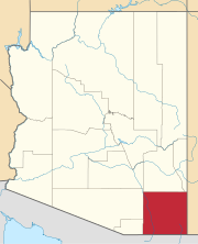
Location of Huachuca City in Cochise County, Arizona.
USA Arizona location map.svg
Red pog.svg
Huachuca City
Location in the United States
Usa edcp location map.svg
Red pog.svg
Huachuca City
Huachuca City (the United States)
Coordinates: 31°37′38″N110°20′37″W / 31.62722°N 110.34361°W / 31.62722; -110.34361
Country Flag of the United States (23px).png  United States
State Flag of Arizona.svg  Arizona
County Flag of Cochise County, Arizona.gif Cochise
Incorporated1958
Area
[1]
  Total2.83 sq mi (7.32 km2)
  Land2.83 sq mi (7.32 km2)
  Water0.00 sq mi (0.00 km2)
Elevation
[2]
4,364 ft (1,330 m)
Population
 (2020)
  Total1,626
  Density575.37/sq mi (222.12/km2)
Time zone UTC-7 (MST (no DST))
ZIP code
85616
Area code 520
FIPS code 04-34120
GNIS feature ID2412775 [2]
Website Town of Huachuca City

Huachuca City is a town in Cochise County, Arizona, United States. As of the 2020 census, the population was 1,626. [3]

Contents

Fort Huachuca, a U.S. Army base, is located just south of the municipality.

History

Huachuca City started out as a stop along the Southern Pacific Railroad. The rail stretched between Tombstone and Patagonia and is no longer in operation today. With the re-opening of Fort Huachuca in 1954, the area began to grow and the community went through several name changes: Campstone Station, Sunset City, and Huachuca Vista, before finally settling on the name Huachuca City. [4] It incorporated in 1958.

Today, Huachuca City is a small town located at the north exit of Fort Huachuca, the major employment for the town. With tourism a major business because of the proximity to Tombstone and Kartchner Caverns State Park, Huachuca City is a growing area.

Geography

Huachuca City is located in southwestern Cochise County. The city of Sierra Vista and Fort Huachuca lie along the town's southern border.

According to the United States Census Bureau, the town has a total area of 2.8 square miles (7.3 km2), all land.

Climate

According to the Köppen Climate Classification system, Huachuca City has a semi-arid climate, abbreviated "BSk" on climate maps. [5]

Transportation

Via Arizona State Route 90 it is 23 miles (37 km) north to Interstate 10, near the city of Benson.

Huachuca City Transit, operated by the city, runs between Huachuca City and Sierra Vista. [6]

Demographics

Historical population
CensusPop.Note
1960 1,330
1970 1,241−6.7%
1980 1,66133.8%
1990 1,7827.3%
2000 1,751−1.7%
2010 1,8535.8%
2020 1,626−12.3%
U.S. Decennial Census [7]

As of the census [8] of 2000, there were 1,751 people, 713 households, and 432 families residing in the town. The population density was 625.6 inhabitants per square mile (241.5/km2). There were 844 housing units at an average density of 301.5 per square mile (116.4/km2). The racial makeup of the town was 75.4% White, 6.8% Black or African American, 2.7% Native American, 1.5% Asian, 0.2% Pacific Islander, 8.2% from other races, and 5.3% from two or more races. 16.3% of the population were Hispanic or Latino of any race.

There were 713 households, out of which 31.3% had children under the age of 18 living with them, 44.3% were married couples living together, 12.3% had a female householder with no husband present, and 39.3% were non-families. 32.8% of all households were made up of individuals, and 11.5% had someone living alone who was 65 years of age or older. The average household size was 2.43 and the average family size was 3.13.

In the town, the age distribution of the population shows 28.4% under the age of 18, 8.8% from 18 to 24, 25.5% from 25 to 44, 24.6% from 45 to 64, and 12.7% who were 65 years of age or older. The median age was 37 years. For every 100 females, there were 93.1 males. For every 100 females age 18 and over, there were 89.4 males.

The median income for a household in the town was $26,311, and the median income for a family was $33,938. Males had a median income of $26,685 versus $20,179 for females. The per capita income for the town was $14,378. About 13.8% of families and 19.3% of the population were below the poverty line, including 24.6% of those under age 18 and 14.7% of those age 65 or over.

Related Research Articles

<span class="mw-page-title-main">Cochise County, Arizona</span> County in Arizona, United States

Cochise County is a county in the southeastern corner of the U.S. state of Arizona. It is named after Cochise, a Chiricahua Apache who was a key war leader during the Apache Wars.

<span class="mw-page-title-main">Graham County, Arizona</span> County in Arizona, United States

Graham County is a county in the southeastern part of the U.S. state of Arizona. As of the 2020 census, the population was 38,533, making it the third-least populous county in Arizona. The county seat is Safford.
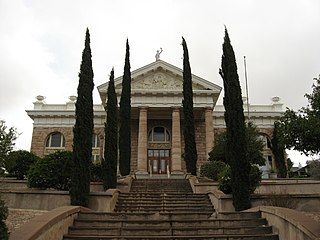
<span class="mw-page-title-main">Santa Cruz County, Arizona</span> County in Arizona, United States

Santa Cruz is a county in southern Arizona, United States. As of the 2020 census, the population is 47,669. The county seat is Nogales. The county was established in 1899. It borders Pima County to the north and west, Cochise County to the east, and the Mexican state of Sonora to the south.

<span class="mw-page-title-main">Houck, Arizona</span> CDP in Apache County, Arizona

Houck is a census-designated place (CDP) in Apache County, Arizona, United States. The population was 1,024 at the 2010 census.

<span class="mw-page-title-main">McNary, Arizona</span> CDP in Apache and Navajo Counties, Arizona

McNary is a census-designated place (CDP) in Apache and Navajo counties in the U.S. state of Arizona, on the Fort Apache Indian Reservation. The population was 528 at the 2010 census.

<span class="mw-page-title-main">Benson, Arizona</span> City in Cochise County, Arizona

Benson is a city in Cochise County, Arizona, United States. As of the 2010 census, the population of the city was 5,105. It was founded as a rail terminal for the area, and located approximately 45 miles (72 km) east-southeast of the city of Tucson.

<span class="mw-page-title-main">Bisbee, Arizona</span> City in Cochise County, Arizona, US

Bisbee is a city in and the county seat of Cochise County in southeastern Arizona, United States. It is 92 miles (148 km) southeast of Tucson and 11 miles (18 km) north of the Mexican border. According to the 2020 census, the population of the town was 4,923, down from 5,575 in the 2010 census.

<span class="mw-page-title-main">Douglas, Arizona</span> City in Cochise County, Arizona

Douglas is a city in Cochise County, Arizona, United States that lies in the north-west to south-east running Sulphur Springs Valley. Douglas has a border crossing with Mexico at Agua Prieta and a history of mining.

<span class="mw-page-title-main">Naco, Arizona</span> CDP in Cochise County, Arizona

Naco is a census-designated place (CDP) located in Cochise County, Arizona, United States. Naco had a recorded population of 1,046 at the 2010 United States Census. Located directly across the United States–Mexico border from its sister city of Naco, Sonora, Naco is best known for an accidental 1929 air raid and is the first and only municipality in the Continental United States to have been aerially bombed by foreigners.

<span class="mw-page-title-main">Sierra Vista, Arizona</span> City in Arizona, United States

Sierra Vista is a city in Cochise County, Arizona, United States. According to the 2020 Census, the population of the city is 45,308, and is the 27th most populous city in Arizona. The city is part of the Sierra Vista-Douglas Metropolitan Area, with a 2010 population of 131,346. Fort Huachuca, a U.S. Army post, has been incorporated and is located in the northwest part of the city. Sierra Vista is bordered by the cities of Huachuca City and Whetstone to the north and Sierra Vista Southeast to the South.

<span class="mw-page-title-main">Sierra Vista Southeast, Arizona</span> CDP in Cochise County, Arizona

Sierra Vista Southeast, often referred to as Hereford or Nicksville, is a census-designated place (CDP) in Cochise County, Arizona, United States. The population was 14,797 at the 2010 census. It includes the neighborhoods Ramsey Canyon, and Sierra Vista Estates within its boundaries.

<span class="mw-page-title-main">St. David, Arizona</span> CDP in Cochise County, Arizona

St. David or Saint David is a census-designated place (CDP) in Cochise County, Arizona, United States. The population was 1,699 at the 2010 census.
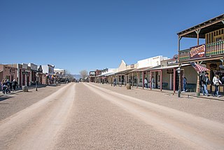
<span class="mw-page-title-main">Tombstone, Arizona</span> City in Arizona, United States

Tombstone is a city in Cochise County, Arizona, United States, founded in 1879 by prospector Ed Schieffelin in what was then Pima County, Arizona Territory. It became one of the last boomtowns in the American frontier. The town grew significantly into the mid-1880s as the local mines produced $40 to $85 million in silver bullion, the largest productive silver district in Arizona. Its population grew from 100 to around 14,000 in less than seven years. It is best known as the site of the Gunfight at the O.K. Corral and presently draws most of its revenue from tourism.

<span class="mw-page-title-main">Whetstone, Arizona</span> CDP in Cochise County, Arizona

Whetstone is a census-designated place (CDP) in Cochise County, Arizona, United States, north of Sierra Vista. The population was 2,617 at the 2010 census.

<span class="mw-page-title-main">Clifton, Arizona</span> Town in Greenlee County, Arizona

Clifton is a town in and is the county seat of Greenlee County, Arizona, United States, along the San Francisco River. The population of the town was 3,311 at the 2010 census, with a 2018 population estimate of 3,700. It was a place of the Arizona copper mine strike of 1983.

<span class="mw-page-title-main">Belle Plaine, Kansas</span> City in Sumner County, Kansas

Belle Plaine is a city in Sumner County, Kansas, United States. As of the 2020 census, the population of the city was 1,467.

<span class="mw-page-title-main">Alta Vista, Kansas</span> City in Wabaunsee County, Kansas

Alta Vista is a city in Wabaunsee County, Kansas, United States. As of the 2020 census, the population of the city was 409.
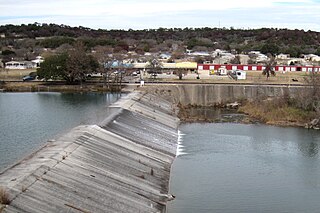
<span class="mw-page-title-main">Ingram, Texas</span> City in Texas, United States

Ingram is a city in Kerr County, Texas, United States. The population was 1,804 at the 2010 census.

<span class="mw-page-title-main">Belington, West Virginia</span> City in West Virginia

Belington is a town in Barbour County, West Virginia, United States, situated along the Tygart Valley River. The population was 1,804 as of the 2020 census.

<span class="mw-page-title-main">Huttonsville, West Virginia</span> Town in West Virginia, United States

Huttonsville is a town in Randolph County, West Virginia, United States, along the Tygart Valley River. The population was 163 at the 2020 census.

References

  1. "2020 U.S. Gazetteer Files". United States Census Bureau. Retrieved October 29, 2021.
  2. 1 2 U.S. Geological Survey Geographic Names Information System: Huachuca City, Arizona
  3. "Explore Census Data". data.census.gov. Retrieved June 28, 2023.
  4. Price, Ethel Jackson (October 1, 2003). Sierra Vista: Young City with a Past. Arcadia Publishing. p. 117. ISBN   9780738524344.
  5. Climate Summary for Huachuca City, Arizona
  6. "Transit". Town of Huachuca City. Retrieved October 20, 2018.
  7. "Census of Population and Housing". Census.gov. Retrieved June 4, 2016.
  8. "U.S. Census website". United States Census Bureau . Retrieved January 31, 2008.