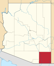
Cochise County is a county in the southeastern corner of the U.S. state of Arizona. It is named after Cochise, a Chiricahua Apache who was a key war leader during the Apache Wars.

Willcox is a city in Cochise County, Arizona, United States. The city is located in the Sulphur Springs Valley, a flat and sparsely populated drainage basin dotted with seasonal lakes. The city is surrounded by Arizona's most prominent mountain ranges, including the Pinaleño Mountains and the Chiricahua Mountains.

Lowell is a populated place situated in Cochise County, Arizona, United States. It was incorporated into Bisbee in the early 1900s. Lowell has an estimated elevation of 5,075 feet (1,547 m) above sea level.

The Chiricahua Mountains massif is a large mountain range in southeastern Arizona which is part of the Basin and Range province of the west and southwestern United States and northwest Mexico; the range is part of the Coronado National Forest. The highest point, Chiricahua Peak, rises 9,759 feet (2,975 m) above sea level, approximately 6,000 feet (1,800 m) above the surrounding valleys. The range takes its name from the Chiricahua Apaches native to the region.

Fairbank is a ghost town in Cochise County, Arizona, next to the San Pedro River. First settled in 1881, Fairbank was the closest rail stop to nearby Tombstone, which made it an important location in the development of southeastern Arizona. The town was named for Chicago investor Nathaniel Kellogg Fairbank who partially financed the railroad, and was the founder of the Grand Central Mining Company, which had an interest in the silver mines in Tombstone. Today Fairbank is located within the San Pedro Riparian National Conservation Area.

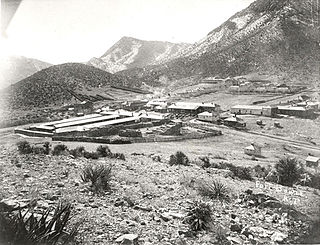
Gleeson is a ghost town situated in southeastern Cochise County, Arizona, United States. It has an estimated elevation of 4,924 feet (1,501 m) above sea level. The town was first settled as Turquoise in the 1870s in what was then the Arizona Territory, then later re-established as Gleeson in 1900.

Fort Bowie was a 19th-century outpost of the United States Army located in southeastern Arizona near the present day town of Willcox, Arizona. The remaining buildings and site are now protected as Fort Bowie National Historic Site.

The Cochise Hotel is a historic and functional hotel located in the town of Cochise in southeastern Arizona. The hotel was listed on the National Register of Historic Places on October 22, 1976.

Cochise is an unincorporated community located in Cochise County, Arizona, United States. The city was created alongside the Southern Pacific Railroad in the 1880s. The city was primarily a stop for coal and water which were needed for trains at the time. At its peak, the town had a population of approximately 3,000 people. Today, only 50 people still live in Cochise. The town is also home to several historic locations. In 1899, Big Nose Kate, the famed sidekick of Doc Holliday, lived in Cochise while she was working at the Cochise Hotel after Holliday's death.

Charleston is a ghost town in Cochise County in the southeastern part of the U.S. state of Arizona. It was occupied from the late-1870s through the late-1880s, and was located in what was then known as the Arizona Territory. Located on the west bank of the San Pedro River, Charleston's economy was based on milling silver ore mined from nearby Tombstone in the community of Millville, located directly across the river.

Paradise is a small ghost town located in Cochise County in the U.S. state of Arizona. The town was settled in 1901 in what was then the Arizona Territory.

Pearce, Arizona, and Sunsites, Arizona, are adjacent unincorporated communities in the Sulphur Springs Valley of Cochise County, Arizona, United States. The two communities are often referred to as Pearce–Sunsites, Pearce/Sunsites, or Pearce Sunsites.
Apache is a ghost town in Cochise County, Arizona, United States. It has an estimated elevation of 4,383 feet (1,336 m) above sea level.
Constellation is a former mining town in Yavapai County, Arizona, United States. It has an estimated elevation of 3,560 feet (1,090 m) above sea level. The town was started to support the Monte Cristo Mine, which was later joined by several other mines. In 1925 the town had a post office and some 250 residents, but no trace of it is left, though ruins of the various mines surround the ghost town site.

Forrest was a populated place situated in Cochise County, Arizona, United States. It has an estimated elevation of 4,196 feet (1,279 m) above sea level.
Galeyville is a populated place situated in Cochise County, Arizona, United States. Founded in 1881, it is now a ghost town. It has an estimated elevation of 5,732 feet (1,747 m) above sea level.
Johnson is a populated place situated in Cochise County, Arizona, United States, on the east side of the Little Dragoon Mountains.
Nicksville is a populated place in Cochise County, Arizona, just north of the international border between the United States and Mexico. It has an estimated elevation of 4,816 feet (1,468 m) above sea level.
Sunnyside is a populated place situated in the far west of Cochise County, Arizona, United States, located just north of the international border with Mexico. It has an estimated elevation of 5,814 feet (1,772 m) above sea level.
Venezia is a ghost town situated in Yavapai County, Arizona, United States. It has an estimated elevation of 6,240 feet (1,900 m) above sea level.


