
Cochise County is a county in the southeastern corner of the U.S. state of Arizona. It is named after Cochise, a Chiricahua Apache who was a key war leader during the Apache Wars.

Bisbee is a city in and the county seat of Cochise County in southeastern Arizona, United States. It is 92 miles (148 km) southeast of Tucson and 11 miles (18 km) north of the Mexican border. According to the 2020 census, the population of the town was 4,923, down from 5,575 in the 2010 census.

Sierra Vista Southeast, often referred to as Hereford or Nicksville, is a census-designated place (CDP) in Cochise County, Arizona, United States. The population was 14,797 at the 2010 census. It includes the neighborhoods Ramsey Canyon, and Sierra Vista Estates within its boundaries.

Lowell is a populated place situated in Cochise County, Arizona, United States. It was incorporated into Bisbee in the early 1900s.

The San Pedro Valley Railroad, formerly the San Pedro & Southwestern Railroad, is an Arizona shortline railroad, currently operating from a connection with the Union Pacific Railroad (UP) at Benson, Arizona, seven miles to Curtiss, Arizona west of St. David. The SPSR formerly ran a total of 76.2 miles (122.6 km), with main track from Benson to Paul Spur, a location about 10 miles (16 km) west of Douglas, as well as the Bisbee Branch which ran 5.6 miles (9.0 km) to Bisbee, Arizona. The SPSR is owned by Ironhorse Resources.

Tombstone Courthouse State Historic Park is a state park of Arizona in the United States. Located in Tombstone, the park preserves the original Cochise County courthouse. The two-story building, constructed in 1882 in the Victorian style, is laid out in the shape of a cross and once contained various county offices, including those of the sheriff, recorder, treasurer, and the Board of Supervisors as well as courtrooms and a jail. Inside, the courthouse contains a museum with numerous artifacts from the town's history while outside, a replica gallows has been constructed in the courtyard to mark the spot where seven men were hanged for various crimes. The park was one of the first to be designated as a state park and in 1959 was the first to open following the 1957 establishment of the Arizona State Parks Board.
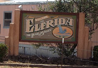
Elfrida is a census-designated place in Cochise County, Arizona, United States. As of the 2010 census it had a population of 459.
KWCD is a radio station broadcasting a country music format. It is licensed to Bisbee, Arizona, United States. This station serves southern Cochise County, Arizona and a small piece of northern Sonora, Mexico. The station is currently owned by Townsquare Media.
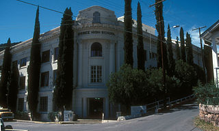
Bisbee High School is a high school in Bisbee, Arizona. It is part of the Bisbee Unified School District, which also operates an elementary school and a junior high school. The high school runs on a four-day school week.
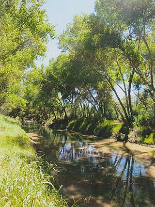
Palominas is a census-designated place located along the San Pedro River in the southern portion of Cochise County in the state of Arizona, United States. Palominas is located very close to the community of Miracle Valley along Arizona State Highway 92. The population of Palominas as of the 2020 U.S. Census was 222.
Bakerville is a populated place situated within the city of Bisbee in Cochise County, Arizona, United States.
Black Diamond is a populated place situated in Cochise County, Arizona, United States.
Double Adobe is a populated place situated in Cochise County, Arizona, United States.
Forrest was a populated place situated in Cochise County, Arizona, United States.
Galeyville is a populated place situated in Cochise County, Arizona, United States. Founded in 1881, it is now a ghost town. It has an estimated elevation of 5,732 feet (1,747 m) above sea level.
Johnson is a populated place situated in Cochise County, Arizona, United States, on the east side of the Little Dragoon Mountains.
Lewis Springs, also called San Pedro Springs after the nearby San Pedro River, is a populated place situated in Cochise County, Arizona, United States.
Nicksville is a populated place in Cochise County, Arizona, just north of the international border between the United States and Mexico.
Sunnyside is a populated place situated in the far west of Cochise County, Arizona, United States, located just north of the international border with Mexico. It has an estimated elevation of 5,814 feet (1,772 m) above sea level.
Vanar was a station on the Southern Pacific railroad and populated place situated in Cochise County, Arizona, United States, adjacent to the border with New Mexico. The community was originally named Vanarman after Hiram M. Van Arman, and the name was shortened for telegraph purposes in 1905 to Vanar.


