Arondizuogu (Aro-ndizuogu) is a town inhabited by the Igbo subgroup, the Aro people in the Imo State of Nigeria. The Arondizuogu community is believed to have migrated from Arochukwu in the present Abia State, to their current settlements in across three local governments of Imo state, which include the Okigwe, Ideato North and Onuimo Local Governments, although there are others of Aro descent in other local governments, in Imo State.

Okigwe is the third largest city in Imo state in Nigeria after Owerri and Orlu. Okigwe is located in the Okigwe Local Government Area of Nigeria. The city lies between the Port Harcourt-Enugu-Maiduguri rail line, being the nearest city to the biggest cattle market in Nigeria located in the Umu Nneochi Area of Abia state. Thus, the city has grown into a major cattle transit town for the southeast and south subregions of Nigeria. Okigwe has a population of 132,237. Most of the population is made up of immigrant workers from other states. Okigwe city was the primary host site of the old Imo State University. Okigwe has various tourist and historical sites. The Federal Government College in the city has remained one of the best unity schools in Nigeria. Okigwe remains one of the breadbaskets of Nigeria with terrace cultivation practised on its hilly farmlands. Okigwe also boasts many relaxation spots such as Alexandra Suites & Hotels Limited Okigwe Imo state which is situated at No 1 Alexandra Ave, Umuchima Road, Ubahu. St. Mary's Cathedral in Okigwe is the seat of the Roman Catholic Diocese of Okigwe. In 2016, the Imo state government recommissioned a new cattle market in the city in respect to the previous one that has been relocated to Abia.

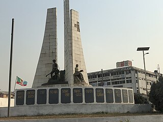
Orlu is the second-largest city in South East, Imo State, Nigeria, with a population of 420,600. It has a long history as the headquarters for the Organisation of African Unity (OAU) and humanitarian relief agencies during the Nigeria-Biafra Civil War. The city houses the Nigerian headquarters of the British Cheshire Home. It is the second most developed city after Owerri in Imo state.
Ikeduru Local Government Area (LGA) is located in the western part of Imo State, in southern Nigeria, West Africa. It was previously carved out of Mbaitolu / Ikeduru LGA. It has its headquarters at Iho (Ihuo).

The Nigerian National Assembly delegation from Imo comprises three Senators representing Imo North, Imo East, and Imo West, and ten Representatives representing Ahiazu Mbaise/Ezinihitte, Orlu/Oru East, Aboh Mbaise/Ngor Okpala, Ohaji/Egbema/Oguta, Ideato North/Ideato South, Okigwe North, Ehime Mbano/Ihitte Uboma/Obowo, Mbaitolu/Ikeduru, Owerri Municipal/Owerri North/Owerri West, and Nkwerre/Nwangele/Isu/Njaba.
Imo State is a state in the South-East geopolitical zone of Nigeria, bordered to the north by Anambra State, Rivers State to the west and south, and Abia State to the east. It takes its name from the Imo River which flows along the state's eastern border. The state capital is Owerri and its state nickname is the "Eastern Heartland."

Aboh Mbaise is a Local Government Area of Imo State, Nigeria. Its headquarters is in the town of Aboh.

Ideato South is a Local Government Area in Imo State, South-eastern Nigeria. Ideato South, with a total of 23 autonomous communities has its headquarters in the town of Dikenafai, the source of Orashi River. Ideato South has an area of 88 km² and a population of 159,879 at the 2006 census. The postal code of the area is 475.

Ihitte/Uboma is a Local Government Area of Imo State, Nigeria. Its headquarters are in the town of Isinweke.

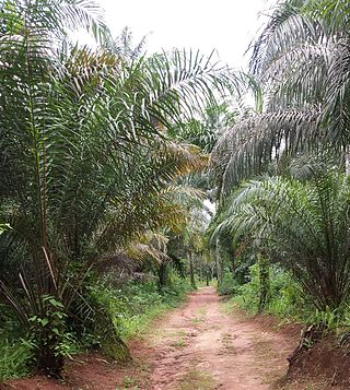
Mbaitoli is a Local Government Area of Imo State, Nigeria. Its headquarters are in the town of Nwaorieubi. It has an area of 204 km² and a population of 327,000. The postal code of the area is 461. Mbaitoli is divided into 9 autonomous communities with 12 INEC wards. The principal occupations of these communities are farming and handicrafts.

Njaba is a Local Government Area of Imo State, Nigeria. Its headquarters is located in the town of Nnenasa. It has an area of 84 km2 and a population of 143,485 at the 2006 census. The 2011 density projection is 2,004.5 inhabitants/km2. The postal code of the area is 474.

Nwangele is a Local Government Area of Imo State, Nigeria. The name was derived from the popular Nwangele river which marks the boundary between Amaigbo and Umuozu Isu. The river which is believed to have originated from Isiekenesi town passes through several villages in Amaigbo and empties into Oramiriukwa a tributary of Imo river. Its headquarter is in Amaigbo.
Obodoukwu is a suburb town in Ideato North Local Government Area, in Imo State a Southeastern state in Nigeria. It consists of nine villages: Umuagbadagwo, Umunwarahu, Umume, Umumejiaku, Umunkwukwa, Umuoka, Umuezugo/Umuezesheta, Uzubi and Ugbele which consists of kindreds. The marketplace in Obodoukwu is called Eke, which is one of the weekdays in the Igbo calendar. Eke market is the largest market in the town. Obodoukwu is ruled by His Royal highest Eze Dim Agbakwuruigbe. The largest village of the nine villages is Umunwarahu being the capital of the town. The town has famous politicians, musicians, comedians and sculptors.
Umueshi is a community in Ideato South Local Government Area in Imo State, Nigeria. The community comprises 15 villages, including: Okorobi, Umuezeanuwai, Umunwangwu, Umuanajughi, Ukabi, Umuokwara, Umudieshi, Okoroikpa, Umuduruaku, Umudire, and Obinugwu.
Amike is a town and autonomous community in Orlu Local Government Area of Imo State, Nigeria. Amike is composed of Villages which include Umuokwaraebika, Umudimodu, Umudimoha, Umuowerre, Eshime, Umuduruewuru, Umudim, Umutukutu, Umuduruelem, Umugboga (Umuduruji), Umukwalam (Ekwealo) and Umuanu.
Osina is a town in Ideato North Local Government of Imo State, Nigeria and is under Orlu senatorial zone. Osina has four villages: Eluama, Uhualla, Ofeke, Umuduru/Umuogbu (Durunogbu). The Nnewi – Okigwe road passes through Osina. The Awka – Umuahia road also passes through Osina.

Orashi River, is a river of the lower Niger River basin, and a tributary of Oguta Lake, southeastern Nigeria. Urashi takes off, 183 m above mean sea level, from the rocks in Ezeama community of Dikenafai, Imo State. Described as a lifeline to Ideato South communities, Orashi stream serves as an all purpose river for drinking, washing and many others to communities such as Umulewe, Umuchima and Ntueke in the area.
Dikenafai is a town in Ideato South Local Government Area of Imo State, Nigeria, famous for its natural waterfall, Ezeama, which turns into the great Orashi River. Dikenafai currently serves as the headquarters of Ideato South.
Isiekenesi, is a community in Ideato South Local Government Area of Imo State, Nigeria.
The 2023 Nigerian presidential election in Imo State will be held on 25 February 2023 as part of the nationwide 2023 Nigerian presidential election to elect the president and vice president of Nigeria. Other federal elections, including elections to the House of Representatives and the Senate, will also be held on the same date while state elections will be held two weeks afterward on 11 March.


