
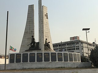
Owerri is the capital city of Imo State in Nigeria, set in the heart of Igboland. It is also the state's largest city, followed by Orlu, Okigwe and Ohaji/Egbema. Owerri consists of three Local Government Areas including Owerri Municipal, Owerri North and Owerri West, it has an estimated population of about 1,401,873 as of 2016 and is approximately 100 square kilometres (40 sq mi) in area. Owerri is bordered by the Otamiri River to the east and the Nworie River to the south. The Owerri Slogan is Heartland.

Nasarawa State is a state in the North Central region of Nigeria, bordered to the east by the states of Taraba and Plateau, to the north by Kaduna State, to the south by the states of Kogi and Benue, and to the west by the Federal Capital Territory. Named for the historic Nasarawa Emirate, the state was formed from the west of Plateau State on 1 October 1996. The state has thirteen local government areas and its capital is Lafia, located in the east of the state, while a key economic centre of the state is the Karu Urban Area—suburbs of Abuja—along the western border with the FCT.

Okigwe is the third largest city in Imo state in Nigeria after Owerri and Orlu. Okigwe is located in the Okigwe Local Government Area of Nigeria. The city lies between the Port Harcourt-Enugu-Maiduguri rail line, being the nearest city to the biggest cattle market in Nigeria located in the Umu Nneochi Area of Abia state. Thus, the city has grown into a major cattle transit town for the southeast and south subregions of Nigeria. Okigwe has a population of 132,237. Most of the population is made up of immigrant workers from other states. Okigwe city was the primary host site of the old Imo State University. Okigwe has various tourist and historical sites. The Federal Government College in the city has remained one of the best unity schools in Nigeria. Okigwe remains one of the breadbaskets of Nigeria with terrace cultivation practised on its hilly farmlands. Okigwe also boasts many relaxation spots such as Alexandra Suites & Hotels Limited Okigwe Imo state which is situated at No 1 Alexandra Ave, Umuchima Road, Ubahu. St. Mary's Cathedral in Okigwe is the seat of the Roman Catholic Diocese of Okigwe. In 2016, the Imo state government recommissioned a new cattle market in the city in respect to the previous one that has been relocated to Abia.

Orlu is the second-largest city in South East, Imo State, Nigeria, with a population of 420,600. It has a long history as the headquarters for the Organisation of African Unity (OAU) and humanitarian relief agencies during the Nigeria-Biafra Civil War. The city houses the Nigerian headquarters of the British Cheshire Home. It is the second most developed city after Owerri in Imo state.
Bida is a Local Government Area in Niger State, Nigeria and a city on the A124 highway which occupies most of the area.
Egbu is a town in Owerri North Local Government Area of Imo state in southern Nigeria, located on the Otamiri River near the city of Owerri. Egbu is among the brother clans in owerri known as "Ala Enyi" including; Ihitta Ogada, Awaka, Owerri Nchi Ise and Naze. Egbu is linked to other towns and villages by the Owerri–Umuahia road.
Nekede is a town in southeastern Nigeria. It is located near the city of Owerri. This is an Igbo speaking town that is made up of three distinct towns, viz Umualum, Umudibia, and Umuoma. Nekede also hosts the Imo State new Owerri capital territory popularly known as new Owerri. Federal University of Technology Owerri is 20 minutes drive from Nekede. It lies on the junction of the Nworie River and the Otamiri River. The population of Nekede is fast developing into a city with increasing population due to the citing of the Federal Polytechnic, Nekede, a federal government-owned higher institution.
Obinze is a community in southeastern Nigeria, located near the city of Owerri, Imo State under the supervision of Owerri West Local Government Area. The community Obinze had six clans/villages but a clan known as Umuanunu got their own autonomous community and separated. It's known for its fast rise in industrialization due to its location along Owerri-Port-harcourt Road, giving hosts/non-indigents access to the Local government area, State capital and neighbouring state such as Abia State, Anambra state and Rivers State. Obinze shares boundaries with Oforola, Avu, Ihiagwa, Eziobodo, Umuokani, Nekede and Mbirichi etc.
Imo State is a state in the South-East geopolitical zone of Nigeria, bordered to the north by Anambra State, Rivers State to the west and south, and Abia State to the east. It takes its name from the Imo River which flows along the state's eastern border. The state capital is Owerri and the state nickname is the "Eastern Heartland."

The Federal University of Technology Owerri (FUTO) is a federal government university in Owerri West, Owerri, the capital of Imo State, Nigeria. The university is bounded by the communities of Eziobodo, Ihiagwa, Obinze, Okolochi and Emeabiam. It is the premier federal university of technology in the South-East and South-South parts of Nigeria.
Bende is a Local Government Area in Abia State, Nigeria with headquarters located in Bende Community. Bende Local Government Area (L.G.A) of Abia state lies on 70 30I of the Greenwich Meridian and latitude 50 30I North of the Equator. It is composed of thirteen (13) communities, namely: Alayi, Bende, Ezukwu, Igbere, Item, Itumbuzo, Nkpa, Ntalakwu, Ozuitem, Ugwueke, Umu-imenyi, Umuhu-Ezechi, and Uzuakoli.
Ihiagwa is a town in Owerri West Local Government Area of Imo State, Nigeria. It is located 12 km (7.5 mi) south of the capital city of Owerri. The township is composed of eight villages: Umuelem, Umuchima, Mboke, Nnkaramochie, Iriamogu, Aku/Umuokwo, Ibuzo and Umuezeawula. Ihiagwa has been divided into two autonomous communities, namely Ihiagwa Ancient Kingdom (Chimelem), comprising two villages: Umuelem and Umuchima;and Dindi-Ihiagwa, comprising the remaining six villages, all divisions done for administrative and developmental reasons. Each autonomous community is a monarchy ruled by an Eze.

The Otamiri River is one of the main rivers in Imo State, Nigeria. The river takes its name from Ota Miri, a deity who owns all the waters that are called by his name, and who is often the dominating god of Mbari houses. The river runs south from Egbu past Owerri and through Nekede, Ihiagwa, Eziobodo, Olokwu Umuisi, Mgbirichi and Umuagwo to Ozuzu in Etche, in the Rivers State, from where it flows to the Atlantic Ocean. The length of the river from its source to its confluence at Emeabiam with the Uramiriukwa River is 30 kilometres (19 mi).

Nkwerre is one of the Local Government Areas in Imo State, South-East, Nigeria. It is situated in Nkwerre town where the name of the local government area was derived. Its population was placed at 80,270 from the 2006 population census with an area of 38.447 km. It is known for its thick vegetation which is supposed to prevent soil erosion however, it is erosion prone area.

Onuimo is a Local Government Area of Imo State, Nigeria. Its headquarters are in the town of Okwe. It comprises four towns namely: Okwe, Okwelle, Umuduru-Egbeaguru and Umuna. It is home to very prominent Nigerians such as The ever influential dynamic estate surveyor; Prof. James Gaius Ibe- USA trained and tenured professor of economics, finance and business administration, Dr Dennis Ndububa-a graduate of UNN with close to 40 years of professional practice as a medical doctor; Dr. Victor Ndububa; Dr. Christian Egemba; Dr. Kaunda Ibe-Consultant Neurosurgeon at Imo State University Teaching Hospital Orlu Imo State; Dr. Geraldine Echue-winner in Global Chemistry competition; Chief Adol N. Obi - the former bursar of Federal Polytechnic Nekede Owerri, and Engr Ekene Echefu - a lecturer in Mechatronics engineering department, federal polytechnic Nekede Owerri.Taiwo Damilola also served there. Also American author and writer Dreux Richard resides in Okwe to complete his writing when in Nigeria.
James N.J. Aneke is a retired Nigerian Navy officer. He served as the Military Governor of Imo State in Nigeria from December 1993 to August 1996. He was Commandant of Nigerian Naval Engineering College (NNEC), Sapele, Delta State.
Umuguma Town is Owerri West Local Government Area's headquarters. It is in Imo State, Nigeria. It evolved out of the old Owerri Local Government Area in 1996. Umuguma—a descendant of Arugo—is one of the 774 communities in the constitution of the Federal Republic of Nigeria as Local Government administrative

The Federal Polytechnic, Nekede, is a federal government-owned higher education institution located in Nekede, Owerri West local government area, Imo State, south-eastern Nigeria. It was established on a temporary site at the premise of Government Technical College by the Imo State government in 1978 as the College of Technology, Owerri before it was moved to its present location in Nekede. On April 7, the Polytechnic was changed to a federal government institution and was named "The Federal Polytechnic, Nekede." The Federal Polytechnic, Nekede offers National Diploma and Higher National Diploma courses at undergraduate levels.
Eziobodo is an ancient kingdom located in today's Owerri-West local government, Owerri - Imo State Nigeria. Eziobodo is an igbo-speaking community with a population of over 15,000 locals.
Okolochi is an ancient community in today's Owerri West Local Government Area of Imo State, Nigeria, it borders Emeabiam, Eziobodo, Ihiagwa and Obibiezena communities. It is one of the host communities of Federal University of Technology, Owerri, FUTO.

