
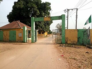
Orlu is the second-largest city in South East, Imo State, Nigeria, with a population of 420,600. It has a long history as the headquarters for the Organisation of African Unity (OAU) and humanitarian relief agencies during the Nigeria-Biafra Civil War. The city houses the Nigerian headquarters of the British Cheshire Home. It is the second most developed city after Owerri in Imo state.
Oguta is a town on the east bank of Oguta Lake in Imo State of southeastern Nigeria.

Nigeria has 774 local government areas (LGAs), each administered by a local government council consisting of a chairman, who is the chief executive, and other elected members, who are referred to as councillors. Each LGA is further subdivided into a minimum of ten and a maximum of twenty wards. A ward is administered to by a councillor, who reports directly to the LGA chairman. The councillors fall under the legislative arm of the local government, the third tier of government in Nigeria, below the state governments and the federal government.

Oguta Lake is a lean 'finger lake' formed by the damming of the lower Njaba River with alluvium. it is the largest natural lake in Imo State, Southeastern Nigeria; within the equatorial rainforest region of Niger Delta. Oguta Lake's catchment area comprises the drainage area of the Njaba River and a part of the River Niger floodplain in the region south of Onitsha.
Eziama Obiato is a town in Mbaitoli Local Government Area of Imo State, southeastern Nigeria. It is about 18 kilometers to the city of Owerri. The town is strategically located as it shares common boundaries with four other Local Government Areas in Imo State. It is bordered by Awo-Omamma, Umu-ofor/Akabo, Amazano/Umuaka, Afara and Umunoha. Eziama Obiato is home to the popular "Ukwuorji" Bus Stop on the Owerri/Onitsha Road.
Awo-Idemili is the headquarters of Orsu Local Government, Imo State in southeastern Nigeria. It is located near the city of Orlu.
Mgbidi is the headquarters of Oru West, a local government area of Imo State in southeastern Nigeria. It is located at latitude 5.37° N and longitude 6.57° E. It was the headquarters of the Oru Local Government Area before its division into two local government areas, Oru West and Oru East, in 1996 under the presidency of Sani Abacha.

The Nigerian National Assembly delegation from Imo comprises three Senators representing Imo North, Imo East, and Imo West, and ten Representatives representing Ahiazu Mbaise/Ezinihitte, Orlu/Oru East, Aboh Mbaise/Ngor Okpala, Ohaji/Egbema/Oguta, Ideato North/Ideato South, Okigwe North, Ehime Mbano/Ihitte Uboma/Obowo, Mbaitolu/Ikeduru, Owerri Municipal/Owerri North/Owerri West, and Nkwerre/Nwangele/Isu/Njaba.
Imo State is a state in the South-East geopolitical zone of Nigeria, bordered to the north by Anambra State, Rivers State to the west and south, and Abia State to the east. It takes its name from the Imo River which flows along the state's eastern border. The state capital is Owerri and the state nickname is the "Eastern Heartland."

Orsu is a local government area (LGA) and tribe in the Imo State of Nigeria. Orsu is also the name of the dialect of this people. They are an Igbo sub-group located west of Orlu, north of Oguta and in the general areas around Oru East, Oru West, Ihiala, Nnewi south and Oguta LGAs. Orsu LGA is made up of several autonomous communities including Ihitenansa, Amaruru, Amazu, Amaebu, Amannachi, Awo-Idemili, Asaa Ubirielem, Eziawa, Umuhu Okabia, Orsu Ihiteukwa, Okwu Ufuruaku, Okwu Amaraihe, and Okwu Etiti.

Njaba is a Local Government Area of Imo State, Nigeria. Its headquarters is located in the town of Nnenasa. It has an area of 84 km2 and a population of 143,485 at the 2006 census. The 2011 density projection is 2,004.5 inhabitants/km2. The postal code of the area is 474.
Amaifeke is an urban town in Orlu Local Government Area LGA of Imo State in the Niger Delta region of South Eastern Nigeria. The town shares the Orlu Urban metropolis area with Umuna and part of Orlu village. The indigenous population of Amaifeke belong to the Igbo ethnic group and the town is situated within the Igbo cultural area. Amaifeke shares boundaries with the following towns; Ihioma, Okporo, Okwuabala, Umuna, Orlu and Owere Ebeiri. The main language spoken in Amaifeke is the Orsu variant of the Igbo language.
Ibele is an autonomous community in the Njaba Local Government Area in Orlu Senatorial zone of Imo State, Nigeria. The town is located at the old Douglas road, running from Afor-Umuaka westward in Njaba Local Government Area to Ukworji in Eziama-Obiator of Mbaitoli local government area, then to Oguta.

Awo-Omamma, in the Northeast of Niger Delta basin is an oil-rich indigenous Igbo town on the banks of Njaba River. It is a potential tourism hub in the region due to its species of wildlife in Umuezukwe and green vegetation.

Njaba River, in the Niger Delta Basin is a major tributary of Oguta Lake in Nigeria's South East Imo State. With 4.5m mean depth, the river has a total stream length of 78.2 km, basin area of 145.63 square kilometers and an average specific discharge of about 1700 m3/hour.
Izombe in the northeast of Niger Delta is an oil town in Njaba River basin, Imo State Southeastern Nigeria.
Umuezukwe is an ancient trade route, a river port, and a farming community in Awo-Omamma, northeast of the Niger Delta region, Nigeria's South East, Imo State. It is one of the densely populated Awo-Omamma rural settlements in the Njaba River basin.
Akatta is a major town in Oru East Local Government Area of Imo State in Nigeria. It is bordered to the north west by the towns Nnempi, Akuma and Amagu, to the north east by Amaebu and Amazu, to the south east by Okporo, Umutanze and Atta Njaba, and to the south west by Omuma. The following villages make up Akatta: Akwa, Urah, Ichi-Amaka, Ubaha, Ubahangwu, Okporo, Okwu and Azu Akatta. The town is approximately 10 km (6 mi) west of Orlu.

The 2023 Nigerian Senate elections in Imo State will be held on 25 February 2023, to elect the 3 federal Senators from Imo State, one from each of the state's three senatorial districts. The elections will coincide with the 2023 presidential election, as well as other elections to the Senate and elections to the House of Representatives; with state elections being held two weeks later. Primaries were held between 4 April and 9 June 2022.
The 2023 Nigerian presidential election in Imo State will be held on 25 February 2023 as part of the nationwide 2023 Nigerian presidential election to elect the president and vice president of Nigeria. Other federal elections, including elections to the House of Representatives and the Senate, will also be held on the same date while state elections will be held two weeks afterward on 11 March.


