Ikot-Abasi

Last updated

Ikot Abasi
Ikot Abasi, Nigeria
LGA
Akpan Udo-Ekpo Road, Ikot Abasi.jpg
Nickname: 
Alu City
Nigeria location map.svg
Red pog.svg
Ikot Abasi
Location in Nigeria
Coordinates: 4°38′0″N7°39′0″E / 4.63333°N 7.65000°E / 4.63333; 7.65000
CountryFlag of Nigeria.svg  Nigeria
State Akwa Ibom State
LGAIkot Abasi
HeadquartersIkot Abasi
Government
  TypeTraditional
  ChairmanHon. Joseph Affia
Area
  Total280.8 km2 (108.4 sq mi)
Population
 (2022) [1]
  Total169,200
  Density600/km2 (1,600/sq mi)
Time zone UTC+1 (WAT)
Climate Am
Website web.archive.org/web/20111006012428/http://www.aksgonline.com/lga.aspx?qrID=ikotabasi
Ikot-Abasi

Ikot Abasi is located in the south west corner of Akwa Ibom State, Nigeria. It is bounded by Oruk Anam Local Government Area in the north, Mkpat Enin and Eastern Obolo Local Government Areas in the east and the Atlantic Ocean in the south. The Imo River forms the natural boundary in the west separating it from Rivers State. [2] The Federal University of Technology Ikot Abasi is a federal government-owned university located in Ikot-Abasi.

Contents

People

The people of Ikot Abasi are made up of the Ibibio ethnic group with diverse cultural heritage and tradition. [3] They speak the Ibibio language.

Ikot Abasi is made up of five clans namely: Edemaya Clan, Ikpa Ibekwe Clan, Ikpa Nnung Assang Clan, Ukpum Ette Clan and Ukpum Okon Clan. Ikpayong Nnung Assang Clan

Districts

Ikpa Ebkwe District

  1. Ata Udo Usung
  2. Ikong Ukpo Inwa
  3. Ikot Aba
  4. Ikot Abasi
  5. Ikot Akpan Ata
  6. Ikot Essien
  7. Ikot Etetuk
  8. Ikot Obong
  9. Ikpetim
  10. Uta Ewa

Edemaya District

  1. Atan Eka Iko
  2. Atan Ikpe
  3. Ediduo
  4. Iboro
  5. Ikot Aboa Ndia
  6. Ikot Akpabo
  7. Ikot Akpan
  8. Ikot Efre
  9. Ikot Eneni
  10. Ikot Etenge Ndom
  11. Ikot Eyen Imo
  12. Ikot Ikara
  13. Ikot Iyire
  14. Ikot Ndien
  15. Ikot Obio Akpan
  16. Ikot Obio Ekpe
  17. Ikot Oboro Enyin
  18. Ikot Okpok
  19. Ikot Ubo Akama
  20. Ikot Ufot
  21. Ikot Unya
  22. Ikot Uso Ide
  23. Ukan

History

Because of its location at the break in the mangrove swamp and rain forest of the eastern Niger River delta, it was a collecting point for slaves in the 19th century. [4] In 1870, Jubo Juboha came to Ikot Abasi and founded the kingdom of Opobo. [4] He was a former Igbo (Ibo) slave. [4]

Ikot Abasi, a community in then Calabar Province, for good reasons. Although Ikot Abasi, formerly part of the famed Opobo Kingdom, was already on the world map before 1929, the women's uprising against Nigeria's colonial rulers in 1929 was to provide a further push into prominence for this town, then already popular as the site of a famous boat yard, seat of a British consulate and part of the late King Jaja's area[ citation needed ].

Three-quarters of a century ago, Ikot Abasi was one of a number of towns in both Calabar and Owerri provinces, whose women bravely took exception to what they considered exploitative excesses of the British rulers of the then non-independent Nigeria.

In 1995, the year of that famed Beijing conference, the National Gallery of Modern Art, Lagos (NGA) put out a very important book, The women's revolt of 1929. The book, which features contributions from notable academics like Prof. Monday E. Noah, Prof. Obaro Ikime and Chief N.U. Akpan, among others, reminds that one of the women killed by the colonial forces during the 1929 protest was the mother of a boy, Egbert. That lad would later grow into a famous jurist and administrator (Justice Egbert Udo Udoma). Such was the impact of the reforms that trailed the women's protest that the March 8, 1933 issue of the Daily Times described the changes as "the great charter of liberty for the people" but the prize did not come easy. Prof. M. E. Ekpo, another of the book's contributors, revealed that in the Calabar Province alone, more than 53 people were killed beside over 50 others injured.

Launched in 1989, in commemoration of the 60th anniversary of the uprising, The women's revolt of 1929 is an anthology of select papers from a national symposium on the subject, which took place in Port-Harcourt in 1982. According to Dr Paul Chike Dike, editor of the anthology, "An attempt by the (protesting) women to move nearer the colonial troops led to the order to shoot, in which over 24 women were killed".
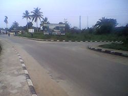
The sculpture for the slain Women Ikot Abasi Women Riot.jpg
The sculpture for the slain Women

Geography

Until the 1970s, the ancient Opobo Kingdom was part of then South Eastern State (later re-Christened Cross River). However, a boundary adjustment exercise split Opobo. Opobo Island was made part of Rivers State while the mainland part remained within Cross River. That area, renamed Ikot Abasi, now lies in present-day Akwa Ibom State. Sources say ancient Ikot Abasi referred to smaller settlement but the name has assumed a more or less generic dimension in recent times. In the larger sense, today's Ikot Abasi comprises five clans: Ikpa-Ibekwe, Ukpum-Ette, Ukpum-Okon, Edem-Aya and Ikpa Nnung Asang. The palace of the paramount ruler of Ikot Abasi is within Ukpum okon clan .

Ikot Abasi once hosted a British Consulate, which is how one of the major streets here, Consulate Road, came by its name. At the roundabout leading to Consulate Road, the tourist would notice a statue of the late Justice Udo Udo Udoma, the first Nigerian to bag a Doctor of Philosophy (PhD) in law. The deceased legend's other achievements included his appointment as Chairman, Constituent Assembly (1977–1979), Chief Justice of Uganda (1963–1969) and Governor-General of that African Great Lakes country in 1963. Sauntering down Consulate Road, the wayfarer is likely to find one or two decent eateries not long after walking past Beracah Chambers, a law office. Further down this road, stands the Local Government Secretariat.

Overlooking the river, which separates Ikot Abasi from Opobo Island, are a number of quaint bungalows. One or two of these blocks serve as offices of the Ikot Abasi Traditional Rulers Council. Opposite these chiefs' secretariat, across a narrow asphalt lane, is a monument that was unveiled on December 16, 1985 by Justice Udoma. The spot, where the sculpture has been installed, is believed to be the place that some of the brave women were martyred in 1929.

Tourism

The area is dotted with tourist attraction centres. Her beautiful beach front at Uta Ewa, the Berger Jetty along Uta Ewa creek and the coastline create attractive tourist resorts.

Natural resources

The abundant gas and oil deposits have attracted many establishments to the area. The oil fields include, Utapate (onshore). Adna (offshore) and Asabo

Agricultural resources

Arable agricultural produce include cassava, yam, sweet yam, taro and maize while cash crops are not limited to oil palm, coconut, raffia, rubber and palm kernel. There is an abundant forest reserve for timber and wild life while commercial fishing thrives in the area. Although known for boat-building, a sand bar partially blocks the entrance to its port from the Gulf of Guinea. [4] Ikot Abasi is also a home to Alscon, the biggest aluminium smelter plant in Africa.

Related Research Articles

Abak is a town and Local Government Area in Akwa Ibom State, Nigeria. The LGA was previously part of Cross River State. It was later sub divided into other local government areas such as Oruk Anam, Etim Ekpo, Ukanafun and Ika. Notable tribes include the Annang. Abak consists of five clans: Abak Urban, Afaha obong, Ediene, Midim and Otoro. The major economic activities of the people of this area before and after the Nigerian Civil War was palm produce exported through river port at Ekpene Okpo, Ntak Ibesit, a distance of about 8 km from Abak town. Abak town, the local government headquarters is located about 18 kilometres from Uyo, the State capital. It has a landmass of 304 square kilometers. Abak to say the least, is the shadow of its former self due to politically motivated neglect by successive governments in Akwa Ibom state. Abak was the economic hub of the former Southeastern Nigeria before the civil war. The Nigerian Army barrack that is popularly known as Ibagwa Barrack is located or can be found in the Abak. The Ime Umana Campus of the university of Uyo which accommodates the Pre-Degree, JUPEB and other special courses is located in Ediene Abak, Abak

Onna is a Local Government Area in Akwa Ibom State, Nigeria. Its name comes from an acronym of the names of the four predominant clans in the area: Oniong, Nnung Ndem, Awa Afaha and Awa.

Ikot Ekpene, also known as The Raffia City, is a historic town in south-southern state of Akwa Ibom. It is the political and cultural capital of the Annang ethnic group in Nigeria. The town is located on the A342 highway that parallels the coast, between Calabar to the south east and Aba to the west, with the state capital, Uyo, on this road just to the east. Umuahia is the next major town to the north. The population of the Ikot Ekpene Local government area was estimated to be 180,500 in 2022.

<span class="mw-page-title-main">Efik people</span> Ethnic group in West Africa

The Efik are an ethnic group located primarily in southern Nigeria, and western Cameroon. Within Nigeria, the Efik can be found in the present-day Cross River State and Akwa Ibom state. The Efik speak the Efik language which is a member of the Benue–Congo subfamily of the Niger-Congo language group. The Efik refer to themselves as Efik Eburutu, Ifa Ibom, Eburutu and Iboku.

Eket is one of the 31 local government areas in Akwa Ibom State, Nigeria. The name Eket or Ekid also refers to the indigenous ethnic group of the region and to their language. The Eket people use the endonym Ekid for themselves and their language, but Europeans spell and pronounce the name as "Eket".

Oruk Anam is a Local Government Area located in the South West of Nigeria in Akwa Ibom State.

Etim Ekpo is a town and Local Government Area in Akwa Ibom State, Nigeria. The area has 11 wards.

Ibiono-Ibom is a Local Government Area of Akwa Ibom State in the south-south region of Nigeria. It has its administrative headquarters at Oko Ita.

Itu is located in the South South of Nigeria and is a Local Government Area of Akwa Ibom State. The Local Government Area occupies a landmass of approximately 200 square kilometers. It is bounded in the North and North-East by Odukpani in Cross River State and Arochukwu in Abia State, in the West by Ibiono Ibom and Ikono Local Government Areas, in the South and southeast by Uyo and Uruan Local Government Areas, respectively.

Mbo is located in the South Eastern part of Nigeria and is a Local Government Area in Akwa Ibom State. Following the local government creation exercise of the federal government in 1989 Mbo Local Government Area was carved out of Oron Division same year.

Nsit Atai Local government area was created in the year 1996 with its capital at Odot by the government of Gen. Sani Abacha. It has an area of out of an about 17,000 square kilometers, with 62 villages.

Obot-Akara is in the south of Nigeria and is a Local Government Area of Akwa Ibom State whose headquarters is located at Nto Edino.

Ukanafun is a Local Government Area located in the South South of Nigeria in Akwa Ibom State.

Uruan is a Local Government Area in Akwa Ibom State, south of Nigeria.

Ikot Ukpong is a village in Okon development ward II of Eket local government area, Akwa Ibom State, Nigeria. Ikot Ukpong means "Family of Ukpong" or "People of Ukpong". Ikot Ukpong is made up of different settler-families and descendants of the founder of the village. The deity of Ikot Ukpong was called "Ukpong Idem", meaning "spirit body". Other deities traditionally recognised by the village were Ekpo (ancestors) and Ndem Ikpa Isong. Their primary language is Ibibio despite their affinity with Ekid people of Eket. Ikot Ukpong is occupied by the Ibibio people.

Ikot Abasi is one of the 31 local government area of Akwa Ibom State. It is surrounded by Eastern Obolo and Mkpat Enin local government areas. The primary language that is spoken is the ibibio language. The villages in Ikot Abasi include Essene, Ete, Uta Ewa, Edem Aya, etc.

Ikot Udoma is a village in Eket Local Government Area of Akwa Ibom State, Nigeria. It is one of the villages under Abikpi (Ebikpi) sub-clan of Eket Offiong clan. It is bounded by Afia Nsit, Ofriyo and Odoro Enen villages to the north, Ikot Ibiok and Mkpok villages to the south, Idua Village to the west and Ata Idong Ikot Usoekong village to the east.

Adadia is a town with five villages in Uruan Local Government Area of Akwa Ibom State, Nigeria. Adadia is inhabited by the Ibibio12people.

Abak/Midim is one of the nine Clans or Districts in Oruk Anam local government area of Akwa Ibom State. It is one of the two Clans or Districts in the former Anam Local Government Area, both in southern Nigeria.

Ikot Inuen is a town in southern Abak/Midim Clan in Oruk Anam LGA of Akwa Ibom State. It is bounded in the south by Edemaya Clan of Ikot Abasi. It is located on Nigeria's East-West road that links Port Harcourt to Ikot Abasi. It marks the linguistic transition zone between the Annang and Ibibio speaking ethnic groups of Akwa Ibom State. Being part of the Anam political unit of Oruk Anam LGA, Ikot Inuen was part of the Opobo Division from the precolonial era until 1967, when it was moved to the newly created South Eastern State, which was later renamed Cross River State. Ikot Inuen is among the communities that is climatically influenced by Imo River that separates Rivers State from Akwa Ibom State of Nigeria. The area is rich in arable farmland, which makes farming the occupation of about half of the populace. Others are involved in petty trading, artisanship, and civil service. The area is rich in crude oil deposits, as evidenced in the corked oil well belonging to Shell Petroleum at Efut Idim Etok, also known as Idim aShell. In academics, the area has a public Primary School, The St Jude's Catholic School, and a public Secondary School, The Community Secondary School. The Ukoessien Central Market boasts commercial activities in the area. Apart from the first church, the St Jude's Catholic Church, established in 1919, other churches in the community include the Methodist Church, the Christ Army Church, the Samuel Spiritual Church, the Apostolic Church, the Mount Zion Mission, the Assemblies of God Church, the Deeper Life Bible Church, the Wings of Redemption Ministries and the Redeemed Christian Church of God.

References

  1. "Akwa Ibom State: Subdivisions". www.citypopulation.de. Retrieved 2024-02-05.
  2. "Ikot Abasi | Nigeria | Britannica". www.britannica.com. Retrieved 2022-11-14.
  3. "List of Terraced Duplexes in Ikot Abasi, Akwa Ibom". nigeriapropertycentre.com. Retrieved 2021-09-15.
  4. 1 2 3 4 "Ikot Abasi | Nigeria". Encyclopedia Britannica. Retrieved 2017-02-06.