The following are lists of the most populous fully defined incorporated settlements in Nigeria by population. This page consists of three different tables, with different kinds of settlements; a list for "defined cities", listing the population, strictly within the defined city limits, a list for "urban area" population, and another list for the population within metropolitan areas.
Nigerian cities are categorized into three types; there is the "Metropolis", which is characterized by having more than one Local Government Areas (LGAs). These types of cities are usually formed when large municipalities are split into smaller LGAs, to aid efficient administration and management, or when small towns grow and merge into existing large cities, or both; some are also formed when urban areas of multiple LGAs merge as a result of growth and are now fully defined as a single settlement, Another type of settlement is the "Municipality", which is basically an LGA that is fully defined as its own city or town. These types of cities are usually mid-sized, although some large cities also exist as a single LGA. The third type of settlement is the "village", which is basically grouped together with several other villages into one sizeable LGA.
The following table lists fully defined incorporated cities in Nigeria, with a population of at least 100,000, as declared by the Nigerian National Population Commission after the 2006 National census. [1] This list refers only to the population of individual cities within their defined limits, which does not include other distinct communities or extended suburban areas within urban agglomerations. A city is displayed in bold if it is a state or federal capital, and in italics if it is the most populous city in the state.
Rank | City | State | 2006 census | Total area (km2) | Population density (/km2) |
---|---|---|---|---|---|
1 | Lagos [lower-alpha 1] | Lagos | 8,048,430 | 1,171.3 | 6,871 |
2 | Kano [lower-alpha 2] | Kano | 2,828,861 | 449 | 6,300 |
3 | Ibadan [lower-alpha 3] | Oyo | 2,559,853 | 1,060 | 831 |
4 | Benin City [lower-alpha 4] | Edo | 1,147,188 | 1,204 | 953 |
5 | Port Harcourt [lower-alpha 5] | Rivers | 1,005,904 | 369 | 2,726 |
6 | Aba [lower-alpha 6] | Abia | 1,002,265 | 901 | 7,400 |
7 | Jos [lower-alpha 7] | Plateau | 821,618 | 1,821 | 451 |
8 | Ilorin [lower-alpha 8] | Kwara | 777,667 | 765 | 1,016 |
9 | Abuja | FCT | 776,298 | 1,769 | 439' |
10 | Kaduna [lower-alpha 9] | Kaduna | 760,084 | 131 | 5,802 |
11 | Enugu [lower-alpha 10] | Enugu | 722,664 | 556 | 1300 |
12 | Zaria [lower-alpha 11] | Kaduna | 695,089 | 563 | 1,234.6 |
13 | Ogbomosho [lower-alpha 12] | Oyo | 602,690 | 2,110 | |
14 | Warri [lower-alpha 13] | Delta | 557,398 | ||
15 | Ikorodu | Lagos | 535,619 | 345 | 1,553 |
16 | Maiduguri | Borno | 521,492 | 137 | 3,807 |
17 | Ife [lower-alpha 14] | Osun | 509,035 | 1,750 | 291 |
18 | Bauchi | Bauchi | 493,810 | 3,687 | 134 |
19 | Akure | Ondo | 484,798 | 991 | 489 |
20 | Abeokuta | Ogun | 451,607 | 879 | 510 |
21 | Uyo [lower-alpha 15] | Akwa Ibom | 436,606 | 362 | 1,206 |
22 | Oyo [lower-alpha 16] | Oyo | 428,798 | 2427 | 177 |
23 | Sokoto | Sokoto | 427,760 | ||
24 | Owerri | Imo | 401,873 | 551 | 729 |
25 | Yola [lower-alpha 17] | Adamawa | 392,854 | 831 | 473 |
26 | Calabar | Cross River | 371,022 | 406 | 910 |
27 | Umuahia [lower-alpha 18] | Abia | 359,230 | 385 | 933 |
28 | Ondo | Ondo | 358,430 | ||
29 | Minna [lower-alpha 19] | Niger | 348,788 | 1,664 | 209 |
30 | Lafia | Nasarawa | 330,712 | ||
31 | Okene | Kogi | 320,260 | 328 | 976.4 |
32 | Katsina | Katsina | 318,459 | 142 | 2,243 |
- | Ikeja | Lagos | 313,196 | 49.92 | 6,274 |
33 | Nsukka | Enugu | 309,633 | 45.38 | |
34 | Ado Ekiti | Ekiti | 308,621 | 293 | 1,053 |
35 | Awka | Anambra | 301,657 | ||
36 | Iseyin | Oyo | 286,700 | 1,820 | |
37 | Mubi [lower-alpha 20] | Adamawa | 280,009 | 1,317 | |
38 | Onitsha [lower-alpha 21] | Anambra | 261,604 | 52 | 5,030.8 |
39 | Sagamu | Ogun | 253,412 | ||
40 | Makurdi | Benue | 249,000 | ||
41 | Mokwa | Niger | 244,937 | 4,338 | 56.4 |
42 | Badagry | Lagos | 241,093 | 441 | 547 |
43 | Ilesa | Osun | 233,900 | ||
44 | Gombe | Gombe | 230,900 | ||
45 | Obafemi Owode | Ogun | 228,851 | 1,410 | 162 |
46 | Owo | Ondo | 218,886 | 1,027 | 213 |
47 | Suleja | Niger | 216,578 | 119 | 1,820 |
48 | Lavun | Niger | 209,917 | 2,835 | 74 |
49 | Potiskum | Yobe | 205,876 | 559 | 368 |
50 | Kukawa | Borno | 203,864 | 4,901 | 41.6 |
51 | Gusau | Zamfara | 201,200 | ||
52 | Iwo | Osun | 191,377 | 214 | 894 |
53 | Bida | Niger | 188,181 | 51 | 3,689 |
54 | Ugep | Cross River | 187,000 | ||
55 | Ijebu Ode | Ogun | 186,700 | ||
56 | Epe | Lagos | 181,409 | 965 | 188 |
57 | Ise Ekiti | Ekiti | 167,100 | ||
58 | Gboko | Benue | 166,400 | ||
59 | Ilawe Ekiti | Ekiti | 160,700 | ||
60 | Ikare | Ondo | 160,600 | ||
61 | Osogbo [lower-alpha 22] | Osun | 156,694 | 47 | 3,334 |
62 | Okpoko | Anambra | 152,900 | ||
63 | Garki | Jigawa | 152,233 | 1,408 | 108.12 |
64 | Sapele | Delta | 151,000 | ||
65 | Ila | Osun | 150,700 | ||
66 | Shaki | Oyo | 150,300 | ||
67 | Ijero | Ekiti | 147,300 | ||
68 | Ikot Ekpene | Akwa Ibom | 143,077 | 116 | 1,233 |
69 | Jalingo | Taraba | 139,845 | ||
70 | Otukpo | Benue | 136,800 | ||
71 | Okigwe | Imo | 132,237 | ||
72 | Kisi | Oyo | 130,800 | ||
73 | Buguma | Rivers | 124,200 | ||
74 | Funtua | Katsina | 122,500 | ||
75 | Abakaliki | Ebonyi | 151,723 | ||
76 | Asaba [lower-alpha 23] | Delta | 149,603 | 268 | 558 |
77 | Gbongan | Osun | 117,300 | ||
78 | Igboho | Oyo | 115,000 | ||
79 | Gashua | Yobe | 109,600 | ||
80 | Bama | Borno | 102,800 | ||
81 | Uromi | Edo | 101,400 | ||
An urban area is a continuously built up land mass of urban development that is within a labor market, without regard for administrative or city boundaries. An urban area is a human settlement with high population density and infrastructure of built environment.
This is section lists contiguous urban areas in Nigeria, with a population of at least 500,000. The figures here have been taken from Demographia's "World Urban Areas" study 2016. Demographia uses maps, satellite photographs to estimate continuous urbanization. [2]
Rank | City | State | Population | Area (km2) | Density (/km2) |
---|---|---|---|---|---|
1 | Lagos | Lagos | 12,830,000 | 1,425 | 9000 |
2 | Onitsha | Anambra | 7,910,000 | 832 | 14,300 |
3 | Kano | Kano | 3,680,000 | 251 | 14,600 |
4 | Ibadan | Oyo | 2,910,000 | 466 | 6,200 |
5 | Port Harcourt | Rivers | 1,865,000 | 158 | 11,800 |
6 | Abuja | FCT | 1,580,000 | 225 | 7,000 |
7 | Benin City | Edo | 1,355,000 | 228 | 5,900 |
8 | Aba | Abia | 1,215,000 | 901 | 13,400 |
9 | Kaduna | Kaduna | 1,100,000 | 153 | 7,200 |
10 | Ilorin | Kwara | 890,000 | 83 | 10,700 |
11 | Enugu | Enugu | 810,000 | 682 | 1,200 |
12 | Jos | Plateau | 790,000 | 70 | 11,300 |
The Catholic Church in Nigeria is part of the worldwide Catholic Church, under the spiritual leadership of the Pope, the curia in Rome, and the Catholic Bishops' Conference of Nigeria (CBCN).
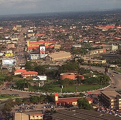
Enugu is the capital city of Enugu State in Nigeria. It is located inland in the Southeastern part of Nigeria. In 2006, the city had a population of 820,000 according to the last Nigerian census.
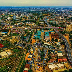
Owerri is the capital city of Imo State in Nigeria, set in the heart of Igboland. It is also the state's largest city, followed by Orlu, Okigwe and Ohaji/Egbema. Owerri consists of three Local Government Areas including Owerri Municipal, Owerri North and Owerri West, it has an estimated population of 1,401,873 as of 2016 and is approximately 100 square kilometres (40 sq mi) in area. Owerri is bordered by the Otamiri River to the east and the Nworie River to the south. The Owerri Slogan is Heartland. It is also called the Las Vegas of Africa, due to the night life of the city and the numerous hotels, casino and leisure parks all over the city.
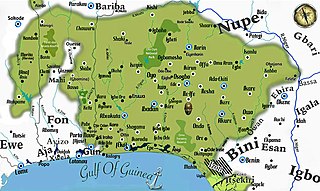
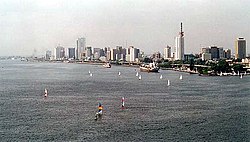
Yorubaland is the homeland and cultural region of the Yoruba people in West Africa. It spans the modern-day countries of Nigeria, Togo and Benin, and covers a total land area of 142,114 km2 (54,871 sq mi). Of this land area, 106,016 km2 (74.6%) lies within Nigeria, 18.9% in Benin, and the remaining 6.5% is in Togo. Prior to European colonization, a portion of this area was known as Yoruba country. The geo-cultural space contains an estimated 55 million people, the majority of this population being ethnic Yoruba.
Enugu State is a state in the South-East geopolitical zone of Nigeria, bordered to the north by the states of Benue and Kogi, Ebonyi State to the east and southeast, Abia State to the south, and Anambra State to the west. The state takes its name from its capital and largest city, Enugu. The city acquired township status in 1917 and was called Enugwu-Ngwo. Due to the rapid expansion towards areas owned by other indigenous communities, it was renamed Enugu in 1928.
The Eastern Region was an administrative region in Nigeria, dating back originally from the division of the colony Southern Nigeria in 1954. Its first capital was Calabar. The capital was later moved to Enugu and the second capital was Umuahia. The region was officially divided in 1967 into three new states, the East-Central State, Rivers State and South-Eastern State. East-Central State had its capital at Enugu, which is now part of Enugu State.
Chimaroke Nnamani is a medical doctor and Nigerian politician from Enugu State. He was elected Governor of Enugu State in the 1999 Enugu State gubernatorial election from 1999 to 2007. He subsequently served as a People's Democratic Party (PDP) Senator for Enugu East Senatorial District from 2007 to 2011 and was re-elected in 2019.
Nigeria has 774 local government areas (LGAs), each administered by a local government council consisting of a chairman, who is the chief executive, and other elected members, who are referred to as councillors. Each LGA is further subdivided into a minimum of ten and a maximum of twenty wards. A ward is administered by a councillor, who reports directly to the LGA chairman. The councillors fall under the legislative arm of the Local Government, the third tier of government in Nigeria, below the state governments and the federal government.
Kafanchan is a town located in the southern part of Kaduna State, Nigeria. The town owes much of its development to the railway development in the area. The railway is situated at a particular junction of the Nigerian Railway Corporation (NRC) station built in 1927. It sits on the railtrack connecting Port Harcourt, Enugu, Kafanchan, Kuru, Bauchi and finally Maiduguri. As of 2007, Kafanchan had an estimated population of 83,092.
The Federal Radio Corporation of Nigeria (FRCN) is Nigeria's state radio broadcasting organization. Its subsidiary is the domestic radio network known as Radio Nigeria, with FM stations across the 36 states and Zonal station in the 6 geopolitical zones that broadcast on the SW. According to FRCN, it is the largest broadcasting organization in Africa.
Railway stations in Nigeria include:
Federalism in Nigeria refers to the devolution of self-governance by the West African nation of Nigeria to its federated states, who share sovereignty with the Federal Government.
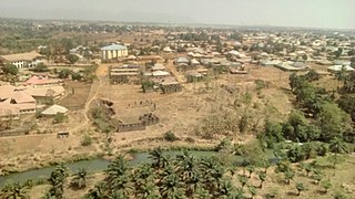
Jaba is a Local Government Area in southern Kaduna State, Nigeria. It covers an area of 531 km2. It is located close to the Jos Plateau region and Abuja in the central part of Nigeria in West Africa. The local government capital is in the town of Kwoi. The postal code of the area is 801. The Chairman of the local government oversee both economic and developmental activities in the area.
Kaduna Museum is a museum in Kaduna, Nigeria. The museum was opened in 1975 following the donation of the old Northern People's Congress (NPC) building by the North Central State Government. The Museum is located along Ali Akilu Road in Ugawana Sarki,Kanduna. The Kaduna Museum contains a substantial collection of archaeological, ethnographic and crafts exhibits and has a live crafts center in which traditional craftsmen and women can be observed making crafts.
The National Commission for Museums and Monuments (NCMM), also referred to as National Museum of Nigeria was Founded in 1979 by the Federal Government of Nigeria with decree 77 of 1979 to be in charge of the collection, documentation, conservation and presentation of the National Cultural properties to the public for the purposes of Education, Enlightenment and Entertainment. This decree recognized the National Commission for Museums and Monuments as a replacement for both the Federal Department of Antiquities of Nigeria and the Antiquities Commission. The decree has since been substituted in 1990 for the NCMM ACT, CAP 242 of the law of Federal Republic of Nigeria 1990.