Imperial, Pennsylvania

Last updated

Imperial, Pennsylvania
US 30 eb in Imperial, PA, May 2024.jpg
US 30 eastbound in Imperial
Allegheny County Pennsylvania incorporated and unincorporated areas Imperial highlighted.svg
Location in Allegheny County and state of Pennsylvania
Coordinates: 40°27′13″N80°14′59″W / 40.45361°N 80.24972°W / 40.45361; -80.24972
Country United States
State Pennsylvania
County Allegheny
Townships Findlay, North Fayette
Area
[1]
  Total3.17 sq mi (8.22 km2)
  Land3.17 sq mi (8.22 km2)
  Water0.00 sq mi (0.00 km2)
Population
 (2020) [2]
  Total2,722
  Density857.86/sq mi (331.27/km2)
Time zone UTC-5 (Eastern (EST))
  Summer (DST) UTC-4 (EDT)
ZIP code
15126 [3]
Area code 724
FIPS code 42-36768

Imperial is a census-designated place (CDP) in Allegheny County, Pennsylvania, United States and part of the Pittsburgh metropolitan area. The population was 2,722 at the 2020 census. [2] The CDP is located in North Fayette and Findlay Townships, and geographically close to Pittsburgh International Airport.

Contents

History

Imperial was established as a mining town circa 1879 by the Imperial Coal Company. [4] It sits along Montour Run on land that had been the farm of Robert Wilson. Known at first as Montour City, the town soon took the name of the coal company, with a post office under the name Imperial opening in 1880. The town and nearby mines were served by the Montour Railroad. [5] The community was formerly part of the Imperial-Enlow CDP before splitting into two separate CDPs. In 2020, Amazon opened a large fulfillment center complex in Imperial off of Pennsylvania Route 576. [6]

Geography

Imperial is located at 40°27′13″N80°14′59″W / 40.45361°N 80.24972°W / 40.45361; -80.24972 (40.4536 N, 80.2498 W). [7] According to the U.S. Census Bureau, the CDP has a total area of 3.1 square miles (8.0 km2), all land.

In terms of road access to Imperial, U.S. Route 30 passes through the middle of the township, with U.S. Route 22 and Interstate 376 providing expressway access to roads in Imperial. Additionally, the partially completed Pennsylvania Route 576 has an exit serving Imperial.

Demographics

Historical population
CensusPop.Note
2010 2,541
2020 2,7227.1%
U.S. Decennial Census [8] [9]

As of the 2010 U.S. census, the population was 2,541, of whom 94 had been born outside of the United States, and 173 were veterans. a total of 85.9% of the population had a high school education or higher. The median age was 40.9 years. The median household income was $56,439. 6.3% of the population were below the poverty level.

Education

Children in Imperial are served by the West Allegheny School District. The current schools serving the community are:

Related Research Articles

<span class="mw-page-title-main">Bethel Park, Pennsylvania</span> Borough in Pennsylvania, United States

Bethel Park is a borough with home rule status in Allegheny County, Pennsylvania, United States. It is a suburb within the Pittsburgh metropolitan area, located approximately 7 miles (11 km) south of Pittsburgh. The population was 33,577 as of the 2020 census.

<span class="mw-page-title-main">Elizabeth, Pennsylvania</span> Borough in Pennsylvania, United States

Elizabeth is a borough in Allegheny County, Pennsylvania, United States, on the east bank of the Monongahela River, where Pennsylvania Route 51 crosses, 15 miles (24 km) upstream (south) of Pittsburgh and close to the county line. The population was 1,398 at the 2020 census. The borough of Elizabeth is entirely contained within the 15037 USPS ZIP code. The local school district is the Elizabeth Forward School District. The borough is home to neighborhoods Walker Heights and Town Hill. Elizabeth Borough is the birthplace of Town Hill Hockey established in 1978.

<span class="mw-page-title-main">Ingram, Pennsylvania</span> Borough in Pennsylvania, United States

Ingram is a borough in Allegheny County, Pennsylvania, United States. The population was 3,391 at the 2020 census.

<span class="mw-page-title-main">Jefferson Hills, Pennsylvania</span> Borough in Pennsylvania, United States

Jefferson Hills is a borough in Allegheny County, Pennsylvania, United States. In the 2020 census, the population was 12,424. It is part of the Pittsburgh metropolitan area.

<span class="mw-page-title-main">Penn Hills, Pennsylvania</span> Home rule township in Pennsylvania, United States

Penn Hills is a township with home rule status in Allegheny County, Pennsylvania, United States. The population was 41,059 as of the 2020 census. A suburb of Pittsburgh, Penn Hills is the second-largest municipality in Allegheny County.

<span class="mw-page-title-main">Pennsbury Village, Pennsylvania</span> Borough in Pennsylvania, United States

Pennsbury Village is a borough in Allegheny County, Pennsylvania, United States. The population was 677 at the 2020 census.

<span class="mw-page-title-main">South Fayette Township, Pennsylvania</span> Township in Pennsylvania, United States

South Fayette Township is a township in Allegheny County, Pennsylvania, United States. The population was 14,416 at the 2010 census.

<span class="mw-page-title-main">Thornburg, Pennsylvania</span> Borough in Pennsylvania, United States

Thornburg is a borough in Allegheny County in the U.S. state of Pennsylvania. The population was 466 at the 2020 census.

<span class="mw-page-title-main">Georgetown, Beaver County, Pennsylvania</span> Borough in Pennsylvania, United States

Georgetown is a borough in western Beaver County, Pennsylvania, United States, along the Ohio River. The population was 208 at the 2020 census. It is part of the Pittsburgh metropolitan area. Little Blue Run Lake, the U.S.'s largest coal slurry waste impound, is located next to the town.

<span class="mw-page-title-main">Iola, Pennsylvania</span> Census-designated place in Pennsylvania, United States

Iola is a census-designated place in Columbia County, Pennsylvania, United States. It is part of Northeastern Pennsylvania. The population was 154 at the 2020 census. It is part of the Bloomsburg-Berwick micropolitan area.

<span class="mw-page-title-main">Chartiers Township, Pennsylvania</span> Township in Pennsylvania, United States

Chartiers Township is a township in Washington County, Pennsylvania, United States. The population was 8,632 at the 2020 census. Along with the borough of Houston, the township makes up the Chartiers-Houston School District. It is part of the Pittsburgh metropolitan area.

<span class="mw-page-title-main">McDonald, Pennsylvania</span> Borough in Pennsylvania, United States

McDonald is a borough in Allegheny and Washington counties in the U.S. state of Pennsylvania, 18 miles (29 km) southwest of Pittsburgh. The population was 2,056 at the 2020 census. Of this, 1,661 were in Washington County, and 395 were in Allegheny County.

<span class="mw-page-title-main">Hampton Township, Allegheny County, Pennsylvania</span> Township in Pennsylvania, United States

Hampton Township is a township in Allegheny County, Pennsylvania, United States. The population was 18,470 at the 2020 census. It is a suburb of the Pittsburgh metropolitan area.

<span class="mw-page-title-main">Kennedy Township, Allegheny County, Pennsylvania</span> Township in Pennsylvania, United States

Kennedy Township is a township in Allegheny County, Pennsylvania, United States, located 10 miles west of Pittsburgh and 12 miles east of Pittsburgh International Airport. The population was 8,701 at the 2020 United States Census.

<span class="mw-page-title-main">Robinson Township, Allegheny County, Pennsylvania</span> Township in Pennsylvania, United States

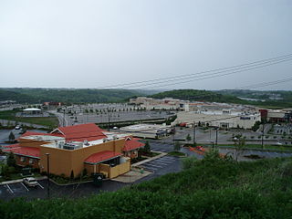
Robinson Township is a township in Allegheny County, Pennsylvania, United States, approximately 12 miles (19 km) west of Pittsburgh. The population was 15,503 at the 2020 census. Home to Robinson Town Centre, Settlers Ridge and The Mall at Robinson, the township serves as a retail hub for the Pittsburgh metropolitan area.

<span class="mw-page-title-main">Scott Township, Allegheny County, Pennsylvania</span> CDP and Township in Pennsylvania, United States

Scott Township is a township in Allegheny County, Pennsylvania, United States. The population was 17,024 at the 2010 census.

<span class="mw-page-title-main">South Park Township, Pennsylvania</span> Township in Pennsylvania, United States

South Park Township is a township in the southern part of Allegheny County, Pennsylvania, United States, near Pittsburgh. The population was 13,416 at the 2010 census.

<span class="mw-page-title-main">Stowe Township, Pennsylvania</span> Township in Pennsylvania, United States

Stowe Township is a township in Allegheny County, Pennsylvania, United States. The population was 6,362 at the 2010 census.

<span class="mw-page-title-main">Clinton, Pennsylvania</span> Census-designated place in Pennsylvania, United States

Clinton is a census-designated place in Findlay Township, Allegheny County, Pennsylvania, United States. It had a population of 905 at the 2020 census. The community is located adjacent to the Pittsburgh International Airport within the Pittsburgh metropolitan area.

<span class="mw-page-title-main">Enlow, Pennsylvania</span> Census-designated place in Pennsylvania, United States

Enlow is a census-designated place (CDP) in Allegheny County, Pennsylvania, United States. The community was formerly part of the Imperial-Enlow CDP, which was split into two separate CDPs as of the 2010 census. The population was 1,138 at the 2020 census.

References

  1. "ArcGIS REST Services Directory". United States Census Bureau. Retrieved October 12, 2022.
  2. 1 2 "Census Population API". United States Census Bureau. Retrieved October 12, 2022.
  3. "Imperial PA ZIP Code". zipdatamaps.com. 2023. Retrieved May 13, 2023.
  4. Espenshade, Abraham Howry (1925). Pennsylvania Place Names. Evangelical Press. p. 296. ISBN   978-0-8063-0416-8.
  5. History of Allegheny County, Pennsylvania. Vol. 2. Chicago: A. Warner & Co. 1889. pp. 11, 19.
  6. Dalton, Deron (September 29, 2020). "Amazon opens fulfillment center in the Pittsburgh area. Here's where else the company is hiring in Pa". The Patriot-News . Retrieved January 11, 2023.
  7. "US Gazetteer files: 2010, 2000, and 1990". United States Census Bureau. February 12, 2011. Retrieved April 23, 2011.
  8. "Census of Population and Housing". Census.gov. Retrieved June 4, 2016.
  9. "Race, Hispanic or Latino, Age, and Housing Occupancy: 2010 Census Redistricting Data (Public Law 94-171) Summary File (QT-PL), Imperial CDP, Pennsylvania". United States Census Bureau . Retrieved September 30, 2011.