
Etawah, also known as Ishtikapuri, is a city on the banks of Yamuna River in the state of Western Uttar Pradesh in India. It is the administrative headquarters of Etawah District. Etawah's population of 256,838 makes it the 180th most populous city in India. The city lies 300 km (190 mi) southeast of the national capital New Delhi, 230 km (140 mi) northwest of the state capital Lucknow, 120 km east of Agra and 140 km west of Kanpur. The city was an important centre for the Indian Rebellion of 1857. It is also the sangam or confluence of the Yamuna and Chambal rivers. It is the 26th most populous city in Uttar Pradesh. There are six revenue divisions in Etawah district-Etawah,Bharthana,Jaswantnagar,Saifai,Chakarnagar, Takha

Kannauj is an ancient city, administrative headquarters and a municipal board or Nagar Palika Parishad in Kannauj district in the Indian state of Uttar Pradesh. The city's name is an evolved form of the classical name Kanyakubja. During the ancient Vedic period, it was the capital city of the Panchala Kingdom during the reign of king Vajrayudha. In the medieval era, it formed the core of the Kingdom of Kannauj and was ruled by multiple successive royal families.

Etah district is one of the districts of Uttar Pradesh, India, since 1854. Etah City is the district headquarters. Etah district is a part of Aligarh Division.

Kanpur division is one of the 18 administrative geographical units of the northern Indian state of Uttar Pradesh. Kanpur city is the administrative headquarters of the division. Kanpur was formerly spelled Cawnpore. The division consists of 6 districts:-
Kannauj district is an administrative district of Uttar Pradesh state in northern India, along the river Ganges. The historic town of Kannauj, northwest of Kanpur, is the administrative center. The district was carved out of Farrukhabad district on 18 September 1997. The native dialect of this district is Kannauji.

Farrukhabad district is a district of Uttar Pradesh state of India. The town of Fatehgarh is the district headquarters. The district is part of Kanpur division.
Farrukhabad is a city in the Indian state of Uttar Pradesh. It is the administrative headquarters of the Farrukhabad tehsil. This city is on the banks of river Ganges is 295 kilometres (183 mi) from the national capital Delhi and 210 kilometres (130 mi) from the state capital Lucknow.

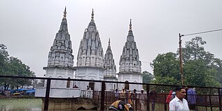
Chitrakoot Dham is a city in the Chitrakoot district, in the Indian state of Uttar Pradesh. It is the headquarters of the Chitrakoot district. Situated in the Bundelkhand region, it holds great cultural, historical, religious and archaeological importance and it is said that Rama, a major deity in Hinduism, spent 11 years of exile in Chitrakoot. It is connected to the town of Chitrakoot, situated in the Satna district of Madhya Pradesh.
Dibiyapur is a municipality-based city in Auraiya district in the most populous state of Uttar Pradesh in India. It is situated on State Highway 21. It is linked to Phaphund railway station on Kanpur–Delhi section of Howrah–Delhi main line and Howrah–Gaya–Delhi line which is operated by North Central Railway. The district administrative headquarter of the city is Auraiya. The city is situated between Agra and Kanpur. Lower Ganga Canal passes through mid of the city.
Jewar is a town and a nagar panchayat in Gautam Buddha Nagar district in the Indian state of Uttar Pradesh. Noida, Dadri and Jewar are the 3 sub-divisions of GB Nagar district, each headed by a SDM.
Raja Ka Rampur is a town, and one of oldest nagar panchayat in Etah district in the Indian state of Uttar Pradesh.

Rasulabad is a town and a nagar panchayat in Kanpur Dehat district in the Indian state of Uttar Pradesh.
Saurikh is a nagar panchayat in Kannauj district in the Indian state of Uttar Pradesh. Its old name was Sau-Rishi.It is located near main industrial and educational hub of Dibiyapur which is around at a distance of 55 km from the town.
Shikohabad is a city and a municipal board in the Firozabad district of the Indian state of Uttar Pradesh.

Shivrajpur is a town and "nagar panchayat" in Kanpur Nagar district in the Indian state of Uttar Pradesh. It comes under Kanpur Metropolitan Area. Tecson India Solution
Uttar Pradesh is the most populous state in India with a population of nearly 240 million people. The economy of Uttar Pradesh is the fourth largest among states in India. The gross state domestic product (GSDP) of Uttar Pradesh increased from Rs 22.58 lakh crore in 2022–2023 to Rs 25.48 lakh crore in 2023–2024. According to chief minister Yogi Adityanath Uttar Pradesh, GSDP might hit 32 lakh crore by March 2025. Merchandise exports from Uttar Pradesh reached US$21.03 billion in FY22.

Auraiya district is one of the districts of Uttar Pradesh state of India, and Auraiya town is the district headquarters. It lies on the south-western portion of Uttar Pradesh and also forms a part of the Kanpur Division.
Mandhana is a town in the Kanpur district of the Indian state of Uttar Pradesh, situated about 20 kilometres (12 mi) from Kanpur on the Grand Trunk Road to Delhi. As of the 2011 Census of India, the town had 213 households with a population of 993 of which 504 were male and 489 female. It has a 60% literacy rate and is 5 kilometres (3.1 mi) from Chobepur, its sister town. It also falls within the Kanpur metropolitan area. The language commonly spoken is Hindi with accent and tone of Kannauji. The IIT Kanpur is just 7 kilometres from Mandhana and also houses some of the successful alumnus of the institute. Mandhana is also known for private institutes like Maharana Pratap Engineering College and Rama University.
Kannauj railway station is a railway station in Kannauj district, Uttar Pradesh. Its code is KJN. It will serve Kannauj city. The station has two platforms. Recently Vivek Gupta, ADRM of izzatnagar railway zone announced to update the entire Kannauj railway station by improving food quality, railway road broadening, and other facilities available at the station.

Kamalganj railway station is located in Farukhabad district, Uttar Pradesh state, India. It serves Kamalganj town. Its code is KLJ. It has two platforms. The station is located between Yaqutganj and Singhirampur railway stations, with them being 4 km away from both sides.


