| Kangra Valley | |
|---|---|
 An aerial view of Bir in Kangra valley | |
| Floor elevation | 2,000 ft (610 m) |
| Geology | |
| Type | River Valley |
| Geography | |
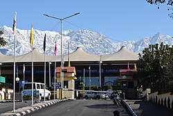
| Location | Himachal Pradesh, India |
| Population centers | Baijnath, Dharamshala, Kangra, McLeodGanj, Palampur, Bhawarna, Sidhbari |
| Coordinates | 32°05′11″N76°15′12″E / 32.08639°N 76.25333°E |
| Rivers | Beas River |
 | |
Kangra Valley is a river valley situated in the Western Himalayas. [1] It lies in the state of Himachal Pradesh in India, and is a popular tourist destination. The Kangri language is spoken there. Dharamshala, the headquarters of Kangra district and the main city of the valley, lies on the southern spur (lateral ridge) of Dhauladhar. [2]
Contents
- History
- Geography
- Climate
- Language
- Important towns
- Transport
- Road
- Railway
- Airport
- Tourism
- References
- Further reading
- External links


