Kesare | |
|---|---|
village | |
| Country | |
| State | Karnataka |
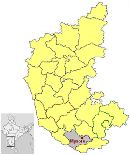
| District | Mysore |
| Talukas | Mysore |
| Government | |
| • Type | Panchayat raj |
| • Body | Gram panchayat |
| Population (2001) | |
| • Total | 5,289 |
| Languages | |
| • Official | Kannada |
| Time zone | UTC+5:30 (IST) |
| ISO 3166 code | IN-KA |
| Vehicle registration | KA |
| Website | karnataka |
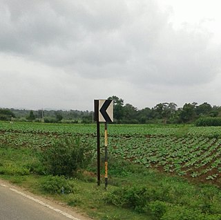
Kesare is a village in the southern state of Karnataka, India. [1] [2] It is located in the Mysore taluk of Mysore district.

Karnataka is a state in the south western region of India. It was formed on 1 November 1956, with the passage of the States Reorganisation Act. Originally known as the State of Mysore, it was renamed Karnataka in 1973. The state corresponds to the Carnatic region. The capital and largest city is Bangalore.

Mysore, officially Mysuru, is a city in the southern part of the state of Karnataka, India. Mysore city is geographically located between 12° 18′ 26″ north latitude and 76° 38′ 59″ east longitude. It is located at an altitude of 2,427 ft (739.75 m).
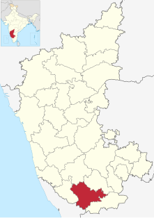
Mysore officially known as Mysuru District is an administrative district located in the southern part of the state of Karnataka, India. The district is bounded by Mandya district to the east and northeast, Chamrajanagar district to the southeast, Kerala state to the south, Kodagu district to the west, and Hassan district to the north. It features many tourist destinations, from Mysore Palace to Nagarhole National Park. This district has a prominent place in the history of Karnataka; Mysore was ruled by the Wodeyars from the year 1399 till the independence of India in the year 1947. Mysore's prominence can be gauged from the fact that the Karnataka state was known previously as Mysore state.