Kinuachdrachd

Last updated

Kinuachdrachd
Kinuachdrachd cottage - geograph.org.uk - 964844.jpg
Argyll and Bute UK location map.svg
Red pog.svg
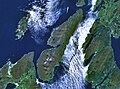
Kinuachdrachd
Location within Argyll and Bute
Council area
Country Scotland
Sovereign state United Kingdom
Police Scotland
Fire Scottish
Ambulance Scottish
List of places
UK
Scotland
56°07′33″N5°41′42″W / 56.125918°N 5.6949254°W / 56.125918; -5.6949254 Coordinates: 56°07′33″N5°41′42″W / 56.125918°N 5.6949254°W / 56.125918; -5.6949254

Kinuachdrachd or Kinuachdrach is a place about 22 miles from Craighouse on the island of Jura, in the council area of Argyll and Bute, Scotland. It comprises a house west of the Aird of Kinuachdrachd. [1] On the 1982 OS 1:10000 map there were 4 buildings. [2]

History

The name "Kinuachdrach" means "Upper end". [3] It once served as a crossing point to Scarba and the mainland. [4] For most of the 19th century Kinuachdrach had a relatively sizable population. [5]

Related Research Articles

Argyll and Bute Council area of Scotland

Argyll and Bute is one of 32 unitary authority council areas in Scotland and a lieutenancy area. The current Lord-Lieutenant for Argyll and Bute is Jane Margaret MacLeod. The administrative centre for the council area is in Lochgilphead at Kilmory Castle, a 19th-century Gothic Revival building and estate. The current Council leader is Councillor Robin Currie, a councillor for Kintyre and the Islands.

Inner Hebrides Archipelago off the west coast of mainland Scotland

The Inner Hebrides is an archipelago off the west coast of mainland Scotland, to the south east of the Outer Hebrides. Together these two island chains form the Hebrides, which experience a mild oceanic climate. The Inner Hebrides comprise 35 inhabited islands as well as 44 uninhabited islands with an area greater than 30 hectares. Skye, Mull, and Islay are the three largest, and also have the highest populations. The main commercial activities are tourism, crofting, fishing and whisky distilling. In modern times the Inner Hebrides have formed part of two separate local government jurisdictions, one to the north and the other to the south. Together, the islands have an area of about 4,130 km2 (1,594 sq mi), and had a population of 18,948 in 2011. The population density is therefore about 4.6 inhabitants per square kilometre.

Crinan Canal

The Crinan Canal between Crinan and Ardrishaig in Argyll and Bute in the west of Scotland is operated by Scottish Canals. The canal, which opened in 1801, takes its name from the village of Crinan at its western end. Approximately nine miles (14 km) long, the canal connects the village of Ardrishaig on Loch Gilp with the Sound of Jura, providing a navigable route between the Clyde and the Inner Hebrides, without the need for a long diversion around the Kintyre peninsula, and in particular the exposed Mull of Kintyre.

Caledonian MacBrayne Ferry operator in Scotland

Caledonian MacBrayne, usually shortened to CalMac, is the major operator of passenger and vehicle ferries, and ferry services, between the mainland of Scotland and 22 of the major islands on Scotland's west coast. Since 2006 the company's official name has been CalMac Ferries Ltd although it still operates as Caledonian MacBrayne. In 2006 it also became a subsidiary of holding company David MacBrayne, which is owned by the Scottish Government.

Argyll Historic county in Scotland

Argyll, sometimes called Argyllshire, is a historic county and registration county of western Scotland.

Seil

Seil is one of the Slate Islands, located on the east side of the Firth of Lorn, 7 miles southwest of Oban, in Scotland. Seil has been linked to the mainland by bridge since the late 18th century.

Scarba

Scarba is an island, in Argyll and Bute, Scotland, just north of the much larger island of Jura. The island was owned by Richard Hill, 7th Baron Sandys, and has not been permanently inhabited since the 1960s. It is now covered in heather and used for grazing animals. Kilmory Lodge is used seasonally as a shooting lodge, the island having a flourishing herd of red deer.

Ardrishaig Human settlement in Scotland

Ardrishaig is a coastal village on Loch Gilp, at the southern (eastern) entrance to the Crinan Canal in Argyll and Bute in the west of Scotland. It lies immediately to the south of Lochgilphead, with the nearest larger town being Oban.

Torsa is one of the Slate Islands in Argyll and Bute, Scotland. Lying east of Luing and south of Seil, this tidal island was inhabited until the 1960s. There is now only one house there, which is used for holiday lets. The underlying bedrock is slate but unlike Torsa's immediate island neighbours this has never been worked commercially. The island's name is of Norse origin but the most prominent historical structure on the island is the ruined Caisteal nan Con on the northeast shore, once held by Clan Campbell. The abundant sea life in the waters surrounding the island are protected by the Loch Sunart to the Sound of Jura Marine Protected Area.

Craighouse Human settlement in Scotland

Craighouse is the main settlement and capital of the Scottish Inner Hebridean island of Jura, in Argyll and Bute. In 1971 it had a population of 113. The village is situated on the sheltered east coast of the island at the southern end of Small Isles Bay.

Eileach an Naoimh Uninhabited island in Scotland

Eileach an Naoimh, also known as Holy Isle, is an uninhabited island in the Inner Hebrides of the west coast of Scotland. It is the southernmost of the Garvellachs archipelago and lies in the Firth of Lorne between Mull and Argyll. The name is Gaelic for "rocky place of the saint".

Island of Danna Inhabited tidal island in Argyll and Bute

The Island of Danna or Danna, is an inhabited tidal island in Argyll and Bute.

Ardmenish Human settlement in Scotland

Ardmenish is a largely cleared village on the island of Jura, in Argyll and Bute, Scotland. In 2003 the Rozga family were the sole inhabitants of Ardmenish.

Jura, Scotland Island in Scotland

Jura is an island in the Inner Hebrides of Scotland, adjacent to and northeast of Islay. With an area of 36,692 hectares (142 sq mi), and 196 inhabitants recorded in the 2011 census, Jura is more sparsely populated than Islay, and is one of the least densely populated islands of Scotland: in a list of the islands of Scotland ranked by size, Jura comes eighth, whereas by population it comes 31st. The island is mountainous, bare and largely infertile, covered by extensive areas of blanket bog.

Islay is the southernmost island of the Inner Hebrides of Scotland. Known as "The Queen of the Hebrides", it lies in Argyll just south west of Jura and around 40 kilometres (25 mi) north of the Northern Irish coast. The island's capital is Bowmore where the distinctive round Kilarrow Parish Church and a distillery are located. Port Ellen is the main port.

Lagg, Jura Human settlement in Scotland

Lagg is a hamlet on Lagg Bay, on the east coast of the island of Jura, in the council area of Argyll and Bute, Scotland. It is on the A846 8 miles (13 km) from Craighouse. Lagg consists of two main areas, Lagg township, above a steep slope from the bay, away from the coastal edge. The former inn is the other. Dunchraobhan is at a similar elevation to Lagg.

Tarbert, Jura Human settlement in Scotland

Tarbert is a hamlet on Tarbert Bay, on the east coast of the island of Jura, in the council area of Argyll and Bute, Scotland. The Tarbert estate is owned by Ginge Manors Estates Ltd. It is on the A846 about 11 miles (18 km) from Craighouse. There is the remains of a chapel that was dedicated to St Columba. Tarbert consists of 2 main areas, the area associated with Rubha nan Crann and the farm overlooking the bay.

Keils Human settlement in Scotland

Keils formerly Kilearnadill is a hamlet 0.25 miles (0.40 km) from Craighouse on the island of Jura, in the council area of Argyll and Bute, Scotland. Keils is located on a wide elevated but distinct ridge.

Inverlussa Human settlement in Scotland

Inverlussa is a hamlet 1 mile (1.6 km) southwest of Ardlussa and 14 miles from Craighouse at the mouth of Lussa River on the east coast of the island of Jura, in the council area of Argyll and Bute, Scotland. It is largely a linear settlement.

References

  1. "Kinuachdrachd". Gazetteer for Scotland . Retrieved 25 July 2020.
  2. Historic Environment Scotland. "Jura, Kinuachdrachd (154199)". Canmore . Retrieved 25 July 2020.
  3. "Placenames K-O" (PDF). Scottish Parliament. Retrieved 25 July 2020.
  4. Fodor's Travel Guides (2014). Fodor's Scotland. Fodor's Travel, 2014. ISBN   9780804141963 . Retrieved 4 August 2020.
  5. Walter Weyndling (1996). Ferry Tales of Argyll and the Isles. A. Sutton, 1996. ISBN   9780750911856 . Retrieved 4 August 2020.