Lismore is an island of some 2,351 hectares (9.1 sq mi) in the Inner Hebrides of Scotland. The climate is damp and mild, with over 166 centimetres (65 in) of rain recorded annually. This fertile, low-lying island was once a major centre of Celtic Christianity, with a 6th-century monastery associated with Saint Moluag, and later became the seat of the medieval Bishop of Argyll. There are numerous ruined structures including a broch and two 13th-century castles.

Oronsay, also sometimes spelt and pronounced Oransay by the local community, is a small tidal island south of Colonsay in the Scottish Inner Hebrides with an area of 543 hectares.

Rona, sometimes called South Rona to distinguish it from North Rona, is a small inhabited island in the Scottish Inner Hebrides. It lies between the Sound of Raasay and the Inner Sound just north of the neighbouring island of Raasay and east of the Trotternish peninsula of Skye. It has a total area of 930 hectares (3.6 sq mi) and a population of 3.

North Uist and South Uist (Scottish Gaelic: Uibhist[ˈɯ.ɪʃtʲ]) are two islands and part of the Outer Hebrides of Scotland.
Easdale is one of the Slate Islands, in the Firth of Lorn, Scotland. Once the centre of the Scottish slate industry, there has been some recent island regeneration.

Scarba is an island, in Argyll and Bute, Scotland, just north of the much larger island of Jura. The island was owned by Richard Hill, 7th Baron Sandys, and has not been permanently inhabited since the 1960s. It is now covered in heather and used for grazing animals. Kilmory Lodge is used seasonally as a shooting lodge, the island having a flourishing herd of red deer.
The Shiant Islands or Shiant Isles are a privately owned island group in the Minch, east of Harris in the Outer Hebrides of Scotland. They are five miles southeast of the Isle of Lewis.
Gometra is an island in the Inner Hebrides of Scotland, lying west of Mull. It lies immediately west of Ulva, to which it is linked by a bridge, and at low tide also by a beach. It is approximately 425 hectares in size. The name is also applied to the island summit, which is a Marilyn.

The Isle of Ewe is a small Scottish island on the west coast of Ross and Cromarty. The island is inhabited by a single family, the Grants, who have lived at the Main House in the south of the island since the mid-19th century.
Lunga is one of the Slate Islands in the Firth of Lorn in Argyll and Bute, Scotland. The "Grey Dog" tidal race, which runs in the sea channel to the south, reaches 8 knots (15 km/h) in full flood. The name 'Lunga' is derived from the Old Norse for 'isle of the longships', but almost all other place names are Gaelic in origin. The population was never substantial and today the main activity is an adventure centre on the northern headland of Rubha Fiola. The surrounding seas are fished for prawns and scallops and there is a salmon farm off the south eastern shores. The Special Area of Conservation of which the island is part hosts a growing number of outdoor leisure pursuits.
Texa is a small island 700 metres directly south of Islay, in the Inner Hebrides, Scotland. It reaches a height of 48 metres at its highest point, Ceann Garbh. It is part of the parish of Kildalton on Islay. The distilleries of Laphroaig and Lagavulin are nearby on the Islay coast, as well as Port Ellen. It is currently uninhabited, but is home to wild goats, as well as otters.

Eilean Mhuire is the most easterly of the Shiant Islands in the Outer Hebrides.
Hermetray is an uninhabited island off North Uist, in the Outer Hebrides of Scotland.

Nave Island lies to the north of Islay in the Inner Hebrides near the mouth of Loch Gruinart. It is uninhabited.

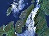
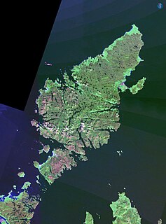
The etymology of Skye attempts to understand the derivation of the name of the Isle of Skye in the Inner Hebrides of Scotland. Skye's history includes the influence of Gaelic, Norse and English speaking peoples, and the relationships between their names for the island are not straightforward.

The Sound of Islay is a narrow strait between the islands of Islay and Jura off the west coast of Scotland. It is about 30 kilometres in extent from north to south and lies between Rubh' a' Mhàil on Islay and Rubh' Aird na Sgitheich on Jura to the north and Macarthur's Head and Rubha na Tràille to the south. The islands in the Sound are Am Fraoch Eilean, Brosdale Island and Glas Eilean, all of which are off the south east coast of Jura. These islands, Jura south of Loch Tarbert and the eastern part of the Sound are one of 40 National Scenic Areas in Scotland.
Eilean-a-beithich or Eilean nam Beitheach was once one of the Slate Islands, located in Easdale Sound between Easdale and Seil, in the Inner Hebrides.

Description of the Western Isles of Scotland is the oldest known account of the Hebrides and the Islands of the Clyde, two chains of islands off the west coast of Scotland. The author was Donald Monro, a clergyman who used the title of "Dean of the Isles" and who lived through the Scottish Reformation. Monro wrote the original manuscript in 1549, although it was not published in any form until 1582 and was not widely available to the public in its original form until 1774. A more complete version, based on a late 17th-century manuscript written by Sir Robert Sibbald, was first published as late as 1961. Monro wrote in Scots and some of the descriptions are difficult for modern readers to render into English. Although Monro was criticised for publishing folklore and for omitting detail about the affairs of the churches in his diocese, Monro's Description is a valuable historical account and has reappeared in part or in whole in numerous publications, remaining one of the most widely quoted publications about the western islands of Scotland.

Am Fraoch Eilean is an uninhabited island in the Sound of Jura, in the council area of Argyll and Bute, Scotland. It is 1 mile from Ardfin on Jura. Brosdale Island is located to the east. The name is Scottish Gaelic and means "the heather isle" and was formerly called "Ellan Charne". The ruins of Claig Castle are on Am Fraoch Eilean.