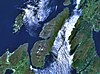
Ben Cruachan is a mountain that rises to 1,126 metres (3,694 ft), the highest in Argyll and Bute, Scotland. It gives its name to the Cruachan Dam, a pumped-storage hydroelectric power station located in a cavern inside the mountain. It is the high point of a ring of mountains, known as the Cruachan Horseshoe, that surrounds the power station reservoir. The horseshoe includes a further Munro, a Corbett, and several subsidiary summits. "Cruachan!" is the battle cry of Highland clans Campbell and MacIntyre.
Loch Eck is a freshwater loch located on the Cowal peninsula, north of Dunoon, Argyll and Bute, Scotland. It is seven miles long. Along with Loch Lomond, it is the only naturally occurring habitat of the Powan (fish). The loch also has salmon, sea trout, brown trout and arctic charr.
Loch an Sgoltaire is an impounding reservoir located on the Inner Hebridean island of Colonsay, Scotland. It is located at grid reference NR386972, northwest of Kiloran and is the main source of fresh water for the island. The concrete dam was constructed in 1982 and is 3.1 metres high.

Allt na Lairige Dam, is a pre-stressed concrete dam in Argyll and Bute, Scotland at grid reference NN25251745. It creates an impounding reservoir which serves the Glen Fyne hydroelectric scheme.
Loch Ascog is a small reservoir on the east coast of the island of Bute, in the council area of Argyll and Bute, Scotland. The loch supplies water to the town of Rothesay and the fishing rights are held by the Isle of Bute Angling Association. Loch Ascog is 44.7 hectares in extent. To the west is the much larger Loch Fad.
Asgog Loch is a natural freshwater loch in Argyll and Bute, Scotland. It is located about 4 kilometres (2.5 mi) southwest of Tighnabruaich, on the Cowal peninsula. The loch was dammed during the 19th century to create an impounding reservoir for the supply of freshwater to the Low Mills of the nearby gunpowder mills at Millhouse.

Blackmill Loch is an impounding reservoir, in Argyll and Bute, Scotland. The loch was constructed in 1964 and is one source of freshwater for the Lochgair Hydroelectric Scheme. The loch feeds the River Add, when not diverted for hydroelectric purposes. It is one of the two significant forest lochs to the north of Loch Glashan, the other being Loch Bealach Ghearran.

The Crarae Reservoir is located 2.5 kilometres north west of the village of Crarae, on the west side of Loch Fyne. The concrete dam is 13.7 metres high.

Crosshill Loch is an impounding reservoir, located 1 kilometre south of the centre of Campbeltown, and is the source of water for the town's Whisky Distilleries: Springbank, Glengyle and Glen Scotia. The earthen dam is 14.3 metres high. Records show the dam was constructed prior to 1868.

Daill Loch is an impounding reservoir located 5 kilometres (3.1 mi) west north west of Lochgilphead and 1.5 kilometres (0.93 mi) south of the Crinan Canal. It is one of a number of lochs supplying water to the canal. The earthen dam is 8.1 metres (27 ft) high and was completed in 1930.

Dhu Loch is an impounding reservoir, located 1 kilometre directly west of the much larger Loch Fad and 5 kilometres south west of Rothesay. The loch is part of the water supply system for the town. The earthen dam is 8.1 metres high and was completed in 1905.
The reservoir is an impounding reservoir located 9 kilometres north east of the Connel Bridge in Barcaldine Forest. The earthen dam is 23.4 metres high and was completed in 1984. The reservoir provides a supply of water for the hydroelectric scheme at the Marine Resource Centre in the village of Barcaldine.
The loch runs south west to north east and is an impounding reservoir located to the west of Lochgilphead, Scotland. It is one of a number of lochs supplying water to the Crinan Canal. The earthen dam is 15 metres high. Records show the dam was constructed before 1860.

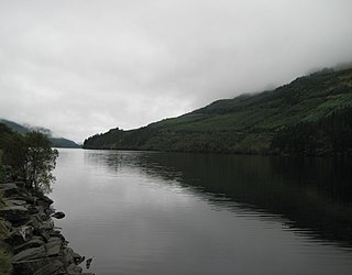
Loch Tarsan; is a freshwater loch and impounding reservoir located 13 kilometres Northwest of Dunoon, on the Cowal peninsula in Argyll and Bute, Scotland. This three-armed Reservoir extends into both Glen Tarsan and Glen Lean. It supplies water to the Striven Hydro-Electric Scheme. The larger of the two dams is 17.6 metres high and was completed in 1953. The water that is collected in the loch, are piped to the hydro-electric generating station, located at Ardtaraig, at the head of Loch Striven.

Kilduskland Reservoir is of the impounding variety and is located 2 kilometres west of Ardrishaig, supplying the village with its water supply. The concrete dam is 9 metres high and it was completed in 1906.

Kirk Dam is an impounding dam, located 1.5 kilometres south of Rothesay, and is separated by a causeway from the much larger Loch Fad to the south-west. It was built to provide water to the cotton mills of the town, and is now the habitat for a variety of marshland birds. The earthfill dam is 6 metres high and records show it was constructed in the late 18th century.
Knockruan Loch is a reservoir of the impounding variety, located 2.5 kilometres north of Campbeltown, Scotland, and is one of three lochs supplying water to the town. The earthfill dam is 1.82 metres high and was completed in 1931.
Leorin Loch is of the impounding variety, located 2.5 kilometres north of Port Ellen, and is one of a group of three lochs supplying water to the island. The earthfill dam is 1.5 metres high.

Ardlussa is a hamlet and estate on The Long Road, just north of the Lussa River, overlooking Ardlussa Bay on the east coast of the island of Jura, in the council area of Argyll and Bute, Scotland. Estate buildings line the road, and the area features semi-natural woodland. It lies 1.2 kilometres (0.75 mi) northeast of Inverlussa and 24 kilometres (15 mi) from Craighouse. Ardlussa is the home of Lussa Gin.