Knockrome

Last updated
Knockrome
Knockrome telephone box - geograph.org.uk - 977592.jpg
Argyll and Bute UK location map.svg
Red pog.svg
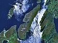
Knockrome
Location within Argyll and Bute
OS grid reference NR5671
Civil parish
Council area
Country Scotland
Sovereign state United Kingdom
Police Scotland
Fire Scottish
Ambulance Scottish
List of places
UK
Scotland
55°52′38″N5°54′40″W / 55.877261°N 5.9110335°W / 55.877261; -5.9110335

Knockrome is a hamlet on the island of Jura, in the civil parish of Jura, in the council area of Argyll and Bute, Scotland. On the 1982 OS 1:10000 map, there were 20 buildings. [1] Knockrome is located about 3.5 miles from Craighouse, on lower lying ground between Knockrome Hill and Cnocan Soilleir. [2] Knockrome is located on the southeast coast of Jura. [3] It is north of Jura Airfield and a prehistoric standing stone. [4] [5]

History

The name "Knockrome" means "The crooked hill". [6]

Related Research Articles

<span class="mw-page-title-main">Argyll and Bute</span> Council area of Scotland

Argyll and Bute is one of 32 unitary council areas in Scotland and a lieutenancy area. The current lord-lieutenant for Argyll and Bute is Jane Margaret MacLeod. The administrative centre for the council area is in Lochgilphead at Kilmory Castle, a 19th-century Gothic Revival building and estate. The current council leader is Robin Currie, a councillor for Kintyre and the Islands.

<span class="mw-page-title-main">Dunoon</span> Town in Scotland

Dunoon is the main town on the Cowal peninsula in the south of Argyll and Bute, Scotland. It is located on the western shore of the upper Firth of Clyde, to the south of the Holy Loch and to the north of Innellan. As well as forming part of the council area of Argyll and Bute, Dunoon also has its own community council. Dunoon was a burgh until 1976.

<span class="mw-page-title-main">County of Bute</span> Historic county in Scotland

The County of Bute, also known as Buteshire, is a historic county and registration county of Scotland.

<span class="mw-page-title-main">Argyll</span> Historic county in Scotland

Argyll, sometimes called Argyllshire, is a historic county and registration county of western Scotland.

<span class="mw-page-title-main">Cowal</span> Human settlement in Scotland

Cowal is a rugged peninsula in Argyll and Bute, on the west coast of Scotland. It is bounded on the west by Loch Fyne and on the east by Loch Long and the Firth of Clyde. The Kyles of Bute separate it from Bute to the south.

<span class="mw-page-title-main">Kilmartin</span> Village in Argyll and Bute, Scotland

Kilmartin is a small village in Argyll and Bute, western Scotland. It is best known as the centre of Kilmartin Glen, an area with one of the richest concentrations of prehistoric monuments and historical sites in Scotland. It contains over 800 monuments within a six-mile (ten-kilometre) radius. It is home to Kilmartin Museum and the Kilmartin Hotel.

<span class="mw-page-title-main">Ford, Argyll</span> Human settlement in Scotland

Ford is a small village at the southern end of Loch Awe in Argyll, Scotland. The village originated as a stopping point on the drove route to Inveraray. The Ford Hotel dates back to 1864, and was probably erected on the site of the old change house. Today it is a guest house and is a listed building.

<span class="mw-page-title-main">Ardfernal</span> Human settlement in Scotland

Ardfernal is a hamlet on the island of Jura in Argyll and Bute, Scotland. The township had 16 buildings in 1882 and 9 buildings in 1982. In 1841 it had a population of 128. There remain 8 occupied buildings.

<span class="mw-page-title-main">Jura, Scotland</span> Island of the Inner Hebrides off Great Britain

Jura is an island in the Inner Hebrides of Scotland, adjacent to and northeast of Islay. With an area of 36,692 hectares (142 sq mi), and 196 inhabitants recorded in the 2011 census, Jura is more sparsely populated than Islay, and is one of the least densely populated islands of Scotland: in a list of the islands of Scotland ranked by size, Jura comes eighth, whereas by population it comes 31st. The island is mountainous, bare and largely infertile, covered by extensive areas of blanket bog.

<span class="mw-page-title-main">Sound of Mull</span> Sound between the Inner Hebridean island of Mull and mainland Scotland

The Sound of Mull is a sound between the Inner Hebridean island of Mull and mainland Scotland. It forms part of the Atlantic Ocean.

Suidhe is a ruined township located on the southwestern peninsula of the Isle of Mull, Scotland. It lies just over 1 km to the west of the village of Bunessan. It was awarded the status of Scheduled monument in 2004 on the basis of its potential value as a source of information about post-medieval, and possibly medieval, settlement and economy in the Western Isles of Scotland.

<span class="mw-page-title-main">Am Fraoch Eilean</span> Island in Scotland

Am Fraoch Eilean is an uninhabited island in the Sound of Jura, in the council area of Argyll and Bute, Scotland. It is 1 mile from Ardfin on Jura. Brosdale Island is located to the east. The name is Scottish Gaelic and means "the heather isle" and was formerly called "Ellan Charne". The ruins of Claig Castle are on Am Fraoch Eilean.

<span class="mw-page-title-main">Lagg, Jura</span> Human settlement in Scotland

Lagg is a hamlet on Lagg Bay, on the east coast of the island of Jura, in the council area of Argyll and Bute, Scotland. It is on the A846 8 miles (13 km) from Craighouse. Lagg consists of two main areas, Lagg township, above a steep slope from the bay, away from the coastal edge. The former inn is the other. Dunchraobhan is at a similar elevation to Lagg.

<span class="mw-page-title-main">Tarbert, Jura</span> Human settlement in Scotland

Tarbert is a hamlet on Tarbert Bay, on the east coast of the island of Jura, in the council area of Argyll and Bute, Scotland. The Tarbert estate is owned by Ginge Manors Estates Ltd. It is on the A846 about 11 miles (18 km) from Craighouse. There is the remains of a chapel that was dedicated to St Columba. Tarbert consists of 2 main areas, the area associated with Rubha nan Crann and the farm overlooking the bay.

<span class="mw-page-title-main">Keils</span> Human settlement in Scotland

Keils formerly Kilearnadill is a hamlet 0.25 miles (0.40 km) from Craighouse on the island of Jura, in the council area of Argyll and Bute, Scotland. Keils is located on a wide elevated but distinct ridge.

<span class="mw-page-title-main">Inverlussa</span> Human settlement in Scotland

Inverlussa is a hamlet 1 mile (1.6 km) southwest of Ardlussa and 14 miles from Craighouse at the mouth of Lussa River on the east coast of the island of Jura, in the council area of Argyll and Bute, Scotland. It is largely a linear settlement.

<span class="mw-page-title-main">Kinuachdrachd</span> Human settlement in Scotland

Kinuachdrachd or Kinuachdrach is a place about 22 miles from Craighouse on the island of Jura, in the council area of Argyll and Bute, Scotland. It comprises a house west of the Aird of Kinuachdrachd. On the 1982 OS 1:10000 map there were 4 buildings.

<span class="mw-page-title-main">Rothesay Town Hall and County Buildings</span> Municipal building in Rothesay, Scotland

Rothesay Town Hall and County Buildings is a former municipal building in Castle Street, Rothesay, Scotland. The structure, which was the meeting place of Rothesay Burgh Council and of Bute County Council, is a Category B listed building.

<span class="mw-page-title-main">2022 Argyll and Bute Council election</span> Argyll and Bute Council election

Elections to Argyll and Bute Council took place on 5 May 2022 on the same day as the 31 other Scottish local government elections. As with other Scottish council elections, it was held using single transferable vote (STV) – a form of proportional representation – in which multiple candidates are elected in each ward and voters rank candidates in order of preference.

References

  1. Historic Environment Scotland. "Jura, Knockrome (154108)". Canmore . Retrieved 21 July 2020.
  2. "Island of Jura" (PDF). Argyll and Bute Council . Retrieved 6 August 2020.
  3. Grant, Allison (November 2007). Island of Jura (PDF) (Report). Retrieved 1 March 2023.
  4. Historic Environment Scotland. "Standing Stone (Prehistoric) (38270)". Canmore . Retrieved 1 March 2023.
  5. "Knockrome". Gazetteer for Scotland . Retrieved 1 March 2023.
  6. "Placenames K-O" (PDF). Scottish Parliament. Archived from the original (PDF) on 4 November 2020. Retrieved 21 July 2020.