Terengganu, formerly spelled Trengganu or Tringganu, is a sultanate and federal state of Malaysia. The state is also known by its Arabic honorific, Dāru l-Īmān. The coastal city of Kuala Terengganu, which stands at the mouth of the broad Terengganu River, is both the state and royal capital as well as the most populous city in Terengganu. Other major cities and towns includes Jerteh, Kuala Dungun, Chukai, Kuala Berang, Marang, and Permaisuri. At 13,035 square kilometres in size and a population of over 1.2 million people in 2023, Terengganu is Malaysia's 7th largest state by area and 10th largest in population. Terengganu, along with Kelantan, Perlis, and the Federal Territory of Putrajaya, is one of the most homogeneous states/territories in the country of which 95% of the population are ethnic Malay-Muslims with its own distinct language/dialect, culture, history, and tradition.

The Perhentian Islands are islands in Besut District, Terengganu, Malaysia.

Redang Island is an island in Kuala Nerus District, Terengganu, Malaysia. It is one of the largest islands off the east coast of Peninsular Malaysia and one of the most beautiful islands in the world. It is famous for its crystal clear waters and white sandy beaches. It is one of nine islands, which form a marine sanctuary park offering snorkeling and diving opportunities for tourists.

Lang Tengah Island is an island in Kuala Nerus District, Terengganu, Malaysia. It is connected to the mainland by ferries to Merang.
Kuala Berang is the seat and largest town of Hulu Terengganu District, Terengganu, Malaysia. The town serves as a gateway to Lake Kenyir. The historical Terengganu Inscription Stone was found near Kuala Berang in 1899. The town of Kuala Berang was the first capital of the modern Sultanate of Terengganu before moving to Kuala Terengganu.

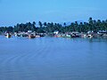
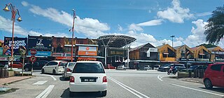
Besut is a district in the Terengganu federal state of Malaysia. It is bordered by the state of Kelantan to the north and west and the South China Sea to the east. It is the northern gateway to Terengganu. Kampung Raja is the district capital, though Jerteh is more developed. Another major town is the fishing port of Kuala Besut. There are other small towns and villages such as Jabi, Apal, Pasir Akar and Tembila.

Setiu is one of the districts in Terengganu, Malaysia. This district is bordered by Besut to the north, Hulu Terengganu to the south, and on the east, Kuala Nerus District.
Marang is a town and the seat of Marang District, in the state of Terengganu, Malaysia. The town is located on the South China Sea coast on the main highway between Kuala Terengganu and Kuantan. The main economic activity in Marang is fishery and tourism.
Bandar Permaisuri is a small town and the capital of Setiu District, Terengganu, Malaysia.
Pasir Puteh District is a district (jajahan) in Kelantan, Malaysia. The town of Pasir Putih is situated on the bank of Semerak River, about 30 kilometers to the south of Kota Bharu. Pasir Puteh district borders Besut District, Terengganu to its south-east.

Floods in Malaysia are one of the most regular natural disasters affecting the country, which occurs nearly every year especially during the monsoon season. The coasts of peninsular Malaysia are the most prone to flooding especially during the northeast monsoon season from October to March.

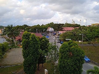
Kampung Raja, also known as Kota Putera is a mukim and capital of Besut District, Terengganu, Malaysia. It is one of the mukim in Besut and also the central administration here. A long time ago, a king lived here and his castle was built here, but now the castle has been moved to Muzium Kuala Terengganu and only an old castle that remained here called Istana Tengku Long. Although located in Terengganu, the people there speak Kelantanese Malay and are culturally Kelantanese, owing to its close proximity to Kelantan.

Universiti Sultan Zainal Abidin is the 18th public institution of higher learning, located in the state of Terengganu, Malaysia. The university is a creature of the Act of Parliament known as the Universities and University Colleges Act 1971, with its constitution laid down under the Universities and University Colleges (Universiti Sultan Zainal Abidin) Order 2010. It is the first full-fledged university in the east coast of Peninsular Malaysia and the first university to be based on the “cluster” concept. It is also the first university in Malaysia to be modelled after University of London, United Kingdom.
Manis FM is a Malay language-radio station operated by Husa Network Sdn Bhd. Its headquarters are located in Kuala Terengganu, Terengganu.

Terengganu Malay is a Malayic language spoken in the Malaysian state of Terengganu all the way southward to coastal Pahang and northeast Johor. It is the native language of Terengganu Malays and highly localised Chinese Peranakan community as well as a second language among the smaller Indian minority. The language has developed distinct phonetic, syntactic and lexical distinctions which makes it mutually unintelligible for speakers from outside the east coast of Peninsular Malaysia, especially those who speak Standard Malay/Malaysian. Terengganu Malay still shares close linguistic ties with neighbouring Kelantan-Pattani and Pahang of which it forms under the umbrella term of "East Coast Peninsular Malayic languages". These similarities have often confused many people outside the region, who usually interchange Terengganu Malay with Kelantan Malay, even though there are major phonological and vocabulary differences between the two.
Tok Bali is a small fishing port and also oil and gas supply base in Kelantan, Malaysia, located about 48 kilometres from Kota Bharu. In recent years, it has served as an alternative departure point for tourists to the Perhentian Islands. Taxi drivers are reportedly given a hefty commission for delivering passengers here rather than the main departure point at Kuala Besut, further south. The village's main sources of income are fishing and farming.
Tourism in Terengganu deals with attractions, events and facilities in Terengganu, Malaysia of special interest to tourists.

The Kingdom of Besut Darul Iman was a historical Malay Kingdom located in the northeastern coast of the Malay Peninsula, precursor of the present-day Besut District and most of Setiu, Terengganu. A principality of Terengganu, the state was established in 1780 following the crowning of a Terengganuan prince, Tengku Kadir as the Raja Palembang Besut. The House of Palembang, a cadet branch of Terengganu nobility continued to rule the territory before it was unified with Terengganu in 1899.
Kuala Besut is a state constituency in Terengganu, Malaysia, that has been represented in the Terengganu State Legislative Assembly.