Redang Island

Last updated
Redang
Native name:
Pulau Redang
ڤولاو رداڠ
Redang Island satellite.jpg
A Sentinel-2 satellite image of the island.
West Malaysia location map.svg
Cercle rouge 100%25.svg
Redang
Malaysia location map.svg
Cercle rouge 100%25.svg
Redang
South China Sea location map.svg
Cercle rouge 100%25.svg
Redang
Geography
Location South China Sea
Coordinates 5°46′30″N103°0′54″E / 5.77500°N 103.01500°E / 5.77500; 103.01500
ArchipelagoRedang Archipelago
Total islands9
Administration
Malaysia
State Terengganu
District Kuala Nerus
Demographics
Population2,000
Ethnic groups Malays

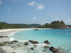
Redang Island (Malay : Pulau Redang, Terengganu Malay: Pula Redang) is an island in Kuala Nerus District, Terengganu, Malaysia. It is one of the largest islands off the east coast of Peninsular Malaysia and one of the most beautiful islands in the world. It is famous for its crystal clear waters and white sandy beaches. It is one of nine islands, which form a marine sanctuary park offering snorkeling and diving opportunities for tourists.

Contents

Archipelago

The Redang archipelago comprises Pulau Redang, Pulau Lima, Pulau Paku Besar, Pulau Paku Kecil, Pulau Kerengga Kecil, Pulau Kerengga Besar, Pulau Ekor Tebu, Pulau Ling and Pulau Pinang. Pulau Redang is the biggest of all the islands in the Marine Park, measuring about 7 km (4.3 mi) long and 6 km (3.7 mi) wide. Its highest peak is Bukit Besar at 359 metres (1,178 feet) above sea level. The boundary of the Pulau Redang Marine Park is established by a line linking all points 2 nautical miles (3.7 km) from the shores of Pulau Redang, Pulau Lima, Pulau Ekor Tebu and Pulau Pinang. The other nearby islands of Pulau Perhentian Besar, Pulau Perhentian Kecil, Pulau Lang Tengah, Pulau Kapas and Pulau Susu Dara are also gazetted and protected as Marine Parks. Today, only the bigger islands like Redang, Lang Tengah, Perhentian and Kapas have resort facilities for visitors. The management of Marine Parks primarily involves protection of the sensitive marine and terrestrial ecosystems by controlling the impact from human activities. These include waste pollution management and conservation of coral reefs and terrestrial habitats.

Tourism

A beach in Pulau Redang during sunset. Pulau Redang - White sandy beach.jpg
A beach in Pulau Redang during sunset.

In contrast to the neighbouring Perhentian Islands, Redang has a more upmarket image, as almost all accommodation on the island is resort-based. The largest beach is Pasir Panjang on the east side, featuring half a dozen resorts. The beach is covered with soft white sand. Coral and fish can be seen just a few metres from the beach. The other beach resorts are located in Teluk Dalam on the north and Teluk Kalong to the south.

The 2000 film, Summer Holiday was filmed on the Laguna Redang Island Resort, and a replica of the tea house now serves as the resort's gift shop.

Summer Collection is one of the most popular oldest souvenir, beachwear, and swimwear seller on the island after the island became famous through the film. They started their business about 20 years ago at Redang Pelangi Resort.

The island is a turtle nesting site, and these turtles serve as a draw for ecotourism. [1]

Climate

Redang has a tropical climate with temperatures steadily around 30 °C (86 °F) and frequent but brief thunderstorms. Like the rest of Malaysia's east coast, Redang is affected by the northeast monsoon from the South China Sea, so most resorts are closed and ferry transport schedules are severely restricted between October and March. The amount of monthly rainfall varies throughout the year, with November to February being the wettest months, whilst April to August being the driest. The island experiences on average about 2,600 millimetres (100 in) of rain per year.

Climate data for Pulau Redang
MonthJanFebMarAprMayJunJulAugSepOctNovDecYear
Record high °C (°F)32.9
(91.2)
34.5
(94.1)
34.8
(94.6)
35.5
(95.9)
35.8
(96.4)
35.5
(95.9)
34.9
(94.8)
35.5
(95.9)
35.2
(95.4)
34.0
(93.2)
33.7
(92.7)
32.3
(90.1)
35.8
(96.4)
Mean daily maximum °C (°F)29.7
(85.5)
30.5
(86.9)
31.5
(88.7)
32.7
(90.9)
33.1
(91.6)
32.7
(90.9)
32.3
(90.1)
32.2
(90.0)
31.9
(89.4)
31.5
(88.7)
30.0
(86.0)
29.3
(84.7)
31.5
(88.6)
Daily mean °C (°F)26.3
(79.3)
26.6
(79.9)
27.2
(81.0)
27.9
(82.2)
28.0
(82.4)
27.5
(81.5)
27.3
(81.1)
27.0
(80.6)
26.9
(80.4)
26.7
(80.1)
26.3
(79.3)
26.2
(79.2)
27.0
(80.6)
Mean daily minimum °C (°F)23.7
(74.7)
23.3
(73.9)
23.7
(74.7)
24.1
(75.4)
24.3
(75.7)
24.0
(75.2)
23.7
(74.7)
23.6
(74.5)
23.6
(74.5)
23.7
(74.7)
23.7
(74.7)
23.8
(74.8)
23.8
(74.8)
Record low °C (°F)19.7
(67.5)
19.4
(66.9)
19.8
(67.6)
22.5
(72.5)
21.3
(70.3)
21.2
(70.2)
20.9
(69.6)
21.0
(69.8)
21.2
(70.2)
21.2
(70.2)
21.3
(70.3)
20.8
(69.4)
19.4
(66.9)
Average precipitation mm (inches)124.6
(4.91)
73.5
(2.89)
162.5
(6.40)
87.0
(3.43)
104.0
(4.09)
116.5
(4.59)
105.1
(4.14)
137.5
(5.41)
188.2
(7.41)
224.3
(8.83)
732.0
(28.82)
534.8
(21.06)
2,590
(101.98)
Average precipitation days1681091011101315192322166
Average relative humidity (%)81818282838383848485878483
Source: Malaysian Meteorological Department [2]

Transportation

Access is from Merang or Shahbandar jetty on boats operated by the resorts. If opting for air travel, SKS Airways also provides daily scheduled flights from Subang Airport. Berjaya Air is also available for charter flights to the island from both Subang Airport and Singapore's Seletar Airport.


Features

Redang Island Beach.jpg

Pasir Panjang beach on Pulau Redang. Pasir Panjang.JPG
Pasir Panjang beach on Pulau Redang.
A rocky beach and a wooden bridge near Laguna Redang Resort in Pulau Redang. Redang Island Bridge.jpg
A rocky beach and a wooden bridge near Laguna Redang Resort in Pulau Redang.
White sandy beach in Pulau Redang. Pulau Redang - White sandy beach.jpg
White sandy beach in Pulau Redang.
White sand beach with turquoise water in Pulau Redang Redang Island.jpg
White sand beach with turquoise water in Pulau Redang

See also

Related Research Articles

<span class="mw-page-title-main">Tioman Island</span> Island in Malaysia

Tioman Island is 32 kilometres off the east coast of Rompin District, Pahang, Malaysia. It is 39 kilometres long and 12 kilometres wide and has seven villages, the largest and most populous being Kampung Tekek on the central western coast. The densely forested island is sparsely inhabited, and is surrounded by numerous coral reefs, making it a popular scuba diving, snorkelling, and surfing spot. There are many resorts and chalets for tourists around the island, which has duty-free status.

<span class="mw-page-title-main">Terengganu</span> State of Malaysia

Terengganu, formerly spelled Trengganu or Tringganu, is a sultanate and federal state of Malaysia. The state is also known by its Arabic honorific, Dāru l-Īmān. The coastal city of Kuala Terengganu, which stands at the mouth of the broad Terengganu River, is both the state and royal capital as well as the most populous city in Terengganu. Other major cities and towns includes Jerteh, Kuala Dungun, Chukai, Kuala Berang, Marang, and Permaisuri. At 13,035 square kilometres in size and a population of over 1.2 million people in 2023, Terengganu is Malaysia's 7th largest state by area and 10th largest in population. Terengganu, along with Kelantan, Perlis and the Federal Territory of Putrajaya is one of the most homogeneous states/territories in the country of which 95% of the population are ethnic Malay-Muslims with its own distinct language/dialect, culture, history and tradition.

<span class="mw-page-title-main">Kuala Terengganu</span> City in Terengganu, Malaysia

Kuala Terengganu, colloquially referred to as KT, is the administrative, economic and royal capital of the state of Terengganu, Malaysia. Kuala Terengganu is also the capital of Kuala Terengganu District. It is also the only royal capital among the nine royal states of the country to bear its state's name. Kuala Terengganu is located about 440 kilometres northeast of Kuala Lumpur on the East Coast of Peninsular Malaysia. The city is situated at the estuary of Terengganu River, facing the South China Sea.

<span class="mw-page-title-main">Perhentian Islands</span> Islands in Malaysia

The Perhentian Islands are islands in Besut District, Terengganu, Malaysia.

Pulau Hantu is located to the south of the main island of Singapore, off the Straits of Singapore. Pulau Hantu is actually made up of two islets: Pulau Hantu Besar and Pulau Hantu Kechil, with a total area of 12.6 hectares. At low tide, it is possible to wade across the shallow lagoon between the two islands, but not at high tide.

Berjaya Air Sdn Bhd is an airline with its head office in the Berjaya Hangar of the SkyPark Terminal Building on the property of Sultan Abdul Aziz Shah Airport in Subang, Selangor, Malaysia. As of 2018, the airline operates charter flights only.

<span class="mw-page-title-main">Lang Tengah Island</span> Island in Malaysia

Lang Tengah Island is an island in Kuala Nerus District, Terengganu, Malaysia. It is connected to the mainland by ferries to Merang.

<span class="mw-page-title-main">Sibu Island</span> Island group in Mersing District, Johor, Malaysia.

Sibu Island is an island group in Mersing District, Johor, Malaysia.

<span class="mw-page-title-main">Besar Island, Johor</span> Island in Mersing District, Johor, Malaysia

Besar Island, also known as Babi Besar Island is an island in Mersing District, Johor, Malaysia.

<span class="mw-page-title-main">Pangkor Island</span> Malaysian island

Pangkor Island is an island in Manjung District, Perak, Malaysia. It has a population of approximately 10,000. Nearby islands include Pangkor Laut Island, Giam Island, Mentagor Island, Simpan Island, and Tukun Terindak Island. The major industries of the island are tourism and fishing.

<span class="mw-page-title-main">Kapas Island</span> Island in Malaysia

Kapas Island is an island in Marang District, Terengganu, Malaysia, with a smaller island, Pulau Gemia, located north of it. It measures roughly 1.5 by 2.5 km. Its name, Pulau Kapas, refers to the island's white beaches. The island has tropical jungle, clear seawater, white sand beaches and coral reefs in the surrounding waters. It is promoted as a "diving and snorkeling paradise". The island is reached by ferry from Marang. Kapas is the location where most of the research on the enigmatic Amphidromus snails is carried out.

Tenggol Island is an island around 24 kilometres (15 mi) off the coast of Terengganu, Malaysia. It is the last island in a string of islands that include Pulau Perhentian and Pulau Redang. It is connected by ferry to Kuala Dungun on the mainland.

<span class="mw-page-title-main">Besut District</span> District of Malaysia in Terengganu

Besut is a district in the Terengganu federal state of Malaysia. It is bordered by the state of Kelantan to the north and west and the South China Sea to the east. It is the northern gateway to Terengganu. Kampung Raja is the district capital, though Jerteh is more developed. Another major town is the fishing port of Kuala Besut. There are other small towns and villages such as Jabi, Apal, Pasir Akar and Tembila.

<span class="mw-page-title-main">Tourism in Malaysia</span> Overview of tourism in Malaysia

Tourism in Malaysia is a major industry and contributor to the Malaysian economy. Malaysia was once ranked 9th in the world for tourist arrivals. The Travel and Tourism Competitiveness Report 2017 ranks Malaysia 25th out of 141 countries overall.

<span class="mw-page-title-main">Penang National Park</span> National park in Malaysia

The Penang National Park spans 1,213ha of land and sea and is used by scientists, researchers, and nature lovers to explore its natural treasures.

<span class="mw-page-title-main">Chan Eng Heng</span> Malaysian academic

Dr. Chan Eng Heng, a retired professor from Universiti Malaysia Terengganu, is a turtle conservationist who has been recognised by the United Nations Environment Program for her efforts to protect sea turtles.

Tourism in Terengganu deals with attractions, events and facilities in Terengganu, Malaysia of special interest to tourists.

<span class="mw-page-title-main">Kuala Nerus District</span> District of Malaysia in Terengganu

Kuala Nerus is a district in Terengganu, Malaysia. It is the youngest district in the state, having been declared a separate district in 2014. Formerly it was part of Kuala Terengganu district but the district is still governed by Kuala Terengganu City Council (MBKT) which is one of few city councils in Malaysia to govern two separate districts. Its capital is Kuala Nerus town, other major towns and villages include Gong Badak, Seberang Takir, Batu Rakit and Batu Enam, all which are located within city limits of Kuala Terengganu. Kuala Nerus' population is 226,177 people as of 2015 which makes it the most populous district in Terengganu. The district has a total land area of 397.52 km2.

<span class="mw-page-title-main">Talang Satang National Park</span>

The Talang Satang National Park is a national park in Kuching Division, Sarawak, Malaysia. It is Sarawak's first marine protected area, and covers the four islands Pulau Talang-Talang Besar, Pulau Talang-Talang Kecil, Pulau Satang Besar and Pulau Satang Kecil and surrounding coral reefs.

References

  1. "From egg hunter to protector, Malaysian battles to save turtles". Rappler. 21 July 2020. Retrieved 28 July 2020.
  2. "Climate of Tourist Places in Malaysia – Pulau Redang (Redang Island)". Met Office. Archived from the original on 20 Aug 2008. Retrieved 10 May 2019.