La Tour-Blanche Anticline

Last updated

The La Tour-Blanche Anticline, also called Chapdeuil Anticline or Chapdeuil-La Tour-Blanche Anticline, is a tectonically caused, dome-like upwarp in the sedimentary succession of the northeastern Aquitaine Basin in France. The structure is oriented westnorthwest-eastsoutheast.

Tectonics The processes that control the structure and properties of the Earths crust and its evolution through time

Tectonics is the process that controls the structure and properties of the Earth's crust and its evolution through time. In particular, it describes the processes of mountain building, the growth and behavior of the strong, old cores of continents known as cratons, and the ways in which the relatively rigid plates that constitute the Earth's outer shell interact with each other. Tectonics also provides a framework for understanding the earthquake and volcanic belts that directly affect much of the global population. Tectonic studies are important as guides for economic geologists searching for fossil fuels and ore deposits of metallic and nonmetallic resources. An understanding of tectonic principles is essential to geomorphologists to explain erosion patterns and other Earth surface features.

Anticline geological term

In structural geology, an anticline is a type of fold that is an arch-like shape and has its oldest beds at its core. A typical anticline is convex up in which the hinge or crest is the location where the curvature is greatest, and the limbs are the sides of the fold that dip away from the hinge. Anticlines can be recognized and differentiated from antiforms by a sequence of rock layers that become progressively older toward the center of the fold. Therefore, if age relationships between various rock strata are unknown, the term antiform should be used.

Aquitaine Basin Mesozoic and Cenozoic sedimentary basin in France

The Aquitaine Basin is, after the Paris Basin, the second largest Mesozoic and Cenozoic sedimentary basin in France, occupying a large part of the country's southwestern quadrant. Its surface area covers 66,000 km2 onshore. It formed on Variscan basement which was peneplained during the Permian and then started subsiding in the early Triassic. The basement is covered in the Parentis Basin and in the Subpyrenean Basin—both sub-basins of the main Aquitaine Basin—by 11,000 m of sediment.

Contents

Description of the structure

The anticline was named after La Tour-Blanche, a small town in the northwestern Dordogne. Yet the centre of the structure is situated farther southeast within the commune of Chapdeuil, hence the names Chapdeuil Anticline or Chapdeuil-La Tour-Blanche Anticline. In plan view the structure has the shape of a nearly rectangular parallelogram with the base lines striking ESE-WNW (N 120) and the sides more or less N-S (reference horizon being the Ligérian/Angoumian boundary). In its long dimension, the anticline measures about 6 km, yet across strike merely 3 km. Similar in shape to the Mareuil Anticline, the La Tour-Blanche Anticline has an asymmetric profile with a steeper northeastern flank (dipping 20° to the NNE) and a very gentle southwestern flank (dipping 5° to the SSW). The northeastern flank is accompanied by a reverse fault with very little heave (10–15 m).

La Tour-Blanche Part of La Tour-Blanche-Cercles in Nouvelle-Aquitaine, France

La Tour-Blanche is a former commune in the Dordogne department in Nouvelle-Aquitaine in southwestern France. On 1 January 2017, it was merged into the new commune La Tour-Blanche-Cercles.

Dordogne Department of France in Nouvelle-Aquitaine

Dordogne is a department in Southwestern France, with its prefecture in Périgueux. The department is located in the region of Nouvelle-Aquitaine between the Loire Valley and the Pyrenees and is named after the river Dordogne that runs through it. It corresponds roughly with the ancient county of Périgord. It had a population of 416,909 in 2013.

Chapdeuil Commune in Nouvelle-Aquitaine, France

Chapdeuil is a commune in the Dordogne department in Nouvelle-Aquitaine in southwestern France.

On its northern side, the La Tour-Blanche Anticline yields to the Villebois-Lavalette-La Chapelle-Montabourlet Syncline (also called Gout-Rossignol-Léguillac Syncline). After a pronounced structural flexure, traceable from Verteillac to Grand-Brassac, follows to the south another syncline (northeast of Ribérac) entirely composed of Campanian strata at the surface. The next anticlinal high traverses Montmoreau in the Charente department and ends just northwest of Ribérac.

Verteillac Commune in Nouvelle-Aquitaine, France

Verteillac is a commune in the Dordogne department in Nouvelle-Aquitaine in south-western France. In 2014, the feast of Félibrée was held in Verteillac.

Grand-Brassac Commune in Nouvelle-Aquitaine, France

Grand-Brassac is a commune in the Dordogne department in Nouvelle-Aquitaine in southwestern France.

Ribérac Commune in Nouvelle-Aquitaine, France

Ribérac is a commune in the Dordogne department in Nouvelle-Aquitaine in southwestern France. The commune is situated by the Dronne River.

The eastern end of the La Tour-Blanche Anticline is crossed by several normal faults trending mainly NE-SW. East of Saint-Just the axis of the anticline slowly disappears simultaneously changing its direction to an easterly course. The structure then definitely ends on the east side of the Boulou (near Paussac).

Saint-Just, Dordogne Commune in Nouvelle-Aquitaine, France

Saint-Just is a commune in the Dordogne department in Nouvelle-Aquitaine in southwestern France.

Boulou Place in Kara Region, Togo

Boulou is a village in the Bassar Prefecture in the Kara Region of north-western Togo.

Paussac-et-Saint-Vivien Commune in Nouvelle-Aquitaine, France

Paussac-et-Saint-Vivien is a commune in the Dordogne department in Nouvelle-Aquitaine in southwestern France.

The area of the anticline is drained in a southeasterly direction by the Euche river, a right-hand tributary of the Dronne, and by the Buffebale, a small rivulet and left-hand tributary of the Euche. It demonstrates inverted topography, i.e. the core of the structure is a depression.

Dronne river in France

The Dronne is a 201-kilometre (125 mi) long river in southwestern France, right tributary of the Isle. Its source is in the north-western Massif Central, east of the town of Châlus at an elevation of 510 metres (1,670 ft). It flows south-west through the following départements and towns:

Regional extent

Seen from the edge of the Aquitaine Basin, the La Tour-Blanche Anticline forms the second anticlinal ridge. At a distance of 25 km, it runs more or less parallel to the edge of the Massif Central. In the centre of the anticline, the sedimentary cover already reaches a thickness of 1000 m.

Like the Mareuil Anticline, the La Tour-Blanche Anticline is a regional feature and can be traced northwestwards to Cognac in the Charente department. To the southeast, the structure links up via the Bussac high with the Périgueux anticline (Beauronne valley); it then continues in the Saint-Cyprien Anticline (an upfaulted anticline) and finally reaches Cahors in the Lot department via the Cazals flexure.

Stratigraphy

Lower Portlandian micrite from the La Tour-Blanche Anticline. The rock is strike-slip-faulted in an ESE-WNW-direction and shows a calcite-filled pull-apart. ChapdeuilPort.jpg
Lower Portlandian micrite from the La Tour-Blanche Anticline. The rock is strike-slip-faulted in an ESE-WNW-direction and shows a calcite-filled pull-apart.

The La Tour-Blanche anticline is cored by Upper Jurassic. Lowest outcropping member is uppermost Kimmeridgian overlain by Lower Portlandian. The Uppermost Kimmeridgian is being cut by the Buffebale and can be observed in the slopes of the rivulet. It has a detrital (sandy) base and then changes into calcareous sandstones and finally into bioclastic, oolithic limestones. Two facies domains can be distinguished: a detrital domain in the east (Serie de la Marteille) and a reefal domain with single corals, occasional oysters and nerineids in the west (Serie de Cercles). This differentiation into two facies domains also persists through the Lower Portlandian, with the eastern domain showing detrital intercalations made of shelly debris, gravels, and breccias. The Lower Portlandian — generally composed of 35 m of well-bedded cryptocrystalline micrites — takes up the major part of the anticline. Its grey to yellowish, sometimes reddish beds are between 10 and 20 cm thick and are separated by thin marly or clayey layers.

After the regression in the Uppermost Jurassic and the complete withdrawal during the entire Lower Cretaceous, the sea transgressed again during the Cenomanian. The usually fairly thin, littoral Cenomanian deposits are very variable in thickness and can reach 40 m in certain places. They can be divided into three sequences: a detrital sequence at the base (sands with shelly debris and lignite intercalations) followed by a calcareous sequence (reddish-brownish to greyish limestones) and another detrital sequence at the top (greyish-blackish to greenish claystones that are very rich in oysters). Concordantly on top of the Cenomanian follow the Turonian deposits which can be subdivided into 15–40 m of Ligérian (chalky, nodular limestones) and 35–65 m of Angoumian (rudist limestones). The overlying Coniacian is slightly discordant. It consists of hard fossiliferous limestones reaching a thickness of 50–80 m. The sedimentary sequence is topped by the typical chalks of the Santonian (60–80 m) and the Campanian (100–180 m); it can reach all in all a total thickness of 535 m.

The deeper parts of the La Tour-Blanche Anticline have been studied by drilling, reaching the variscan basement (dark grey metamorphic schists) at 1085 m depth. From top to bottom, there is a very thick Upper Jurassic (670 m) followed by 158 m of Middle Jurassic, 182 m of Lias, and 75 m of Triassic.

Structural observations

The tectonic deformations registered by the sediments in the La Tour-Blanche Anticline find their expression in many structural features. Especially the Lower Portlandian was quite strongly deformed and exhibits lots of stylolites and slickolites. The following structures can be recognized:

The (most likely) polycyclic movements in the anticline clearly were not just due to compression, but were also caused by shearing (transpression or transtension).

All these observations invoke a shear zone underlying the anticline, probably with a dextral sense of shear.

Time frame

The compressional shortening affecting the sedimentary cover clearly must have happened after the deposition of the Campanian strata. The genesis of the anticlinal ridges in the northern Aquitaine Basin is generally attributed to an endcampanian-maastrichtian phase at the end of the Cretaceous. Certainly the pyrenean orogeny with its strong north-south compression must have had an influence in the shaping of the structures. The main deformation in the Pyrenees happened during the Eocene (Ypresian to Lutetian), peaking during the Lutetian.

Conclusions

The La Tour-Blanche Anticline forms part of a system of anticlinal ridges in the northeastern Aquitaine Basin. During the time interval Uppermost Cretaceous till Eocene compressional movements coupled with considerable shearing motions were responsible in their genesis. Important to note is the rather regular spatial organisation of these structures, which extend ESE-WNW or SE-NW and follow in a dekakilometric spacing (15–20 km) the outline of the Massif Central.

The southern Armorican Massif shows a rather similar spatial organisation in the eastern Vendée; here dextral shear zones in dekakilometric spacing and the intervening far less deformed synclinoria follow the same trend. It therefore can be assumed that the variscan spatial organisation of the southern Armorican Massif also continued into the northern Aquitaine shelf.

Furthermore, this seems to imply that the same or very similar deformation patterns continued right into the Cenozoic. The fractures/shear zones affecting the variscan basement must have been reactivated and consequently left their imprint on the overlying Mesozoic sedimentary cover.

Related Research Articles

The London-Brabant Massif or London-Brabant Platform is in the tectonic structure of Europe a structural high or massif that stretches from the Rhineland in western Germany across northern Belgium and the North Sea to the sites of East Anglia and the middle Thames in southern England.

Inversion (geology) Relative uplift of a sedimentary basin or similar structure as a result of crustal shortening

In structural geology inversion or basin inversion relates to the relative uplift of a sedimentary basin or similar structure as a result of crustal shortening. This normally excludes uplift developed in the footwalls of later extensional faults, or uplift caused by mantle plumes. "Inversion" can also refer to individual faults, where an extensional fault is reactivated in the opposite direction to its original movement.

Strážov Mountains

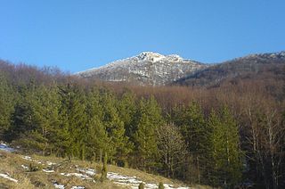
The Strážov Mountains are a mountain range in northwestern Slovakia, being part of Inner Western Carpathians, and of the Fatra-Tatra Area. They are situated between the towns of Trenčín, Považská Bystrica, Rajec, Prievidza and Bánovce nad Bebravou, bordering White Carpathians and the Váh river in the northwest and west, Javorníky in the north, Malá Fatra in the east, Vtáčnik and Nitra river in the south and Považský Inovec in the southwest. The highest mountain is Strážov

Tremp Formation

The Tremp Formation, alternatively described as Tremp Group, is a geological formation in the comarca Pallars Jussà, Lleida, Spain. The formation is restricted to the Tremp or Tremp-Graus Basin, a piggyback foreland basin in the Catalonian Pre-Pyrenees. The formation dates to the Maastrichtian to Thanetian, thus the formation includes the Cretaceous-Paleogene boundary that has been well studied in the area, using paleomagnetism and carbon and oxygen isotopes. The formation comprises several lithologies, from sandstone, conglomerates and shales to marls, siltstones, limestones and lignite and gypsum beds and ranges between 250 and 800 metres in thickness. The Tremp Formation was deposited in a continental to marginally marine fluvial-lacustrine environment characterized by estuarine to deltaic settings.

The Massif Central is one of the two large basement massifs in France, the other being the Armorican Massif. The Massif Central's geological evolution started in the late Neoproterozoic and continues to this day. It has been shaped mainly by the Caledonian orogeny and the Variscan orogeny. The Alpine orogeny has also left its imprints, probably causing the important Cenozoic volcanism. The Massif Central has a very long geological history, underlined by zircon ages dating back into the Archaean 3 billion years ago. Structurally it consists mainly of stacked metamorphic basement nappes.

Geology of the Pyrenees

The Pyrenees are a 430-kilometre-long, roughly east–west striking, intracontinental mountain chain that divide France, Spain, and Andorra. The belt has an extended, polycyclic geological evolution dating back to the Precambrian. The chain's present configuration is due to the collision between the microcontinent Iberia and the southwestern promontory of the European Plate. The two continents were approaching each other since the onset of the Upper Cretaceous (Albian/Cenomanian) about 100 million years ago and were consequently colliding during the Paleogene (Eocene/Oligocene) 55 to 25 million years ago. After its uplift, the chain experienced intense erosion and isostatic readjustments. A cross-section through the chain shows an asymmetric flower-like structure with steeper dips on the French side. The Pyrenees are not solely the result of compressional forces, but also show an important sinistral shearing.

The Génis Unit is a Paleozoic metasedimentary succession of the southern Limousin and belongs geologically to the Variscan basement of the French Massif Central. The unit covers the age range Cambrian/Ordovician till Devonian.

The Thiviers-Payzac Unit is a metasedimentary succession of late Neoproterozoic and Cambrian age outcropping in the southern Limousin in France. The unit geologically forms part of the Variscan basement of the northwestern Massif Central.

The Angoumian is a geological group restricted to the northern Aquitaine Basin in France. The group consists of two fossiliferous limestone formations deposited during the Turonian.

Geology of East Sussex

The geology of East Sussex is defined by the Weald–Artois anticline, a 60 kilometres (37 mi) wide and 100 kilometres (62 mi) long fold within which caused the arching up of the chalk into a broad dome within the middle Miocene, which has subsequently been eroded to reveal a lower Cretaceous to Upper Jurassic stratigraphy. East Sussex is best known geologically for the identification of the first dinosaur by Gideon Mantell, near Cuckfield, to the famous hoax of the Piltdown man near Uckfield.

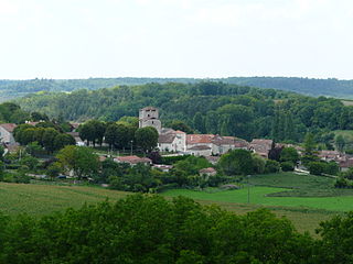
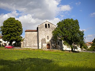
The Mareuil Anticline, also called Mareuil-Meyssac Anticline, is a structural high within the sedimentary sequence of the northeastern Aquitaine Basin. The northwest-southeast trending anticline was caused by tectonic movements probably starting in the Upper Cretaceous.

Périgord noir Natural region in France

The Périgord noir, also known as Sarladais, is a traditional natural region of France, which corresponds roughly to the Southwest of the current Dordogne département, now forming the northern part of the Aquitaine région. It is centered around the town of Sarlat-la-Canéda.

Lacq gas field

The Lacq gas field is a natural gas field located in Aquitaine. It was discovered in 1950 and developed by and Total S.A.. It began production in 1958 and produces natural gas and condensates. The total proven reserves of the Lacq gas field are around 8.8 trillion cubic feet (251 km³), and production is slated to be around 1 billion cubic feet/day (35×105m³).

Geology of the Isle of Wight

The geology of the Isle of Wight is dominated by sedimentary rocks of Cretaceous and Paleogene age. This sequence was affected by the late stages of the Alpine Orogeny, forming the Isle of Wight monocline, the cause of the steeply-dipping outcrops of the Chalk Group and overlying Paleogene strata seen at The Needles, Alum Bay and Whitecliff Bay.

The geology of West Sussex in southeast England comprises a succession of sedimentary rocks of Cretaceous age overlain in the south by sediments of Palaeogene age. The sequence of strata from both periods consists of a variety of sandstones, mudstones, siltstones and limestones. These sediments were deposited within the Hampshire and Weald basins. Erosion subsequent to large scale but gentle folding associated with the Alpine Orogeny has resulted in the present outcrop pattern across the county, dominated by the north facing chalk scarp of the South Downs. The bedrock is overlain by a suite of Quaternary deposits of varied origin. Parts of both the bedrock and these superficial deposits have been worked for a variety of minerals for use in construction, industry and agriculture.

Geology of Germany

The geology of Germany is heavily influenced by several phases of orogeny in the Paleozoic and the Cenozoic, by sedimentation in shelf seas and epicontinental seas and on plains in the Permian and Mesozoic as well as by the Quaternary glaciations.

The geology of Georgia is the study of rocks, minerals, water, landforms and geologic history in Georgia. The country is dominated by the Caucasus Mountains at the junction of the Eurasian Plate and the Afro-Arabian Plate, and rock units from the Mesozoic and Cenozoic are particularly prevalent. For much of its geologic history, until the uplift of the Caucasus, Georgia was submerged by marine transgression events. Geologic research for 150 years by Georgian and Russian geologists has shed significant light on the region and since the 1970s has been augmented with the understanding of plate tectonics.

The geology of the Czech Republic is highly tectonically complex, split between the Western Carpathian Mountains and the Bohemian Massif.

References

Coordinates: 45°21′N0°28′E / 45.350°N 0.467°E / 45.350; 0.467