
Transylvania County is a county in the U.S. state of North Carolina. As of the 2020 census the population is 32,986. Its county seat is Brevard.
New Hill is an unincorporated community located in southwestern Wake County, North Carolina, United States, at the crossroads of old U.S. 1, New Hill Olive Chapel Road and New Hill Holleman Road. New Hill is located along the original alignment of the New Hope Valley Railway between Durham and Bonsal. The ZIP Code for New Hill is 27562.

Falls Lake State Recreation Area is a North Carolina state park in Durham and Wake Counties, North Carolina in the United States. Near Wake Forest, North Carolina, it covers 5,035 acres (20.38 km2) along the shores of 12,410-acre (50.2 km2) Falls Lake.
Gorges State Park is a 7,709-acre (31.20 km2) North Carolina state park in Transylvania County, North Carolina in the United States and along with other conservation lands is part of a 100,000+ acre conservation corridor stretching some 80 miles along the NC/SC state line. The land, along Jocassee Gorges, was purchased by the state from Duke Energy Corporation in 1999. It is North Carolina's westernmost state park and one of the state's newest. The park is adjacent to part of the Pisgah National Forest and the N.C. Wildlife Resources Commission's Toxaway Game Land. Gorges State Park provides the principal access to the Horsepasture River on these adjoining public lands.
The Toxaway River is a 21.4-mile-long (34.4 km) waterway that flows south from headwaters in Transylvania County, North Carolina, into Lake Toxaway and over Toxaway Falls, after which it crosses into South Carolina and enters Lake Jocassee, the reservoir behind Lake Jocassee Dam.
Fairfield is a census-designated place (CDP) and unincorporated community in Hyde County, North Carolina, United States. As of the 2010 census it had a population of 258. The Fairfield Historic District was listed on the National Register of Historic Places in 1985.

Kings Mountain State Park is a South Carolina state park located in the Piedmont region of South Carolina. It is situated in York County near the city of Blacksburg, about 40 miles (64 km) southwest of Charlotte, North Carolina near Interstate 85.
Farrington is an unincorporated community in Chatham County, North Carolina, United States. It is now part of the Fearrington Village census-designated place.
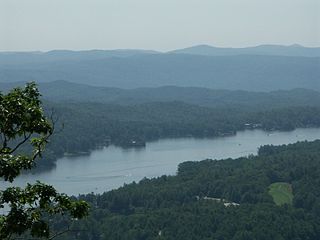
Lake Toxaway is the largest privately held lake in North Carolina. The lake, developed by the Lake Toxaway Company, is man-made and covers 640 acres (2.6 km2) 60 feet (18 m), and the shoreline is 14 miles (23 km). Water sources for the lake include multiple free-flowing mountain streams with the Toxaway River being the main source. The lake flows out onto Toxaway Falls and then continues down the Toxaway River. The main road through the Lake Toxaway area is U.S. Highway 64, a typical winding mountain road with tight turns. Lake Toxaway history encompasses two distinct time periods. The first era which began in 1890 ended with the collapse of the earthen dam in 1916. In 1960 the second era began when the Lake Toxaway Company purchased the land and rebuilt the lake.

This list includes properties and districts listed on the National Register of Historic Places in Edgecombe County, North Carolina, United States. Click the "Map of all coordinates" link to the right to view a Google map of all properties and districts with latitude and longitude coordinates in the table below.

This list includes properties and districts listed on the National Register of Historic Places in Pitt County, North Carolina. Click the "Map of all coordinates" link to the right to view an online map of all properties and districts with latitude and longitude coordinates in the table below.

This list includes properties and districts listed on the National Register of Historic Places in Dare County, North Carolina. Click the "Map of all coordinates" link to the right to view a Google map of all properties and districts with latitude and longitude coordinates in the table below.
The Mattamuskeet National Wildlife Refuge is a federally protected wildlife refuge located within Hyde County, North Carolina, United States. North Carolina's largest natural lake, Lake Mattamuskeet, is located entirely within the National Wildlife Refuge. The refuge has a total area of 50,173 acres (203.04 km2).

Lake Toxaway Methodist Church, also known as Methodist Episcopal Church South, is a historic Methodist church on Cold Mountain Road on the north side, 0.1 miles norwest of the junction with NC 281 in Lake Toxaway, Transylvania County, North Carolina. It was built in 1912, and is a small one-story, Late Gothic Revival style frame structure. It has a six-sided louvered bell tower and a tin roof.
Tuxedo is an unincorporated community in Henderson County, North Carolina, United States, which was originally called Lakewood.

North Carolina Highway 281 (NC 281) is a primary state highway in the U.S. state of North Carolina. The highway runs north–south, connecting communities in western Jackson County and scenic areas of southwest Transylvania County. It is the only North Carolina state highway that changes numbers when crossing into South Carolina.
The National Register Information System (NRIS) is a database of properties that have been listed on the United States National Register of Historic Places. The database includes more than 84,000 entries of historic sites that are currently listed on the National Register, that were previously listed and later removed, or that are pending listing. The database includes approximately 45 pieces of data for each listed property. Accuracy of the NRIS database may be imperfect. For example, a 2004 paper addressed accuracy of spatial location data for part of the NRIS content.
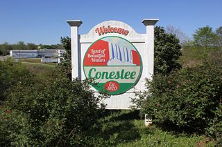
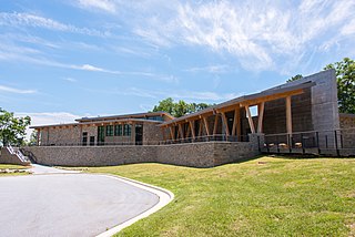
Conestee is an unincorporated community and census-designated place (CDP) in Greenville County, South Carolina, United States. It was first listed as a CDP in the 2020 census with a population of 904.

E. M. Backus Lodge, also known as Camp Toxaway, The Cold Mountain Lodge and Canaan Land Christian Retreat , is a historic hunting lodge and national historic district located near Lake Toxaway, Jackson County and Transylvania County, North Carolina. The lodge was built about 1903, and is a 2-story, double-pile house of chestnut logs. The lodge contains eight rooms on two floors, each grouped around a central hall. Also on the property are the contributing log stable, caretaker's cottage, guest cottage, barn, and Davis Cottage. The site was the former hunting lodge of Thomas Edison, Henry Ford and Harvey Firestone. The camp became an exclusive girls' camp, Camp Toxaway, in 1922, and a religious and educational retreat in 1955 known as Canaan Land. The estate was bought by George and Nancy Corbett of Florida in 1986 and is still operated by the Corbett family.

Hillmont, also known as the Armstrong-Moltz House and Greystone Inn, is a historic home located at Lake Toxaway, Transylvania County, North Carolina. It was built about 1915, and is a large 2+1⁄2-story, board and batten sheathed square block with two rambling stone additions. It features flower boxes on all windows, balconies, and casement windows, which give an impression of Swiss-chalet design. It was rehabilitated as the Greystone Inn in the mid-1980s.


