Lakewood, Illinois

Last updated

The Village of Lakewood
McHenry County Illinois Incorporated and Unincorporated areas Lakewood Highlighted.svg
Location of Lakewood in McHenry County, Illinois.
Illinois in United States (US48).svg
Location of Illinois in the United States
Coordinates: 42°13′26″N88°22′18″W / 42.22389°N 88.37167°W / 42.22389; -88.37167
CountryUnited States
StateIllinois
County McHenry County
Townships Algonquin, Dorr, Grafton
FoundedJuly 10, 1933
Area
[1]
  Total4.89 sq mi (12.66 km2)
  Land4.59 sq mi (11.88 km2)
  Water0.30 sq mi (0.78 km2)
Population
 (2020)
  Total4,283
  Density933.73/sq mi (360.52/km2)
Time zone UTC-6 (CST)
  Summer (DST) UTC-5 (CDT)
ZIP Code(s)
60014
Area code 815
FIPS code 17-41651
Wikimedia CommonsLakewood, Illinois
Website http://www.village.lakewood.il.us/

The Village of Lakewood is a village in McHenry County, Illinois, United States. It was incorporated as a village on July 10, 1933. Per the 2020 census, the population was 4,283. [2] Although commonly referred to as Lakewood, the town's proper name is preceded by 'The Village of'.

Contents

Geography

The Village at Lakewood is located in McHenry County in the state of Illinois. The Village shares its boundaries with the City of Crystal Lake, Village of Lake in the Hills, Village of Huntley, and City of Woodstock.

The Village covers just under 4 square miles (10 km2). There are about 650 acres (2.6 km2) of open space, which equals about 3/4 acre per household. There are 6 lakes, including Crystal Lake which is situated partially in the Village and partially in the City of Crystal Lake, Illinois. The Village is home to two golf courses and several natural areas or wetlands, including the Kishwaukee Fen Nature Preserve. There are also a number of public and private parks and beaches within the Village, as well as walking and bicycle paths and permanent open spaces in the newer subdivisions. Lakewood's recreational areas are West Beach, Crystal Lake, and a number of parks that dot the area.

Small parks, beaches, and boat docks along Crystal Lake's South Shore are private and maintained for use by members of the Country Club Additions Property Owners Association (CCAPOA). This is a homeowners association-like entity for Lakewood houses from approximately Country Club Road (named for Crystal Lake Country Club just to the south) and extending to the south lakeshore. Roads in this lakeside area have decorative posts on the corner of streets intersecting Lake Shore Drive and are called "Gates", such as "Gate 7". The CCAPOA parks take their names from these gates, so a lakeside park would be called "Gate 7 Beach" locally.

Gate 6 sign on South Lake Shore Drive Lakewood Illinois Gate 6 street sign.jpg
Gate 6 sign on South Lake Shore Drive
CCAPOA Gate 3 Beach of Crystal Lake View of Crystal Lake from Gate 3 CCAPOA Beach on lake's south shore.jpg
CCAPOA Gate 3 Beach of Crystal Lake

Lakewood is located at 42°13′26″N88°22′18″W / 42.22389°N 88.37167°W / 42.22389; -88.37167 (42.223864, -88.371662), [3] immediately adjacent to Crystal Lake, Illinois.

According to the 2010 census, Lakewood has a total area of 3.974 square miles (10.29 km2), of which 3.67 square miles (9.51 km2) (or 92.35%) is land and 0.304 square miles (0.79 km2) (or 7.65%) is water. [4]

Demographics

Historical population
CensusPop.Note
1940 125
1950 393214.4%
1960 63561.6%
1970 78223.1%
1980 1,25460.4%
1990 1,60928.3%
2000 2,33745.2%
2010 3,81163.1%
2020 4,28312.4%
U.S. Decennial Census [5]
2010 [6] 2020 [7]

2020 census

Lakewood village, Illinois – Racial and ethnic composition
Note: the US Census treats Hispanic/Latino as an ethnic category. This table excludes Latinos from the racial categories and assigns them to a separate category. Hispanics/Latinos may be of any race.
Race / Ethnicity (NH = Non-Hispanic)Pop 2010 [6] Pop 2020 [7] % 2010% 2020
White alone (NH)3,4603,69990.79%86.36%
Black or African American alone (NH)44251.15%0.58%
Native American or Alaska Native alone (NH)870.21%0.16%
Asian alone (NH)1331533.49%3.57%
Pacific Islander alone (NH)000.00%0.00%
Some Other Race alone (NH)290.05%0.21%
Mixed Race or Multi-Racial (NH)441781.15%4.16%
Hispanic or Latino (any race)1202123.15%4.95%
Total3,8114,283100.00%100.00%

2000 Census

As of the census [8] of 2003, there were 3,050 people, 815 households, and 705 families residing in the village. The population density was 756.0 inhabitants per square mile (291.9/km2). There were 871 housing units at an average density of 281.8 per square mile (108.8/km2). The racial makeup of the village was 96.11% White, 0.77% African American, 0.17% Native American, 1.54% Asian, 0.68% from other races, and 0.73% from two or more races. Hispanic or Latino of any race were 2.35% of the population.

There were 815 households, out of which 39.0% had children under the age of 18 living with them, 80.5% were married couples living together, 5.4% had a female householder with no husband present, and 13.4% were non-families. 11.5% of all households were made up of individuals, and 4.8% had someone living alone who was 65 years of age or older. The average household size was 2.87 and the average family size was 3.09.

In the village, the population was spread out, with 27.3% under the age of 18, 4.6% from 18 to 24, 26.2% from 25 to 44, 31.8% from 45 to 64, and 10.1% who were 65 years of age or older. The median age was 41 years. For every 100 females, there were 96.2 males. For every 100 females age 18 and over, there were 93.5 males.

The median income for a household in the village was $111,172, and the median income for a family was $116,893. Males had a median income of $89,749 versus $40,341 for females. The per capita income for the village was $44,579. About 1.1% of families and 1.7% of the population were below the poverty line, including 3.3% of those under age 18 and 1.5% of those age 65 or over.

Education

Lakewood is primarily served by Crystal Lake Community Consolidated School District 47 [9] and Community High School District 155, specifically South Elementary School for those east of Huntley Road, West Elementary School for those west of Huntley Road, Richard F. Bernotas Middle School and Crystal Lake Central High School. The Turnberry Meadows subdivision is served by Huntley's Consolidated School District 158, specifically Chesak Elementary School, Martin Elementary School, Marlowe Middle School and Huntley High School. [10] Turnberry Country Club is used by Crystal Lake Central golf teams for home games. [11]

See also

Related Research Articles

<span class="mw-page-title-main">Deer Park, Illinois</span> Village in Illinois, United States

Deer Park is a village in Lake and Cook Counties, Illinois. Per the 2020 census, the population was 3,681. The village is one of the few left in the Chicago area that enjoy a green belt which is bordered by two large natural areas providing outdoor recreation and open space. The village is home to popular shopping and dining destinations: Deer Park Town Center and the Town Center Promenade. The town is also home to the Vehe Farm, an Illinois Centennial Farm.

<span class="mw-page-title-main">Glenwood, Illinois</span> Village in Illinois, United States

Glenwood is a village in Cook County, Illinois, United States. The population was 8,662 at the 2020 census.

<span class="mw-page-title-main">Hanover Park, Illinois</span> Village in Illinois, United States

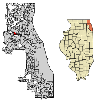
Hanover Park is a village in Cook and DuPage counties in the U.S. state of Illinois, a suburb of Chicago. The population was 37,470 at the 2020 census. Ontarioville is a neighborhood within the village.

<span class="mw-page-title-main">Lansing, Illinois</span> Village in Illinois, United States

Lansing is a village in Cook County, Illinois, United States. Lansing is a south suburb of Chicago. The population was 29,076 at the 2020 census.

<span class="mw-page-title-main">Orland Hills, Illinois</span> Village in Illinois, United States

Orland Hills is a village in Cook County, Illinois, United States. Per the 2020 census, the population was 6,893.

<span class="mw-page-title-main">Stickney, Illinois</span> Village in Illinois, United States

Stickney is a village in Cook County, Illinois, United States. The village is named for Alpheus Beede Stickney, a railroad executive who played a central role in establishing the Clearing Industrial District. Per the 2020 census, the population was 7,110. It was well known in the 1920s and early 1930s as the home for several bordellos linked to mobster Al Capone's empire.

<span class="mw-page-title-main">Algonquin, Illinois</span> Village in Illinois, United States

Algonquin is a village in McHenry and Kane counties, Illinois, in the United States. It is a suburb of Chicago, located approximately 40 miles (64 km) northwest of the Loop. As of the 2020 census, the village's population was 29,700.

<span class="mw-page-title-main">Gilberts, Illinois</span> Village in Illinois, United States

Gilberts is a village in Kane County, Illinois, United States. The population was 8,366 at the 2020 census.

<span class="mw-page-title-main">Huntley, Illinois</span> Village in Illinois, United States

Huntley is a village in McHenry and Kane counties, Illinois, United States. As of the 2021 census it had a population of 28,008. It is a part of the Chicago metropolitan area.

<span class="mw-page-title-main">Fox Lake, Illinois</span> Village in Illinois, United States

Fox Lake is a village in Grant and Antioch townships in Lake County, Illinois and Burton Township, McHenry County, Illinois, United States. The population was 10,978 at the 2020 census. It is located approximately 57 miles north of Chicago.

<span class="mw-page-title-main">Island Lake, Illinois</span> Village in Illinois, United States

Island Lake is a village in Lake and McHenry counties in the U.S. state of Illinois. Per the 2020 census, the population was 8,051. The village surrounds Island Lake, a lake which contains a small island.

<span class="mw-page-title-main">Lake Villa, Illinois</span> Village in Illinois, United States

Lake Villa is a village in Lake County, Illinois United States. Per the 2020 census, the population was 8,741. Lake Villa lies within Lake Villa Township and about 50 miles north of Chicago and is part of the United States Census Bureau's Chicago combined statistical area (CSA).

<span class="mw-page-title-main">Lakemoor, Illinois</span> Village in Illinois, United States

Lakemoor is a village in Lake and McHenry counties in the U.S. state of Illinois. Per the 2020 census, the population was 6,182.

<span class="mw-page-title-main">Mundelein, Illinois</span> Village in Illinois, United States

Mundelein is a village in Lake County, Illinois, United States and a northern suburb of Chicago. Per the 2020 census, the population was 31,560. It is approximately thirty-five miles northwest of Chicago.

<span class="mw-page-title-main">North Barrington, Illinois</span> Village in Illinois, United States

North Barrington is a village in Lake County, Illinois, United States. Per the 2020 census, the population was 3,171.

<span class="mw-page-title-main">Riverwoods, Illinois</span> Village in Illinois, United States

Riverwoods is a village in Lake County, Illinois, United States. It was established on the banks of the Des Plaines River in 1959 by local steel magnate Jay Peterson. Per the 2020 census, the population was 3,790. The corporate headquarters of Discover Financial and CCH are located there, as well as Orphans of the Storm, an animal shelter founded in 1928 by famous dancer Irene Castle. The village used to host the annual "Arts & Riverwoods" festival.

<span class="mw-page-title-main">Crystal Lake, Illinois</span> City in Illinois, United States

Crystal Lake is a city in McHenry County, Illinois, United States. Named after a lake 1.6 miles (2.6 km) southwest of the city's downtown, Crystal Lake is 45 miles (72 km) northwest of Chicago. The population was 40,269 as of the 2020 census. Crystal Lake is the most populous city in McHenry County, part of the Chicago metropolitan area.

<span class="mw-page-title-main">Lake in the Hills, Illinois</span> Village in Illinois, United States

Lake in the Hills is a village in McHenry County, Illinois, United States. As of the 2020 census, the population was 28,982.

<span class="mw-page-title-main">Oakwood Hills, Illinois</span> Village in Illinois, United States

Oakwood Hills is a village in McHenry County, Illinois, United States. It was founded in 1959. The population was 2,076 at the 2020 census.

<span class="mw-page-title-main">Prairie Grove, Illinois</span> Village in Illinois, United States

Prairie Grove is a village in McHenry County, Illinois, United States, first incorporated in 1973. Per the 2020 census, the population was 1,963.

References

  1. "2020 U.S. Gazetteer Files". United States Census Bureau. Retrieved March 15, 2022.
  2. "Lakewood village, Illinois". United States Census Bureau . Retrieved April 15, 2022.
  3. "US Gazetteer files: 2010, 2000, and 1990". United States Census Bureau. February 12, 2011. Retrieved April 23, 2011.
  4. "G001 - Geographic Identifiers - 2010 Census Summary File 1". United States Census Bureau. Archived from the original on February 13, 2020. Retrieved August 4, 2015.
  5. "Decennial Census of Population and Housing by Decades". US Census Bureau.
  6. 1 2 "P2 Hispanic or Latino, and Not Hispanic or Latino by Race – 2010: DEC Redistricting Data (PL 94-171) – Lakewood village, Illinois". United States Census Bureau .
  7. 1 2 "P2 Hispanic or Latino, and Not Hispanic or Latino by Race – 2020: DEC Redistricting Data (PL 94-171) – Lakewood village, Illinois". United States Census Bureau .
  8. "U.S. Census website". United States Census Bureau . Retrieved January 31, 2008.
  9. "Overview / Boundary Maps". d47.org. Retrieved March 26, 2016.
  10. "Map of Crystal Lake" (PDF). Ww3.d155.org. Retrieved March 26, 2016.
  11. "8to18".