Lamas, Norfolk

Last updated

Lamas
St Andrew, Lamas, Norfolk - geograph.org.uk - 316170.jpg
St Andrew, Lamas
Norfolk UK location map.svg
Red pog.svg
Lamas
Location within Norfolk
Civil parish
District
Shire county
Region
Country England
Sovereign state United Kingdom
Post town Norwich
Postcode district NR10
List of places
UK
England
Norfolk
52°45′00″N1°20′00″E / 52.75°N 1.3333°E / 52.75; 1.3333 Coordinates: 52°45′00″N1°20′00″E / 52.75°N 1.3333°E / 52.75; 1.3333

Lamas (also spelled Lammas) is a village in Broadland, Norfolk, England. Administratively it falls within the civil parish of Buxton with Lamas.

Contents

The village's name means "loam marsh".

Location

Located between Norwich and Aylsham, Lamas is a linear village immediately to the east of the larger village of Buxton, and where the two meet is Buxton Mill. [1] Lamas is separated by the River Bure from Buxton.

Description

Lamas gives the impression of being a sleepy, rural place. Today it has no pubs or shops, being served by Buxton. The village's two main roads are called The Street and Scottow Road (which is the continuation of The Street leading to RAF Coltishall). There are four large houses located within the village, Lammas Hall, which is located in a park, and not visible from the road, the Tudor Manor House, which Pevsner describes as having formed part of a larger structure (today this is two houses), Bure House, which stands on the other side of the churchyard from the Manor, and the Rectory, which is located on the Little Hautbois Road. A house opposite Bure House describes itself as 'Blacksmith's Cottage', a reference to its former use as a Blacksmith. Early photographs of the village show that the house called 'The Old Anchor of Hope' by the river Bure was once a pub.

In earlier centuries, agriculture was the main industry. Today, Lamas serves mainly as a dormitory for the city of Norwich, with many residents using the village as a retreat from jobs in Norwich City centre and the surrounding area, with daily commutes into the City.

Local government

For local government purposes, the two villages jointly elect the Buxton with Lamas Parish Council, and both fall within the area covered by Broadland District Council and Norfolk County Council. Lamas and Buxton together have a population of 1,695. Although Lamas is the smaller of the two places, it is historically a parish in its own right, and for centuries had its own Rector. Lamas has been united with the neighbouring hamlet of Little Hautbois since the 15th century. [2] The village is a part of the Buxton Division of the district of Broadland, and the Aylsham Division of the County Council.

Places of worship

The village church is dedicated to St. Andrew. Much restored in the 19th century, the church nevertheless still displays some traces of Anglo-Saxon work in the walls of the nave. The chancel slants away from the nave, probably due to the marshy nature of the riverside site. Inside, there is a finely-painted organ decorated with images of St. George and St. Michael. Two RAF standards hang in the chancel. [3] A late 19th-century writer reports that, prior to the restoration, the old church possessed some fine medieval figurative stained-glass, but that this had vanished during the restoration. [4] Today, the church possesses a ring of five bells, and the ringing chamber was extensively restored by Peggy Anne Williamson of Lammas Hall, a former tower captain. [5] The writer Anna Sewell is buried in the graveyard of the old Quaker Meeting-House on The Street. The meeting house itself has now been converted into a residential house, but Anna Sewell's gravestone is set in a wall fronting the Street. [6] The other stones commemorate local benefactors John Wright and Phillip Sewell, of Dudwick Park, Buxton. The burial ground was partially destroyed in 1984, when a large part was bulldozed by contractors without prior warning or permission . [7] A map of the village dated 1885 indicates that the Friends at one point let the Meeting House to the Wesleyan Methodists, while retaining the burial ground. [8]

In the 19th century, Lamas had a small Particular Baptist Chapel, but this has long since vanished. [9] Calvinistic Baptist John Grace, minister of Tabernacle Chapel, Brighton preached here in 1856. [10]

The Rector of Lamas from 1738 to 1754, the Reverend William Lubbock, was the ancestor of the Lubbock family, Lords Avebury.

One of the former Rectors of the Parish is named simply as 'Roger' on the board in the Church. Local legend says this is because he murdered a man shortly after he had been inducted to the benefice and fled. It is said that the man's body still lies under the church porch. [11]

The Rev. Dr Peter Hansell, married to the Revd Anupama Kamble-Hansell, was instituted as Rector of the Bure Valley Benefice in September 2010 (his wife as Assistant Curate of Bure Valley /St Edmundsbury & Ipswich/ until her resignation in 2013), until his 30 August 2013 appointment to be Chaplain of Trent College, Long Eaton (Derby). [12]

Historic houses

Lammas Hall, a large building of uncertain date, lies in a small park, concealed from the road. The building has a 17th-century porch, a doorcase with stone quoins contained within a 19th-century single storey brick porch. The North wing is of the same date as the porch. The shaped gable above the entrance is one of the few surviving traces of architecture. [7] Limewash has been applied to the exterior in an attempt to create an impression of architectural unity. Among the notable inhabitants of the Hall was Wallace White Williamson, actuary, of Norwich Union, [13] who is buried at the church. The Hall was an old people's home for a time, before returning to private ownership.

The Manor House was built in several sections over the centuries. It was begun by three sheep farming brothers, the Allens, around the reign of Henry VII, with subsequent extensions: the east gable was said by Pevsner to bear the date of 1525 on the east gable. It was extended to the west around 1600. There appears to be a Georgian addition to the west gable, and there was one final modern alteration/extension carried out in the late 1980s. The Manor became the home of the Dammant family between the 17th century and the early 19th century. They were a family of doctors who had a private gate to the adjacent church through the brick wall which partly bounds the property. After their departure, the house was subdivided into five homes, chiefly for workers at Lammas Hall. It was bought and restored by Canon and Mary Boston in the 1960s.

The slightly eccentric looking house with Dutch gables on the Little Hautbois Road was once the home of Walter Rye, the historian, pioneer of cross-country running and one-time mayor of Norwich. Although Rye died in Norwich, he is buried at the entrance to the churchyard extension. Rye bought what was at that time called Rectory Cottage, and extended it, incorporating a former schoolroom as a large parlour. The stained glass roundels containing the arms of every former Lord of the Manor of Lamas, now in the church, were originally created for this house. [14]

Lamas in 1845

William White's History, Gazetteer, and Directory of Norfolk, 1845 says of Lamas: [15]

LAMMAS, a pleasant village on the east bank of the Bure, 4 miles (6.4 km) S.E. of Aylsham, has in its parish 257 souls, and about 500 acres (2.0 km2) of land, exclusive of Little Hautboys, which is united with it. They contain together 299 souls, and 829 acres (3.35 km2). Lamas is mostly the property of Sir John Lubbock and the Rev. W. H. Marsh, sen., the latter of whom is lord of the manor, and patron of the consolidated rectories of Lamas and Little Hautboys, valued in the King's Book at £7, and enjoyed by the Rev. W. H. Marsh, jun., of Erpingham. The glebe is 36A., and the tithes were commuted in 1840 for £240 per annum. The CHURCH (St. Andrew,) has a low embattled tower, with four bells. Near the west end of the village is an ancient Quakers' Meeting House, with a small burial ground. The Church Land is one acre.

Sources

Related Research Articles

<span class="mw-page-title-main">Wroxham</span> Human settlement in England

Wroxham is a village and civil parish in the English county of Norfolk. The civil parish of Wroxham has an area of 6.21 square kilometres, and in 2001, had a population of 1,532 in 666 households. A reduced population of 1,502 in 653 households was noted in the 2011 Census. The village is situated within the Norfolk Broads on the south side of a loop in the middle reaches of the River Bure. It lies in an elevated position above the Bure, between Belaugh Broad to the west, and Wroxham Broad to the east and south east. Wroxham is some eight miles north-east of Norwich, to which it is linked by the A1151 road. The village and broad lie in an area of fairly intensive agriculture, with areas of wet woodland adjoining the broad and river. For the purposes of local government, the parish falls within the district of Broadland although the river, broad and their immediate environs fall within the executive area of the Broads Authority. On the northern side of the Bure is the village of Hoveton, often confused with Wroxham.

<span class="mw-page-title-main">Horning</span> Human settlement in England

Horning is an ancient village and parish in the English county of Norfolk. It covers an area of 11 km2 and had a population of 1,033 in the 2001 census. Horning parish lies on the northern bank of the River Bure south of the River Thurne and is located in The Broads National Park. For the purposes of local government, it falls within the district of North Norfolk, although areas alongside the rivers and broads fall into the executive area of the Broads Authority.
<span class="mw-page-title-main">Hoveton</span> Human settlement in England

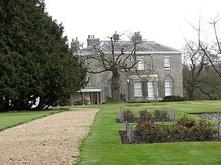
Hoveton is a village and civil parish in the English county of Norfolk. It is located within the Norfolk Broads, and immediately across the River Bure from the village of Wroxham. Whilst Hoveton is north of the river, Wroxham is south; but many people refer to the whole settlement as "Wroxham".

<span class="mw-page-title-main">Bure Valley Railway</span>

The Bure Valley Railway is a 15 in minimum gauge visitors' attraction in Norfolk, England. It was created on the original disused full-gauge bed of a defunct passenger service to incorporate a new, adjacent pedestrian footpath.

<span class="mw-page-title-main">River Bure</span> River in Norfolk, England

The River Bure is a river in the county of Norfolk, England, most of it in the Broads. The Bure rises near Melton Constable, 11 miles (18 km) upstream of Aylsham, which was the original head of navigation. Nowadays, the head of navigation is 10 miles (16 km) downstream at Coltishall Bridge. After Aylsham Lock and Burgh Bridge, the Bure passes through Buxton Lammas, Coltishall, Belaugh, Wroxham, Horning, past St. Benet's Abbey, through Oby, Acle, Stokesby, along the northern border of the Halvergate Marshes, through Runham and Great Yarmouth where it meets Breydon Water and flows into the sea at Gorleston.

The Bure Valley Path is a 9-mile (14 km) long walking trail and cycling trail in Norfolk, England. It runs alongside the Bure Valley Railway, a heritage railway from Wroxham to Aylsham.

<span class="mw-page-title-main">Aylsham</span> Town in Norfolk, England

Aylsham is a historic market town and civil parish on the River Bure in north Norfolk, England, nearly 9 mi (14 km) north of Norwich. The river rises near Melton Constable, 11 miles (18 km) upstream from Aylsham and continues to Great Yarmouth and the North Sea, although it was only made navigable after 1779, allowing grain, coal and timber to be brought up river.

<span class="mw-page-title-main">Old Catton</span> Human settlement in England

Old Catton is a suburban village and civil parish in the English county of Norfolk which lies 2 miles (3.2 km) to the north-east of central Norwich. The parish is bounded by the Norwich International Airport at Hellesdon to the west and Sprowston to the east. The northern boundary is with the village of Spixworth while the A1042 road forms the southern boundary. It covers an area of 2.33 km2 (0.90 sq mi) and had a population of 5,954 in 2,512 households at the 2001 census, increasing to a population of 6,108 in 2,666 households at the 2011 Census. For the purposes of local government, it falls within the district of Broadland. The village is twinned with the French commune of Lavaré.

<span class="mw-page-title-main">Buxton, Norfolk</span> Human settlement in England

Buxton is a village and former civil parish, now in the parish of Buxton with Lamas, in the Broadland district of the county of Norfolk, England. Buxton is located between Norwich and Aylsham and is separated from Lamas by the River Bure. In 2021 it had a population of 1295.

<span class="mw-page-title-main">Gateley</span> Human settlement in England

Gateley is a village and civil parish in the Breckland district of Norfolk, England.

<span class="mw-page-title-main">Reepham, Norfolk</span> Town in Norfolk, England

Reepham is a market town and civil parish in the Broadland district of Norfolk, England. Reepham is situated on the B1145 road between the Bure and Wensum valleys. The town is 12 miles (19 km) northwest of Norwich. At the time of the 2001 census the civil parish had a population of 2,455 residents in 970 households, occupying an area of 1,909 hectares. increasing to a population of 2,709 in 1,169 households at the 2011 census.

<span class="mw-page-title-main">Hevingham</span> Human settlement in England

Hevingham is a village and civil parish in the Broadland district of the English county of Norfolk. Situated between the A140 road Norwich to Cromer road and the B1149 road Norwich to Holt road. It is 7 miles (11 km) north from the city of Norwich and 4 miles (6.4 km) south from the market town of Aylsham.

<span class="mw-page-title-main">Buxton with Lamas</span> Human settlement in England

Buxton with Lamas is a civil parish in Broadland in the English county of Norfolk. It comprises the villages of Buxton lying to the west of the River Bure and Lamas on the eastern side of the river. At this point the River Bure is crossed by the Bure Valley Railway on a 105-foot (32 m) long girder bridge. Buxton has a halt on the railway. The former railway station on the Great Eastern Railway was called Buxton Lamas prior to closure of the line.

Little Hautbois is a small hamlet in Broadland, England, part of the parish of Lamas. The name is pronounced 'Hobbis', and can be seen thus spelled on a memorial on the outside of nearby Lamas Church. The population of the hamlet is included in the civil parish of Buxton with Lamas. In the Middle Ages, the settlement of Great Hautbois was the head of the navigation on the River Bure, and it is thought Little Hautbois developed from that. The name, which can be translated to "High Woods" in English, is taken from that of the de Alto Bosco, or de Haut Bois, family, who acquired these lands at the Norman Conquest (alternatively, they may have taken the name from the settlement, Blomefield being uncertain on this point.
<span class="mw-page-title-main">Buxton Watermill</span> Watermill in Buxton with Lammas, England

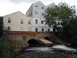
Buxton Mill, is located on the River Bure about 0.5 miles (0.80 km) east of the village of Buxton, Norfolk, and is in the hamlet of Lamas, Norfolk. A watermill was recorded here in the Domesday Book. The present mill is thought to date from 1754 and was built by William Pepper, a merchant living in Buxton.

<span class="mw-page-title-main">Skeyton</span> Human settlement in England

Skeyton is a small village and civil parish in the English county of Norfolk. The village and parish of Skeyton had in the 2001 census a population of 200, increasing slightly to 207 at the 2011 census. For the purposes of local government, the parish falls within the district of North Norfolk. Skeyton lies 4 miles (6.4 km) east of the market town of Aylsham, 13.5 miles (21.7 km) south of Cromer, 13.4 miles (21.6 km) north of Norwich and 129 miles (208 km) north-east of London. The nearest railway station is at North Walsham for the Bittern Line which runs between Sheringham, Cromer and Norwich. The nearest airport is Norwich International Airport.

<span class="mw-page-title-main">East Barsham</span> Human settlement in England

East Barsham is a village and former civil parish, now in the parish of Barsham, in the North Norfolk district, in the English county of Norfolk. In 1931 the parish had a population of 144. On 1 April 1935 the parish was abolished to form Barsham.

<span class="mw-page-title-main">Thurning, Norfolk</span> Village in Norfolk, England

Thurning is a small dispersed village and civil parish in the English county of Norfolk and district of North Norfolk, near the border with Broadland. The population at the 2011 Census remained less than 100 and is recorded together with the neighbouring civil parish of Hindolveston.

<span class="mw-page-title-main">Marsham, Norfolk</span> Human settlement in England

Marsham is a village and civil parish in the English county of Norfolk, about 10 miles (16 km) north of Norwich. It covers an area of 7.40 km2 (2.86 sq mi) and had a population of 674 in 282 households at the 2001 census.

<span class="mw-page-title-main">Calthorpe, Norfolk</span> Village in Norfolk, England

Calthorpe is a small village and former civil parish, now in the parish of Erpingham, in the North Norfolk district, in the county of Norfolk, England. The village is located 0.5 miles (0.80 km) west of the village of Erpingham, 3.4 miles (5.5 km) north of the nearest town of Aylsham and is 15.8 miles (25.4 km) north of the nearest city of Norwich. The nearest railway station is at Gunton for the Bittern Line which runs between Sheringham, Cromer and Norwich and is 7.8 miles (12.6 km) from the village. The nearest airport is Norwich International 14.2 miles (22.9 km) south of the village. In 1931 the parish had a population of 143.

References

  1. Further information on Buxton Mill can be found at Norfolk Mills and at Bure View or Millers Lodge Archived 11 May 2008 at the Wayback Machine
  2. Church Guidebook
  3. Church Guidebook and information displayed within the church
  4. Pending verification
  5. Memorial inscription in the ringing chamber
  6. Norfolk Churches Site
  7. 1 2 "Record Details - Norfolk Heritage Explorer". www.heritage.norfolk.gov.uk.
  8. "Old-Maps - the online repository of historic maps - home page". www.old-maps.co.uk.
  9. 1859 Religious Census
  10. B. H. N. 'Recollections of John Grace (London, 1893), p.228.
  11. Donald Mackenzie: Guidebook to St. Andrews Church, Lamas, c.2013
  12. "Appointments". www.churchtimes.co.uk.
  13. Norwich Union Promotional Literature, 1959
  14. Christopher Kitchling, A Passion for Records: Walter Rye (1843–1929), topographer, sportsman and Norfolk's champion (Kibworth Harcourt, 2017), pp.65-6
  15. William White's History, Gazetteer, and Directory of Norfolk, 1845