Dewey Beach is an incorporated coastal town in eastern Sussex County, Delaware, United States. According to the 2010 census, the population of the town is 341, an increase of 13.3% over the previous decade. It is part of the rapidly growing Cape Region and lies within the Salisbury, Maryland-Delaware Metropolitan Statistical Area. In 2011, the NRDC awarded Dewey Beach with a 5-Star rating in water quality. This award was given only to 12 other locations, one being neighboring Rehoboth Beach. Out of the 30 states with coastline, the Delaware Beaches ranked number 1 in water quality in 2011.
Henlopen Acres is a municipality north of Rehoboth Beach in Sussex County, Delaware, United States, and is the third smallest incorporated town in Delaware. According to 2010 census figures, the population of the town is 122, a decrease of 12.2% from the 2000 census. It is part of the Salisbury, Maryland-Delaware Metropolitan Statistical Area.

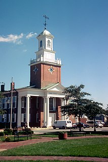
Rehoboth Beach is a city on the Atlantic Ocean along the Delaware Beaches in eastern Sussex County, Delaware, United States. As of the 2010 United States Census, the population was 1,327, reflecting a decline of 161 (11.2%) from the 1,488 counted in the 2000 Census. Along with the neighboring coastal city of Lewes, Rehoboth Beach is one of the principal cities of Delaware's rapidly growing Cape Region. Rehoboth Beach lies within the Salisbury, Maryland-Delaware Metropolitan Statistical Area.
Rehoboth Bay is a body of water in Sussex County, Delaware. It is connected to the Broadkill River by the Lewes and Rehoboth Canal.

The Lewes and Rehoboth Canal is a canal in Sussex County, Delaware, which connects the Broadkill River and the Delaware Bay to Rehoboth Bay. It forms a portion of the Intracoastal Waterway.
The Junction and Breakwater Trail is a 6-mile (9.7 km) long rail trail located on the southwestern side of Cape Henlopen State Park connecting Lewes and Rehoboth Beach, Delaware, United States. It is the third rail trail built in Delaware and it is the longest in the state. It follows the former Pennsylvania Railroad Rehoboth Beach branch that once transported passengers to several Methodist resort camps along the Atlantic coast. The line was abandoned by the Penn Central in the early 1970s.
The Cape Henlopen School District is a public school district in Sussex County, Delaware in the United States. The district is based in Lewes and serves the Cape Region in eastern Sussex County.

Midway is an unincorporated area in Sussex County, Delaware. It is located "midway" between Rehoboth Beach and Lewes along Delaware Route 1 at the intersection with Delaware Route 24. The community is part of the Salisbury, Maryland-Delaware Metropolitan Statistical Area.
The first USS Rehoboth (SP-384) was a United States Navy patrol vessel in commission in 1917.
Baltimore Hundred is a hundred in the southeastern section of Sussex County, Delaware, United States. Baltimore Hundred was formed in 1775 from Worcester County, Maryland. Its primary community is Millville. The old colonial term "hundred" is used to describe a sectioned area of the county in which 100 farms should fit. The Hundred was home to 3 villages, Selbyville, Roxanna and Ocean View.

Indian River Hundred is a hundred in Sussex County, Delaware, United States. Indian River Hundred was formed in 1706 from Lewes & Rehoboth Hundred. Its primary community is now Angola on Delaware Route 24, but maritime transportation dominated during the colonial and early federal era. Thus settlers as early as 1794 built a nearby chapel St. George's to serve their spiritual needs and as a community gathering place. By 1821 they paid to share a pastor with St. Peter's Church in Lewes, Delaware, as well as Old Christ Church, Prince George's Chapel in Dagsboro, Delaware and St. Pauls' Church in Georgetown, Delaware. By the late 20th century, fishing and farming had declined but tourism had increased, so the parish was linked to All Saints' Church in Rehoboth Beach.
Seaford Hundred is a hundred in Sussex County, Delaware, United States. Seaford Hundred was formed in 1869 from Northwest Fork Hundred. Its primary community is Seaford.
Nassau Valley Vineyards was the first winery in the state of Delaware in the United States, and is currently the largest in the state. When jazz singer Peggy Raley decided to open a winery in Delaware, she first had to get the local state legislature to pass a law allowing wineries in the state. By 1991 she drafted the necessary legislation, and she obtained a license and opened the vineyard in 1993. Until October 2007, when Pizzadili Winery opened, it was the first and only winery in the state. There are eight acres of property at the site, and it caters to the beach-bound tourist traffic in the area.
Carpenters Corner, Delaware is a village 2 miles south of Lewes and 4 miles northwest of Rehoboth Beach in Sussex County, at 38°44′30″N75°09′00″W.

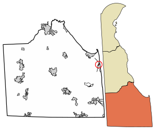
The Cape Henlopen Region, or the Cape Region, is a region in Sussex County, in southern Delaware, on the Delmarva Peninsula. The region is part of the Salisbury, Maryland-Delaware Metropolitan Statistical Area. The region takes its name from Cape Henlopen, as does the Cape Henlopen School District and Cape Henlopen State Park. Much of the region's populated areas are found along the Delaware Bay, Rehoboth Bay and the Atlantic Ocean. Northern and western parts of the Cape Region are rural areas dominated by farmland and wetlands. The area is often referred to as the Delaware Beaches.
Beebe Healthcare is a healthcare system serving Sussex County in southern Delaware in the United States. Its primary facility is Beebe Medical Center, a hospital located in Lewes.