Lightstreet, Pennsylvania

Last updated

Lightstreet, Pennsylvania
Map of Lightstreet, Columbia County, Pennsylvania Highlighted.png
Location within Columbia County
USA Pennsylvania location map.svg
Red pog.svg
Lightstreet
Location within the U.S. state of Pennsylvania
Coordinates: 41°2′23″N76°25′20″W / 41.03972°N 76.42222°W / 41.03972; -76.42222
Country United States
State Pennsylvania
County Columbia
Townships Scott, Orange
Area
[1]
  Total0.99 sq mi (2.56 km2)
  Land0.98 sq mi (2.53 km2)
  Water0.01 sq mi (0.03 km2)
Elevation
550 ft (170 m)
Population
 (2020) [2]
  Total1,098
  Density1,125.00/sq mi (434.45/km2)
Time zone UTC-5 (Eastern (EST))
  Summer (DST) UTC-4 (EDT)
FIPS code 42-43224
GNIS feature ID1179322

Lightstreet is a census-designated place (CDP) in Columbia County, Pennsylvania, United States. It is part of Northeastern Pennsylvania. The population was 1,098 at the 2020 census. [3] It is part of the Bloomsburg-Berwick micropolitan area. The CDP is named after a street in Baltimore. [4]

Contents

History

Lightstreet was originally called Williamsburg. The community was laid out in 1817 by Phillip Seidle. By 1821, the community had six residents. One gristmill was built in Lightstreet in 1823. It was rebuilt in 1868 by Peter Ent. Samuel L. Bettle built another gristmill south of the first mill in 1825. A post office was built in the vicinity of the northern gristmill by Matthew McDowell. Both of the gristmills were run by Fishing Creek's water power. There were also once two iron furnaces in Lightstreet. One of the furnaces was built in 1845. The community was also once home to two distilleries and a tannery. [4]

Lightstreet's name was changed to what it is now in 1844 by Marmaduke Pearce. [4] Lightstreet is now currently home to the Lightstreet little league baseball academy which is ranked as one of the top teams in Pennsylvania on a year to year basis. The Lightstreet baseball teams are the top feeder program to the Central Columbia High School Varsity squad.

Geography

Lightstreet is located near the geographic center of Columbia County at 41°2′35″N76°25′15″W / 41.04306°N 76.42083°W / 41.04306; -76.42083 (41.042946, -76.420829). [5] It occupies the northern part of Scott Township, and a small portion extends north into Orange Township. According to the United States Census Bureau, the CDP has a total area of 0.99 square miles (2.56 km2), of which 0.97 square miles (2.52 km2) is land and 0.01 square miles (0.03 km2), or 1.37%, is water. [6]

Lightstreet is approximately 4 miles (6 km) northeast of Bloomsburg via Pennsylvania Route 487, and is east of Fishing Creek, a tributary of the Susquehanna River. Interstate 80 passes 1 mile (1.6 km) south of the community, with access from Exit 236 with PA 487. Most of the eastern section of Lightstreet is farmland, and most of the western part is a residential area. [7]

Demographics

Historical population
CensusPop.Note
2020 1,098
U.S. Decennial Census [8]

As of the census [9] of 2000, there were 881 people, 405 households, and 255 families residing in the CDP. The population density was 1,098.5 inhabitants per square mile (424.1/km2). There were 430 housing units at an average density of 536.2 per square mile (207.0/km2). The racial makeup of the CDP was 99.09% White, 0.45% Asian, 0.23% Pacific Islander, 0.11% from other races, and 0.11% from two or more races. Hispanic or Latino of any race were 0.34% of the population.

There were 405 households, out of which 22.7% had children under the age of 18 living with them, 52.3% were married couples living together, 8.6% had a female householder with no husband present, and 36.8% were non-families. 33.6% of all households were made up of individuals, and 21.0% had someone living alone who was 65 years of age or older. The average household size was 2.18 and the average family size was 2.76.

In the CDP, the population was spread out, with 20.0% under the age of 18, 6.2% from 18 to 24, 22.0% from 25 to 44, 25.9% from 45 to 64, and 25.9% who were 65 years of age or older. The median age was 46 years. For every 100 females, there were 85.1 males. For every 100 females age 18 and over, there were 78.9 males.

The median income for a household in the CDP was $29,375, and the median income for a family was $50,208. Males had a median income of $25,417 versus $25,313 for females. The per capita income for the CDP was $19,071. None of the families and 6.1% of the population were living below the poverty line, including no under eighteens and 8.3% of those over 64.

Related Research Articles

<span class="mw-page-title-main">Almedia, Pennsylvania</span> Census-designated place in Pennsylvania, United States

Almedia is a census-designated place (CDP) in Columbia County, Pennsylvania, United States. It is part of Northeastern Pennsylvania. The population was 1,040 at the 2020 census. It is part of the Bloomsburg-Berwick micropolitan area.

<span class="mw-page-title-main">Buckhorn, Pennsylvania</span> Census-designated place in Pennsylvania, United States

Buckhorn is a census-designated place (CDP) in Columbia County, Pennsylvania, United States. It is part of Northeastern Pennsylvania. The population was 332 at the 2020 census. It is part of the Bloomsburg-Berwick micropolitan area. It uses the Bloomsburg ZIP code of 17815.

<span class="mw-page-title-main">Espy, Pennsylvania</span> Census-designated place in Pennsylvania, United States

Espy is a census-designated place (CDP) in Columbia County, Pennsylvania, United States. It is part of Northeastern Pennsylvania. The population was 1,620 at the 2020 census. It is part of the Bloomsburg-Berwick micropolitan area. Espy was first settled in the late 18th century. It was home to a boatyard in the 19th century.

<span class="mw-page-title-main">Eyers Grove, Pennsylvania</span> Census-designated place in Pennsylvania, United States

Eyers Grove is a census-designated place in Columbia County, Pennsylvania, United States. It is part of Northeastern Pennsylvania. The population was 102 at the 2020 census. It is part of the Bloomsburg-Berwick micropolitan area.

<span class="mw-page-title-main">Fernville, Pennsylvania</span> Census-designated place in Pennsylvania, United States

Fernville is a census-designated place (CDP) in Columbia County, Pennsylvania, United States. It is part of Northeastern Pennsylvania. The population was 481 at the 2020 census. It is part of the Bloomsburg-Berwick micropolitan area.

Foundryville is a census-designated place (CDP) in Columbia County, Pennsylvania, United States. It is part of Northeastern Pennsylvania. The population was 260 at the 2020 census. It is part of the Bloomsburg-Berwick micropolitan area.

<span class="mw-page-title-main">Iola, Pennsylvania</span> Census-designated place in Pennsylvania, United States

Iola is a census-designated place in Columbia County, Pennsylvania, United States. It is part of Northeastern Pennsylvania. The population was 154 at the 2020 census. It is part of the Bloomsburg-Berwick micropolitan area.

<span class="mw-page-title-main">Jamison City, Pennsylvania</span> Census-designated place in Pennsylvania, United States

Jamison City is a census-designated place in Sugarloaf Township, Columbia County, Pennsylvania, United States. It is part of Northeastern Pennsylvania. The population was 111 at the 2020 census. It is part of the Bloomsburg-Berwick micropolitan area.

<span class="mw-page-title-main">Jerseytown, Pennsylvania</span> Census-designated place in Pennsylvania, United States

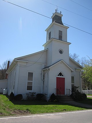
Jerseytown is a census-designated place (CDP) that is located in Madison Township, Columbia County, Pennsylvania, United States. It is part of Northeastern Pennsylvania and of the Bloomsburg-Berwick micropolitan area.

<span class="mw-page-title-main">Jonestown, Columbia County, Pennsylvania</span> Census-designated place in Pennsylvania, United States

Jonestown is a census-designated place (CDP) in Columbia County, Pennsylvania, United States. It is part of Northeastern Pennsylvania. The population was 115 at the 2020 census. It is part of the Bloomsburg-Berwick micropolitan area.

<span class="mw-page-title-main">Lime Ridge, Pennsylvania</span> Census-designated place in Pennsylvania, United States

Lime Ridge is a census-designated place (CDP) in Columbia County, Pennsylvania, United States. It is part of Northeastern Pennsylvania. The population was 823 at the 2020 census. It is part of the Bloomsburg-Berwick micropolitan area.

<span class="mw-page-title-main">Mainville, Pennsylvania</span> Census-designated place in Pennsylvania, United States

Mainville is a census-designated place in Columbia County, Pennsylvania, United States. It is part of Northeastern Pennsylvania. The population was 134 at the 2020 census. It is part of the Bloomsburg-Berwick micropolitan area.

<span class="mw-page-title-main">Mifflinville, Pennsylvania</span> Census-designated place in Pennsylvania, United States

Mifflinville is an unincorporated community and census-designated place (CDP) in Columbia County, Pennsylvania, United States. It is part of Northeastern Pennsylvania. The population was 1,233 at the 2020 census. It is part of the Bloomsburg-Berwick micropolitan area.

<span class="mw-page-title-main">Numidia, Pennsylvania</span> Census-designated place in Pennsylvania, United States

Numidia is a census-designated place (CDP) in Columbia County, Pennsylvania, United States. It is part of Northeastern Pennsylvania. The population was 274 at the 2020 census. It is part of the Bloomsburg-Berwick metropolitan area.

<span class="mw-page-title-main">Rohrsburg, Pennsylvania</span> Census-designated place in Pennsylvania, United States

Rohrsburg is a census-designated place (CDP) in Columbia County, Pennsylvania, United States. It is part of Northeastern Pennsylvania. The population was 150 at the 2020 census. It is part of the Bloomsburg-Berwick micropolitan area.

<span class="mw-page-title-main">Rupert, Pennsylvania</span> Census-designated place in Pennsylvania, United States

Rupert is a census-designated place (CDP) in Columbia County, Pennsylvania, United States. It is part of Northeastern Pennsylvania. The population was 154 at the 2020 census. It is part of the Bloomsburg-Berwick micropolitan area.

<span class="mw-page-title-main">Slabtown, Pennsylvania</span> Census-designated place in Pennsylvania, United States

Slabtown is a census-designated place in Columbia County, Pennsylvania, United States. It is part of Northeastern Pennsylvania. The population was 145 at the 2020 census. It is part of the Bloomsburg-Berwick micropolitan area.

<span class="mw-page-title-main">Waller, Pennsylvania</span> Census-designated place in Pennsylvania, United States

Waller is a census-designated place (CDP) in Columbia County, Pennsylvania, United States. It is part of the Bloomsburg–Berwick micropolitan area in Northeastern Pennsylvania. The population was 45 at the 2020 census.

<span class="mw-page-title-main">Wilburton Number One, Pennsylvania</span> Census-designated place in Pennsylvania, United States

Wilburton Number One is a census-designated place (CDP) in Columbia County, Pennsylvania, United States. It is part of Northeastern Pennsylvania. The population was 223 at the 2020 census. It is part of the Bloomsburg-Berwick micropolitan area.

<span class="mw-page-title-main">Wilburton Number Two, Pennsylvania</span> Census-designated place in Pennsylvania, United States

Wilburton Number Two is a census-designated place (CDP) in Columbia County, Pennsylvania, United States. It is part of Northeastern Pennsylvania. The population was 54 at the 2020 census. It is part of the Bloomsburg-Berwick micropolitan area.

References

  1. "ArcGIS REST Services Directory". United States Census Bureau. Retrieved October 12, 2022.
  2. "Census Population API". United States Census Bureau. Retrieved October 12, 2022.
  3. "Explore Census Data". data.census.gov. Retrieved March 25, 2024.
  4. 1 2 3 - J.H. Beers (1915), Historical and Biographical Annals of Columbia and Montour Counties , retrieved June 22, 2013
  5. "US Gazetteer files: 2010, 2000, and 1990". United States Census Bureau. February 12, 2011. Retrieved April 23, 2011.
  6. "Geographic Identifiers: 2010 Census Summary File 1 (G001): Lightstreet CDP, Pennsylvania". U.S. Census Bureau, American Factfinder. Archived from the original on February 13, 2020. Retrieved May 28, 2015.
  7. maps.google.com
  8. "Census of Population and Housing". Census.gov. Retrieved June 4, 2016.
  9. "U.S. Census website". United States Census Bureau . Retrieved January 31, 2008.