Mifflin Township, Columbia County, Pennsylvania

Last updated

Mifflin Township,
Columbia County,
Pennsylvania
Mifflin TOwnship Field (1).jpg
A Mifflin Township vista
Map of Mifflin Township, Columbia County, Pennsylvania Highlighted.png
Map of Columbia County, Pennsylvania highlighting Mifflin Township
Map of Pennsylvania highlighting Columbia County.svg
Map of Columbia County, Pennsylvania
Country United States
State Pennsylvania
County Columbia
Settled1779
Incorporated1799
Area
[1]
  Total19.86 sq mi (51.44 km2)
  Land19.22 sq mi (49.78 km2)
  Water0.64 sq mi (1.66 km2)
Population
 (2020) [2]
  Total2,277 Decrease2.svg
  Estimate 
(2021) [2]
2,296
  Density118.99/sq mi (45.94/km2)
Time zone UTC-5 (Eastern (EST))
  Summer (DST) UTC-4 (EDT)
Area code 570
FIPS code 42-037-49256

Mifflin Township is a township in Columbia County, Pennsylvania. It is part of Northeastern Pennsylvania. The population was 2,277 at the 2020 census. [2]

Contents

Geography

Mifflin Township is in eastern Columbia County, bordered by Luzerne County on the east. The Susquehanna River forms the northern border of the township, and the ridgeline of Nescopeck Mountain is the southern border. The unincorporated community of Mifflinville along the Susquehanna is the main settlement in the township. Hetlerville is a small unincorporated community in the eastern part of the township.

According to the U.S. Census Bureau, the township has a total area of 19.8 square miles (51.4 km2), of which 19.2 square miles (49.8 km2) is land and 0.66 square miles (1.7 km2), or 3.23%, is water. [3] Interstate 80 (Keystone Shortway) runs east and west through the township with an exit at Pennsylvania Route 339, southwest of Mifflinville.

History

The first European settlers probably arrived in the area that is now Mifflin Township in the late 1770s, although the exact date cannot be determined. In 1799, the township was formed from part of Catawissa Township and named for Thomas Mifflin, governor of Pennsylvania. Mifflin Township historically did not have much industrial business, because of the lack of transportation until the construction of the North and West Branch Railroad. However, a gunpowder factory was erected in the township in 1855, although it was destroyed less than three days later in an explosion. [4]

Demographics

Historical population
CensusPop.Note
2010 2,322
2020 2,277−1.9%
2021 (est.)2,296 [2] 0.8%

As of the census [5] of 2000, there were 2,251 people, 899 households, and 674 families residing in the township. The population density was 117.4 inhabitants per square mile (45.3/km2). There were 953 housing units at an average density of 49.7 per square mile (19.2/km2). The racial makeup of the township was 98.71% White, 0.18% Native American, 0.71% Asian, and 0.40% from two or more races. Hispanic or Latino of any race were 0.22% of the population.

There were 899 households, out of which 30.8% had children under the age of 18 living with them, 63.5% were married couples living together, 7.6% had a female householder with no husband present, and 25.0% were non-families. 21.6% of all households were made up of individuals, and 9.8% had someone living alone who was 65 years of age or older. The average household size was 2.50 and the average family size was 2.92.

In the township the population was spread out, with 23.2% under the age of 18, 6.1% from 18 to 24, 29.7% from 25 to 44, 26.7% from 45 to 64, and 14.3% who were 65 years of age or older. The median age was 40 years. For every 100 females, there were 96.9 males. For every 100 females age 18 and over, there were 94.1 males.

The median income for a household in the township was $37,083, and the median income for a family was $41,439. Males had a median income of $31,097 versus $21,213 for females. The per capita income for the township was $17,844. About 4.4% of families and 4.8% of the population were below the poverty line, including 3.0% of those under age 18 and 7.5% of those age 65 or over.

Education

Map of Columbia County, Pennsylvania School Districts, with Central Columbia School District in blue in the center of the county Map of Columbia County Pennsylvania School Districts.png
Map of Columbia County, Pennsylvania School Districts, with Central Columbia School District in blue in the center of the county

The area's local school district is the Central Columbia School District. It serves about 2,100 students and features three academic buildings and one administration building. Students are divided into the Elementary School (grades K through 4), Middle School (grades 5 through 8) and the High School (grades 9 through 12).

According to the 2003 data collected by Standard & Poor's, 18.4% of students are economically disadvantaged, 13.1% receive special education services and 71.1% of students pass the state-mandated testing. The district spends about $6,999 per student. [6]

In 2007, the Pittsburgh Business Times ranked the district 146th out of 499 Pennsylvania school districts based on three years of Pennsylvania System of Student Assessment test scores. [7]

The Middle School is under construction, as of 2006. Several small additions are being added to accommodate the increasing class size, and a major renovation on the existing portion will bring it up to code. It's expected to be near completion by the beginning of the 2007–2008 school year.

Related Research Articles

<span class="mw-page-title-main">Herrick Township, Bradford County, Pennsylvania</span> Township in Pennsylvania, United States

Herrick Township is a township in Bradford County, Pennsylvania, United States. It is part of Northeastern Pennsylvania. The population was 754 at the 2010 census. For years it was known for a chair sitting on a fence post as you entered the town from the south on route 1017.

<span class="mw-page-title-main">Bloom Township, Pennsylvania</span> Township in Pennsylvania, United States

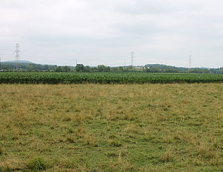
Bloom Township is a township in Clearfield County, Pennsylvania, United States. The population was 381 at the 2020 census.

<span class="mw-page-title-main">Berwick, Pennsylvania</span> Borough in Pennsylvania, United States

Berwick is a borough in Columbia County, Pennsylvania, United States. It is part of Northeastern Pennsylvania and is located 28 miles (45 km) southwest of Wilkes-Barre. As of the 2020 census, Berwick had a population of 10,355. It is one of the two principal communities of the Bloomsburg–Berwick metropolitan area, which covers Columbia and Montour counties, and had a combined population of 85,562 at the 2010 census.

<span class="mw-page-title-main">Briar Creek, Pennsylvania</span> Borough in Pennsylvania, United States

Briar Creek is a borough in Columbia County, Pennsylvania, United States. It is part of Northeastern Pennsylvania. The population was 597 at the 2020 census. It is part of the Bloomsburg-Berwick micropolitan area.

<span class="mw-page-title-main">Madison Township, Columbia County, Pennsylvania</span> Township in Pennsylvania, United States

Madison Township is a township in Columbia County, Pennsylvania. It is part of Northeastern Pennsylvania. The population was 1,566 at the 2020 census.

<span class="mw-page-title-main">Main Township, Columbia County, Pennsylvania</span> Township in Pennsylvania, United States

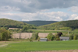
Main Township is a township in Columbia County, Pennsylvania. It is part of Northeastern Pennsylvania. The population was 1,272 at the 2020 census. Main Township was settled in 1772 and incorporated in 1844. The iron industry was once preeminent in the township.

<span class="mw-page-title-main">Mifflinville, Pennsylvania</span> Census-designated place in Pennsylvania, United States

Mifflinville is an unincorporated community and census-designated place (CDP) in Columbia County, Pennsylvania, United States. It is part of Northeastern Pennsylvania. The population was 1,233 at the 2020 census. It is part of the Bloomsburg-Berwick micropolitan area.

<span class="mw-page-title-main">North Centre Township, Pennsylvania</span> Township in Pennsylvania, United States

North Centre Township is a township in Columbia County, Pennsylvania. It is part of Northeastern Pennsylvania. The population was 2,039 at the 2020 census.

<span class="mw-page-title-main">Orange Township, Pennsylvania</span> Township in Pennsylvania, United States

Orange Township is a township in Columbia County, Pennsylvania. It is part of Northeastern Pennsylvania. The population was 1,163 at the 2020 census.

<span class="mw-page-title-main">Orangeville, Pennsylvania</span> Borough in Pennsylvania, United States

Orangeville is a borough in Columbia County, Pennsylvania, United States. It is part of Northeastern Pennsylvania. The population was 478 at the 2020 census. It is part of the Bloomsburg-Berwick micropolitan area.

<span class="mw-page-title-main">Scott Township, Columbia County, Pennsylvania</span> Township in Pennsylvania, United States

Scott Township is a township in Columbia County, Pennsylvania. It is part of Northeastern Pennsylvania. The population was 5,527 at the 2020 census, an increase over the figure of 5,113 tabulated in 2000.

<span class="mw-page-title-main">South Centre Township, Pennsylvania</span> Township in Pennsylvania, United States

South Centre Township is a township in Columbia County, Pennsylvania. It is part of Northeastern Pennsylvania. The population was 1,908 at the 2020 census.

<span class="mw-page-title-main">Upper Mifflin Township, Pennsylvania</span> Township in Pennsylvania, United States

Upper Mifflin Township is a township in Cumberland County, Pennsylvania, United States. The population was 1,304 at the 2010 census.

<span class="mw-page-title-main">Clay Township, Lancaster County, Pennsylvania</span> Township in Pennsylvania, United States

Clay Township is a township in north central Lancaster County, Pennsylvania, United States. The population was 6,887 at the 2020 census.

<span class="mw-page-title-main">Union Township, Schuylkill County, Pennsylvania</span> Township in Pennsylvania, United States

Union Township is a township that is located in Schuylkill County, Pennsylvania, United States. The population was 1,231 at the time of the 2020 census.

<span class="mw-page-title-main">Spring Township, Snyder County, Pennsylvania</span> Township in Pennsylvania, United States

Spring Township is a township in Snyder County, Pennsylvania, United States. The population was 1,635 at the 2020 census.

<span class="mw-page-title-main">New Milford Township, Pennsylvania</span> Township in Pennsylvania, United States

New Milford Township is a township in Susquehanna County, Pennsylvania, United States. The population was 1,797 at the 2020 census. Children living in New Milford Township are served by the schools in the Blue Ridge School District, including Blue Ridge High School.

<span class="mw-page-title-main">Hartley Township, Union County, Pennsylvania</span> Township in Pennsylvania, United States

Hartley Township is a township in Union County, Pennsylvania, United States. The population was 1,725 at the 2020 census.

<span class="mw-page-title-main">White Deer Township, Pennsylvania</span> Township in Pennsylvania, United States

White Deer Township is a township in Union County, Pennsylvania, United States. The population was 4,331 at the 2020 census.

<span class="mw-page-title-main">Cook Township, Westmoreland County, Pennsylvania</span> Township in Pennsylvania, United States

Cook Township is a township in Westmoreland County, Pennsylvania, United States. The population was 1,888 at the 2020 census, a decrease from 2,250 at the 2010 census, and 2,403 at the 2000 census.

References

  1. "2016 U.S. Gazetteer Files". United States Census Bureau. Retrieved August 13, 2017.
  2. 1 2 3 4 Bureau, US Census. "City and Town Population Totals: 2020—2021". Census.gov. US Census Bureau. Retrieved July 28, 2022.
  3. "Geographic Identifiers: 2010 Census Summary File 1 (G001): Mifflin township, Columbia County, Pennsylvania". U.S. Census Bureau, American Factfinder. Archived from the original on February 13, 2020. Retrieved May 26, 2015.
  4. "Chapter XVII, Mifflin Township, History of Columbia and Montour Counties, Pennsylvania".
  5. "U.S. Census website". United States Census Bureau . Retrieved January 31, 2008.
  6. Central Columbia School District report Archived September 27, 2007, at the Wayback Machine , School Matters, Standard & Poors 2003, 2005.
  7. Blacklidge, Karen, Valley schools all over the Chart, The Daily Item, June 6, 2007.

41°02′00″N76°15′59″W / 41.03333°N 76.26639°W / 41.03333; -76.26639