List of U.S. Highways in Utah

Last updated

US 6.svg

US 89.svg

US 191.svg

Highway markers for U.S. Highways in Utah
Highway names
US Highways US Highway nn (US nn)
System links
  • Utah State Highway System

The U.S. Highways in Utah are maintained by the Utah Department of Transportation (UDOT). The United States Numbered Highway System is a nationwide system with only a small portion of its routes entering Utah. Originally, the State Road Commission of Utah, created on March 23, 1909, was responsible for maintenance, but these duties were rolled into the new UDOT in 1975. [1] There are 2,061.979 miles (3,318.434 km) of U.S. Highways in the state. The longest is U.S. Route 89 at 502.577 miles (808.819 km) and the shortest is U.S. Route 89A at 2.94 miles (4.73 km). Six former U.S. Highways exist in the state of Utah; of these, five have been replaced by current interstate and U.S. Highways, while the other was replaced by a state route. The most recent change was the redesignation of U.S. Route 666 as U.S. Route 491 in 2003. [2]

Contents

Mainline routes

NumberLength (mi)Length (km)Southern or western terminusNorthern or eastern terminusFormedRemovedNotes
US 6.svg US 6 373.963601.835 US 6  / US 50 at the Nevada state line towards Ely I-70  / US 6  / US 50 at the Colorado state line towards Grand Junction 01936-01-011936currentUS 6 enters Utah through Delta, joined with US 50 until just after Delta and crosses across the middle of the state before joining I-70 and US 50 again to enter into Colorado, east of Cisco. [3] [4]
US 30S (1961).svg US 30S Idaho state line near Snowville Wyoming state line towards Evanston 01926-01-01192601970-01-01c.1970Replaced by I-80  / I-84  / US 189 [5]
US 40.svg US 40 174.624281.030 I-80 at Silver Creek Junction near Park City US 40 at the Colorado state line towards Dinosaur 01926-01-011926currentUS 40 starts at I-80 outside of Park City and heads through Heber City and Duchense before passing into Colorado near the Dinosaur National Monument. [6] [7]
US 50.svg US 50 334.920539.001 US 6  / US 50 at the Nevada state line towards Ely I-70  / US 6  / US 50 at the Colorado state line towards Grand Junction 01926-01-011926currentUS 50 enters Utah joined with US 6 until just outside Delta, crossing the midsection of Utah, before joining with I-70 for its final 174 miles (280 km) to Colorado. [8] [9]
US 89.svg US 89 502.577808.819 US 89 at the Arizona state line towards Page US 89 at the Idaho state line at Bear Lake 01926-01-011926currentUS 89 is the longest U.S. Highway in Utah, going from the Arizona border to Idaho, paralleling I-15 for a good majority of the route, but it does split off at the north and south end of the route. [10] [11]
US 91.svg US 91 45.27172.857 I-15 south of Brigham City US 91 at the Idaho state line towards Preston 01926-01-011926currentThe highway currently serves as a connection between the Cache Valley area of Utah and Idaho to the Salt Lake and Pocatello population centers. [12] [13]
US 160 (1961).svg US 160 US 6  / US 50 at Crescent Junction Colorado state line near Monticello 01970-01-011970Replaced by US 163/US 666 (modern US 191 and US 491) [14]
US 163.svg US 163 41.40566.635 US 163 at the Arizona state line in Monument Valley US 191 at Bluff 01970-01-011970currentUS 163 enters Utah in Monument Valley in the southeastern part of the state, across the San Juan River towards Bluff. [15] [16]
US 189.svg US 189 29.21647.019 I-15 south of Provo I-80  / US 189 at the Wyoming state line towards Evanston 01938-01-011938currentFrom I-15 in Provo northeast through Provo Canyon to Heber City. From this point it overlaps US 40 until it intersects I-80, at which point it overlaps I-80 until the Wyoming border near Evanston. [17] [18]
US 189 (1926).svg US 189 US 91 in Nephi US 89 at Pigeon Hollow Junction 01938-01-011938Replaced by SR-132 [19]
US 191.svg US 191 404.168650.445 US 191 at the Arizona state line towards Ganado US 191 at the Wyoming state line towards Rock Springs 01981-01-011981currentUS 191 enters Utah in the southeastern part of the state and travels northward through Moab, veers to the northwest to Price, and back to the northeast through Vernal, before exiting into Wyoming near Flaming Gorge Reservoir. [20] [21]
US 450 (1926).svg US 450 US 6  / US 50 at Crescent Junction Colorado state line near Monticello 01926-01-011926Replaced by US 160 (modern US 191 and US 491) [22]
US 491.svg US 491 17.02027.391 US 191 in Monticello US 491 at the Colorado state line towards Dove Creek 02003-01-012003currentFrom US 191 in Monticello eastward until it exits the state into Colorado. [23] [24]
US 530 (1926).svg US 530 US 40 near Park City US 30S near Echo 01926-01-011926Replaced by US 189 (modern I-80) [22]
US 666.svg US 666 US 191 in Monticello US 666 at the Colorado state line towards Dove Creek 01970-01-01197002003-01-012003Replaced by US 491 [2]
  •       Former

Special routes

NumberLength (mi)Length (km)Southern or western terminusNorthern or eastern terminusFormedRemovedNotes


Business plate.svg
US 6.svg US 6 Bus.
3.435.52 US 6/US 191 in Helper US 6/US 191 in Spring Glenn (south of Helper)01953-01-011953currentServes Helper, former US 6 through downtown. Currently co-signed US 191 Business. Was previously cosigned US 50 Business
Business plate.svg
US 6.svg US 6 Bus.
2.9424.735 US 6/US 191 in Price US 6/US 191 in Price01975-01-011975currentCosigned SR-55; former routing of US 6/50
Alternate plate.svg
US 40.svg US 40 Alt.
State Street mouth of Parley's Canyon 01964-01-01196401974-01-011974Served Salt Lake City along modern SR 186/Foothill Blvd. Was signed US 40 ALt in 1964, signed mainline US 40 in 1965, reverted back to Alternate in the 1970s.
Alternate plate.svg
US 40.svg US 40 Alt.
Kimball Junction east of Park City01953-01-01195301969-01-011969Served Park City
Alternate plate.svg
US 50.svg US 50 Alt.
Ely, Nevada Provo 01954-01-01195401976-01-011976Former mainline US 50. Utah portion was entirely concurrent with other US Routes except for the portion that is modern SR 201. Most of the Nevada portion is today US 93 ALT/US 93.
Temporary plate.svg
US 50.svg Temp. US 50
Colton, Utah Castle Gate 01912-01-011912 [25] [26] 01927-01-011927Exited the Price River Canyon along modern US 191 near Castle Gate and returned via Emma Park Road to bypass a narrow, meandering portion of the canyon.
US 89A.svg US 89A 2.944.73 US 89A at the Arizona state line towards Fredonia US 89 in Kanab 01960-01-011960currentOriginal routing of US 89 prior to the construction of the Glen Canyon Dam; demoted to an auxiliary route listed as SR-11 until 2008; provides access to Grand Canyon National Park from Utah [10] [27]
US 89A.svg US 89A Corner of 300 West and North Temple st in Salt Lake City South Salt Lake Routed along 300 West in Salt Lake City. Co-signed US 91 ALT
US 89A.svg US 89A North Salt Lake Farmington 01930-01-01c.1930Former US 89/91, Modern SR 106
Alternate plate.svg
US 91.svg US 91 Alt.
Corner of 300 West and North Temple St in Salt Lake City South Salt Lake Cosigned US 89 ALT, along 300 West in Salt Lake City
Alternate plate.svg
US 91.svg US 91 Alt.
North Salt Lake Farmington 01930-01-01c.1930Cosigned with US 89 ALT, modern SR 106
Alternate plate.svg
US 91.svg US 91 Alt.
Layton Ogden Former US 91, modern SR 26, SR 126 and briefly SR 273
No image.svgAlternate plate.svgNo image.svg
US 189.svg US 189 Alt.
Hailstone Wanship Modern SR 32. Modern SR 32 has alternated designations between US 189 and US 189ALT.
No image.svgBusiness plate.svgNo image.svg
US 191.svg US 191 Bus.
3.435.52 US 6/US 191 in Helper US 6/US 191 in Spring Glenn (south of Helper)01981-01-011981currentServes Helper Cosigned US 6 Business, former mainline US 6/50
  •       Former

See also

Related Research Articles

<span class="mw-page-title-main">U.S. Route 491</span> U.S. Highway in New Mexico, Colorado, and Utah in the United States

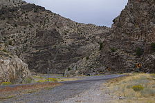
U.S. Route 491 (US 491) is a north–south U.S. Highway serving the Four Corners region of the United States. It was created in 2003 as a renumbering of U.S. Route 666 (US 666). With the US 666 designation, the road was nicknamed the "Devil's Highway" because of the significance of the number 666 to many Christian denominations as the Number of the Beast. This Satanic connotation, combined with a high fatality rate along the New Mexico portion, convinced some people the highway was cursed. The problem was compounded by persistent sign theft. These factors led to two efforts to renumber the highway, first by officials in Arizona, then by those in New Mexico. There have been safety improvement projects in recent years, and fatality rates have subsequently decreased.

<span class="mw-page-title-main">U.S. Route 163</span> Highway in Arizona and Utah

U.S. Route 163 is a 64-mile (103 km) U.S. Highway that runs from US 160 northward to US 191 in the U.S. states of Arizona and Utah. The southernmost 44 miles (71 km) of its length are within the Navajo Nation. The highway forms part of the Trail of the Ancients, a National Scenic Byway. The highway cuts through the heart of Monument Valley and has been featured in numerous movies and commercials.

<span class="mw-page-title-main">U.S. Route 189</span> Highway in the United States

U.S. Route 189 is a spur of U.S. Route 89. It currently runs for 322 miles (518 km) from Provo, Utah at Interstate 15 to Jackson, Wyoming. The highway was not part of the original 1926 U.S. Highway system. The highway was created in the 1930s, absorbing former U.S. Route 530 and a portion of U.S. Route 30S. The portion through Provo Canyon has been designated the Provo Canyon Scenic Byway by the state of Utah.

<span class="mw-page-title-main">Utah State Route 32</span> State highway in Wasatch and Summit counties in Utah, United States

State Route 32 (SR-32) is a state highway in Wasatch and Summit Counties in the U.S. state of Utah. Most of the highway is an old routing of U.S. Route 189 that became disconnected from the rest of US-189 during the construction of the Jordanelle Reservoir. SR-32 runs for 29.053 miles (46.756 km) from US-40 and US-189 north of Heber City to I-80 near Wanship. Although signed US-189 or US-189 Alternate for most of its history, the highway pre-dates the creation of U.S. Highways and has had several numerical designations and route changes through the years.

<span class="mw-page-title-main">Utah State Route 198</span>

State Route 198 is a highway completely within Utah County in northern Utah that connects Santaquin to Spanish Fork via Payson and Salem. The route runs 16 miles (26 km). The entire length of the route is an old routing of US-6 and US-50; a portion of the route was also US-91. These routes were re-aligned or truncated after the Interstate Highway System was constructed through this part of Utah.

<span class="mw-page-title-main">Interstate 80 Business (West Wendover, Nevada–Wendover, Utah)</span> Interstate Highway business loop in Nevada and Utah in the United States

Interstate 80 Business is an unofficial business loop of Interstate 80 (I-80) that is 2.26 miles (3.64 km) long and serves as the main street for the US cities of West Wendover, Nevada, and Wendover, Utah, along a roadway named Wendover Boulevard. Wendover Boulevard was originally part of US Route 40 (US 40), which connected California to New Jersey via Nevada and Utah. A portion of the Nevada segment is concurrent with US 93 Alternate, and the entire portion in Utah is coterminous with Utah State Route 58 (SR-58). The Nevada Department of Transportation (NDOT) applied for the business loop designation in the early 1980s, but the designation has never been approved; nevertheless, signs are posted in both states. Between July 1976 and 1993, I-80 Bus was concurrent with Nevada State Route 224 (SR 224) in Nevada.

<span class="mw-page-title-main">Utah State Route 19</span> State highway in Emery and Grand Counties in Utah, United States

State Route 19 (SR-19) is a state highway in southeastern Utah, running 4.552 miles (7.326 km) in Emery and Grand Counties through Green River. It carries Business Loop I-70 along Main Street in Green River.

<span class="mw-page-title-main">Interstate 80 in Utah</span> Section of Interstate highway in Utah, United States

Interstate 80 (I-80) is a part of the Interstate Highway System that runs from San Francisco, California, to Teaneck, New Jersey. The portion of the highway in the US state of Utah is 197.51 miles (317.86 km) long through the northern part of the state. From west to east, I-80 crosses the state line from Nevada in Tooele County and traverses the Bonneville Salt Flats—which are a part of the larger Great Salt Lake Desert. It continues alongside the Wendover Cut-off—the corridor of the former Victory Highway—US Route 40 (US-40) and the Western Pacific Railroad Feather River Route. After passing the Oquirrh Mountains, I-80 enters the Salt Lake Valley and Salt Lake County. A short portion of the freeway is concurrent with I-15 through Downtown Salt Lake City. At the Spaghetti Bowl, I-80 turns east again into the mouth of Parleys Canyon and Summit County, travels through the mountain range, and intersects the eastern end of I-84 near Echo Reservoir before turning northeast toward the Wyoming border near Evanston. I-80 was built along the corridor of the Lincoln Highway and the Mormon Trail through the Wasatch Range. The easternmost section also follows the historical routes of the first transcontinental railroad and US-30S.

<span class="mw-page-title-main">Interstate 84 in Utah</span> Section of Interstate Highway in Utah, United States

Interstate 84 (I-84) is a part of the Interstate Highway System that links Portland, Oregon, to I-80 near Echo, Utah. The 117.38-mile-long (188.90 km) segment in the US state of Utah is the shortest of any of the three states the western I-84 passes through and contains the eastern terminus of the highway. I-84 enters Box Elder County near Snowville before becoming concurrent with I-15 in Tremonton. The concurrent highways travel south through Brigham City and Ogden and separate near Ogden-Hinckley Airport. Turing east along the Davis County border, I-84 intersects US Route 89 (US-89) and enters Weber Canyon as well as Morgan County. While in Morgan County, I-84 passes the Devil's Gate-Weber Hydroelectric Power Plant and Devil's Slide rock formation. Past Morgan, the highway crosses into Summit County, past the Thousand Mile Tree before reaching its eastern terminus at I-80 near Echo.

<span class="mw-page-title-main">Wendover Cut-off</span> Highway in Utah

The Wendover Cut-off, also called the Wendover Road or Wendover Route, is a two-lane highway in the western part of Tooele County in the U.S. state of Utah. Stretching 40.3 miles (64.9 km) from Wendover to Knolls across the Bonneville Salt Flats, a part of the Great Salt Lake Desert, the cut-off was once part of the primary link between the Nevada state line and Salt Lake City. In 2012, between 240 and 250 vehicles used the cut-off near its western terminus in Wendover on an average day.

<span class="mw-page-title-main">Utah State Route 126</span>

State Route 126 (SR-126) is a highway completely within the Ogden-Clearfield metropolitan area in northern Utah that makes a loop around Interstate 15 in its more than twenty-one mile path. The street is given the names Main Street, 1900 West and 2000 West respectively from south to north. Previous to 1977, SR-126 was a road in southern Utah. A portion of the highway is an old routing of US-91.

<span class="mw-page-title-main">Utah State Route 132</span>

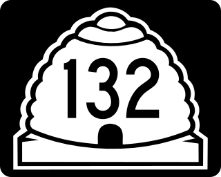
State Route 132 (SR-132) is a 63.132-mile-long (101.601 km) state highway in the U.S. state of Utah. It connects U.S. Route 6 (US-6) in Lynndyl to US-89 at Pigeon Hollow Junction, crossing Interstate 15 (I-15) in Nephi.

<span class="mw-page-title-main">U.S. Route 191 in Utah</span> Section of U.S. Highway in Utah, United States

U.S. Route 191 (US-191) is a major 404.168-mile (650.445 km), north–south U.S. Numbered Highway through eastern Utah, United States. The present alignment of US-191, which stretches from Mexico to Canada, was created in 1981 through Utah. Previously the route had entered northern Utah, ending at US-91 in Brigham City, but with the completion of I-15 it was truncated to Yellowstone National Park and re-extended on a completely different alignment. In addition to a large portion of US-163, this extension absorbed several state routes: SR-33, most of SR-44, and SR-260.

<span class="mw-page-title-main">Utah State Route 30</span>

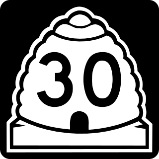
State Route 30 (SR-30) is a state highway in the U.S. state of Utah. It is the only highway signed as a Utah state route to traverse the entire width of the state. Legislatively the highway exists as 3 separate segments. With implied connections via Interstate 84 and U.S. Route 89, the highway is drivable as a continuous route from Nevada to Wyoming. The western segment is a historic corridor paralleling the pre-Lucin Cutoff routing of the First transcontinental railroad. A portion of the eastern segment has been designated the Bear Lake Scenic Byway as part of the Utah Scenic Byways program. The route was created in 1966 by combining several state highways into a single designation.

<span class="mw-page-title-main">Utah State Route 10</span>

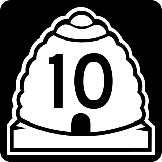
State Route 10 (SR-10) is a State Highway in the U.S. state of Utah. The highway follows a long valley in Eastern Utah between the Wasatch Plateau on the west and the San Rafael Swell on the east.

<span class="mw-page-title-main">Utah State Route 248</span> State highway in Summit and Wasatch Counties, Utah, United States

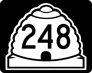
State Route 248 is a highway in northern Utah that connects Park City with Kamas. In Park City it is known as Kearns Boulevard.

<span class="mw-page-title-main">Utah State Route 200</span>

State Route 200 (SR-200) is a 1.565-mile-long (2.519 km) state highway in the U.S. state of Utah. It serves to connect Lewiston's Center Street (SR-61) to the Idaho border. The roadway continues north past the state line into the city of Preston, Idaho.

<span class="mw-page-title-main">Utah State Route 208</span> State highway in Duchesne County, Utah, United States

State Route 208 (SR-208) is a 10.205-mile (16.423 km), north–south state highway on the Uintah and Ouray Indian Reservation in the Uinta Basin in eastern Duchesne County, Utah, United States, that connects U.S. Route 40 (US-40) with Utah State Route 35 (SR-35).

References

  1. "Utah State Archives Catalog" . Retrieved July 29, 2008.
  2. 1 2 Linthicum, Leslie (July 31, 2003). "It's Now U.S. 491, Not U.S. 666". Albuquerque Journal . Retrieved July 29, 2008.
  3. "Highway Reference - 0006 P" (PDF). Utah Department of Transportation. May 1, 2008. Retrieved July 26, 2008.
  4. "Utah Code §72-4-106". Utah State Legislature. Archived from the original on July 11, 2008. Retrieved July 29, 2008.
  5. Bureau of Public Roads & American Association of State Highway Officials (November 11, 1926). United States System of Highways Adopted for Uniform Marking by the American Association of State Highway Officials (Map). 1:7,000,000. Washington, DC: U.S. Geological Survey. OCLC   32889555 . Retrieved November 7, 2013 via Wikimedia Commons.
  6. "Highway Reference - 0040 P" (PDF). Utah Department of Transportation. May 1, 2008. Retrieved July 26, 2008.
  7. "Utah Code §72-4-109". Utah State Legislature. Archived from the original on July 11, 2008. Retrieved July 29, 2008.
  8. "Highway Reference - 0050 P" (PDF). Utah Department of Transportation. May 1, 2008. Retrieved July 26, 2008.
  9. "Utah Code §72-4-110". Utah State Legislature. Archived from the original on July 11, 2008. Retrieved July 29, 2008.
  10. 1 2 "Utah Code §72-4-114". Utah State Legislature. Retrieved July 29, 2008.
  11. "Highway Reference - 0089 P" (PDF). Utah Department of Transportation. May 1, 2008. Retrieved July 26, 2008.
  12. "Highway Reference - 0091 P" (PDF). Utah Department of Transportation. May 1, 2008. Retrieved July 26, 2008.
  13. "Utah Code §72-4-115". Utah State Legislature . Retrieved July 29, 2008.
  14. Road Atlas of the United States (Map). National Geographic Company. 1960.
  15. "Highway Reference - 0163 P" (PDF). Utah Department of Transportation. May 1, 2008. Retrieved July 26, 2008.
  16. "Utah Code §72-4-122". Utah State Legislature. Archived from the original on July 11, 2008. Retrieved July 29, 2008.
  17. "Highway Reference - 0189 P" (PDF). Utah Department of Transportation. May 1, 2008. Retrieved July 26, 2008.
  18. "Utah Code §72-4-124". Utah State Legislature. Archived from the original on July 11, 2008. Retrieved July 29, 2008.
  19. Rand McNally (1931). "Utah" (Map). Auto Road Atlas. Chicago: Rand McNally. Archived from the original on May 14, 2004.[ full citation needed ]
  20. "Highway Reference - 0191 P" (PDF). Utah Department of Transportation. May 1, 2008. Retrieved July 26, 2008.
  21. "Utah Code §72-4-125". Utah State Legislature. Archived from the original on July 11, 2008. Retrieved July 29, 2008.
  22. 1 2 Rand McNally Junior Auto Road Map Utah (Map). Rand McNally. 1927.
  23. "Highway Reference - 0491 P" (PDF). Utah Department of Transportation. May 1, 2008. Retrieved July 26, 2008.
  24. "Utah Code §72-4-137". Utah State Legislature. Archived from the original on July 11, 2008. Retrieved July 29, 2008.
  25. Carbon County News, Highway Commission Approves Price Route, May 9, 1912, p. 1
  26. Carbon County News, Price River Route for State Highway, August 15, 1912, p. 1
  27. "Highway Reference - 089A P" (PDF). Utah Department of Transportation. May 1, 2008. Retrieved July 26, 2008.