
Cheshire is a ceremonial and historic county in North West England. The county town is Chester. The county is governed by four unitary authorities: Cheshire East, Cheshire West and Chester, Halton, and Warrington. Halton is part of Liverpool City Region combined authority, which also includes the five metropolitan boroughs of Merseyside. Cheshire borders Merseyside and Greater Manchester to the north, Derbyshire to the east, Staffordshire and Shropshire to the south, and the Welsh counties of Flintshire and Wrexham to the west, with a short coastline on the Irish Sea.
Warrington South is a constituency represented in the House of Commons of the UK Parliament since 2019 by Andy Carter, a Conservative Party politician.

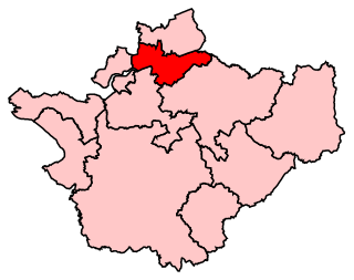
Northwich is a town and civil parish in the unitary authority of Cheshire West and Chester in the ceremonial county of Cheshire, England. It lies in the heart of the Cheshire Plain, at the confluence of the rivers Weaver and Dane. The town is about 18 miles (29 km) east of Chester, 15 miles (24 km) south of Warrington, and 19 miles (31 km) south of Manchester.
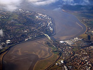
Halton is a unitary authority district with borough status in Cheshire, North West England. It was created in 1974 as a district of the non-metropolitan county of Cheshire, and became a unitary authority area on 1 April 1998 under Halton Borough Council. Since 2014, it has been a member of the Liverpool City Region Combined Authority. The borough consists of the towns of Runcorn and Widnes and the civil parishes of Daresbury, Hale, Halebank, Moore, Preston Brook, and Sandymoor. The district borders Merseyside, the Borough of Warrington and Cheshire West and Chester.
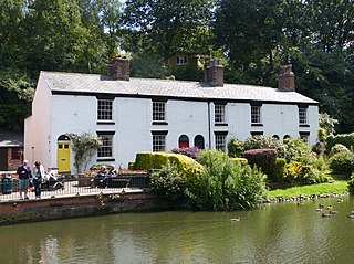
Lymm is a village and civil parish in the Borough of Warrington, Cheshire, England, which incorporates the hamlets of Booths Hill, Broomedge, Church Green, Deansgreen, Heatley, Heatley Heath, Little Heatley, Oughtrington, Reddish, Rushgreen and Statham. At the 2021 United Kingdom census it had a population of 12,700.

Stockton Heath is a civil parish and suburb of Warrington, in the Borough of Warrington, Cheshire, England. It is located to the north of the Bridgewater Canal and to the south of the Manchester Ship Canal, which divides Stockton Heath from Latchford and north Warrington. It has a total resident population of 6,396.

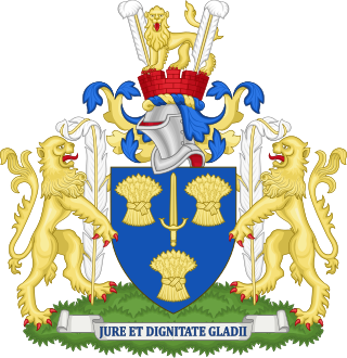
Warrington Borough Council is the local authority of Warrington, Cheshire, England. It is a unitary authority, having the powers of a non-metropolitan county and district council combined. It provides a full range of local government services including Council Tax billing, libraries, social services, processing planning applications, waste collection and disposal, and it is a local education authority. Within Warrington Borough are parts of the historic counties of both Lancashire and Cheshire.
Cheshire County Council was the county council of Cheshire. Founded on 1 April 1889, it was officially dissolved on 31 March 2009, when it and its districts were superseded by two unitary authorities; Cheshire West and Chester and Cheshire East.

The unitary authorities of England are those local authorities which are responsible for the provision of all local government services within a district. They are constituted under the Local Government Act 1992, which amended the Local Government Act 1972 to allow the existence of counties that do not have multiple districts. They typically allow large towns to have separate local authorities from the less urbanised parts of their counties and originally provided a single authority for small counties where division into districts would be impractical. However, the UK government has more recently created much larger unitary authority areas, including a single authority for North Yorkshire, the largest non-metropolitan county in England, previously divided into seven districts.
Warrington Borough Council elections are held every four years. Warrington Borough Council is the local authority for the unitary authority of Warrington in Cheshire, England. Since the last boundary changes in 2016, 58 councillors have been elected from 22 wards.

Cheshire West and Chester is a unitary authority with borough status in the ceremonial county of Cheshire, England. It was established on 1 April 2009 as part of the 2009 local government changes, by virtue of an order under the Local Government and Public Involvement in Health Act 2007. It superseded the boroughs of Ellesmere Port and Neston, Vale Royal and the City of Chester; its council assumed the functions and responsibilities of the former Cheshire County Council within its area. The remainder of ceremonial Cheshire is composed of Cheshire East, Halton and Warrington.
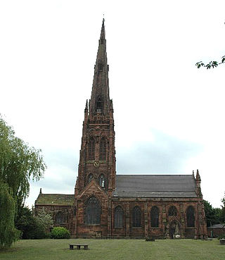
St Elphin's Church is the parish church of the town of Warrington, Cheshire, England. The church is recorded in the National Heritage List for England as a designated Grade II* listed building. It is an active Anglican parish church in the diocese of Liverpool, the archdeaconry of Warrington and the deanery of Warrington.
In the United Kingdom, the term conservation area almost always applies to an area of special architectural or historic interest, the character of which is considered worthy of preservation or enhancement. It creates a precautionary approach to the loss or alteration of buildings and/or trees, thus it has some of the legislative and policy characteristics of listed buildings and tree preservation orders. The concept was introduced in 1967, and by 2017 almost 9,800 had been designated in England.

The Borough of Warrington is a unitary authority area with borough status in the ceremonial county of Cheshire, North West England. The borough is centred around the town of Warrington, and extends out into outlying areas such as Lymm, Great Sankey, and Birchwood. The borough is geographically located to the north and northeast of the Cheshire West and Chester and Halton districts in Cheshire, the metropolitan borough of St Helens in Merseyside to the northwest and north and the metropolitan boroughs of Wigan and Trafford in Greater Manchester to the northeast, east, and southeast. Additionally, to the south-east, the borough borders Cheshire East. The borough is also located between the cities of Liverpool, Salford, Manchester, Chester and Preston. The district straddles the historic counties of Cheshire and Lancashire.

Warrington is an industrial town in the borough of the same name in Cheshire, England. The town sits on the banks of the River Mersey and until 1974, was part of Lancashire. It is 19 miles (31 km) east of Liverpool, and 18 miles (29 km) west of Manchester.
Warrington Bridge is the name given to several historical bridges crossing the River Mersey in the town of Warrington, England. The current structure is the sixth to stand in this location and was constructed 1909–15 by Alfred Thorne & Sons. For centuries Warrington Bridge provided the lowest crossing of the Mersey and thus was of strategic and commercial importance. It is located to the south of the present town centre and linked to it via Bridge Street.

Bridge Street is one of the main thoroughfares of Warrington, Cheshire, England, linking the town centre to Warrington Bridge across the River Mersey.
Church Street is one of the main thoroughfares of Warrington in Cheshire, England, linking the modern town centre to St Elphin's Church, to the east.

The history of Warrington began when it was founded by the Romans at an important crossing place on the River Mersey. A new settlement was established by the Saxon Wærings. By the Middle Ages, Warrington had emerged as a market town at the lowest bridging point of the river. A local tradition of textile and tool production dates from this time. The expansion and urbanisation of Warrington coincided with the Industrial Revolution, particularly after the Mersey was made navigable in the 18th century. Warrington became a manufacturing town and a centre of steel, textiles, brewing, tanning and chemical industries.


