List of conservation areas in Bournemouth, Christchurch and Poole

Last updated

As of January 2023, there are 48 Conservation Areas in the Bournemouth, Christchurch and Poole, in Dorset, England. [1]

Contents

Conservation areas

NameImageAreaYearNotesRefs
Ashington Ashington, Lady Wimborne Cottages - geograph.org.uk - 1923188.jpg Poole 2002Historic hamlet in the green belt north of Poole [2]
Ashley Cross Castle Hill in Parkstone - geograph.org.uk - 383977.jpg Poole 1987, amended June 2012Victorian suburb of Parkstone [3]
Avon Buildings Old Cottages, Avon Buildings, Christchurch - geograph.org.uk - 1948153.jpg Christchurch 1991Suburb of Christchurch
Boscombe Manor Boscombe, Shelley Manor - geograph.org.uk - 1119387.jpg Bournemouth 1993Shelley Manor, Shelley Manor, St Andrew's Church [4]
Boscombe Spa Boscombe, parish church of St. John - geograph.org.uk - 455757.jpg Bournemouth 1994 St John's Church, Burlington Mansions
Bramble Lane Tiny House end of Chewton Common Footpath - geograph.org.uk - 1714466.jpg Christchurch 1982Historic suburb of Highcliffe [5]
Branksome Park and Chine Gardens Branksome Chine, Branksome Park, Poole Stanley Larpent Allan.jpg Poole 1981, extended November 2014Historic suburb of Poole and woodland [6]
Brunstead Road Old Boundary Marker by Surrey Road, Poole parish (geograph 6072950).jpg Poole 1989, amended May 2000 and boundary amended November 2014Edwardian suburb of Poole, noted for Arts and Crafts architecture as well as the historic boundary of Dorset and Hampshire near County Gates [7]
Burton Burton Hall - geograph.org.uk - 2262074.jpg Christchurch 1986 Linear settlement north of Christchurch, agricultural land and Green space
Canford Cliffs Village and Penn Hill Canford Cliffs Village - geograph.org.uk - 4242648.jpg Poole 1977, extended 2014Historic suburb of Poole [8]
Canford Magna Canford Magna, Lady Wimborne Cottages - geograph.org.uk - 1910273.jpg Poole 1977, amended December 1992Historic village [9]
Chester Road Branksome, postbox No. BH13 105, Ormonde Road - geograph.org.uk - 1427482.jpg Poole 2010Edwardian suburb of Branksome
Christchurch Central Christchurch - Fountain - geograph.org.uk - 1763395.jpg Christchurch 1969Historic centre of Christchurch Town
Christchurch Hospital Christchurch Hospital - geograph.org.uk - 1999556.jpg Christchurch 1991Historic hospital
Churchill Gardens Boscombe, Churchill Gardens - geograph.org.uk - 880903.jpg Bournemouth 1993, amended December 2013Victorian square in Boscombe [10]
Dean Park DeanPark1.jpeg Bournemouth 1993Historic cricket ground
East Cliff Bournemouth, The Lansdowne - geograph.org.uk - 509109.jpg Bournemouth 1987, amended January 1988Historic buildings; St Swithun's Church, Historic Lansdowne, Bournemouth and Poole College
Evening Hill Luscombe Valley Local Nature Reserve - geograph.org.uk - 78508.jpg Poole 1992, amended November 2014Historic buildings and Site of Special Scientific Interest [11]
Heckford Park Poole, Elizabeth Road - geograph.org.uk - 1636112.jpg Poole 2010Victorian and Edwardian area of Longfleet [12]
Holdenhurst Village Holdenhurst, village green in summer - geograph.org.uk - 885372.jpg Bournemouth 1974, amended March 2014Historic village [13]
Hurn Hurn Post Office - geograph.org.uk - 1067736.jpg Christchurch 1991Historic village
Knole Road The Knole, Now Freemason's Hall, Knole Road, Boscombe - geograph.org.uk - 1727510.jpg Bournemouth 1993, amended April 1999Historic area of Boscombe
Meyrick Park and Talbot Woods Entrance to Wimborne Road Cemetery - geograph.org.uk - 1327005.jpg Bournemouth 1988, amended July 2009Victorian and Edwardian suburbs, historic green spaces, Bournemouth Gardens, Wimborne Road Cemetery
Mudeford Quay Cottages, Mudeford - geograph.org.uk - 1761271.jpg Christchurch 1981, amended May 2008History quayside
Muscliff Lane Muscliffe Lane, Bournemouth - geograph.org.uk - 2117102.jpg Christchurch 1992, amended July 1999Historic village of Muscliff, and green space in the valley of the River Stour
Oakley Lane Merley, The Willett Arms - geograph.org.uk - 1551933.jpg Poole 1987, amended December 1992Historic village
Old Christchurch Road Ask in Old Christchurch Road - geograph.org.uk - 2102866.jpg Bournemouth 1993Historic buildings in Bournemouth Town Centre, St. Andrew's Church, Richmond Hill, Norfolk Royale Hotel, Sacred Heart Church, Bournemouth Daily Echo building, St Peter's Church
Poole Park Poole Park - geograph.org.uk - 1162901.jpg Bournemouth 1995, amended October 1996Historic park [14]
Portchester Road Junction, Milton Road and Portchester Road - geograph.org.uk - 164907.jpg Bournemouth 1993Historic suburb, south of Malmesbury Park
Purewell Purewell, The Salisbury Arms - geograph.org.uk - 1210034.jpg Bournemouth 1991, amended June 1995Historic suburb of Christchurch
Ridgeway and Broadstone Park Broadstone, postbox No. BH18 220, Ridgeway - geograph.org.uk - 1398619.jpg Poole 2004, extended December 2008Victorian village, golf course
Sandbanks Sandbanks, former coastguard cottages - geograph.org.uk - 2774492.jpg Poole 2003Historic homes on the north coast of Sandbanks [15]
Southbourne Grove Southbourne, Southbourne Grove - geograph.org.uk - 1091647.jpg Bournemouth 1993Historic commercial district [16]
Stanpit and Fisherman's Bank Christchurch, former Stanpit Post Office and postbox No. BH23 36 - geograph.org.uk - 1379625.jpg Christchurch 1991, revised May 2008Historic area along Christchurch Harbour
Talbot Village Talbot Village, St. Mark's CE Aided Primary School - geograph.org.uk - 874958.jpg Bournemouth 1975, amended June 2016Historic village, woodland and farmland, St Mark's Primary School, St Mark's Church [17]
The Avenue Westminster Road East, near Poole - geograph.org.uk - 3103427.jpg Poole 1989, amended December 1992 and May 2000, extended November 2014Historic suburb of Branksome Park
The Saints St Augustin's Church, Bournemouth - geograph.org.uk - 164914.jpg Bournemouth 1987, amended April 1999Historic buildings around St Augustin's, St Winifred's, St Anthony's and Saint Valerie's Roads including St Augustin's Church
Throop and Muccleshell Villages Throop, Throop Mill Cottage - geograph.org.uk - 719549.jpg Bournemouth 1975, amended July 1999Historic village and farmland
Town Centre Heritage Poole , High Street - geograph.org.uk - 1214083.jpg Poole 2012Historic buildings across Old Town, High Street, Poole Quay, Poole Town Centre
Tudor Road and Golf Links Road Lower Golf Links Road, Broadstone - geograph.org.uk - 135502.jpg Poole 2004, extended December 2008Historic area of Broadstone
Undercliff Road Houses in Boscombe - geograph.org.uk - 2267237.jpg Bournemouth 1990Historic terrace in Boscombe
Verno Lane "The Lodge" - geograph.org.uk - 498931.jpg Christchurch 1988Historic buildings and green space
West Cliff and Poole Hill Bournemouth, the Goat ^ Tricycle - geograph.org.uk - 2169572.jpg Bournemouth 1989Historic commercial district west of Bournemouth Town Centre
West Overcliff Drive Westbourne, Middle Chine passes under West Overcliff Drive - geograph.org.uk - 3030813.jpg Bournemouth 1987Historic homes and Chine
Westbourne Westbourne, The Westbourne - geograph.org.uk - 2312452.jpg Bournemouth 1993Historic district
Wick Wick, Quality and Tranquility - geograph.org.uk - 719506.jpg Bournemouth 1985, amended April 1991Historic village
Winkton Old Houses at Winkton - geograph.org.uk - 535107.jpg Christchurch 1989, boundary amended January 2007Historic hamlet

Related Research Articles

<span class="mw-page-title-main">Poole</span> Town in England

Poole is a coastal town and seaport on the south coast of England in the Bournemouth, Christchurch and Poole unitary authority area in Dorset, England. The town is 21 miles (34 km) east of Dorchester and adjoins Bournemouth to the east. Since 1 April 2019, the local authority is Bournemouth, Christchurch and Poole Council. The town had an estimated population of 151,500 making it the second-largest town in the ceremonial county of Dorset. Together with Bournemouth and Christchurch, the conurbation has a total population of nearly 400,000.

<span class="mw-page-title-main">Sandbanks</span> Human settlement in England

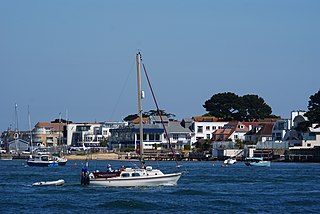
Sandbanks is an affluent neighbourhood of Poole, Dorset, on the south coast of England, situated on a narrow spit of around 1 km2 or 0.39 sq mi extending into the mouth of Poole Harbour.

<span class="mw-page-title-main">Bournemouth West (UK Parliament constituency)</span> UK Parliament constituency in England since 1950

Bournemouth West is a parliamentary constituency in Dorset represented in the House of Commons of the UK Parliament since 2010 by Conor Burns, a Conservative.

<span class="mw-page-title-main">Branksome, Dorset</span> Human settlement in England

Branksome is a suburb of Poole in Dorset, England. The area consists of residential properties and also a number of commercial and industrial areas.

<span class="mw-page-title-main">Pokesdown</span> Human settlement in England

Pokesdown is a suburb of Bournemouth in Dorset, England. It lies just east of Boscombe and west of Southbourne.

<span class="mw-page-title-main">Holdenhurst</span> Human settlement in England

Holdenhurst is a small isolated village situated in the green belt land of the north-east suburbs of Bournemouth, England. The village comprises fewer than 30 dwellings, two farms and the parish church. There are no shops and few local facilities in the village.

<span class="mw-page-title-main">Branksome Park</span> Suburb of Poole, Dorset, England

Branksome Park is a suburb of Poole in Dorset, which adjoins Branksome, Dorset. The area covers approximately 360 acres (1.5 km2), mostly occupied by housing, and includes Branksome Chine which leads to the award-winning blue-flagged beaches of Poole.

<span class="mw-page-title-main">History of Bournemouth</span> Coastal city in southern England

The history of Bournemouth and human settlement in the surrounding area goes back for thousands of years. Bournemouth is a coastal town on the island of Great Britain in Dorset, England, United Kingdom.

<span class="mw-page-title-main">Wilts & Dorset</span> British bus operator

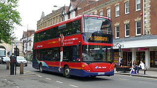
Wilts & Dorset is a bus and coach operator providing services in East Dorset, South Wiltshire, and West Hampshire. It operates services under the morebus brand around Bournemouth and Poole, and under the Salisbury Reds brand around Salisbury and Amesbury. It is part of Go South Coast, a subsidiary of the Go-Ahead Group.

<span class="mw-page-title-main">2019 Bournemouth, Christchurch and Poole Council election</span> 2019 local election in Bournemouth, Christchurch and Poole

The 2019 Bournemouth, Christchurch and Poole Council election took place on 2 May 2019 to elect the inaugural members of Bournemouth, Christchurch and Poole Council in England, formed from the former unitary authorities of Bournemouth and Poole, and borough of Christchurch. At the same time an election for the new Christchurch Town Council was held.

The following were mayors of Poole, Dorset, England:

<span class="mw-page-title-main">Strouden Park</span> Suburb of Bournemouth, England

Strouden Park is an area of Bournemouth, Dorset, England.

<span class="mw-page-title-main">Boscombe East and Pokesdown (ward)</span>

Boscombe East and Pokesdown is a ward in Bournemouth, Dorset. Since 2019, the ward has elected 2 councillors to Bournemouth, Christchurch and Poole Council.

Bournemouth, Christchurch and Poole Council is a unitary authority in Dorset, England. It was formed in April 2019, with the inaugural elections held in May of that year. The council is made up of 76 councillors from 33 wards, elected for a four-year term, with the next elections due take place in 2023.

<span class="mw-page-title-main">Muscliff and Strouden Park (ward)</span>

Muscliff and Strouden Park is a ward in Bournemouth, Dorset. Since 2019, the ward has elected 3 councillors to Bournemouth, Christchurch and Poole Council.

References

  1. "Conservation areas". www.bcpcouncil.gov.uk. Retrieved 2023-01-18.
  2. "Ashington Cutting". www.bcpcouncil.gov.uk. Retrieved 2023-01-18.
  3. "PICTURES: The changing face of Ashley Cross". Bournemouth Echo. 18 January 2023. Retrieved 2023-01-18.
  4. "Boscombe Manor" (PDF).
  5. "Highcliffe Residents' Association - News - Bramble Lane Development". highclifferesidents.co.uk. Retrieved 2023-01-18.
  6. "Branksome Chine Gardens". www.bcpcouncil.gov.uk. Retrieved 2023-01-18.
  7. "Original and charming villa". Bournemouth Echo. April 2011. Retrieved 2023-01-18.
  8. "Canford Cliffs Conservation Area Change | Branksome Park". 4 August 2014. Retrieved 2023-01-18.
  9. "Canford Magna Parish Records Dorset". www.opcdorset.org. Retrieved 2023-01-18.
  10. "Churchill Gardens, Boscombe - Bournemouth Christchurch and Poole (UA) | Historic England". historicengland.org.uk. Retrieved 2023-01-18.
  11. "Luscombe Valley". www.bcpcouncil.gov.uk. Retrieved 2023-01-18.
  12. "About Heckford Park & Oakdale | Quay Living". www.quayliving.co.uk. Retrieved 2023-01-18.
  13. "Holdenhurst Village". holdenhurst village. Retrieved 2023-01-18.
  14. "Poole Park celebrated". Bournemouth Echo. 26 May 2009. Retrieved 2023-01-18.
  15. "Sandbanks Coastguard Cottages". Sandbanks Coastguard Cottages. Retrieved 2023-01-18.
  16. "Southbourne". Bournemouth. Retrieved 2023-01-18.
  17. "Talbot Heath Conservation Case | Our Work". The RSPB. Retrieved 2023-01-18.

See also