List of covered bridges in Minnesota

Last updated

This is a listing of vintage and modern covered bridges located in the U.S. state of Minnesota.

Contents

Bridges

NameCountyLocationCoordinatesBuiltLengthSpansImageNotes
Pleasure Anoka Coon Rapids 45°8′21.2″N93°16′25.7″W / 45.139222°N 93.273806°W / 45.139222; -93.273806 (Pleasure Bridge) 198750 ft (15 m)Branch Coon Creek [1]
8260 Anoka Centerville 45°12′25.4″N93°2′8.3″W / 45.207056°N 93.035639°W / 45.207056; -93.035639 (Bridge 8260) 199612 ft (3.7 m)pond [1]
Schaefer Becker Frazee 46°44′11.2″N95°41′43″W / 46.736444°N 95.69528°W / 46.736444; -95.69528 (Schaefer Bridge) 199890 ft (27 m) Otter Tail River [1]
Chevalle Carver Victoria 44°50′41″N93°38′24″W / 44.84472°N 93.64000°W / 44.84472; -93.64000 (Chevalle Bridge) ~201160 ft (18 m)ponds Summer Bridge 2 sm.jpg [1] [2]
Blue Eagle Park Clay Barnesville 46°39′35″N96°24′44.3″W / 46.65972°N 96.412306°W / 46.65972; -96.412306 (Blue Eagle Park Bridge) ?~25 ft (7.6 m) Whisky Creek [1]
Lutsen Resort Upper Cook Lutsen 47°38′13.8″N90°42′26″W / 47.637167°N 90.70722°W / 47.637167; -90.70722 (Lutsen Resort Upper Bridge) 193077 ft (23 m) Poplar River [1]
Lutsen Resort Lower Cook Lutsen 47°38′10.5″N90°42′27″W / 47.636250°N 90.70750°W / 47.636250; -90.70750 (Lutsen Resort Lower Bridge) 1950s144 ft (44 m) Poplar River [1]
Lande Crow Wing Fifty Lakes 46°44′48″N94°3′7″W / 46.74667°N 94.05194°W / 46.74667; -94.05194 (Lande Bridge) 197562 ft (19 m)Daggett Brook [1]
Adventureland Crow Wing Brainerd 46°21′3.8″N94°1′42.4″W / 46.351056°N 94.028444°W / 46.351056; -94.028444 (Adventureland Bridge) ?23 ft (7.0 m)Dry CreekLocated at Paul Bunyan Land [1]
Goat Island Dodge Mantorville 44°3′49″N92°45′27″W / 44.06361°N 92.75750°W / 44.06361; -92.75750 (Goat Island Bridge) 197232 ft (9.8 m)South Branch Middle Fork Zumbro River [1]
Zumbrota Goodhue Zumbrota 44°17′47″N92°40′13.5″W / 44.29639°N 92.670417°W / 44.29639; -92.670417 (Zumbrota Covered Bridge) 1869120 ft (37 m)North Fork Zumbro River Zumbrota Covered Bridge 2014.jpg Listed on the U.S. National Register of Historic Places. [1] [3] [4]
Swanson/Whippler Hennepin Bloomington 44°47′39.5″N93°21′37.4″W / 44.794306°N 93.360389°W / 44.794306; -93.360389 (Swanson/Whippler Bridge) 197554 ft (16 m)pond [1]
Richard Hammel Memorial Hennepin Edina 44°53′20.8″N93°22′22.5″W / 44.889111°N 93.372917°W / 44.889111; -93.372917 (Richard Hammel Memorial Bridge) 198862 ft (19 m)Nine Mile Creek [1] [4]
? Houston Reno 43°33′54.5″N91°17′2″W / 43.565139°N 91.28389°W / 43.565139; -91.28389 ??ditch [1]
Lions Mower Austin 43°40′42.8″N92°56′4.2″W / 43.678556°N 92.934500°W / 43.678556; -92.934500 (Lions Bridge) 197426 ft (7.9 m)Dobbins Creek [1]
Lake Lida Otter Tail Pelican Rapids 46°33′49.3″N96°0′18″W / 46.563694°N 96.00500°W / 46.563694; -96.00500 (Lake Lida Bridge) ?14 ft (4.3 m)brookOn Lida Greens Golf Course. [1]
Stensgaard Pennington Thief River Falls 197916 ft (4.9 m)? [1]
Sturgeon Island Pine Windmere Township 46°22′44.7″N92°44′39.7″W / 46.379083°N 92.744361°W / 46.379083; -92.744361 (Sturgeon Island Bridge) 197040 ft (12 m)channel [1]
Clandstine Ramsey North Oaks 45°5′43.4″N93°4′28.3″W / 45.095389°N 93.074528°W / 45.095389; -93.074528 (Clandestine Bridge) 199743 ft (13 m)pond [1]
Kiechker's Crossing Renville Fairfax 44°32′1.4″N94°39′59″W / 44.533722°N 94.66639°W / 44.533722; -94.66639 (Kiechker's Crossing) 198560 ft (18 m)Little Rock Creek [1]
Lake Wobegon Trail Stearns Holdingford 45°43′43″N94°28′39″W / 45.72861°N 94.47750°W / 45.72861; -94.47750 (Lake Wobegon Trail Bridge) 2008186 ft (57 m) Two Rivers Longest covered bridge in Minnesota, located along the Lake Wobegon Trail. [1] [5]
Horseshoe Lake Washington Scandia 45°15′28.5″N92°49′20.4″W / 45.257917°N 92.822333°W / 45.257917; -92.822333 (Horseshoe Lake Bridge) 198132 ft (9.8 m)Horseshoe Lake [1]
Covered Bridge Farm Washington Forest Lake 45°13′12″N92°58′49.8″W / 45.22000°N 92.980500°W / 45.22000; -92.980500 (Covered Bridge Farm Bridge) ?~19 ft (5.8 m)small stream [6]

Below is a list of some of the other historic covered bridges in Minnesota which were eventually destroyed, removed or altered.

NameCountyLocationBuiltLengthSpannedNotes
The Arches Winona Winona 196816 ft (4.9 m)Peterson BrookDestroyed by a flood in 2007 [1]

Related Research Articles

<span class="mw-page-title-main">National Register of Historic Places listings in Scott County, Minnesota</span>

This is a list of the National Register of Historic Places listings in Scott County, Minnesota. It is intended to be a complete list of the properties and districts on the National Register of Historic Places in Scott County, Minnesota, United States. The locations of National Register properties and districts for which the latitude and longitude coordinates are included below, may be seen in an online map.

<span class="mw-page-title-main">National Register of Historic Places listings in Blue Earth County, Minnesota</span>

This is a list of the National Register of Historic Places listings in Blue Earth County, Minnesota. It is intended to be a complete list of the properties and districts on the National Register of Historic Places in Blue Earth County, Minnesota, United States. The locations of National Register properties and districts for which the latitude and longitude coordinates are included below, may be seen in an online map.

<span class="mw-page-title-main">National Register of Historic Places listings in Morrison County, Minnesota</span>

This is a list of the National Register of Historic Places listings in Morrison County, Minnesota. It is intended to be a complete list of the properties and districts on the National Register of Historic Places in Morrison County, Minnesota, United States. The locations of National Register properties and districts for which the latitude and longitude coordinates are included below, may be seen in an online map.

<span class="mw-page-title-main">National Register of Historic Places listings in Olmsted County, Minnesota</span>

This is a list of the National Register of Historic Places listings in Olmsted County, Minnesota. It is intended to be a complete list of the properties and districts on the National Register of Historic Places in Olmsted County, Minnesota, United States. The locations of National Register properties and districts for which the latitude and longitude coordinates are included below, may be seen in an online map.

<span class="mw-page-title-main">National Register of Historic Places listings in Pine County, Minnesota</span>

This is a list of the National Register of Historic Places listings in Pine County, Minnesota. It is intended to be a complete list of the properties and districts on the National Register of Historic Places in Pine County, Minnesota, United States. The locations of National Register properties and districts for which the latitude and longitude coordinates are included below, may be seen in an online map.

<span class="mw-page-title-main">National Register of Historic Places listings in Le Sueur County, Minnesota</span>

This is a list of the National Register of Historic Places listings in Le Sueur County, Minnesota. It is intended to be a complete list of the properties and districts on the National Register of Historic Places in Le Sueur County, Minnesota, United States. The locations of National Register properties and districts for which the latitude and longitude coordinates are included below, may be seen in an online map.

<span class="mw-page-title-main">National Register of Historic Places listings in Lake County, Minnesota</span>

This is a list of the National Register of Historic Places listings in Lake County, Minnesota. It is intended to be a complete list of the properties and districts on the National Register of Historic Places in Lake County, Minnesota, United States. The locations of National Register properties and districts for which the latitude and longitude coordinates are included below, may be seen in an online map.

<span class="mw-page-title-main">National Register of Historic Places listings in Clay County, Minnesota</span>

This is a list of the National Register of Historic Places listings in Clay County, Minnesota. It is intended to be a complete list of the properties and districts on the National Register of Historic Places in Clay County, Minnesota, United States. The locations of National Register properties and districts for which the latitude and longitude coordinates are included below, may be seen in an online map.

<span class="mw-page-title-main">National Register of Historic Places listings in Pipestone County, Minnesota</span>

This is a list of the National Register of Historic Places listings in Pipestone County, Minnesota. It is intended to be a complete list of the properties and districts on the National Register of Historic Places in Pipestone County, Minnesota, United States. The locations of National Register properties and districts for which the latitude and longitude coordinates are included below, may be seen in an online map.

<span class="mw-page-title-main">National Register of Historic Places listings in Houston County, Minnesota</span>

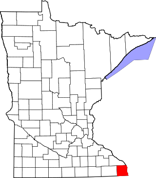
This is a list of the National Register of Historic Places listings in Houston County, Minnesota. It is intended to be a complete list of the properties and districts on the National Register of Historic Places in Houston County, Minnesota, United States. The locations of National Register properties and districts for which the latitude and longitude coordinates are included below, may be seen in an online map.

<span class="mw-page-title-main">National Register of Historic Places listings in Todd County, Minnesota</span>

This is a list of the National Register of Historic Places listings in Todd County, Minnesota. It is intended to be a complete list of the properties and districts on the National Register of Historic Places in Todd County, Minnesota, United States. The locations of National Register properties and districts for which the latitude and longitude coordinates are included below, may be seen in an online map.

<span class="mw-page-title-main">National Register of Historic Places listings in Mille Lacs County, Minnesota</span>

This is a list of the National Register of Historic Places listings in Mille Lacs County, Minnesota.

<span class="mw-page-title-main">National Register of Historic Places listings in Kandiyohi County, Minnesota</span>

This is a list of the National Register of Historic Places listings in Kandiyohi County, Minnesota. It is intended to be a complete list of the properties and districts on the National Register of Historic Places in Kandiyohi County, Minnesota, United States. The locations of National Register properties and districts for which the latitude and longitude coordinates are included below, may be seen in an online map.

<span class="mw-page-title-main">National Register of Historic Places listings in Lyon County, Minnesota</span>

This is a list of the National Register of Historic Places listings in Lyon County, Minnesota. It is intended to be a complete list of the properties and districts on the National Register of Historic Places in Lyon County, Minnesota, United States. The locations of National Register properties and districts for which the latitude and longitude coordinates are included below, may be seen in an online map.

<span class="mw-page-title-main">National Register of Historic Places listings in Chippewa County, Minnesota</span>

This is a list of the National Register of Historic Places listings in Chippewa County, Minnesota. It is intended to be a complete list of the properties and districts on the National Register of Historic Places in Chippewa County, Minnesota, United States. The locations of National Register properties and districts for which the latitude and longitude coordinates are included below, may be seen in an online map.

<span class="mw-page-title-main">National Register of Historic Places listings in Meeker County, Minnesota</span>

This is a list of the National Register of Historic Places listings in Meeker County, Minnesota.

<span class="mw-page-title-main">National Register of Historic Places listings in Lac qui Parle County, Minnesota</span>

This is a list of the National Register of Historic Places listings in Lac qui Parle County, Minnesota. It is intended to be a complete list of the properties and districts on the National Register of Historic Places in Lac qui Parle County, Minnesota, United States. The locations of National Register properties and districts for which the latitude and longitude coordinates are included below, may be seen in an online map.

<span class="mw-page-title-main">National Register of Historic Places listings in Mower County, Minnesota</span>

This is a list of the National Register of Historic Places listings in Mower County, Minnesota. It is intended to be a complete list of the properties and districts on the National Register of Historic Places in Mower County, Minnesota, United States. The locations of National Register properties and districts for which the latitude and longitude coordinates are included below, may be seen in an online map.

References

  1. 1 2 3 4 5 6 7 8 9 10 11 12 13 14 15 16 17 18 19 20 21 22 23 Travis, Dale (2017-03-04). "Minnesota Covered Bridges List". Round Barns & Covered Bridges. Retrieved 2020-08-23.
  2. "Chevalle: On Lake Bavaria in Chaska with hiking, biking and equestrian trails; parks, woods, wetlands and three neighboring golf courses". www.chevallehomes.com. Retrieved 2017-01-03.
  3. "Covered Bridge". Zumbrota Covered Bridge. Retrieved July 16, 2014.[ permanent dead link ]
  4. 1 2 "Minnesota Covered Bridge Map" . Retrieved July 26, 2016.
  5. "Holdingford covered bridge - Minnesota Trails Magazine" . Retrieved June 29, 2015.
  6. "Covered Bridge Farm". Covered Bridge Farm LLC. Retrieved 2017-01-03.