List of crossings of the Kootenay River

Last updated

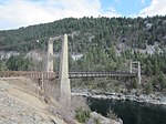
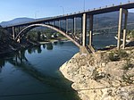
This is a list of bridges and other crossings of the Kootenay River from its source downstream to the Columbia River.

Contents

Crossings

CrossingCarriesLocationCoordinatesImage
Kootenay Crossing BridgeBC-93.svg Hwy 93 Kootenay Crossing, British Columbia
(Kootenay National Park)
50°53′13″N116°02′44″W / 50.8869°N 116.0455°W / 50.8869; -116.0455
Canal Flats BridgeBC-93.svgBC-95.svg Hwy 93  / Hwy 95 Canal Flats, British Columbia 50°08′52″N115°48′03″W / 50.1479°N 115.8009°W / 50.1479; -115.8009
Springbrook BridgeBC-93.svgBC-95.svg Hwy 93  / Hwy 95 Skookumchuck, British Columbia 49°54′39″N115°44′14″W / 49.9108°N 115.7372°W / 49.9108; -115.7372
Wasa BridgeBC-93.svgBC-95.svg Hwy 93  / Hwy 95 Near Wasa, British Columbia 49°48′34″N115°46′02″W / 49.8094°N 115.7671°W / 49.8094; -115.7671
Fort Steele BridgeBC-93.svgBC-95.svg Hwy 93  / Hwy 95 Fort Steele, British Columbia 49°36′45″N115°38′04″W / 49.6125°N 115.6345°W / 49.6125; -115.6345
Wardner BridgeBC-3 (Crowsnest).svgBC-93.svg Hwy 3  / Hwy 93 Near Wardner, British Columbia 49°26′00″N115°25′21″W / 49.4333°N 115.4224°W / 49.4333; -115.4224
Highway BridgeKikomun-Newgate Roadnear Kikomun Creek Provincial Park,
British Columbia
49°15′37″N115°16′22″W / 49.2602°N 115.2727°W / 49.2602; -115.2727
Kootenay crosses Canada-U.S. border (as Lake Koocanusa impoundment)
Libby Dam Near Jennings, Montana 48°24′35″N115°18′53″W / 48.4096°N 115.3146°W / 48.4096; -115.3146 Libby Dam (Libby Montana) 1986.jpg
Lake Koocanusa BridgeMT-37.svg MT 37 48°21′57″N115°19′31″W / 48.3658°N 115.3252°W / 48.3658; -115.3252 Kootenai Bridge Over Lake Koocanusa.jpg
Highway BridgeMT-37.svg MT 37 Libby, Montana 48°23′48″N115°32′52″W / 48.3966°N 115.5477°W / 48.3966; -115.5477
Kootenai Falls Swinging BridgeFootbridge Kootenai Falls, Montana 48°27′12″N115°46′17″W / 48.4532°N 115.7715°W / 48.4532; -115.7715 Kootenai Falls Swinging Bridge.jpg
Theodore Roosevelt Memorial Bridge Roosevelt Parkway Troy, Montana 48°28′12″N115°53′11″W / 48.47°N 115.886389°W / 48.47; -115.886389 RooseveltBridgeTroyMontana.jpg
Kootenai River BridgeUS 2.svg US 2 48°29′42″N115°55′04″W / 48.4951°N 115.9179°W / 48.4951; -115.9179
Highway BridgeLeona RoadNear Leona, Idaho
(In Montana near MT-ID border.)
48°37′02″N116°02′54″W / 48.6171°N 116.0482°W / 48.6171; -116.0482
Bonner's Ferry BridgeUS 2.svgUS 95.svg US 2  / US 95 Bonners Ferry, Idaho 48°41′59″N116°18′48″W / 48.6998°N 116.3132°W / 48.6998; -116.3132
Kootenay crosses U.S.-Canada border
Kootenay River BridgeBC-3 (Crowsnest).svg Hwy 3 Near Creston, British Columbia 49°07′02″N116°34′50″W / 49.1173°N 116.5805°W / 49.1173; -116.5805
Kootenay Lake Ferry BC-3A.svg Hwy 3A Connecting Kootenay Bay
and Balfour, British Columbia
49°39′07″N116°54′41″W / 49.65200°N 116.9115°W / 49.65200; -116.9115 KootenayLakeFreeFerry.jpg
Harrop Cable Ferry Harrop, British Columbia 49°36′34″N117°03′15″W / 49.6095°N 117.0541°W / 49.6095; -117.0541
Nelson Bridge
(Big Orange Bridge)
BC-3A.svg Hwy 3A Nelson, British Columbia 49°30′37″N117°16′56″W / 49.5103°N 117.2821°W / 49.5103; -117.2821 Nelson's Big Orange Bridge.jpg
Taghum BridgeBC-3A.svgBC-6.svg Hwy 3A  / Hwy 6 Taghum, British Columbia 49°29′40″N117°22′46″W / 49.4944°N 117.3795°W / 49.4944; -117.3795
Corra Linn Dam Corra Linn, British Columbia 49°28′05″N117°28′03″W / 49.4680°N 117.4675°W / 49.4680; -117.4675 Corra Linn Dam 20140902.jpg
Upper Bonnington Falls Dam Bonnington Falls, British Columbia 49°27′32″N117°29′09″W / 49.4588°N 117.4858°W / 49.4588; -117.4858
Lower Bonnington Falls Dam 49°27′39″N117°29′59″W / 49.4609°N 117.4998°W / 49.4609; -117.4998
Blewett RoadNear South Slocan, British Columbia 49°27′32″N117°30′33″W / 49.4590°N 117.5092°W / 49.4590; -117.5092
South Slocan Dam 49°27′23″N117°31′05″W / 49.4563°N 117.5181°W / 49.4563; -117.5181
Glade Ferry Tarry's, British Columbia 49°23′42″N117°32′40″W / 49.395126°N 117.544426°W / 49.395126; -117.544426
Brilliant Dam Near Brilliant, British Columbia 49°19′28″N117°37′10″W / 49.3244°N 117.6195°W / 49.3244; -117.6195 Brilliant Dam.jpg
Brilliant Suspension Bridge Footbridge 49°19′03″N117°37′47″W / 49.3175°N 117.6297°W / 49.3175; -117.6297 Brilliant Suspension Bridge Kootenay River.JPG
Brilliant BridgeBC-3A.svg Hwy 3A 49°19′00″N117°37′52″W / 49.3168°N 117.6311°W / 49.3168; -117.6311 Bridge at Brilliant, Canada (21375206175).jpg
References: ACME Mapper [1] [ failed verification ]

See also

Related Research Articles

Highway 93 is a north–south route through the southeastern part of British Columbia, in the Regional District of East Kootenay and takes its number from U.S. Highway 93 that it connects with at the Canada–United States border. It follows the Crowsnest Highway (Highway 3) and Highway 95 through Radium Hot Springs and to where it crosses the Continental Divide into Alberta at Vermilion Pass, where it continues as Alberta Highway 93. The section between the Canada-U.S. border and the Crowsnest Highway is known as the Elko–Roosville Highway, the section between the Crowsnest Highway and Radium Hot Springs is known as the Kootenay–Columbia Highway, while the section east of Radium Hot Springs is known as the Banff–Windermere Parkway.

Theodore Roosevelt Bridge

The Theodore Roosevelt Bridge is a bridge crossing the Potomac River which connects Washington, D.C., with the Commonwealth of Virginia. The bridge crosses over Theodore Roosevelt Island, and carries Interstate 66/U.S. Route 50. The center lane in the bridge is reversible; the middle barrier is moved with a barrier transfer machine. It's operated eastbound during the morning rush hour from 6-11 am. The bridge is named in honor of Theodore Roosevelt, the 26th President of the United States.

U.S. Route 730 (US 730) is an east–west United States Highway, of which all but 6.08 miles of its 41.78 miles are within the state of Oregon. The highway starts in rural Morrow County in Eastern Oregon at an interchange with Interstate 84 (I-84) and US 30, located east of the city of Boardman. US 730 travels east along the Columbia River as a continuation of Columbia River Highway No. 2 into Umatilla County, intersecting I-82 and US 395 in the city of Umatilla. US 730 and US 395 form a short concurrency within the city before the highways part, with US 730 continuing northeast into Washington. The highway travels through rural Walla Walla County and ends at an intersection with US 12 south of Wallula.

The International Selkirk Loop is a 280-mile-long (450 km) scenic highway in the U.S. states of Idaho and Washington, as well as the Canadian province of British Columbia. The loop encircles the Selkirk Mountain Range, and offers several side trips aside from the main route. Included on the loop is the Kootenay Lake Ferry, the longest free ferry in the world. The portion of the loop in the United States has been designated an All-American Road by the United States Department of Transportation.

Index of Idaho-related articles Wikipedia index

The following is an alphabetical list of articles related to the U.S. state of Idaho.

Index of Missouri-related articles Wikipedia index

The following is an alphabetical list of articles related to the U.S. state of Missouri.

Index of Oregon-related articles Wikipedia index

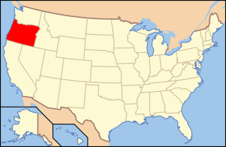
The following is an alphabetical list of articles related to the U.S. state of Oregon.

Index of Washington (state)-related articles Wikipedia index

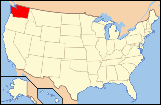
The following is an alphabetical list of articles related to the U.S. state of Washington.

Index of Guam-related articles Wikimedia list article

The following is an alphabetical list of articles related to the United States Territory of Guam.

Index of Guatemala-related articles Wikipedia index

The following is an alphabetical list of topics related to the Republic of Guatemala.

Outline of Missouri Overview of and topical guide to Missouri

The following outline is provided as an overview of and topical guide to the U.S. state of Missouri:

Outline of Washington (state) Overview of and topical guide to Washington (state)

The following outline is provided as an overview of and topical guide to the U.S. state of Washington:

Fifteenmile Creek (Columbia River tributary)

Fifteenmile Creek is a 54-mile (87 km) long tributary of the Columbia River in the U.S. state of Oregon. It drains 373 square miles (966 km2) of Hood River and Wasco counties. Arising in the Cascade Range near Mount Hood, it flows northeast then west to its confluence with the Columbia near The Dalles.

References

  1. USGS Topo Maps for United States (Map). Cartography by United States Geological Survey. ACME Mapper. Retrieved 2010-03-28.
Map all coordinates using: OpenStreetMap  
Download coordinates as: KML